In the medieval city of Fribourg
DIDIER HEUMANN, ANDREAS PAPASAVVAS
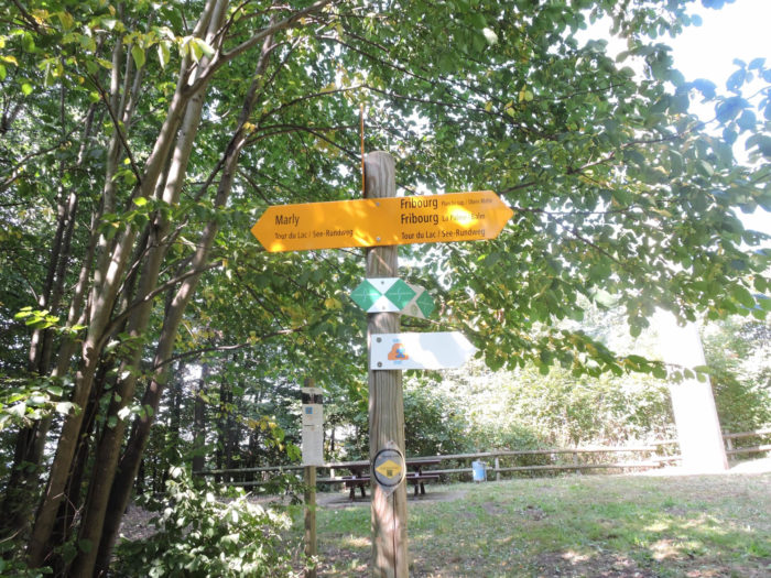
Fribourg, this medieval city with undeniable charms, presents itself to you like a precious grimoire overflowing with millennia-old stories, an invitation to a timeless escapade in the heart of Europe. To wander its cobbled streets is to embark on a journey through the ages, an epic where past and present harmoniously mingle, painting a picturesque tableau of timeless beauty. Centuries have passed, leaving in their wake remnants that testify to the grandeur and splendor of a bygone era, yet whose essence remains vibrant, anchored in the stones that have witnessed the passage of time. Thus, unfolds before you a day filled with discoveries and wonders, an ode to history that reveals itself with every step, in every corner of this city with a glorious past, Here is a map of a route that highlights the most significant points of interest, in a walk exploring the old town and the meanders of the Sarine.
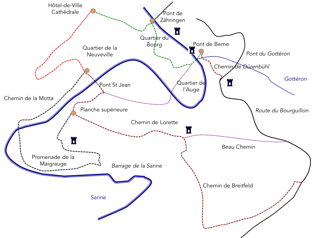
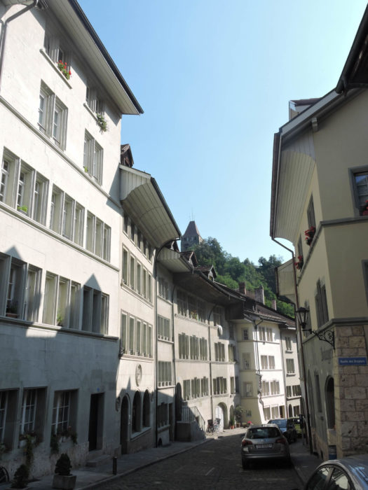
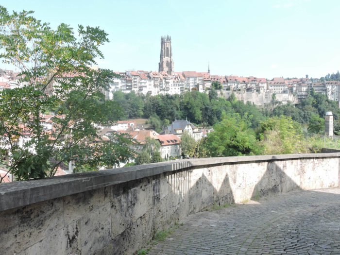
You are already familiar with part of it, having arrived the previous day via the Pink Tower and the Zähringen bridge towards the Lower Town. Therefore, we won’t describe this part that you already know. The best starting point is from the cathedral, the center of the old town, and to slope down from the cathedral to the Zähringen bridge.The cathedral, a majestic stone sentinel, stands proudly at the heart of the old town, like a guardian of ancient times. From its heights, it overlooks the constant flow of visitors, ephemeral witnesses to an immutable era. At its feet, stretch narrow, winding streets, each a path leading to discovery. It is here, in this emblematic place, that your journey begins, an enchanting stroll through the twists and turns of time, where each step resonates like an echo of the past.
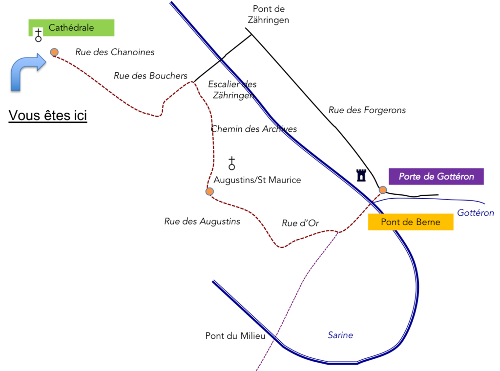
| Descending Rue des Chanoines, you are captivated by the enchanting atmosphere of the old town, where every stone seems to whisper a forgotten tale. The ancient facades, with their warm hues weathered by time, pass before your delighted eyes, silent witnesses to centuries gone by. Then, Rue des Bouchers presents itself to you, with its characteristic hustle and bustle and picturesque shops, where intoxicating scents mingle with flavors of yesteryear. Around a corner, the Zähringen bridge emerges, a true link between two worlds, offering a breathtaking view of the peaceful waters of the Sarine. |
 |
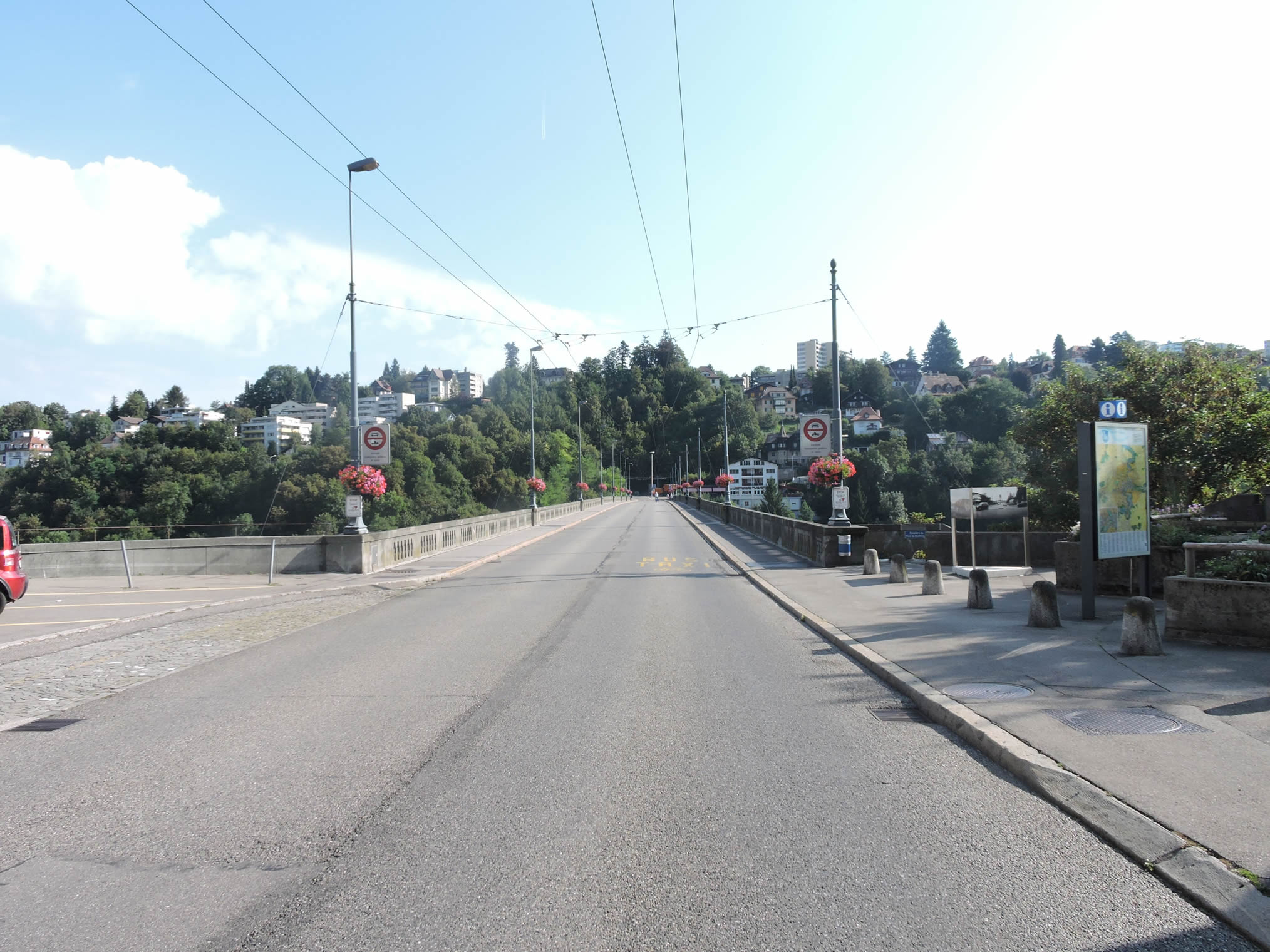 |
From the top of the bridge, the panorama unfolds into a striking tableau, seamlessly blending past and present. To the north, the new Pont de la Poya stands like a symbol of modernity, gradually eclipsing the memory of the Zähringen bridge engulfed by the flow of ages.
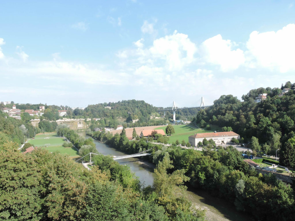
| On the other side, the gaze embraces the splendor of Quartier de l’Auge, with its colorful houses and red-tiled roofs stretching as far as the eye can see. The towers of Cats and Pink Tower stand like sentinels, faithful guardians of a glorious past, while the Augustinian Church rises majestically, like a sacred relic at the heart of the city. |
 |
 |
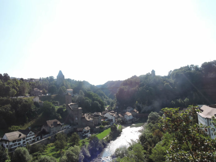
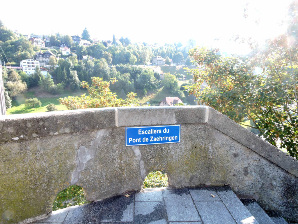
Let yourself be carried away by the majestic stairs of Pont de Zähringen. A descent reminiscent of a dive into history, where each step seems to murmur the forgotten tales of Fribourg.
| The timid morning light dances on the cobblestones as you set foot on Chemin des Archives, a path laden with emotions and memories, flanked by Rue de Lenda delicately caressing the Augustinian convent with its morning shadows. |
 |
 |
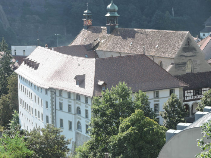
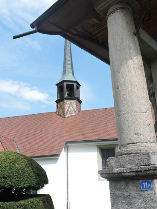
As you progress, the embrace of the past becomes more tangible. There, standing like a beacon in the ocean of time, is the Augustinian/St. Maurice Church, guardian of the architectural secrets of the mendicant orders of the 13th century. Since 1916, it has proudly stood, an immutable witness to the vicissitudes of history, transformed into a state edifice. Yet its heart has remained parochial since 1872, welcoming souls thirsty for spirituality. The stained-glass windows, like jewels set in stone, and the liturgical furniture, works of art in their own right, are revealed to the awestruck gaze, provided that the doors of the church open to you, like wings offered to the lost traveler.
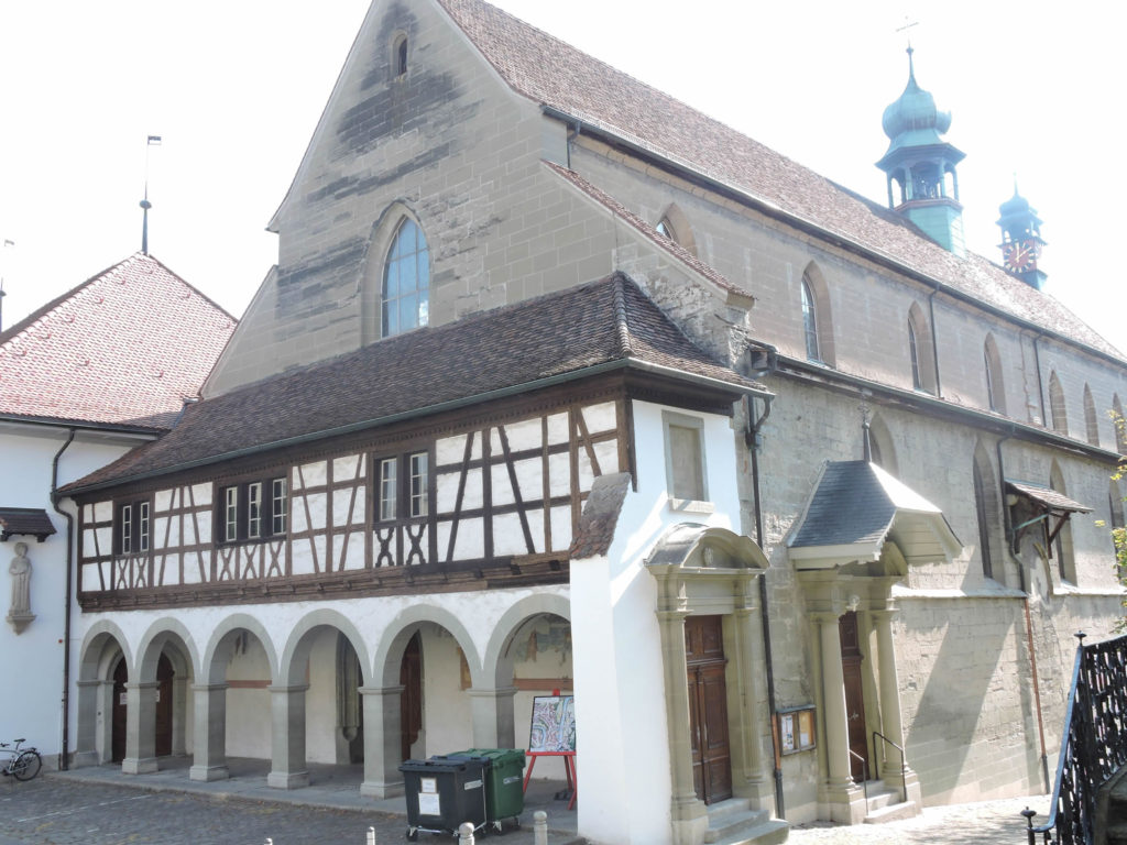
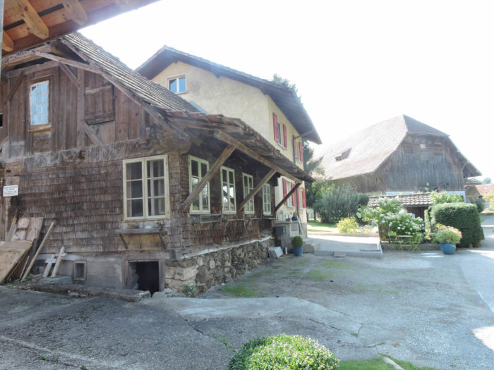
| In this quarter where the shadow of the past blends with the light of hope, medieval dwellings, once slumbering, have awakened anew under the gentle kiss of restoration. The ineffable charm emanating from their weathered facades evokes a glorious past, a present vibrant with life. Each stone seems to tell a story, each open window offers a glimpse into a world teeming with forgotten tales. |
 |
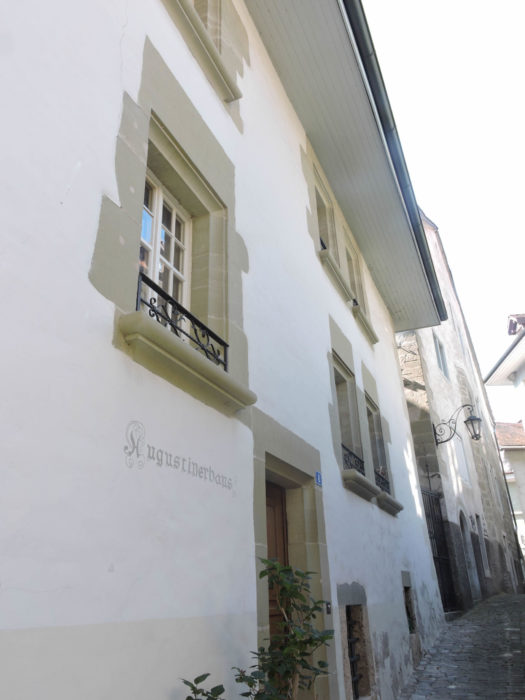 |
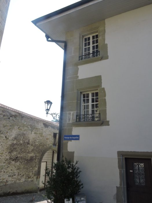
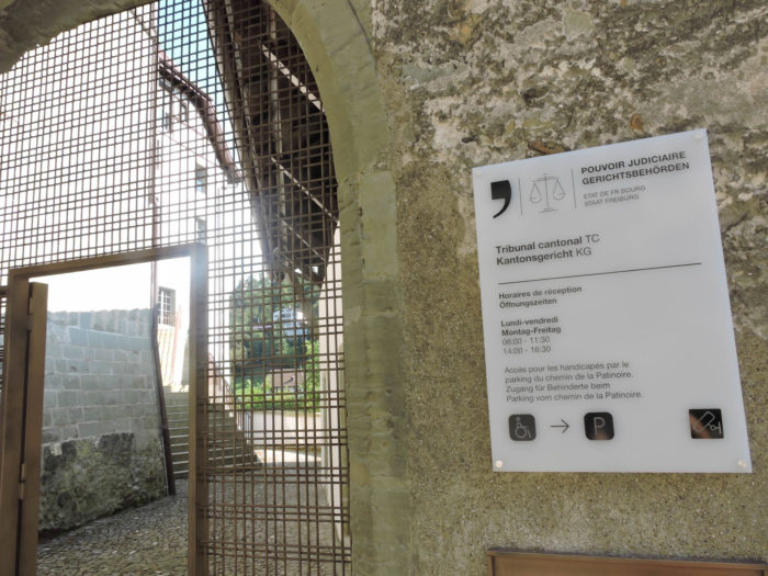
| Rue des Augustins, like a faithful companion, winds alongside the convent, cradling the steps of the curious and the dreamers. It continues its path, brushing past the Cantonal Court, an impassive witness to judicial tumults, before plunging into Rue d’Or, the pulsating artery of Quartier de l’Auge. |
 |
 |
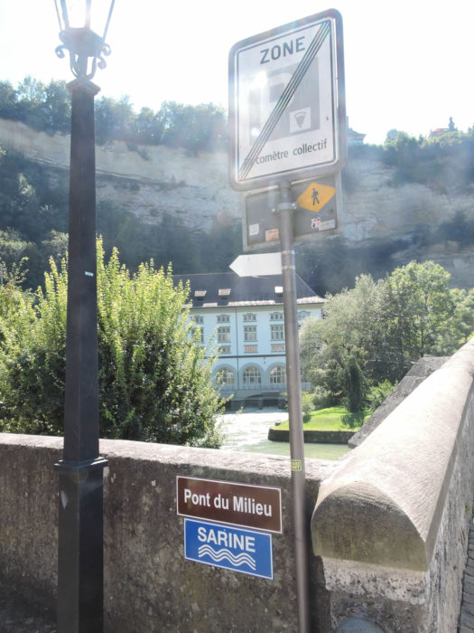
| Descending into the unknown, where the alleyways whisper forgotten legends, you reach the bottom of Rue d’Or. To your right lies Place du Petit St Jean, a fleeting witness to your steps on the Way of St. James yesterday. But today, you turn towards new horizons, crossing the Middle Bridge that leads you to Neuveville, another world to discover, another facet of the city to explore. |
 |
 |
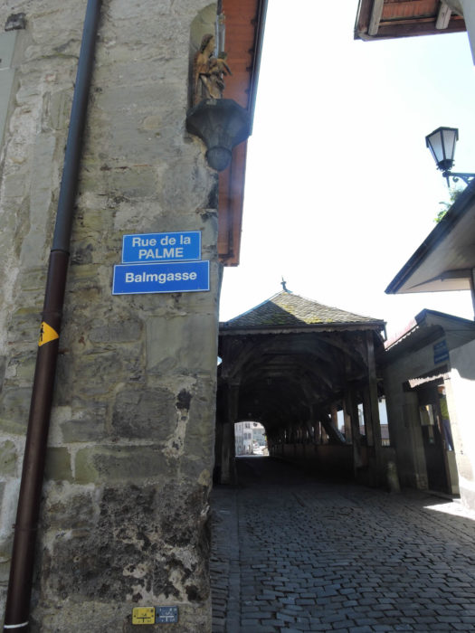
| However, for this day marked by adventure, another path unfolds before you. Retrace your steps, cross the majestic Bern Bridge that seems to suspend time, and you find yourself on Rue de Palme. There, in front of the Fountain of Fidelity, an eternal symbol of commitment and loyalty, stretches Rue des Forgerons, where your steps have already become rooted in the sacred ground of the Way of St. James. It is here, at this crossroads of destinies, that your journey takes on a new breath, a new dimension, promising undiscovered revelations and intense emotions. |
 |
 |
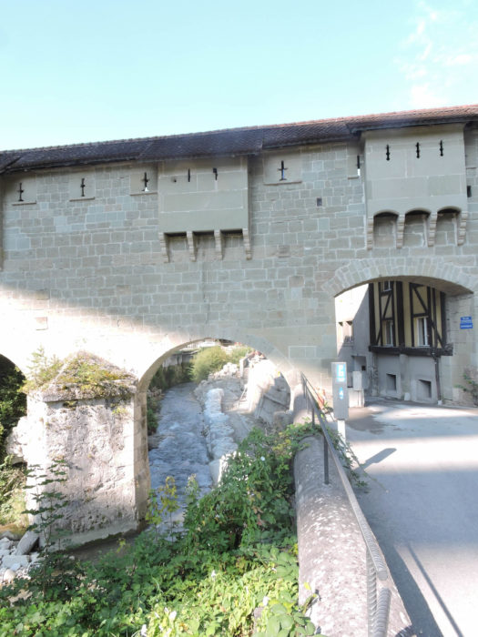
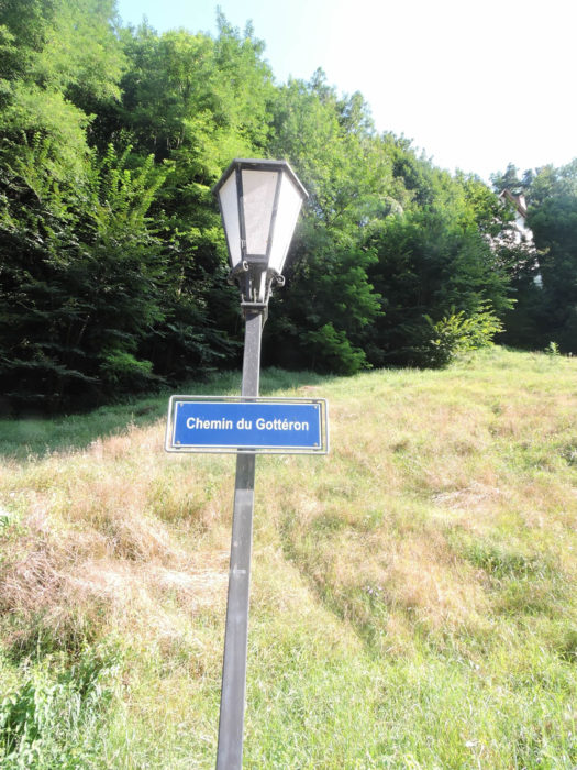
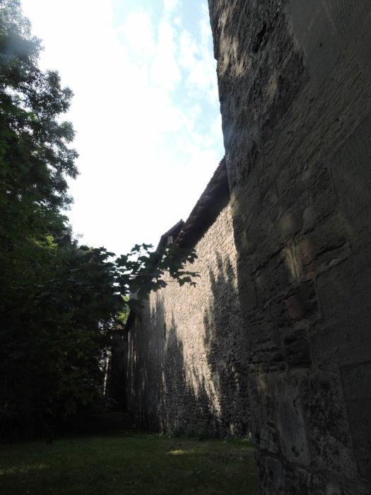
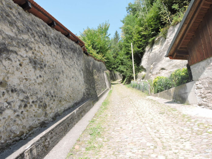
| Now, before you, stands majestically the gate of Gottéron, a secular witness to the first fortification erected in the 13th century. Its imposing silhouette, frozen in time since the 15th century, exudes an aura of grandeur and mystery, reminding passersby of the indelible imprint of the past on the present. But behind this facade steeped in history lies a tumultuous tale, forged by the impetuous whims of nature. The tumultuous waters of the Sarine and the Gottéron, alternately benefactors and destroyers, spurred the eminent bourgeois of the city to undertake a fierce struggle against the unleashed elements. The regulation of flows, the erection of dikes and canals constituted the weapons of their relentless battle to tame the wild forces of the rivers. From this confrontation emerged an ingenious hydraulic system, conducive to the development of the milling industry. More than thirty mills, symbols of prosperity and vitality, then enlivened this quarter, the cradle of pre-industrial activity where the hammering of ironworks and rolling mills resounded, where beat the vibrant heart of a city in full bloom. |
 |
 |
| If you choose to cross the threshold of this gate steeped in history, you embark on the banks of the Gottéron, under the eponymous bridge that spans these tumultuous waters. |
 |
 |
But today, your journey leads you onto less traveled paths, towards lands steeped in mystery and legends. Around the Fountain of Fidelity, the path of Dürrenbühl unfolds before you, winding beneath the steep cliffs and the chapel of St. Béat, towards Bourguillon.

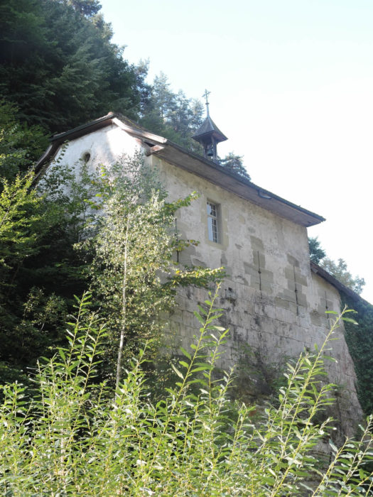
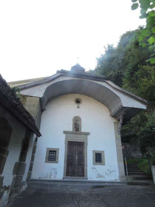
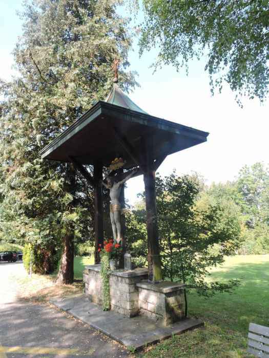
| In ancient times, as the shadows of legends stretched over the steep walls of the narrow gorges, it was whispered that somewhere, nestled in the folds of the rock, lurked a fearsome dragon. A creature as ancient as the memory of men, whose roar seemed to shake the very foundations of the earth. But today, only the stones bear the memory of these fantastical tales, while proudly standing on the path is the charming little chapel of St. Béat. Once a sacred place and refuge for troubled souls, this humble chapel was the rallying point for the inhabitants of the Lower Town, who came to implore divine protection against the plagues threatening their existence. Nestled within the rampart, embracing the contours of the cliff like a precious jewel box, it seemed to watch over the faithful with benevolence, offering them a haven of peace amidst the turmoil of the world. In the Middle Ages, another chapel, now disappeared, stood near the Gate of Gottéron, marking with its presence the dark and luminous hours of the city. The one we see today, erected between the 17th and 18th centuries, perpetuates the memory of St. Béat, this Bernese hermit saint whose legend narrates bravery in the face of a fearsome monster haunting the murky waters of Lake Thun. The cult of St. Béat, emblem of devotion and courage, spread like a sacred fire throughout Switzerland, imbuing every corner of the land with its benevolent aura. The Way of St. James, an ancient pilgrimage route, intersects with his path, offering walkers a salutary halt on the banks of Beatenberg, facing the hypnotic azure of Lake Spiez, where the horizon embraces eternity. |
 |
 |
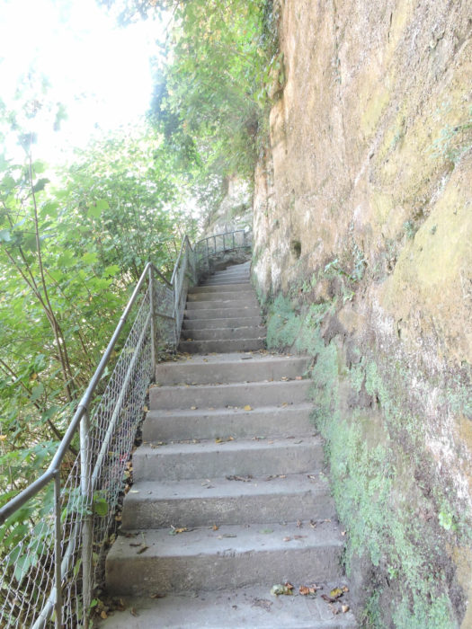
| But the ascent to the heights is not without challenges. From the very first steps, stairs carved into the rock, immutable witnesses to the relentless work of ancestors, invite the walker to climb the flanks of the cliff, to defy the heights in order to better embrace the expanse of the panorama unfolding before you. |
 |
 |
| As the path ascends, the dense forest closes in around the traveler, enveloping him in its ancestral mystery. Soon, the Road to Bourguillon emerges on the horizon, emerging from the Gottéron bridge. |
 |
 |
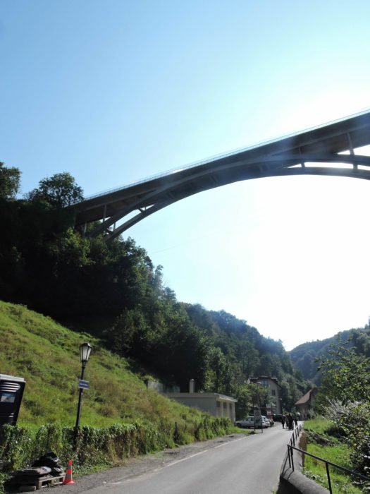
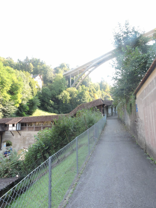
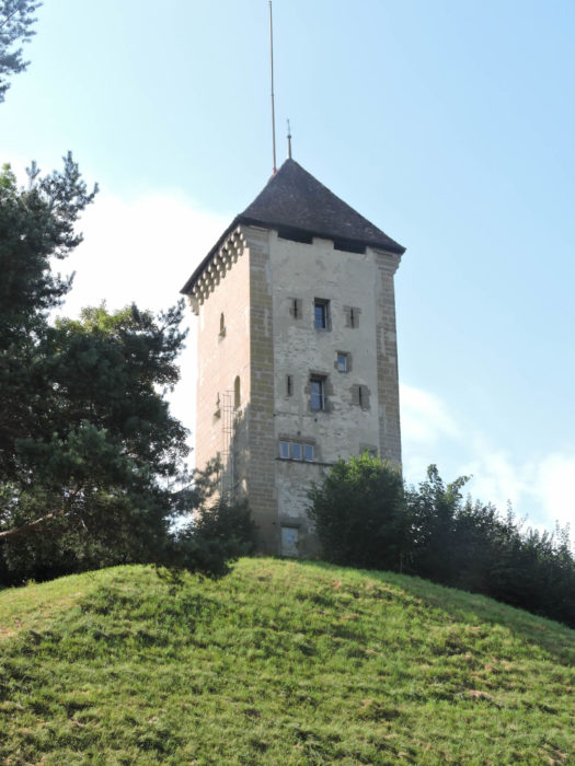
| A stop is warranted at the height of the Dürrenbühl Tower, a proud sentinel standing against the assaults of time. It dates from the mid-13th century and was raised after 1400. The adjacent rampart was demolished in 1840 to allow for the construction of the Gottéron bridge . |
 |
 |
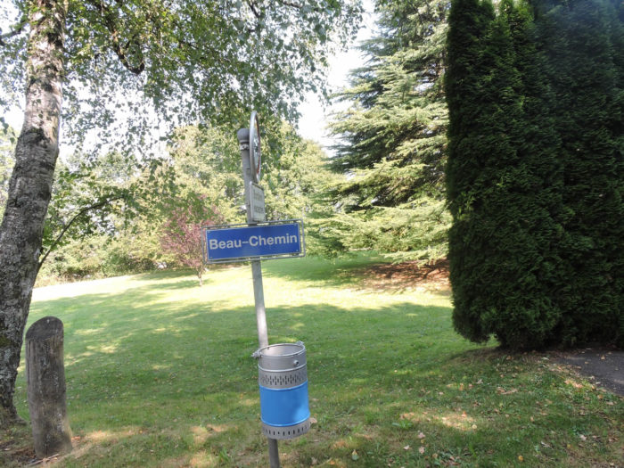
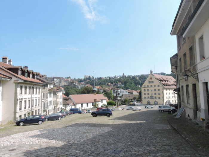
| After paying homage to this sentinel of the past, the path ascends to the road, winding through the meanders of generous nature. At one point, a fork presents itself on your right, the fork of the Beau Chemin, offering a faster alternative to reach the Porte de Bourguillon. But for those who prefer the slow pace and charm of detours, the main road offers a longer but equally enchanting journey, leading towards the village of Bourguillon. |
 |
 |
| Exiting the village, gaze towards the horizon and continue your journey to the right, along the Route de Bourguillon until reaching a modest parking area. |
 |
 |
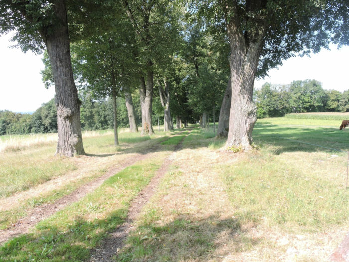
| Here begins a charming escapade along the ridge, a walk that will take you beyond the green hills, sometimes embraced by the freshness of the undergrowth, along the winding Promenade Madeleine Eggendorffer. Like an emerald ribbon, it invites you to follow its twists and turns, to savor the caress of the wind and the song of birds, far from the bustle of the city . |
 |
 |
| Soon, the path, true to its capricious nature, turns at a right angle, beginning a majestic descent towards Upper Planche, along the picturesque Chemin du Breitfeld, until reaching the end of the Beau Chemin. |
 |
 |
| Here you are at the top of Lorette’s path, dominating the horizon with your majestic presence, above the Porte du Bourguillon. |
 |
 |
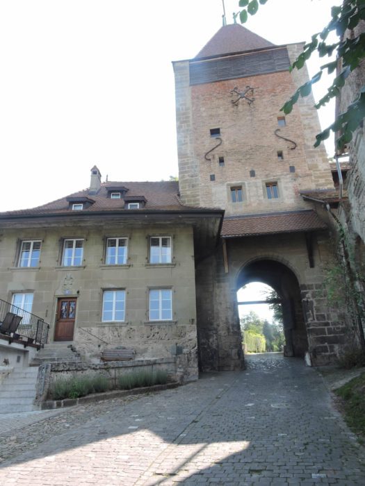
| This ancient gate, erected in the middle of the 14th century, then adorned with new embellishments in the 16th century, is a living testimony of bygone centuries. Even today, remnants of the past stand proudly, reminding passersby of the grandeur and splendor of a bygone era. There are still a moat and remnants of ramparts, as well as a house leaning against the gate. |
 |
 |
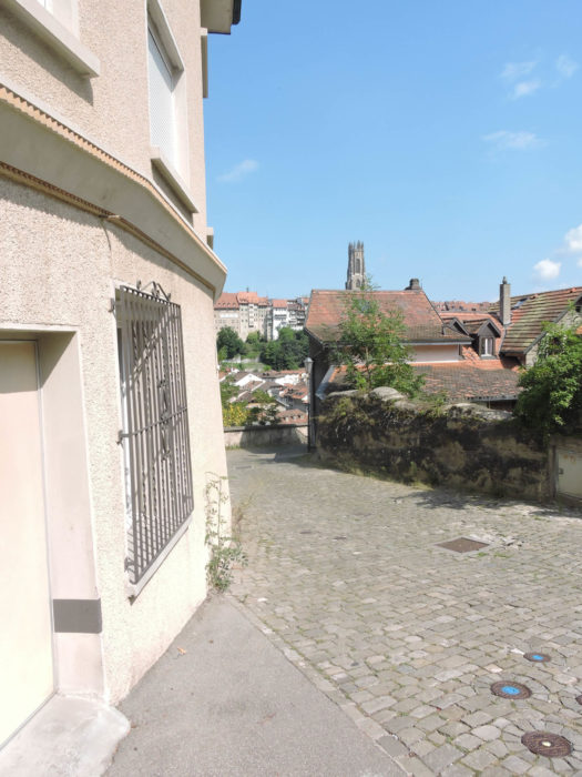
| From the majestic gate, a paved road, descending the steep slope of Lorette’s path, stretches before you like an asphalt ribbon, connecting the summit to the gentle tranquility of the Lower Town. On the horizon, the familiar silhouette of the funicular emerges, a faithful companion to travelers traversing the paths of this city of a thousand mysteries. |
 |
 |
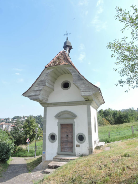
| As you descend, on your right stands proudly the small and curious chapel of Lorette, a discreet yet eloquent witness to the passage of centuries. Dating back to the 17th century, it seems to silently watch over lost souls, offering a haven of peace amidst the tumult of the world. |
 |
 |
| Opposite, stretches the Montorge Monastery, built in 1621 and since then housing the holy Franciscan women, devoted to work and contemplation. A place of retreat and meditation, it embodies serenity and spirituality in a perpetually agitated world. |
 |
 |
| Lorette’s path, like a silver serpent, continues its imperturbable descent, guiding travelers towards new horizons, new encounters . |
 |
 |
| And thus, at the end of this descent, the path joins the vast paved square of Upper Planche. |
 |
 |
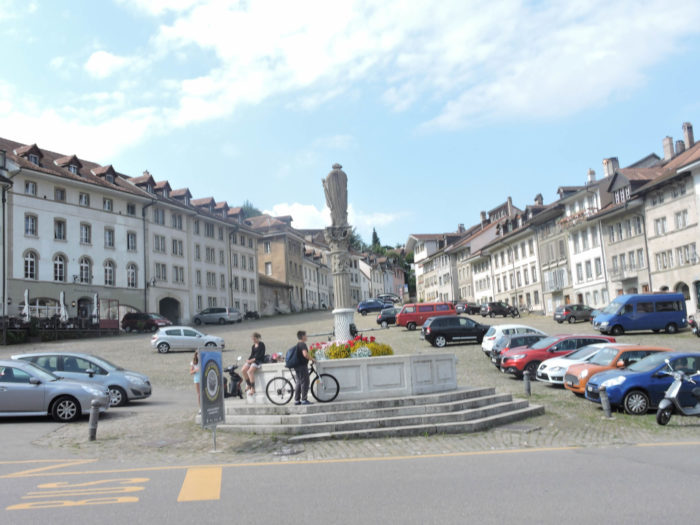
| At the heart of this square stands the St. Jean Fountain, a symbol of conviviality and sharing, around which the murmurs of daily life come alive. Not far away, one of the famous breweries of the “Basse” unfolds its charms. However, despite their renown, it is whispered that these breweries, once so typical, have lost some of their soul in the intricacies of overly zealous restoration, much to the dismay of connoisseurs. |
 |
 |
A chapter of history opens on the Order of St. John of Jerusalem, whose roots delve into the fertile soil of the late 11th century. Originally, pious merchants from Jerusalem, inspired by a divine call, erected the first sanctuaries of compassion, baptized Hospices, hence their appellation as Hospitallers. Soon, their philanthropic work evolved into a vast enterprise, extending its tentacles throughout Catholic Europe. They erected establishments, priories, commanderies, forming a tight web of devotion and determination. Like a mirror of the Templars, these knights of charity quickly assumed a dual role, embracing the mantle of faith while brandishing the sword of justice. Their weapons, forged in the fiery forge of piety, rose to defend pilgrims on the tumultuous roads of the Holy Land, to repel the assaults of the Saracens. From this sacred and martial duality, the Order of St. John drew its greatness, its renown, until the meanders of time led it to the gates of dissolution in the 19th century, thus sealing the fate of these valiant knights.
In Fribourg, the presence of the Order dates back to the early dawn of the 13th century, firmly anchoring itself in the place of Petit St Jean, on the majestic heights of Upper Planche. Over the years, its influence has spread like a sacred fire, igniting hearts and minds, investing every corner of the square and its surroundings. The commandery, like a fortress of faith and bravery, shaped the contours of the city, leaving its indelible mark on the passing centuries. It was only towards the end of the 17th century that the commandery donned its definitive stone mantle, adorning itself with its finest adornments to face the assaults of time. Thus, the ardor of builders burst forth, giving rise to a vast grain loft, nestled at the feet of the Saint-Jean church, a silent witness to the passage of ages. In 1821, this imposing stone structure was transformed into an imposing barracks, symbolizing the perpetual transformation of the city and its history.
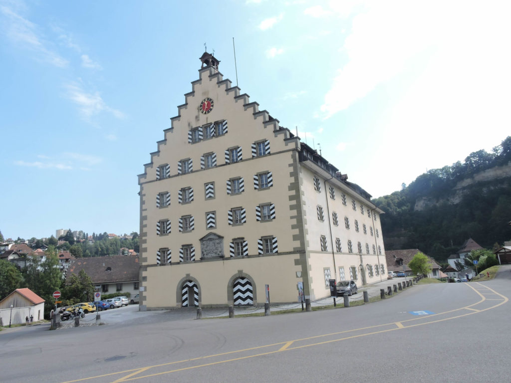
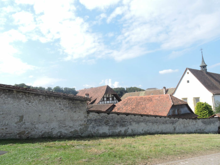
| After the decline of the Order of St. John, a new chapter unfolds in the history of the buildings that once resonated with the prayers and cries of the knights. Like a theater where the whims of destiny are played out, these edifices were alternately the stage for various political vicissitudes. From a correctional facility to a boarding school for students, from a barracks to an officers’ mess, they witnessed the tumults and changes that shook the city over the years. But like the phoenix rising from its ashes, the entire complex was adorned in 2011-2012 with a new garment, lovingly and devotedly restored, to now accommodate the Cultural Heritage Service of the canton. A new era began, marked by respect and preservation of heritage. The ensemble is complemented by the nearby church of St. Jean . |
 |
 |
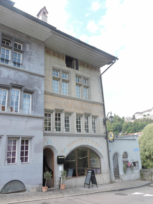
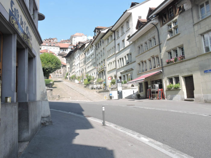
| Continuing your descent from Upper Planche, the path crosses the majestic St. Jean Bridge, near which still stands, proud and vibrant, the Café de la Clef. An eloquent witness to the lively nights of the “Basse” in ancient times, it continues to attract revelers in search of thrills and escape. |
 |
 |
Beyond the St. Jean Bridge, a final stretch of the medieval city unfolds before you, on the other side of the Sarine.
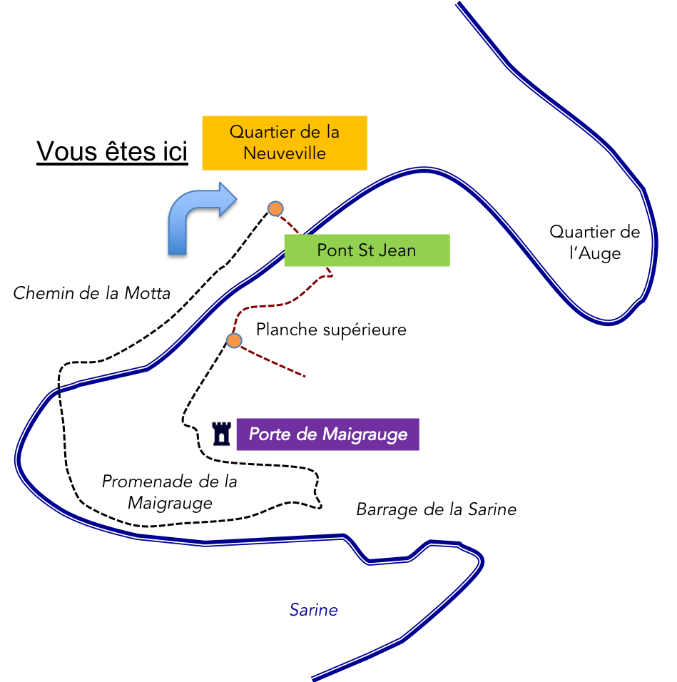
| Following the Motta path, on the left, along the calm waters of the river, you head towards the Abbey of Maigrauge, an immutable witness to the monastic fervor that has permeated these lands for centuries. |
 |
 |
| The road extends to the Motta Bridge, where the Sarine River has carved a large loop into the molasse. |
 |
 |
| Just a few steps away stands the Abbey of Maigrauge, founded in 1255 and the first female monastery in Fribourg. For over seven and a half centuries, it has been home to the monastic sisters of the Cistercian order, guardians of the flame of faith. |
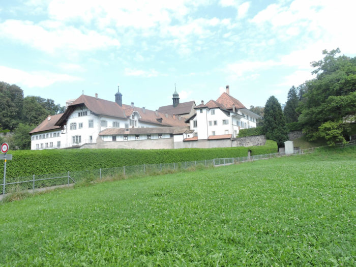 |
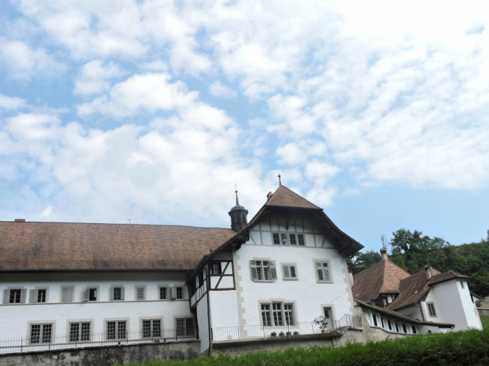 |
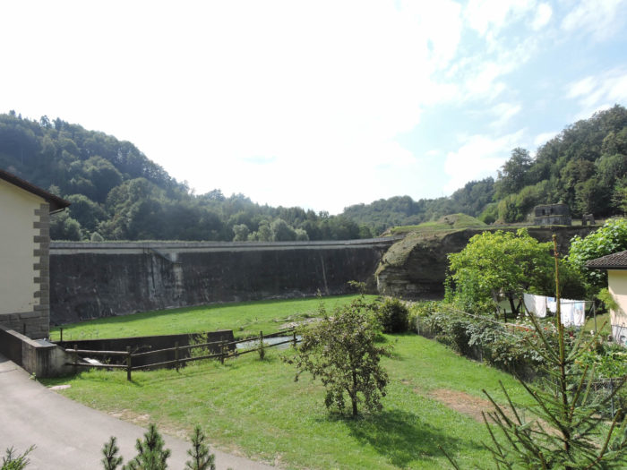
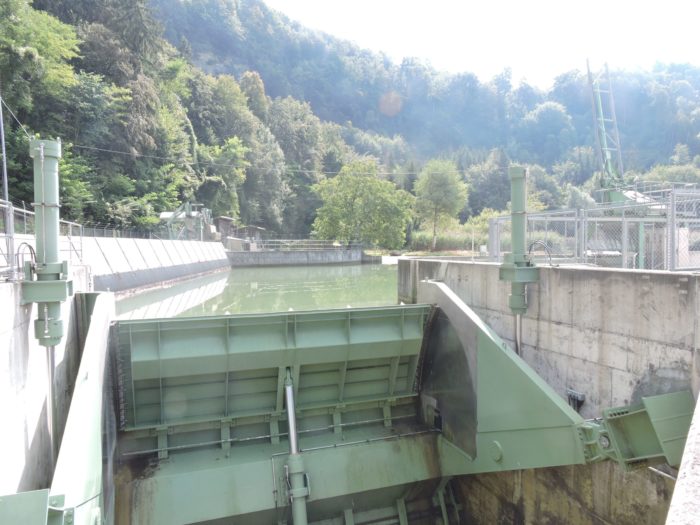
| Beside it, a dam on the Sarine and a small hydroelectric plant mark the marriage between tradition and modernity, between the force of nature and human ingenuity. |
 |
 |
| The Abbey Path, winding near the convent’s ancient wall, presents itself as a steep but brief ascent, offering passersby the discovery of a lesser-known treasure: the last medieval gate on this side of the city, the Maigrauge Gate, erected around 1350. |
 |
 |
| From this historically laden bastion, the return journey begins, following the meanders of Sonnenberg Path, gracefully descending towards the majestic Upper Plank. |
 |
 |
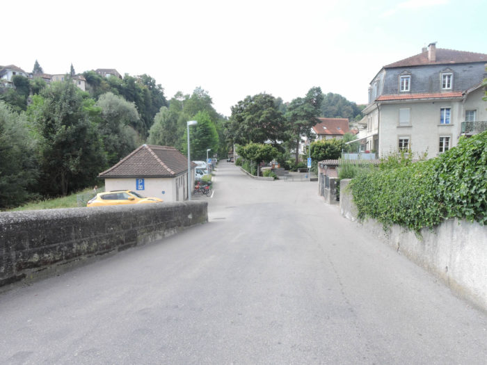
In the vibrant bustle of the Lower Town, on the other side of St. Jean Bridge, unfolds the picturesque district of Neuveville.

| Immediately beyond the bridge, you will find Neuveville Street. This one isn’t steep, and it leads towards the funicular. |
 |
 |
| The funicular, opened in 1899, a true gem of ingenuity, connects the City Centre to the Lower Town, defying gravity’s laws with a clever counterweight system powered by the city’s wastewater. Classified as a historical monument, it bears witness to the harmonious alliance between tradition and modernity. |
 |
 |
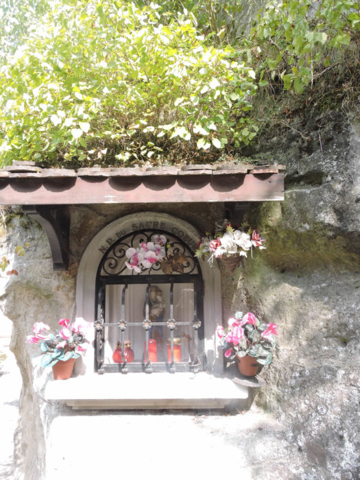
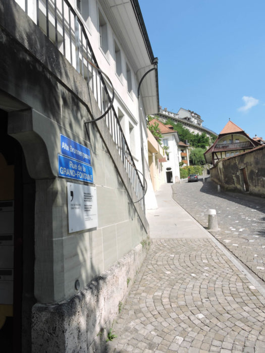
| If you feel like strolling instead of taking the funicular, head towards Grande Fontaine Street. This sloping path will lead you to the heights of the Upper Town. Along the way, your eyes will surely catch a singular curiosity: a troglodyte house, nestled in the marls, like a relic from ancient times. |
 |
 |
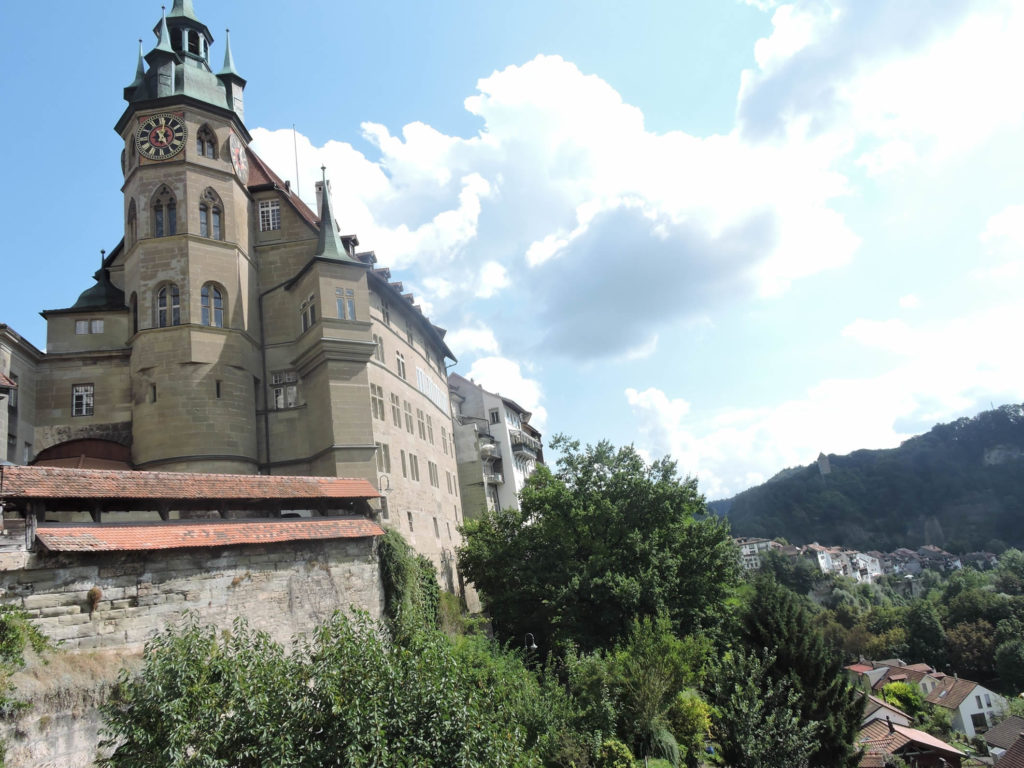
Your journey will culminate in the majestic surroundings of the cathedral, where the Town Hall stands proudly, its foundations plunging into the depths of the cliff overlooking the city.
To explore the medieval city in more detail, you’ll need to venture to the other side of the ramparts, to the north of the city.
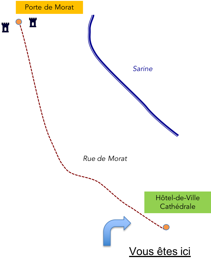
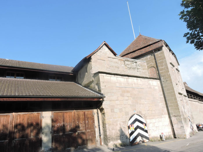
After about ten minutes’ walk, you’ll reach Morat Gate along its eponymous street. Built in the 1400s, it has seen centuries pass and has adapted to the changing needs of the city. Today, it welcomes the constant flow of traffic from the north, like an unwavering sentinel.

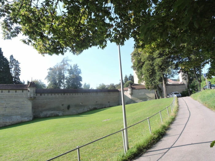
| Around this imposing gate, the ramparts stand proudly, silent witnesses to the city’s glorious past. They descend to the river, offering a breathtaking view of Poya Bridge, a symbol of the union between the city’s shores. |
 |
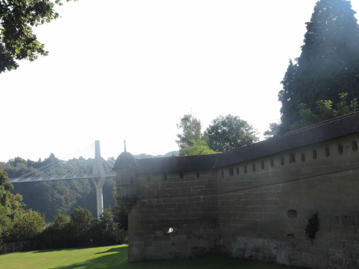 |
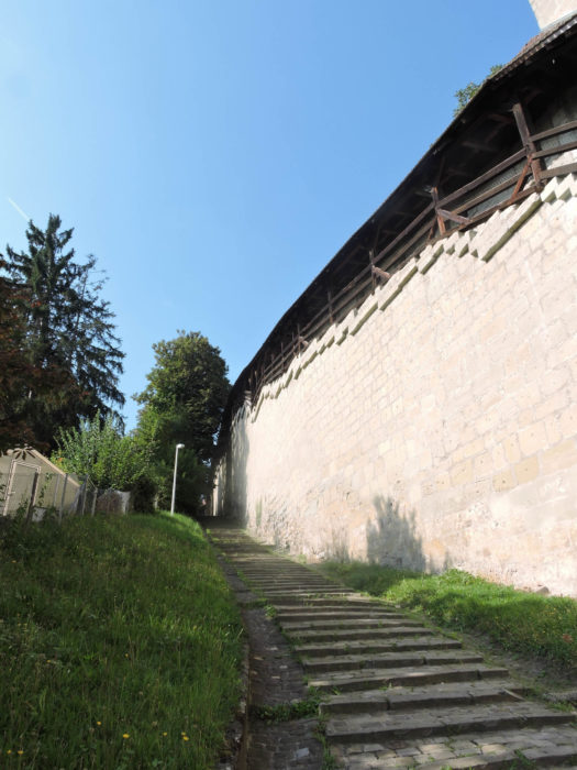
| On the other side of the tower, the ramparts rise towards the hill, to the majestic Rasoirs Tower. |
 |
 |
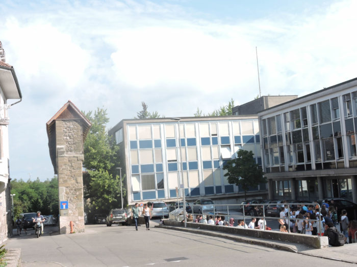
| At the top of the hill, near the vocational school, the ramparts give way to remnants, reminding us of the city’s past grandeur. Fragments of walls still stand, like mute witnesses to the history that unfolded within these walls. |
 |
 |
Did you enjoy this stroll through the twists and turns of time and history? We certainly did.
Feel free to add comments. This is often how you move up the Google hierarchy, and how more pilgrims will have access to the site.
 Next stage: Stage 15: From Fribourg to Romont
|
 |
Back to the menu |