A very beautiful stage to traverse the land of the « Bernese »
DIDIER HEUMANN, ANDREAS PAPASAVVAS
We divided the course into several sections to make it easier to see. For each section, the maps show the course, the slopes found on the course, and the state of the route (paved or dirt roads). The courses were drawn on the « Wikilocs » platform. Today, it is no longer necessary to walk around with detailed maps in your pocket or bag. If you have a mobile phone or tablet, you can easily follow routes live.
For this stage, here is the link:
https://fr.wikiloc.com/itineraires-randonnee/de-moutier-a-sornetan-par-la-via-jura-91-189357184
| It’s clear that not all travelers are comfortable using GPS and navigating via smartphone, and there are still many areas without an internet connection. As a result, you find a book on Amazon that covers this journey.
If you only want to consult lodging of the stage, go directly to the bottom of the page. |
|
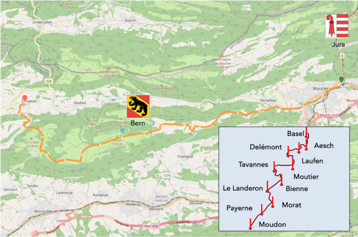
Today, you find yourself in the heart of the French-speaking Bernese Jura, a region that, as Asterix would say, fiercely resists invaders. These invaders, who speak French, live in the neighboring Jura, but they are all brothers and cousins, former German speakers from the canton of Bern. Originally, the families were not all from the region. When the Bernese Jura experienced significant growth in the last century due to the rise of the watchmaking industry, entire populations from poorer cantons, particularly from Valais and Fribourg, migrated to this part of Switzerland.
In the Jura, people tend to vote with their hearts rather than their heads. The « Jura question » has always had a deeply emotional dimension. If you ask the locals, pro-Bernese individuals will certainly say it would be foolish to leave a canton that “has done so much for them.” The reasons, such as the presence of hospitals and the number of civil servants, carry weight, especially when compared to a wealthy canton like Bern versus a poorer one like Jura. In Moutier, the nerve center of the Jura cause, there have always been bistros that are either pro- or anti-Bernese. Now that Moutier seems to be attached to the Jura canton, do pro-Bernese still shop in anti-Bernese stores? Probably, but for the older generation, it is less certain. For anti-Bernese, it is really just a more acute sense of freedom, tinged with exacerbated Germanophobia. How we will one day resolve this deadlock is uncertain. Among all the variables that help to understand the Jura question, language plays a crucial role. Moutier is the most French-speaking region of the Bernese Jura, having said yes to the Jura. However, in Champoz, just below, where the Via Jura 80 runs, there are more German speakers, and for them, the message is “nein.” Religion is another significant variable. In 1815, it was mainly Catholics who were transplanted into a Protestant canton. At the start of this story, they were Catholics. Then, the number of Catholics increased with the arrival of watchmakers from predominantly Catholic cantons. Generally, Catholics are more pro-Jura than pro-Bernese, but is that still true in a time when traditional churches are emptying at a rapid pace? Additionally, a new religious phenomenon is emerging in the region, with a good dozen of « unofficial » communities, making it one of the most densely populated areas of evangelical churches in Europe. In Tramelan, just a stone’s throw from Tavannes, there coexist a traditional Reformed parish, an evangelical Baptist church, a Catholic church, and several other evangelical communities, such as the Salvation Army and Mennonites. All of this could help shed light on the Jura question, don’t you think?
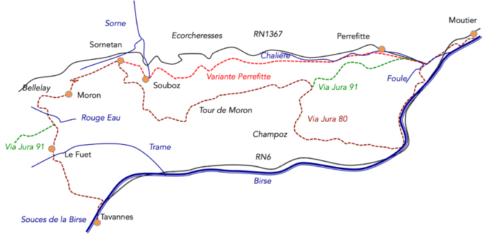
Today, you have a wide choice for crossing a large part of the Bernese Jura. Sornetan is the nerve center of this stage.
- The Via Jura 80, which we have been following since Basel, begins by following the Birs River and traversing the Gorges of Court. At Court, it leaves the river and climbs along the Forêt du Droit towards Champoz. It continues to climb until it joins the Via Jura 91 at the place called Prés du Haut de la Charrière, at an altitude of 1075 meters. Then, there is a long climb to the Moron Tower, which peaks at 1340 meters. From there, it descends through pastures and groves to the Montagne de Saules, at an altitude of 1054 meters, before continuing its descent to Sornetan.
- The Via Jura 91, also known as the “Path of the Bernese Jura,” runs from Moutier to La Chaux-de-Fonds. It initially shares the route with the Via Jura 80 at the exit of Moutier, then separates when the Via Jura 80 heads towards Court. The Via Jura 91 briefly follows the road to Perrefitte before leaving the road for the underbrush and pastures, where it rejoins the Via Jura 80 at the place called Prés du Haut de la Charrière, at 1075 meters. From this point, the Via Jura 91 and Via Jura 80 are together, passing through the Moron tower, Sornetan, and just before the Fuet. At that point, the Via Jura 80 descends towards Tavannes, while the Via Jura 91 heads towards Tramelan.
- The Perrefitte Variant, which does not have a specific code name, follows the Via Jura 91 up to the entrance of Perrefitte. Then, it runs through Souboz and Sornetan, with multiple points of access to the Moron Tower. This route has the advantage of staying below 1000 meters in altitude and also runs through the beautiful gorges of Chalière.
Distances of the routes to Sornetan:
- Via Jura 80: 22.3 km
- Via Jura 91: 16.9 km
- « Perrefitte Variant »: 14.4 km
There are solid reasons to prefer one of the two variants over the Via Jura 80. You will start today by following the Via Jura 91, which will also lead you to the Tour de Moron, an essential viewpoint in the region. Many hikers choose not to stop at Sornetan and continue their trek to Bellelay or even Tavannes, achieving nearly 30 kilometers from Moutier. An Annex « Perrefitte Variant » is also offered for those who wish to diversify their itinerary.
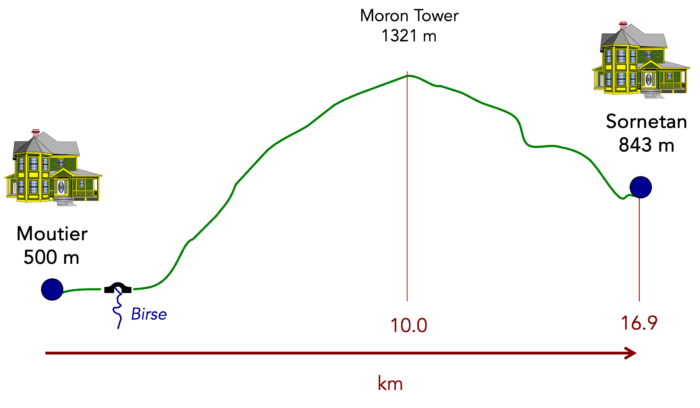
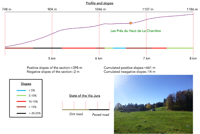
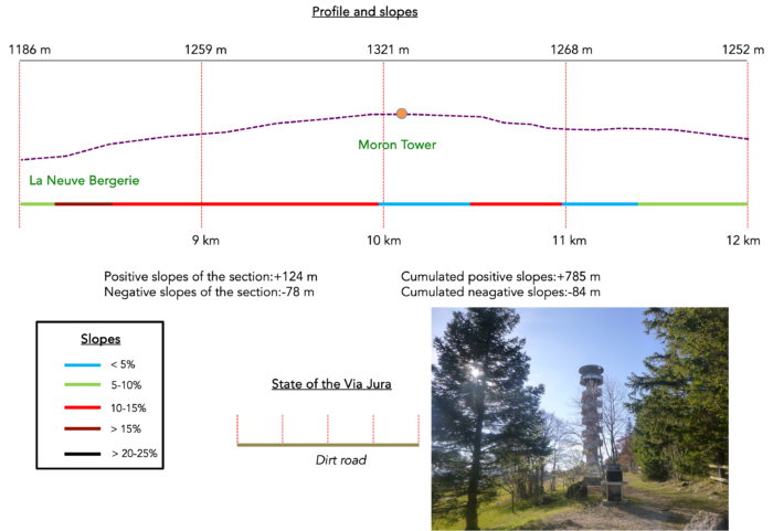
Difficulty level : The elevation changes are significant today, with an ascent of 806 meters and a descent of 478 meters. This stage can therefore be described as gemanding. Until Perrefitte, the course presents no particular difficulty; the ascent is gentle and steady. However, once you join the Via Jura 91, the tone changes: the climb becomes steep, sometimes harsh, until you reach the Moron Tower. The further you go, the more the slope eases, punctuated by some welcome flat sections. On the other side of the mountain, the descent also occurs in stages, with average gradients being more moderate than those on the ascent, although there are many exceptions.
State of the Via Jura : The course currently favors the paths:
- Paved roads: 4.5 km
- Dirt roads : 12.4 km
Sometimes, for reasons of logistics or housing possibilities, these stages mix routes operated on different days, having passed several times on these routes. From then on, the skies, the rain, or the seasons can vary. But, generally this is not the case, and in fact this does not change the description of the course.
It is very difficult to specify with certainty the incline of the slopes, whatever the system you use.
For those seeking « true elevations » and enthusiasts of genuine altimetric challenges, carefully review the information on mileage at the beginning of the guide.

Section 1 : Choosing the right route

Overview of the route’s challenges : an easy route before the steep climb.

|
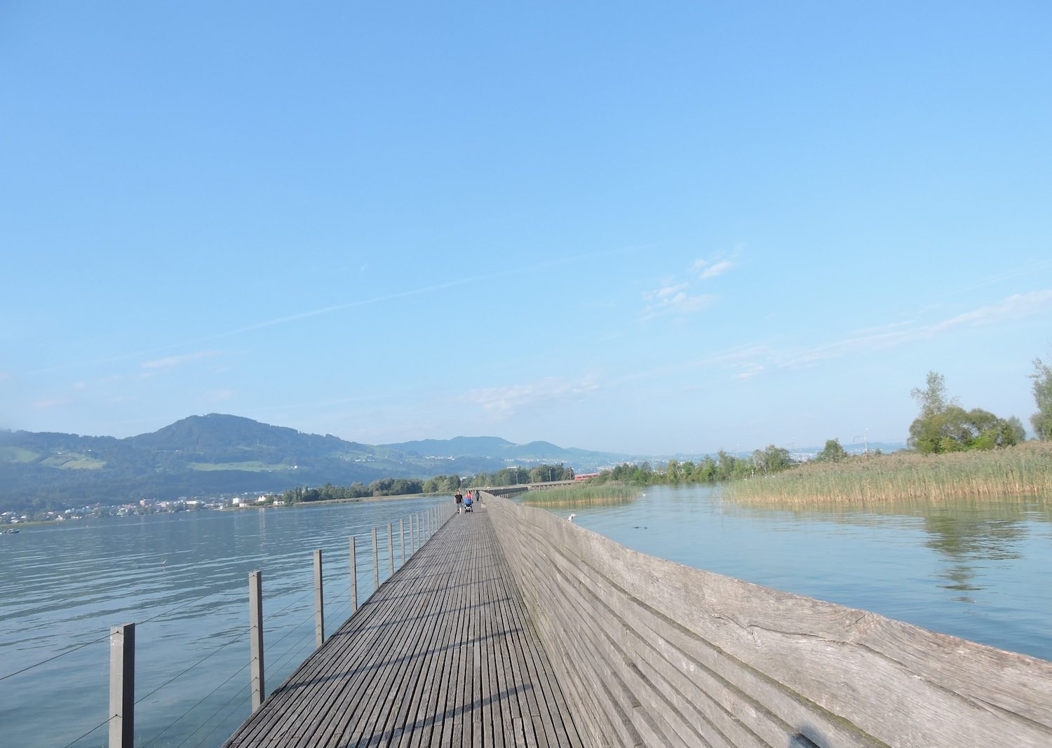
You begin at Moutier station, where you left your bags the previous day. The station, like a silent witness to journeys past, stands as a gateway to the unknown. A gentle walk awaits you along the Max-Robert Promenade, which stretches alongside the Birs River, winding through the heart of the town like a nourishing vein.
|
 |
 |
| The marked route, skillfully laid out, avoids the bustle of downtown, choosing instead to follow the river’s peaceful course. On the opposite bank, the town displays its broad arteries, showing an urban landscape devoid of spirit—a blend of old and modern constructions that seem bored with their own existence. Continuing on the road, you’ll see, off to your right in the distance, the Collegiate Church of Saint Germain, standing like a sentinel guarding the remnants of a bygone era. Moutier, called Münster in German, evokes the term « monastery. » The former abbey, founded in the Middle Ages, is the birthplace of a wave of evangelization that left its mark on the Jura region. It was destroyed during the Reformation, giving way to the Collegiate Church of Saint Germain, built in 1860 on the foundations of the old abbey as a tribute to history. In this area, many chapels bear witness to the plurality of faiths. Although the Canton of Bern is predominantly Protestant, the French-speaking people of the Bernese Jura have long held on to Catholicism. But times change. On some balconies, the Bernese cantonal flag still flies as remnants of a tenacious nostalgia, echoes of a past not easily forgotten. |
 |
 |
At the end of the Max-Robert Promenade, the route slips under the railway tracks, like a darting trout evading the river’s flow. You then follow Rue du Midi, which dances to the rhythms of the river and the trains rushing past—a spontaneous choreography between the murmur of water and the crash of locomotives.
|
 |
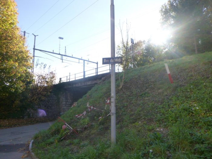 |
| This street, like a cul-de-sac of countless tales, ends abruptly, then, in one final burst, leads you through a tunnel that weaves under the railway. Emerging from the shadows, you find yourself in the old town of Moutier, discreet and filled with serenity, where the church steeple rises as a timeless landmark watching over the souls that gather here. |
 |
 |
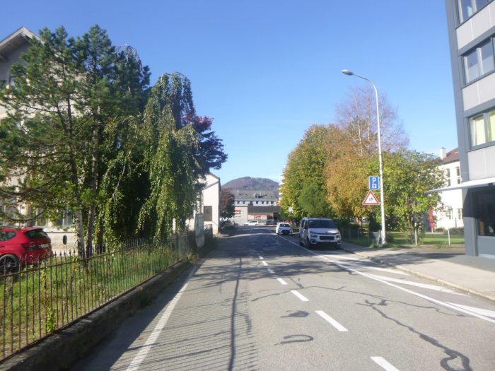
| The route remains confined to the quiet part of Moutier, away from the urban clamor, where nature and tranquility blend in subtle harmony. |
 |
 |
| Moutier, stretching out like a lazy snake, is a narrow town where crossing the peripheral boulevards can feel endless, a maze of asphalt that moves you from one landscape to another without much sparkle… |
 |
 |
| .… until you reach the Birs River at the edge of town, where its sparkling waters welcome you like a mirror reflecting the heavens. |
 |
 |
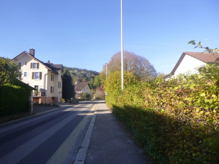
| Here, at the roundabout, the route leaves the main road, which moves away from the town, to turn toward Perrefitte. A promise emerges on the horizon: the Moron Tower, an essential landmark for locals, attracting the curious like a lighthouse in the night. |
 |
 |
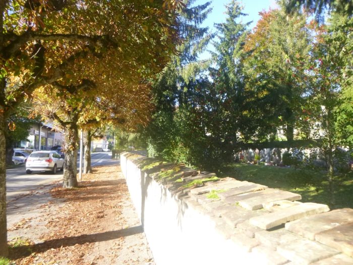
The paved road gently slopes up toward the Chalière Chapel, a gem restored in the 20th century, with origins dating back to the 11th century when it belonged to the abbey chapter. During its renovation, frescoes dating from the year 1000 were uncovered—among the oldest in Switzerland—a testament to a time when art and faith intertwined. Today, it stands elegantly as a cemetery chapel, watching over those who rest in peace.

| On a shaded sidewalk, the route follows the soothing murmur of the Chalière stream, winding gently along the cemetery, where silence is punctuated by birdsong. |
 |
 |
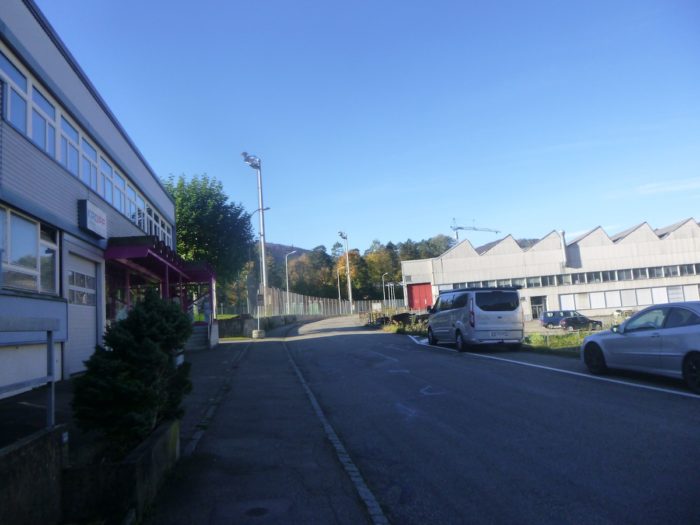
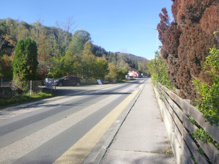
| The paved road to Perrefitte continues, winding through the outskirts of Moutier, bordered by small villas standing as sentinels, keeping memories of lives once flourished here. |
 |
 |
| You’ll soon arrive at a strategic intersection where caution is advised. A wrong turn could add miles to your journey and complicate the stage. You must ignore the Via Jura 80, which descends toward Court following the Birs River before climbing further to Moron Tower, where it will later join the Via Jura 91. |
 |
 |
| The paved road climbs in a gentle slope, skimming houses and factories between Moutier and Perrefitte, as the village begins to appear on the horizon, though it still seems distant. |
 |
 |
| The road feels endless, stretching until the first houses of the village emerge slowly, like mirages in the mist. |
 |
 |
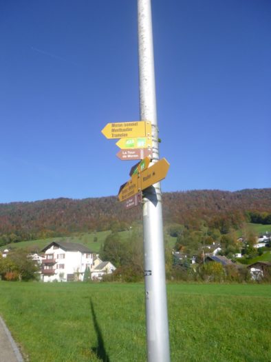
| Stay attentive on this route, as several trails lead to the Moron Tower. Don’t be tempted by the first option; continue a few dozen more meters to find the real turnoff for the Via Jura 91, which will lead you to the long-awaited destination. Here, the risk of getting lost is real. At this point, the Via Jura 91 ascends, also leading to the Moron Tower, unmissable for local adventurers. And if you walk further through Perrefitte, a climb a bit farther on will also lead you to the tower. |
 |
 |
| However, the climb toward the tower doesn’t start out invitingly. Before you lie stairs cut into the slope, challenging hikers to take bold steps. |
 |
 |
| It’s a narrow, unruly path winding through rough vegetation, entangled in wild grasses and thickets, climbing boldly above the paved road on a dizzying slope nearing 40%. |
 |
 |
| In this tangle of greenery, the path is barely discernible, often muddied by capricious rains. After a laborious stretch, you’ll come upon a metal gate, a discreet portal opening into the forest above, like a secret passage into the unknown, where effort meets adventure. |
 |
 |
| The incline remains steady, steep, and taxing, under the shade of majestic beeches and dense maple leaves, creating a cocoon of coolness, but also exertion. |
 |
 |
| As you progress, the path widens within the lush greenery of the vast pastures of Moron, where nature breathes deeply, exhaling scents of earth and grass. |
 |
 |
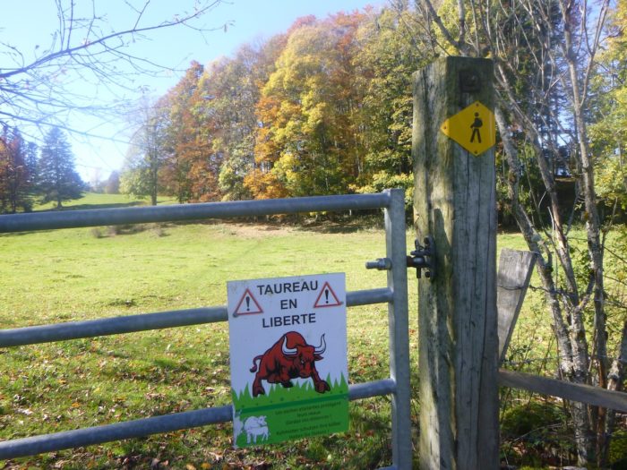
| Here, however, the presence of freely grazing cattle turns the ground into a scene of disorder: cow hooves plow the terrain, often making it marshy and difficult to cross. |
 |
 |
| To avoid sinking into this trampled ground, you might try climbing onto the grass and moss, although these can also be treacherous, sometimes as chaotic as the path itself. |
 |
 |
| The climb proves long, with a slope close to 15% and sometimes even steeper, in the heart of a vibrant natural setting where birdsong mingles with the quiet breaths of cattle grazing peacefully. Below, the last houses of Perrefitte become faint silhouettes in the landscape. |
 |
 |
| The steepness continues throughout the pastureland, punctuated by metal barriers along the path that must be carefully opened and closed to allow cattle to pass, a daily gesture that reminds you of the close bond between humans and nature. |
 |
 |
Section 2 : Between dazzling alpine pastures and dense forest

Overview of the route’s challenges : challenging route with very steep inclines.
|
Though the incline is sharp, as cutting as the edge of a blade, and offers little respite to catch your breath, nature reveals itself in radiant beauty, a true hymn to the landscape’s charm. Here lies the peace of the alpine pastures, where majestic beech trees and slender spruce reach skyward, seemingly embracing one another, expanding as the path winds through the lush meadows where the grass sways in the wind.
|
 |
 |
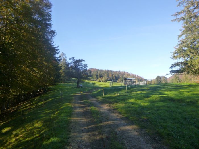
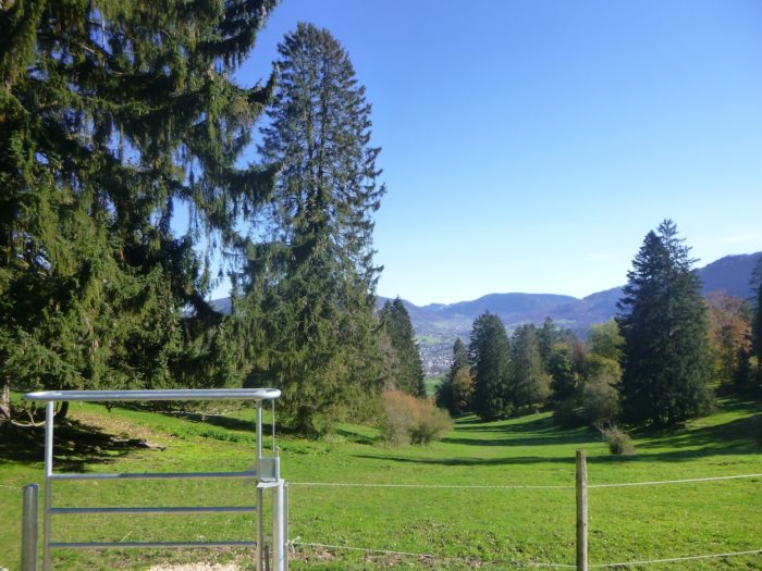
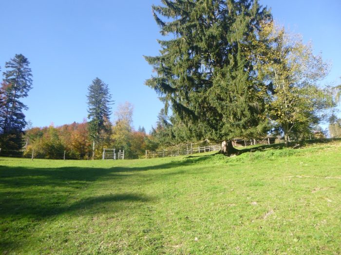
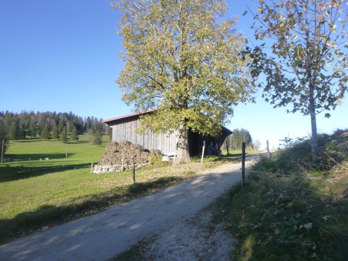
| After conquering this initial long ascent, the path leads you near a containment fence, at the crossing of a modest dirt path winding toward a mountain barn. From here, a sweeping view unfolds, with a dizzying drop toward Moutier, glistening in the distance like a jewel nestled in nature. It’s an ideal spot for a well-earned pause, where you can savor the cool air while catching your breath at the picnic area. |
 |
 |
| The trail resumes its climb across the pasture, steadily ascending on a grassy slope nearing a 15% incline. Small limestone rock formations punctuate the landscape, like memories frozen in time, giving this setting a gentle melancholy. Every step resonates with poetry, each gaze drifts into a delicate panorama imbued with serenity. |
 |
 |
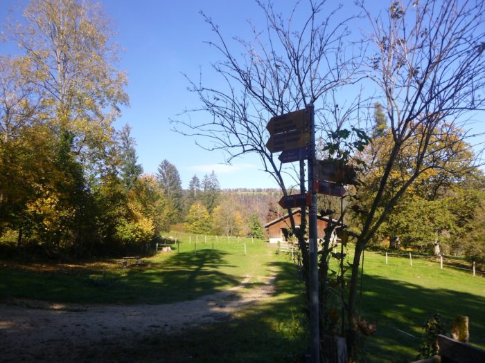
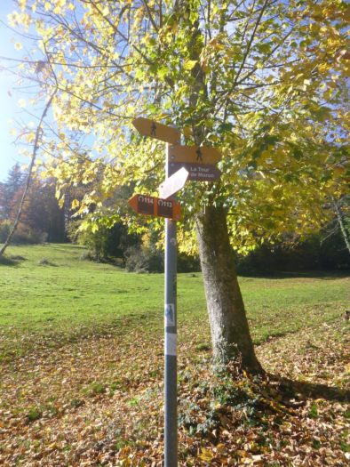
| Soon after, a signpost appears, promising further adventure: the Moron Tower is scheduled, beckoning adventurers toward uncharted territories. |
 |
 |
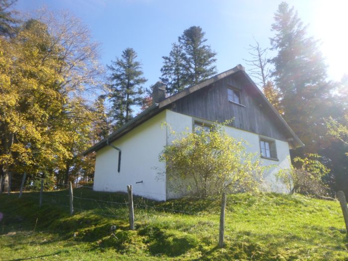
| As you climb, a small stone chalet with brilliant white walls emerges like a hidden treasure. |
 |
 |
| In this enchanting spot, the urge to settle on a bench or unpack a comforting picnic becomes irresistible. This location feels like a haven for locals, an alpine chalet accessible by a dirt road that stretches across the mountain, promising welcome and warmth. |
 |
 |
The signpost, always reliable, continues to guide you toward the Moron Tower along the Via Jura 91, like a beacon in this mountainous landscape, inviting you to continue your journey through these natural wonders.

| Here begins the hardest segment of the ascent to the Moron Tower, a true challenge as the dirt road quickly narrows into a determined path climbing the mountain. |
 |
 |
| The trail offers an intense blend of sensations, with a sometimes-vertiginous slope nearing 40%, stretching for nearly half a kilometer. It’s a test requiring resilience, an unyielding courage, to tackle this exhilarating challenge. |
 |
 |
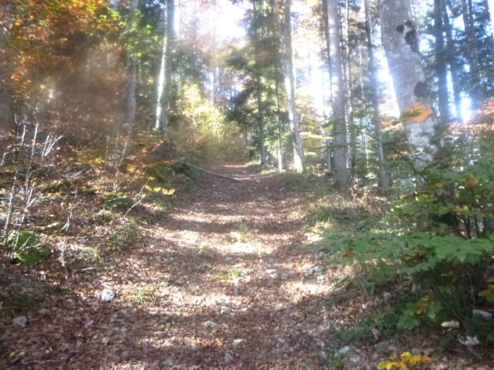
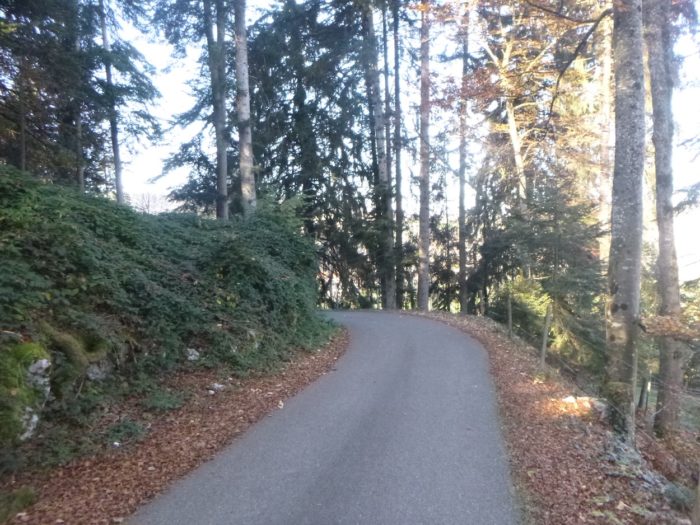
| Thankfully, nature provides refuge. Rounded beeches, quiet maples, and tall spruces envelop you in their comforting shade. In autumn, each step resonates on a crunchy carpet of leaves that softens the journey, though small, sharp stones occasionally graze your soles. |
 |
 |
| At the summit of this ordeal—or pleasure, depending on your view—the path finally emerges from the woods, basking in the open air. |
 |
 |
| Here, a divine clearing unfolds, bathed in light and poetry. You reencounter the pasture, with the forest now a distant memory. |
 |
 |
| The landscape opens with the return of fences, these faithful cattle guardians, in pastures where the slope eases to below 15%, revealing verdant meadows. In this broad expanse, cows roam freely, embodying the rich variety of breeds admired throughout Switzerland—a living pastoral tableau in a palette of colors and forms. |
 |
 |
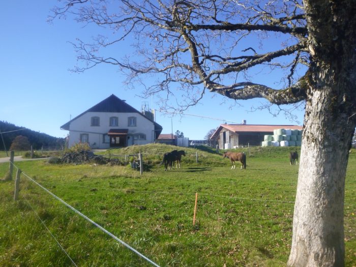
| Shortly after, the path encounters the first farmhouse at the edge of the woods, a first sign of civilization since the Perrefitte fork. The farmer, with a warm smile, explains that most of the alpine pastures in this region are privately owned, a rarity in landscapes where communal lands are almost invisible. His domain spans 100 hectares, where around fifty cows graze—a true testament to a life rooted in the land and tradition. |
 |
 |
| The path slopes up gracefully through the grass to the entrance gate of the estate, marking a significant transition. |
 |
 |
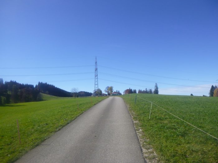
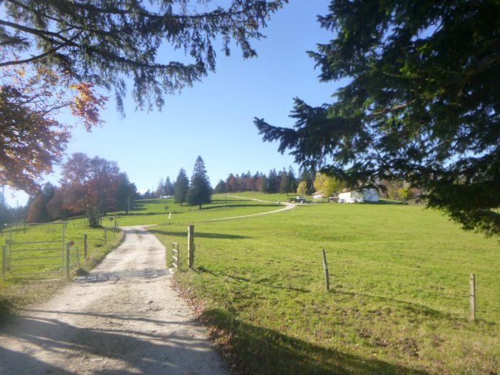
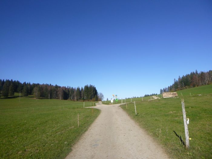
| From this point, the landscape transforms, shedding its wild character for a more human touch, unveiling itself to the travelers passing by. A broad paved road snakes through the cleared meadows, climbing toward a small high plateau, like a promise of wonder. |
 |
 |
| You proceed lightly past the well-kept chalets of the Prés du Haut de la Charrière. At first glance, this haven seems to be a retreat for locals, often retirees, who find a peaceful living environment here. It’s hard to determine whether they reside here year-round, but the region exudes a warm, welcoming atmosphere, brimming with local tourism. |
 |
 |
Here, a paved road ascends from the valley, where the Via Jacobi 80 and Via Jura 91 converge once again, forming an Ariadne’s thread that leads you to Sornetan and beyond, uniting the stories and journeys of travelers.

| However, don’t be misled by this soft illusion of tranquil holidays. A paved road with a determined incline continues rising toward the mountain, bordered by chalets, hidden from curious eyes within the undergrowth. |
 |
 |
| Higher up, the slope considerably softens, the road stretching slowly across the meadows, even passing a few rare crops, yet the climb continues. |
 |
 |
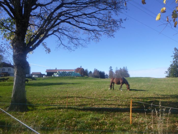
| Here, walking becomes a true pleasure on this little paved road, where cows graze peacefully alongside chalets and small farms dotting the plateau. You make your way toward La Neuve Bergerie, a name evoking the promise of a comforting stop. |
 |
 |
Section 3 : Passing by the Moron Tower
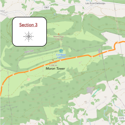
Overview of the route’s challenges : a route with gentler slopes.
|
Just a short distance ahead stands the Nouvelle Bergerie, a farm at the end of the paved road, nestled in a cul-de-sac.
|
 |
 |
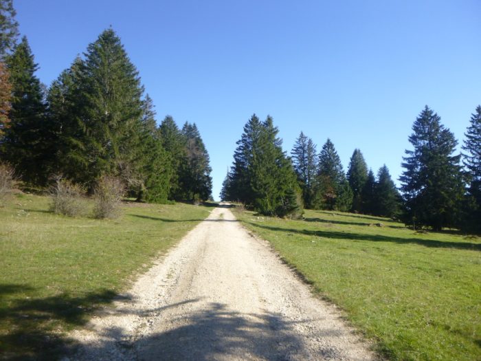
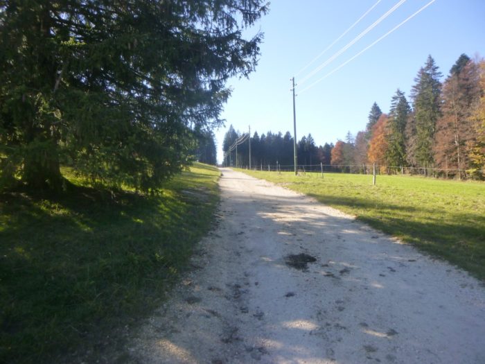
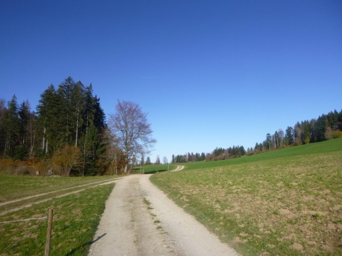
| From this point, the wild beauty of nature takes center stage once again. A broad dirt road winds through open meadows, climbing the mountain slopes with determined twists and turns. The first bends are steep, with gradients over 15%, urging hikers to summon their strength, as if nature itself were testing their endurance. |
 |
 |
| Gradually, the climb eases, softening to a gentler 10% incline. The pace slows, allowing breaths to come more freely, and the surrounding nature flourishes in full splendor. Here, spruce trees take precedence over the deciduous trees, their resilient trunks rising toward the clear sky. |
 |
 |
| The path becomes rockier but doesn’t deter avid mushroom foragers, who, in autumn, park along the roadside to gather the earth’s bounty. Many cyclists traverse this route too, speeding by, accustomed to keeping a tight schedule. |
 |
 |
Further along, the path transforms into the Chemin des Bouvreuils, where cyclists, equestrians, and hikers unite in their shared journey toward the Moron Tower.

| Before reaching the final ascent to the tower, a last farmhouse appears amid the sparse landscape, a reminder of the enduring rural life. |
 |
 |
| At this point, the path quiets, as if in gratitude to those who have persevered, ascending at a steady 10% grade. In this remote landscape, hikers feel a deep connection with nature. |
|
 |
| Soon after, the Swiss Alpine Club’s cabin emerges along the ridge, welcoming weary yet delighted hikers. |
 |
 |
And there, atop the hill, stands the long-anticipated Moron Tower, a true architectural masterpiece that appears almost like a mirage. It becomes clear why so many hikers make the effort to reach this point, at 1,350 meters in altitude, having climbed a grueling 800 meters. Here, in this raw, unadorned setting, an oasis of enchantment awaits, embodying the primal beauty of the wild.

| At the base of the Moron Mountain chain, a local resident once built a metal observation tower, where passersby could ascend to admire sweeping views from the Swiss Alps to the Black Forest. However, the structure was deemed unsafe and closed. It was then that a new tower, designed by renowned architect Mario Botta, was built. This remarkable creation, dedicated to vocational training, was constructed with the help of 700 apprentice masons from across French-speaking Switzerland and Sursee in the German-speaking region. Completed in 2004, it symbolizes the unity of craftsmanship and creativity. Sadly, in 2022, around forty of the tower’s 209 steps collapsed, forcing its closure. The cause of the incident remains uncertain, with theories ranging from construction defects to other potential issues. This story remains unresolved, sparking intrigue and speculation. |
 |
 |
 |
 |
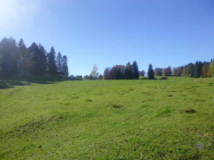
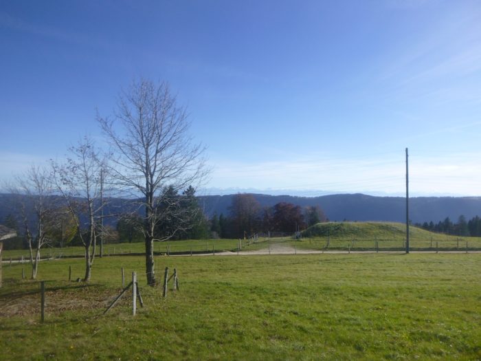
| From the majestic Moron Tower, the path descends into the meadows, gently rolling down verdant slopes where clusters of spruce trees stand like sentinels. The vast landscape stretches out, mesmerizing those seeking serenity and grandeur. |
 |
 |
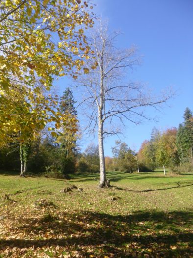
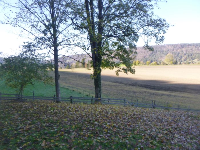
| Farther down, a wooden fence marks the edge of the pasture, guiding the path toward a solitary house—an elegant stone building with neatly closed shutters, possibly a rustic farm or vacation home, keeping its secrets to itself. |
 |
 |
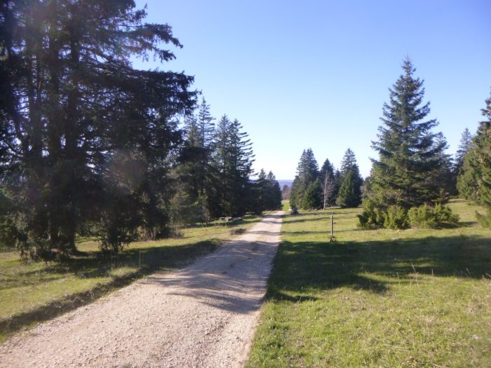
| At this point, the path veers at a right angle, leading into a stately dirt avenue that slopes gently downward, almost in a straight line, like a lazy serpent basking in the sun. |
 |
 |
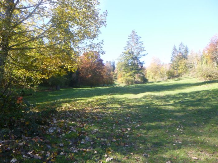
| What lies ahead is a long passage through a sublime pasture, where the wide, rocky path invites slow, contemplative wandering. The quiet murmur of nature seems to guide one’s gentle meanderings. |
 |
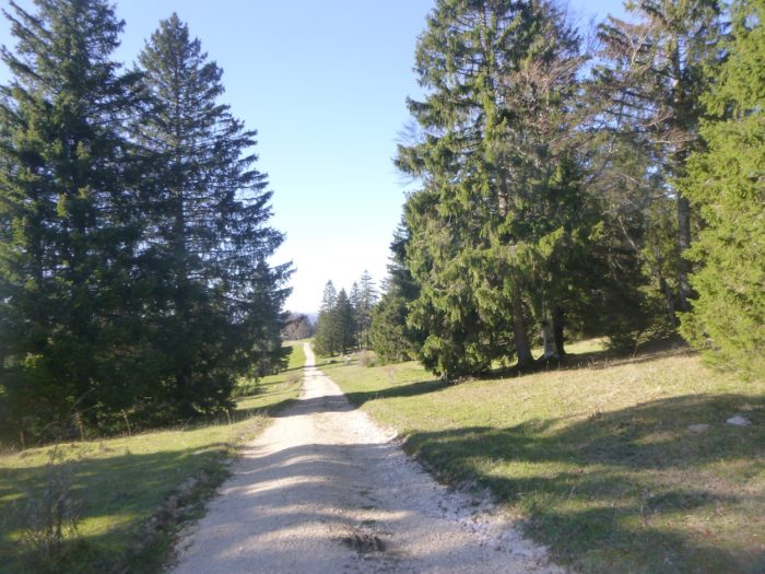 |
| On this mountainside, the pastures stretch wide, dotted with magnificent isolated spruce trees, offering a contrasting view to the previous side of the mountain, where dense forests dominated the landscape. |
 |
 |
| Soon, the secluded farm complex of the Bergerie de Loveresse appears, nestled deep within this enchanting wilderness that envelops everything in its magical embrace. |
 |
 |
Section 4 : Steep descent toward Sornetan
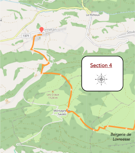
Overview of the route’s challenges : a route with significant slopes averaging 10-15%, with some steeper sections.

|
The trail pauses at the Bergerie de Loveresse, a pastoral haven where cows, horses, and goats roam freely across lush green pastures. This bucolic scene evokes a lost world, an isolated paradise at the edge of civilization, as the animals graze in peaceful rhythm. Though you have already descended 150 meters from the Moron Tower, a long journey still awaits, full of both challenges and discoveries.
|
 |
 |
Below the farm, a steep, rocky path winds through enchanting meadows where time feels suspended, frozen in a landscape unchanged for centuries.
|
 |
 |
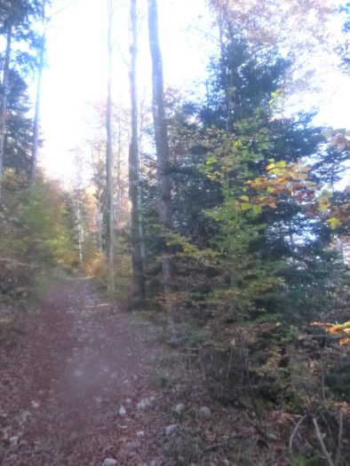
| Farther down, the trail enters a sparse woodland, populated by familiar species that thrive on this mountain: abundant spruce trees, along with a charming blend of beech and maple, with other species appearing only rarely. |
 |
 |
| In this semi-open space, poised between shaded woods and sunlit pastures, nature reveals a beauty that could bring tears to your eyes. Though the slope is steep and steady, it remains manageable, not exceeding a 15% incline, presenting a moderate challenge for walkers. |
 |
 |
| A little farther along, at a lone barn that casts a welcoming shadow, the path begins to gradually leave the wild pasture. |
 |
 |
| The path then becomes rockier, plunging with delightful intensity toward the small valley below, inviting you to continue exploring this preserved wilderness. |
 |
 |
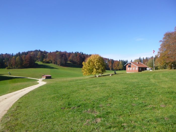
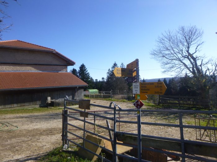
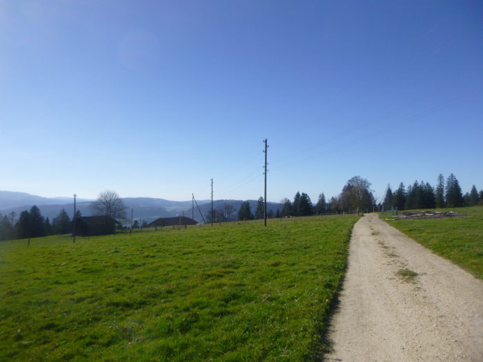
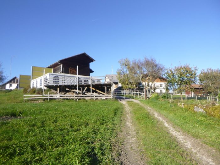
| The path emerges at La Montagne de Saules, where charming, active farms dot the landscape, bearing witness to a rustic, authentic way of life. Here, the air is filled with the delicate scents of the countryside, inviting you to experience a profound sense of peace. On the horizon, the Jura’s higher peaks stand majestic and distant. Sornetan remains your destination for the day, though from here, you could also head toward Le Fuet, where you’ll continue your journey tomorrow. You have now descended 300 meters from the Moron Tower. |
 |
 |
| A dirt road gradually emerges from the hamlet, winding behind the farms toward a long plain that seems to stretch endlessly. |
 |
 |
| This straight path traverses fields that recall verdant alpine meadows, a testament to an agricultural past. This entire mountain feels like a “mountain of cows,” where crop cultivation fades into pastoral life. |
 |
 |
| Shortly after, a wide path skirts the forest’s edge, where cows move gracefully through the meadows, adding a lively touch to this pastoral tableau. |
 |
 |
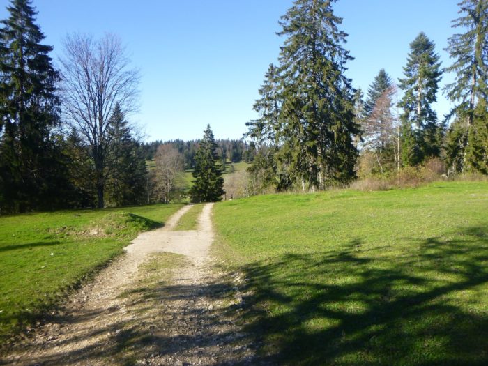
| The trail then plunges into the forest, where the slope becomes more pronounced, a challenge you’ll tackle with determination. In autumn, it’s common to encounter hunters here, awaiting deer that are said to populate the area. |
 |
 |
| A path cuts across a quiet patch of pasture before reaching a dirt road below. This brief stretch is often tricky, punctuated with loose stones and tangled roots, requiring careful attention. |
 |
 |
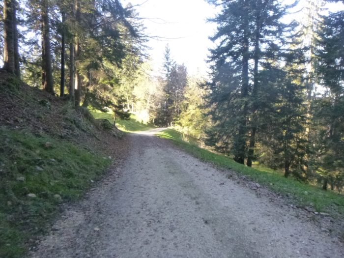
| A broad dirt road then descends, winding peacefully through the dense forest, where sunlight struggles to penetrate, enveloping you in a cool, almost mystical shade. |
 |
|
| At the bottom of this descent, the trail joins a paved road that climbs from Sornetan to the farms above. |
 |
 |
| Just below, near a weathered bench, a marked junction for Via Jura 80 appears. It follows the left path, which dives into a steep and often chaotic track, rejoining the main road farther down. Here, take the easier paved road on the right, a smoother, more welcoming route. |
 |
 |
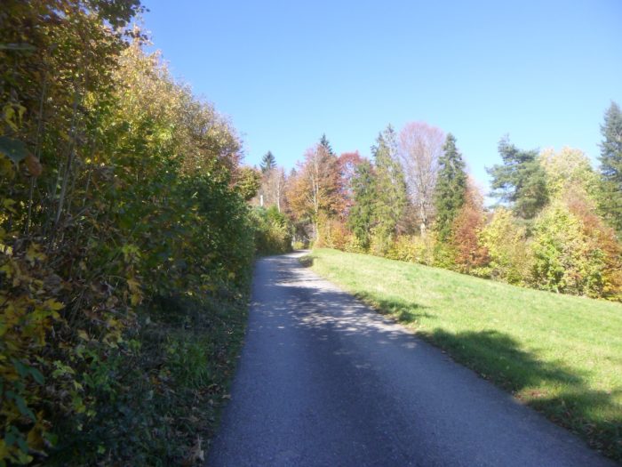
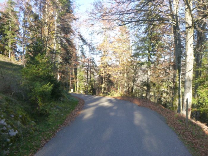
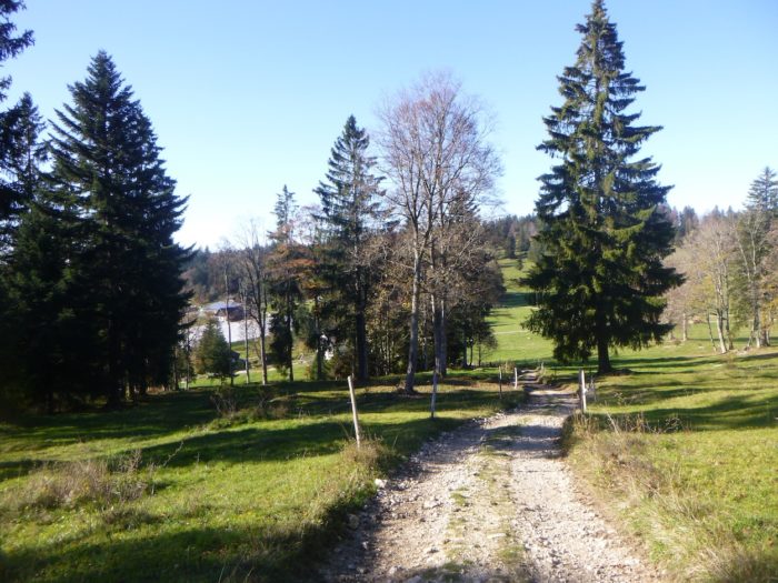
| This road, though long and sloped, provides a gentle, undisturbed walk, filled with birdsong and a soft breeze beneath the comforting shade of trees. |
 |
|
Farther down, through the tree trunks, you catch glimpses of the village of Saubraz on a neighboring hill—a picturesque stop if you choose the Perrefitte route from Moutier.

| Lower still, Sornetan finally appears, its steeple elegantly visible below the grassy slope flanking the road, inviting a moment of serene reflection. |
 |
 |
| Soon after, the Via Jura path, which you might have taken through the forest, merges with the road, uniting the routes. |
 |
 |
| The route then diverges from the road onto a very steep, often slippery path, shaded from the sun, cautiously descending through fields, weaving through tall grasses. |
 |
 |
| At the bottom of the descent, the slope levels out, offering a respite under the majestic maple trees that stretch their crowns toward the sky and their branches toward you in a gesture of welcome. |
 |
 |
| Crossing lush green meadows, the path brings you to the outskirts of Sornetan, each step resonating in the tranquil harmony of this pastoral landscape. |
 |
 |
However, the Via Jura does not lead directly into the village; it veers left toward Bellelay, promising new discoveries ahead.

| Yet, the road opens quickly into the village, a haven where life moves with the rhythm of the seasons. |
 |
 |
| Sornetan is a small village with a population of only 150. Since 2015, it has been part of the Petit Val municipality, joining with nearby villages such as Souboz through popular vote. Here, you find yourself in a Protestant community. Sornetan’s church, a gem of rustic Gothic style dating back to 1708 and restored in 1965, stands proudly in the village center.
Across from the church stands the Sornetan center, a Protestant-affiliated venue for meetings and educational programs covering ethical, theological, and cultural topics, where visitors can also stay. |
 |
 |
Accommodation on Via Jura
- Camping de Sornetan, Le Maupas 30A, Sornetan; 032 484 92 46; Camping, dinner, breakfast
- B&B Nora et Heinz Gyger-Amstutz, La Combe, Sornetan; 032 484 92 77; Pension, dinner, breakfast
- Centre de Sornetan, Les Rondez 2, Sornetan; 032 484 95 35; Hotel, dinner, breakfast
The Jura remains a popular destination, mainly for local tourists. Therefore, the accommodations are rather modest, with the exception of Airbnb listings, for which we do not have specific addresses. There are no options for food or overnight stays on this section until you reach Sornetan, where accommodation choices are limited. Availability may vary depending on the season, so it’s advisable to check in advance. Be sure to book in time.
Feel free to add comments. This is often how you move up the Google hierarchy, and how more pilgrims will have access to the site.
|
 |
Next stage : Stage 5b: From Moutier to Sornetan via Perrefitte Variante |
|
 |
Back to menu |