A gentler alternative to Sornetan
DIDIER HEUMANN, ANDREAS PAPASAVVAS
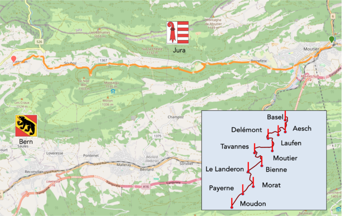
We divided the course into several sections to make it easier to see. For each section, the maps show the course, the slopes found on the course, and the state of the route (paved or dirt roads). The courses were drawn on the « Wikilocs » platform. Today, it is no longer necessary to walk around with detailed maps in your pocket or bag. If you have a mobile phone or tablet, you can easily follow routes live.
For this stage, here is the link:
https://fr.wikiloc.com/itineraires-randonnee/de-moutier-a-sornetan-par-la-variante-de-perrefitte-189552209
| It’s clear that not all travelers are comfortable using GPS and navigating via smartphone, and there are still many areas without an internet connection. As a result, you find a book on Amazon that covers this journey.
If you only want to consult lodging of the stage, go directly to the bottom of the page. |
|
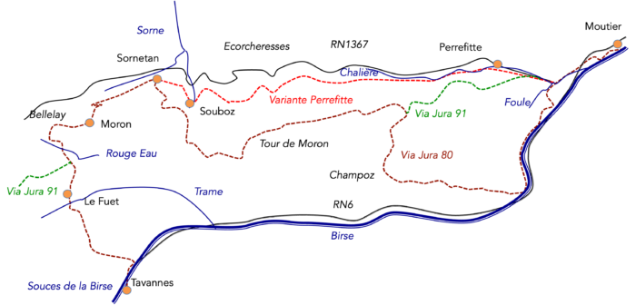
The residents of Jura will surely tell you that it would be a shame to overlook the Moron-Tower, this concrete obelisk erected in homage to the majestic mountain that overlooks the surrounding valleys. However, reaching this monument requires a certain effort and a good dose of determination. It is true that not all pilgrims are the youngest. That’s why we offer you an alternative that is not included among the listed routes of the Swiss Via Jacobi. This route is, however, well-marked, like all the trails in the region. Although you won’t be able to admire the tower, you will have the privilege of walking along the magnificent gorges of La Chalière. Another advantage of this variant is that it measures only 14.4 kilometers, compared to 16.9 kilometers for the Via Jura91.
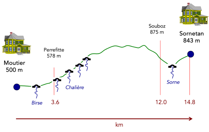
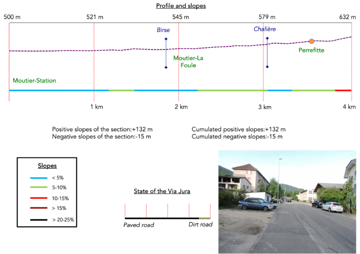
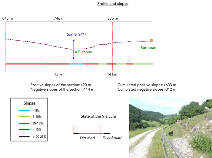
Difficulty level : The elevation changes remain significant, even when choosing the « Variante Perrefitte » (+633 meters/-312 meters). This stage is therefore also demanding. However, the altitude will not exceed 1,000 meters, and the terrain is better distributed along the route. You will start with an exploration of the beautiful gorges of La Chalière, followed by long straight climbs to Souboz. The descent towards Souboz is marked by steep slopes, just like the ascent towards Sornetan, which also requires effort.
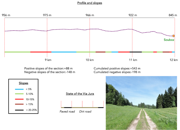
State of the Via Jura : The route still offers advantages in terms of paths today:
- Paved roads: 4.6 km
- Dirt roads : 10.2 km
Sometimes, for reasons of logistics or housing possibilities, these stages mix routes operated on different days, having passed several times on these routes. From then on, the skies, the rain, or the seasons can vary. But, generally this is not the case, and in fact this does not change the description of the course.
It is very difficult to specify with certainty the incline of the slopes, whatever the system you use.
For those seeking « true elevations » and enthusiasts of genuine altimetric challenges, carefully review the information on mileage at the beginning of the guide.

Section 1 : To conquer the « Perrefitte Variant »
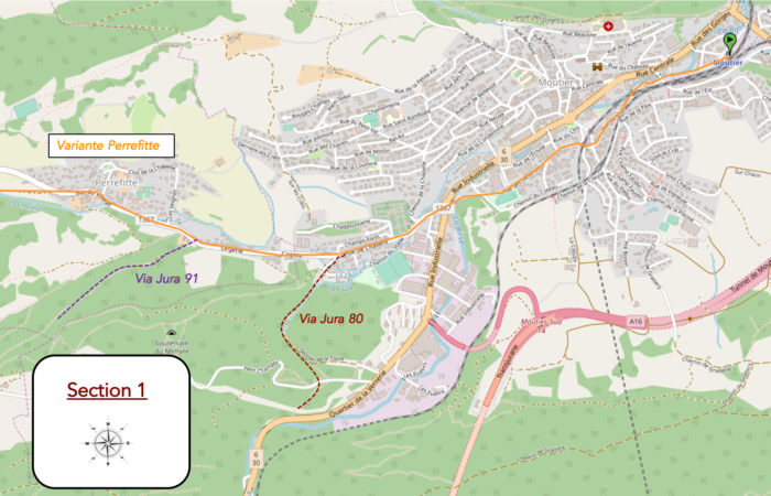
Overview of the route’s challenges : This route is without difficulty.
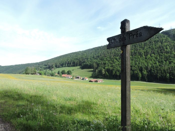
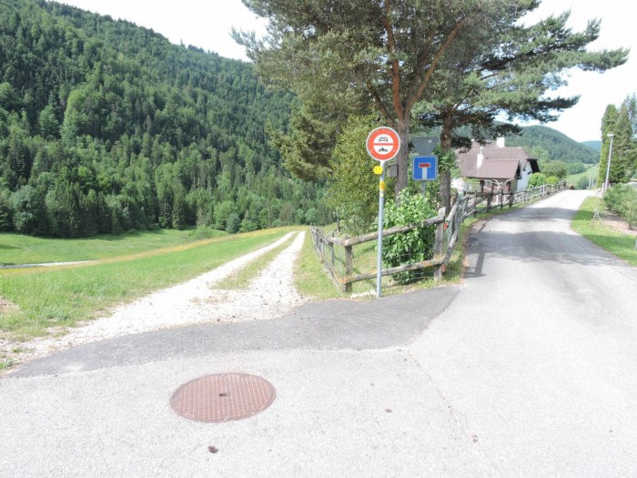
Until the gates of Perrefitte, Via Jura 91, which proudly leads up to the Moron Tower, and what is known as the “Perrefitte Variant” follow the same route. Then, at the fork, where Via Jura 91 begins its steep ascent, climbing with difficulty up the rugged slope, a subtle invitation emerges: continue straight towards the village, leaving behind the challenge of the tower.
Now you find yourself on the variant, the road that crosses Perrefitte, as it’s called here, winding toward Souboz and Sornetan. Navigation is straightforward: follow the signs to Sornetan, and ignore the other routes. You are heading toward a more secret and preserved landscape, where grand panoramas give way to the pleasures of detail, to a nature that whispers, distant from Moron’s grandeur.

|
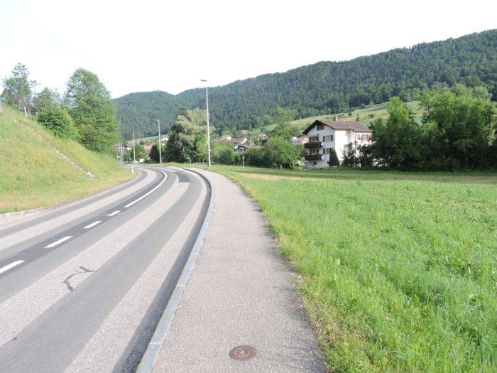
The paved road slopes up gently toward the heart of Perrefitte, following the Chalière stream, barely noticeable a few steps from the fork.
|
 |
 |
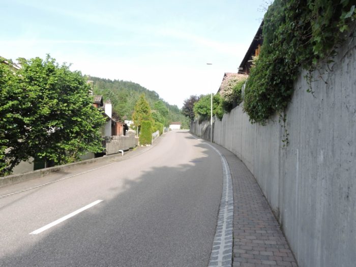
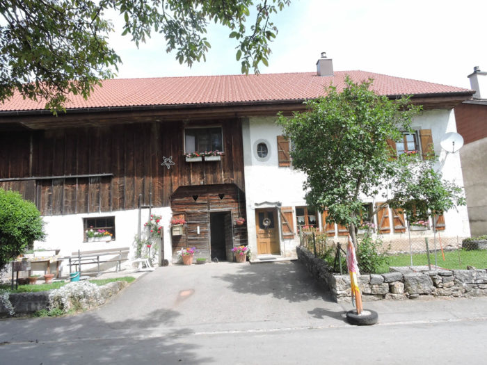
| The village gradually reveals itself, in all its simplicity. The houses here seem almost shy, nestled in greenery, as if protecting what remains of the area’s original spirit. The atmosphere is peaceful, with a palpable serenity; Perrefitte is anything but loud. Its discreet tourist infrastructure blends harmoniously with the bucolic setting, respectful of the locals and the rare visitors who venture here. |
 |
 |
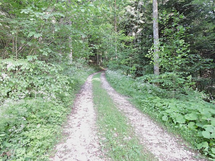
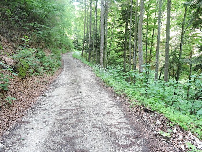
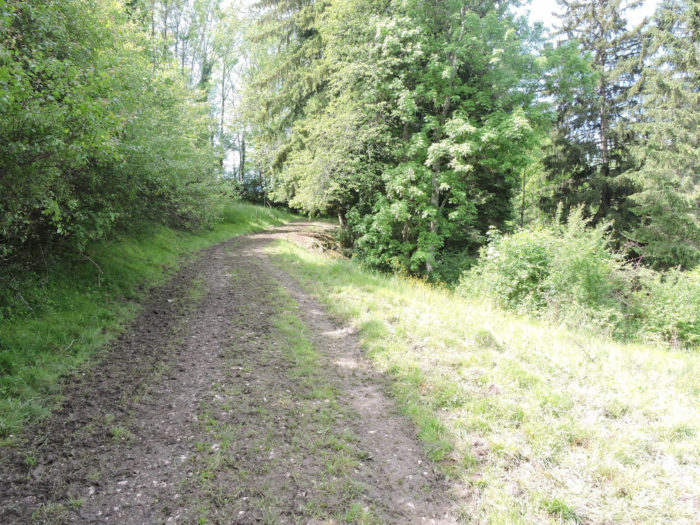
At the edge of the village, a dirt path appears, leading straight towards the gorges of the Chalière. It gradually sinks into a dense forest, where the deep shade seems to promise coolness and mystery. This portion of the route, wilder, takes you toward untamed nature, where light plays hide-and-seek with the dense branches, and each step takes you further from the civilized world.
|
 |
 |
| The path then descends gently toward the stream, which flows silently, hidden among bushes and tall grass. The murmur of the water accompanies your steps, a soft, calming sound that lulls you as you walk and invites a moment of contemplation. You thus follow this modest but faithful watercourse, away from the major tourist circuits, sheltered from the crowds, savoring this almost forgotten atmosphere of the Jura. The path stretches out, winding along with the meanders of the stream, as if unwilling to break this silent dialogue. Vegetation thickens around you, trees draw closer, and the Chalière becomes your guide in this maze of greenery. Each turn is a step further into another dimension, an intimate and unsuspected Jura, where time seems suspended. |
 |
 |
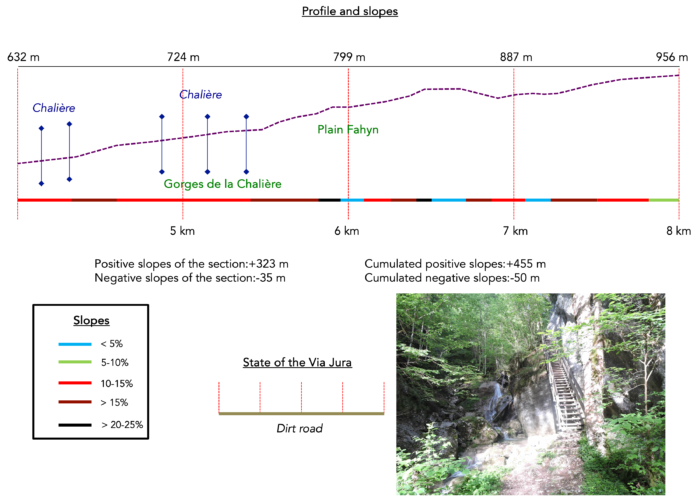
Section 2 : Along the beautiful Chalière Gorges
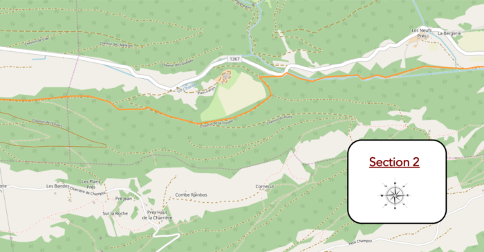
Overview of the route’s challenges : This section features a near-continuous ascent. Note the slopes, which range from 10% to well over 15%, with only a brief flat section for catching your breath.
| Here, the path plays with the stream, crossing, winding around, and ignoring it, only to return as in a hesitant dance between two partners who meet and part. From the start, the incline is noticeable, a slight slope that steadily increases. The stream, modest and serene, glides over moss and finds its way between thick stones, its clear waters glinting silver as they caress the rocks in a gentle embrace. |
 |
 |
| At first, the current seems calm. This is not the place to feel the fury of great waterfalls; you won’t hear the thunderous roar of Niagara here. Instead, the stream murmurs rather than roars. But the climb continues, crossing the water from bridge to bridge as the vegetation thickens with every step. Beneath the lush canopy, a humidity sets in that the steepness makes inevitable. You sense the rhythm of the stream will soon change, as if to mirror the slow climb unfolding before you. |
 |
 |
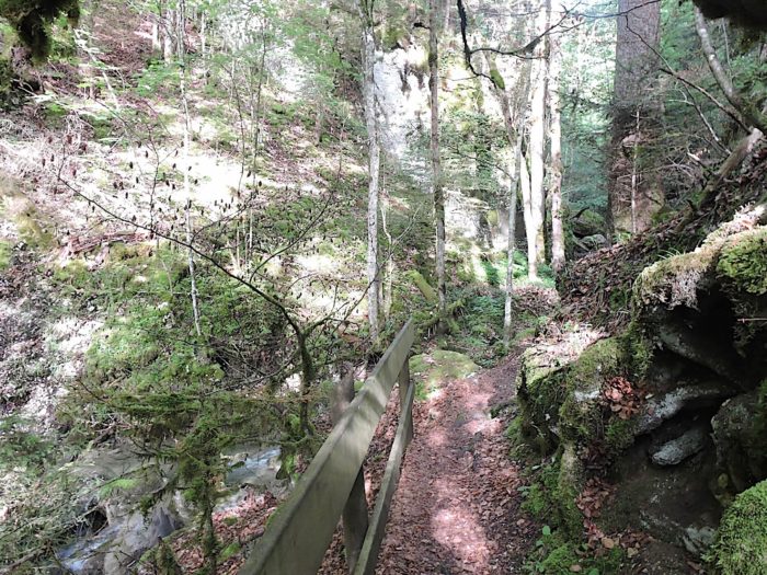
| Soon, the first waterfalls appear, true poetic pauses within the deep gorges. The crossing is magnificent, almost surreal. The stream, sometimes tame, slows and babbles across the surface before suddenly quickening, narrowing into a cascade where the water, caught in the rapids, leaps and splashes between the steep walls of the valley. The path follows the water’s edge, zigzagging from bank to bank over stairs and bridges blending into this timeless landscape. The incline remains gentle, except where stone steps, securely anchored and bordered with sturdy railings, guide less cautious visitors. |
 |
 |
| The stairs occasionally give way to wooden footbridges, suspending the path over the rushing waters, entwined within thick vegetation. It’s an enchanting place, almost otherworldly, within this wild landscape, sheltered by ancient maples and beeches, silent witnesses to time’s passage. |
 |
 |
| Though contained, the torrent reveals its strength; it doesn’t overflow but makes its presence felt. For over a kilometer, it sculpts the landscape, turning this forest into a natural maze where wild grasses intertwine with leafy trees. Here, the water has spent centuries polishing the rock, slipping through fine cracks and deep funnels, carving its path through this tenacious stone. |
 |
 |
| Three more bridges to cross this stream, a silent guide, and then the path exits the gorges, returning to an unspoiled, lush nature. At the gorge’s end, you rediscover the stream’s gentle song, a serene music blending perfectly with the forests. The path eases, winding calmly along the water, offering a welcomed pause in the incline—a promise of respite for the hiker. |
 |
 |
| Finally, the forest opens in silence, revealing a stream that babbles peacefully, in perfect harmony with the surroundings. The path undulates softly, following the stream’s meanders as it flows freely. The effort subsides, the landscape invites contemplation, and here you breathe in the gentle, comforting scent of the undergrowth, in a restored tranquility. |
 |
 |
| The path then meets the modest RN1367, a paved road winding towards Les Ecorcheresses in the direction of Bellelay, weaving subtly into the relief. Here, a narrow trail climbs steeply, with challenging slopes exceeding 30%, climbing through the forest above the road. The effort is brief but intense before the path emerges near the clearing of Plan Fahyn, where a large, solitary farmhouse stands quietly under often-clouded skies. |
 |
 |
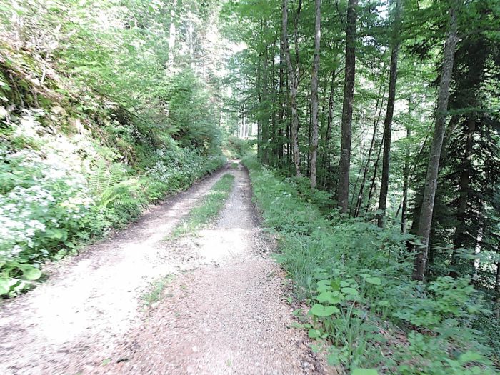
| On a wide dirt track known as « Chemin de la Trouée, » the route continues well above the clearing, through a sparse forest, where the trees seem hesitant to form a full canopy. This drab woodland, mixing rocks and ferns, unfolds in a monotonous rhythm, accentuated by a rare, timid sun. Here, light is scarce, the crossing feels prolonged, and the shadow casts an almost oppressive blanket, confining the hiker to this austere ambiance. |
 |
 |
| Like much of the Jura, the forest remains mixed, a mosaic of deciduous trees, shrubs, and spruces. The beeches dominate, though these are not the towering giants usually encountered on trails, the trees met with an almost instinctive respect. Here, scattered saplings, young shoots, and a few field maples and rare oaks are more common. The vegetation doesn’t always enchant, and when the light fades, this uninspiring mix takes on a drab aspect, almost indifferent to the hiker. |
 |
 |
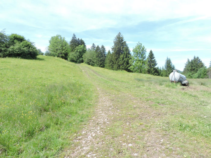
| In this monotonous setting, the wide path oscillates slightly, sometimes briefly descending before sloping up again, offering some variation with the occasional flat spot. But the overall incline remains unyielding, always gently climbing in a nearly wearisome pattern. These undulations echo a never-ending motion, a gentle yet inevitable progress toward heights that reveal themselves little by little, without immediate promise of relief. |
 |
 |
| Further along, the path crosses a darker wood, where the trees finally gather into a true forest, dense and serene, as one imagines in dreams. Here, the spruces grow more prominent, their crowns meeting to plunge the path into a refreshing, calming dimness. Then, as swiftly as it came, this deep forest brightens again, the trees thin out, and the stony ground reappears underfoot, drawing the hiker back to a wilder, sparser ambiance. |
 |
 |
| Soon, light filters once more through the leaves, and the paved road reappears below in a clearing, watched over by the path from above. The path, unwavering, continues its ascent along the forest’s edge as the landscape unfolds, gradually revealing a brighter horizon. |
 |
 |
Section 3 : Long undulations in the forest
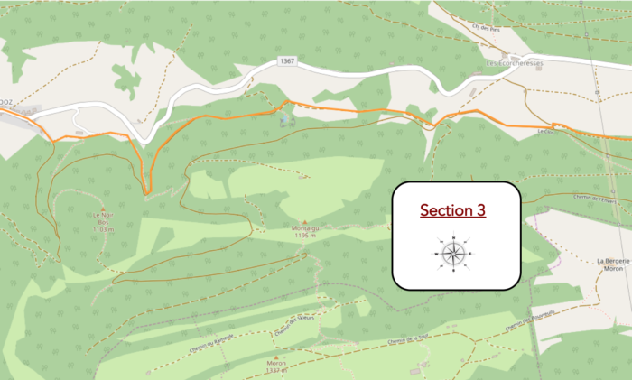
Overview of the route’s challenges : a route with less pronounced slopes.
|
After a long wandering in the forest, the path, undulating and sometimes gently descending, finally emerges in clearings overlooking the RN1367. There, between the green fields at the foot of the forest, the village of Ecorcheresses appears, peaceful and nestled in tender, almost shy green meadows. The contrast is striking: you move from the wild nature of the forest to a more serene landscape, bathed in a soft and welcoming light, which envelops the hills and gives a calming air to this region.
|
 |
 |
|
The « Variante Perrefitte, » on the other hand, ignores the village of Ecorcheresses. By deviating from the marked routes of the Via Jura, you must now follow the directions toward Sornetan. The directions come one after the other like a familiar refrain, indicating at each fork either Souboz or Bellelay. On these signs, arrows pointing towards the Moron-Tower can always be found, markers of multiple detour paths converging towards this iconic rocky promontory.
|
 |
 |
|
Then, a small paved road gently slopes up through the meadows, away from the hamlet. There, in the heart of the pastures and woods, you’ll find that characteristic Jura ambiance: vast clearings nestled in an ocean of dense forests, true islands of greenery where the landscape seems to breathe, offered to the sky like a pause in the forest cover.
|
 |
 |
|
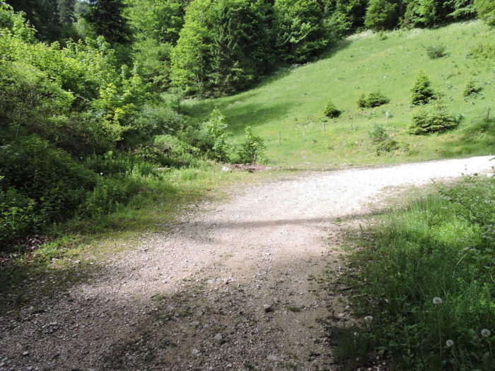
The road gently slopes down before reaching another crossroads, a new invitation towards Ecorcheresses. The intersections follow one another here, each marking the passage to a place or a breathtaking view. Shortly after, the road heads back towards the forest, encountering a strategic intersection where the opportunity to climb to the Moron-Tower again presents itself. But today, you will leave this temptation behind to continue serenely towards Sornetan.
|
 |
 |

|
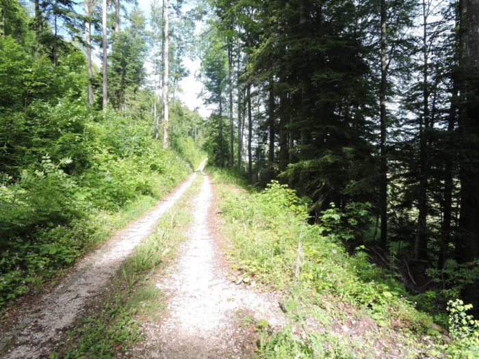
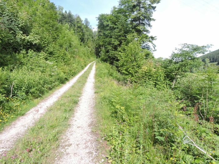
The path, now a wide gravel road, winds between meadows and groves, progressing leisurely through a landscape of pastoral softness. Here, the spruces gradually take over, imposing their stature on the landscape. The higher you climb, the denser they seem to become, their dark silhouette contrasting with the lightness of the meadows. The majestic white firs, however, remain in the background, like discreet observers, reserved for the higher altitudes where they reign as silent masters.
|
 |
 |
|
 |
 |
Shortly after, the path opens into a new clearing, revealing a small pond of rare beauty, nestled under the cliffs. This gem, seemingly placed like magic in the hollow of the valley, breathes peace. Here, silence reigns supreme, and you can feel nature vibrating in this tiny Eden. The ferns, humus, and moss release their fragrances, and the air, heavy with humidity, permeates every breath. It is impossible not to stop for a moment, captivated by the dance of light beams playing on the golden and greenish reflections of the water. It is a suspended moment, like a final gift offered by the path.

|
Further on, the stroll becomes softer and more soothing, bordered by tall spruces standing like sentinels of the forest, and deciduous trees framing the path. The ground here is gray, not very stony, offering a soft carpet to the footsteps of walkers, a welcoming and gentle earth that prolongs the calm of the underbrush. The atmosphere is serene, with a soothing sobriety, like a passage between two worlds.
|
 |
 |
|
The path then climbs, delving a little deeper into the forest, winding around the hollow of Raverattes, a fold in the landscape where a constant coolness reigns. There, humidity seems to settle permanently, and light struggles to pierce the dense foliage. The hollow jealously keeps itself in semi-darkness, like a little kingdom ignored by the sun.
|
 |
 |
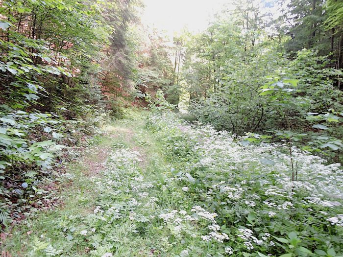
At the end of the dale, be particularly vigilant! The route does not continue along the dirt road but suddenly turns down the slope of the valley. A sign is posted there, although sometimes hidden by the generous leaves of the trees. But in Switzerland, the yellow hiking signs shine in the underbrush like chanterelles in the heart of the moss. A path then presents itself, less inviting, lost in tall wild grasses; yet, this is indeed where it descends, even if the first glance might raise doubts.

|
The trail here is rough, almost wild, and the slope becomes steep, almost dizzying, escaping through thick and unruly vegetation. In this corner of the enclosed valley, where the sun rarely ventures, maintenance is minimal: you can guess that the gardeners of the Via Jura rarely pass through here, leaving this little path abandoned, reserved for the few adventurous souls who prefer this discreet route to the heights of the Moron-Tower.
|
 |
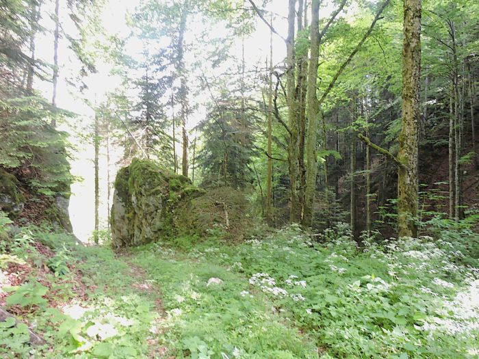 |
No, do not fear that you have strayed! A little further down, the road leading to Souboz eventually reveals itself among the trees, a reassuring paved ribbon for those who have lost their bearings in the thick forest. Nothing like a fragment of road to reassure lonely hikers.

|
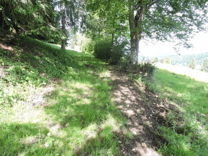
However, the path is not perfectly marked here, only skirting the edge of the woods. In case of getting lost, no worries: head down towards the road below! The adventure could turn into a small test of gymnastics, where you might have to crawl under some barbed wire to find the path again. We ourselves experienced this mishap, paddling through the underbrush, although since our passage, things may have changed or a more visible sign might have been added. Sometimes, it only takes a distracted glance to miss a precious sign.
|
 |
 |
|
The « Variante Perrefitte » finally reaches the village, with the direction to follow remaining Sornetan. The signs can be confusing here, as Via Jura 91 does not lead directly to Souboz; however, a detour from the tower can lead there. Let us not blame SchweizMobil too quickly for the sometimes-contradictory indications; updates may happen at the pace of the seasons, and who knows, the signage may now be more precise. It will be up to you to discover that.
|
 |
 |
|
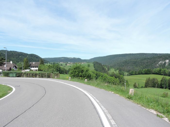
Crossing Souboz, the route follows the main road that connects Moutier to Bellelay. The road gently winds through the village, brushing past the school topped with its little bell tower and gliding near the charming fountains, which seem to freeze the pastoral spirit of this Jura hamlet. Each fountain adds its fresh and sparkling note to this bucolic setting.
|
 |
 |
As you leave the bottom of the village, Sornetan appears in the distance, seeming to be almost at the same altitude. But the stroll here holds a major surprise: an unexpected valley interposes itself between the two villages, adding a final step to this lace-like journey that continues to play with the Jura’s relief.
Section 4 : Between Souboz and Sornetan, it’s earned
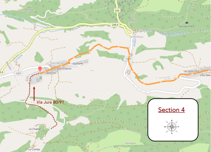
Overview of the route’s challenges :a large opening towards the Sorne, with significant slopes averaging 10-15%, with some steeper sections, both uphill and downhill..
| It will be necessary to descend and then ascend, in a play of elevation changes that tests the legs and endurance. The slope becomes steep, sometimes reaching inclines of over 15%, plunging into enchanting nature, alive and vibrant, full of pastoral charm. Fruit trees punctuate the path, and here, animals abound, giving the landscape a touch of spontaneity, as if life, in all its simplicity, blossoms freely. |
 |
 |
| After a marked descent, the path, although quite steep, remains comfortable underfoot. Once at the bottom of the dale, it runs alongside a clear stream that also descends, flowing towards the nearby Sorne River. This is where the locality of Pichoux is located, a cozy and peaceful little fold in the valley. The route, however, does not linger long in this freshness and soon takes the upward path towards Sornetan. |
 |
 |
| Before you rises a slope that seems to beckon you to climb. The ascent is marked by the presence of another indicator sign that could cause confusion, claiming that you are on Via Jura 91. The same perplexity that arose before sets in again, but it is not concerning: the path here does indeed lead to Sornetan. |
 |
 |

| The path winds through the grass across a large pasture, a vast natural space that the eye embraces with delight. Feet sink slightly into the soft, dense grass, a comforting sensation that sometimes contrasts with the steep slopes. The landscape, here, presents itself in absolute silence, and the meadows shine with a vivid green, mingled with the deep green of the spruces. These trees, imposing and silent, seem to dip their branches as if to drink from the ground, adding a note of serenity to the pastoral panorama. |
 |
 |
| Higher up, the path modestly enters the underbrush. The shade of the trees, soft and soothing, seems to want to temper the ardor of the ascent, offering a discreet transition before reaching the first houses of Sornetan, where the path finds the more secure pavement. |
 |
 |
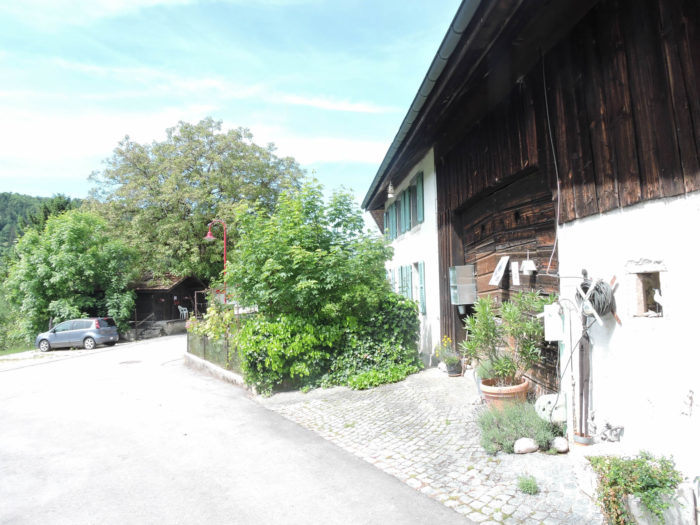
| But something strikes here, a subtle difference that stands out from the rest of the Canton of Bern. The farms of Sornetan are functional, pragmatic, but they lack the refinement and opulence of the large Bernese farms, which, along the routes of Via Jacobi, catch the eye with their grandeur and presence. Here, the farms are more modest, a way of saying that the Jura farmers in this region may not be quite « real » Bernese, without wanting to offend them in any way. |
 |
 |
| The village of Sornetan is just a tiny dot in the Jura: barely 150 inhabitants. Since 2015, following a popular vote, it has become part of the municipality of Petit Val along with neighboring villages, including Souboz. In this corner of Protestant Switzerland, the Sornetan temple, built in 1708 in rustic Gothic style and restored in 1965, stands at the center of the village, adding a historical and sacred touch to the place.
Opposite this temple stands the Sornetan Center, a place for meetings and training, bearing an ethical, theological, and cultural vocation, where everyone can come to rejuvenate. The center invites a stay, a moment of pause within oneself, far from the noise of the world, in this valley where time seems to stretch to allow for reflection and peace. |
 |
 |
Accommodation on Via Jura
- Hôtel Restaurant de l’Etoile, Gros Clos 4, Perrefitte; 032 493 10 17; Hôtel, dinner, breakfast
- Camping de Sornetan, Le Maupas 30A, Sornetan; 032 484 92 46; Camping, dinner, breakfast
- B&B Nora et Heinz Gyger-Amstutz, La Combe, Sornetan; 032 484 92 77; Guestroom, dinner, breakfast
- Centre de Sornetan, Les Rondez 2, Sornetan; 032 484 95 35; Hotel, dinner, breakfast
The Jura remains a popular destination primarily for local tourists. Consequently, accommodations are more discreet, except for Airbnbs, for which we do not have addresses. On this stage, there are no dining or lodging options before reaching Sornetan, where accommodations are scarce. Check in advance for the availability of lodging, as it depends on the season. Make sure to book at all costs.
Feel free to add comments. This is often how you move up the Google hierarchy, and how more pilgrims will have access to the site.
|
 |
Next stage : Stage 6: From Sornetan to Tavannes |
|
 |
Back to menu |