Very high in the mountain, in a canton still searching for itself
DIDIER HEUMANN, ANDREAS PAPASAVVAS
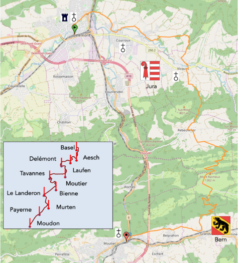
We divided the course into several sections to make it easier to see. For each section, the maps show the course, the slopes found on the course, and the state of the route (paved or dirt roads). The courses were drawn on the « Wikilocs » platform. Today, it is no longer necessary to walk around with detailed maps in your pocket or bag. If you have a mobile phone or tablet, you can easily follow routes live.
For this stage, here is the link:
https://fr.wikiloc.com/itineraires-randonnee/de-delemont-a-moutier-par-la-via-jura-34710927
| It’s clear that not all travelers are comfortable using GPS and navigating via smartphone, and there are still many areas without an internet connection. As a result, you find a book on Amazon that covers this journey.
If you only want to consult lodging of the stage, go directly to the bottom of the page. |
|
In Delémont, we left the Jurassians in 1815 when the Congress of Vienna handed them over to the Bernese. But in Switzerland, the Alemannic (German-speaking) and Francophone populations barely tolerate each other. Bern is prosperous, while the Jura region is far less fortunate. Thus, a gradual split emerged among the Francophone Jurassians: those in the North dreamed of independence, while those in the South preferred Bern’s wealth. It took time to find even the beginnings of a solution. During the 19th century, the North only managed to create a society to preserve the French language and culture. Tensions slowly escalated between the two camps, but the winds of change were in the air. In 1917, a committee was formed advocating for the creation of an independent and autonomous canton. In 1947, a crucial event occurred when Bern refused to appoint a Francophone Jurassian to head the Department of Public Works. This man didn’t speak German. This led to the formation of the Jura Separatist Movement (MSJ) in Moutier. An escalation of separatist actions followed, with some more aggressive than others, such as the Bélier Group, which didn’t hesitate to use violence. The struggle culminated in the organization of a plebiscite. On June 23, 1974, a referendum on creating the canton of Jura received 52% in favor, but only three out of seven districts voted for it. Strange paradoxes, such is democracy. Fifty-two percent is just half, and the district of Moutier, where it all started, preferred to remain Bernese.
In 1975, the canton of Bern asked the three southern districts, still loyal to Bern, and the Laufon region (wavering between Bern and Basel-Country) to give their opinion. The latter reaffirmed their attachment to Bern. In 1976, a constitution for the future canton was drafted. But in Switzerland, the people always have the final say. The opinion of people from Appenzell, Geneva, and other regions was sought, many of whom had never even been to the Jura. On September 24, 1978, the canton of Jura was accepted by the Swiss and became the youngest of the Swiss cantons.
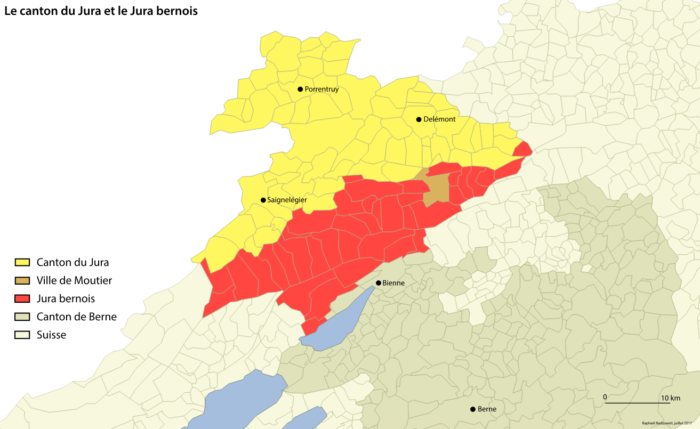
You think this matter is over? Absolutely not. In 2013, a referendum was held to ask the longtime cantonal rivals if they wanted to unite. The answer was clear. In the South, they were in favor of remaining Bernese until the end of time; in the North, they were wholeheartedly Jurassian. Now, the municipalities in the region can decide whether they want to belong to the new canton or not, regardless of whether they share a border with it. When we passed through here in early 2017, separatist flags were flying in Moutier. The city was in turmoil, torn between supporters of joining the canton of Jura and pro-Bernese opponents. After a long suspense, the citizens of Moutier decided, by a narrow margin, to join the Jura: 2,067 votes to 1,930, or 51.72%. It wasn’t exactly a resounding victory, but that’s democracy. However, appeals were filed, suspending the decision. But today, the knot seems to have finally been untied. Since the latest votes in 2021, Moutier is now officially part of the Jura. But at the same time, Sorvilier and Belprahon definitively said no to the canton of Jura. Long live the canton of Bern! So, remember this. When you pass through Belprahon, just a stone’s throw from Moutier, remember that you are on Bernese soil, and a little further down, with a wave of a magic wand, you’ll be back in Jura territory. But the story isn’t over. Politics is complicated and requires many back-and-forth negotiations between the municipalities, cantons, and citizens. There will still be another vote to confirm the situation. Simple, right? Bern and Jura still need to come to an agreement. The canton’s borders aren’t definitively set yet!
The landscapes of the Jura are not always as gentle as one might imagine. They are marked by authentic ruggedness, dotted with silent valleys and austere mountains. This is a place where history and nature meet, creating a setting where the past still resonates strongly. It’s a theater where every hill and forest tells a story of struggle, resistance, and identity.
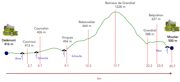
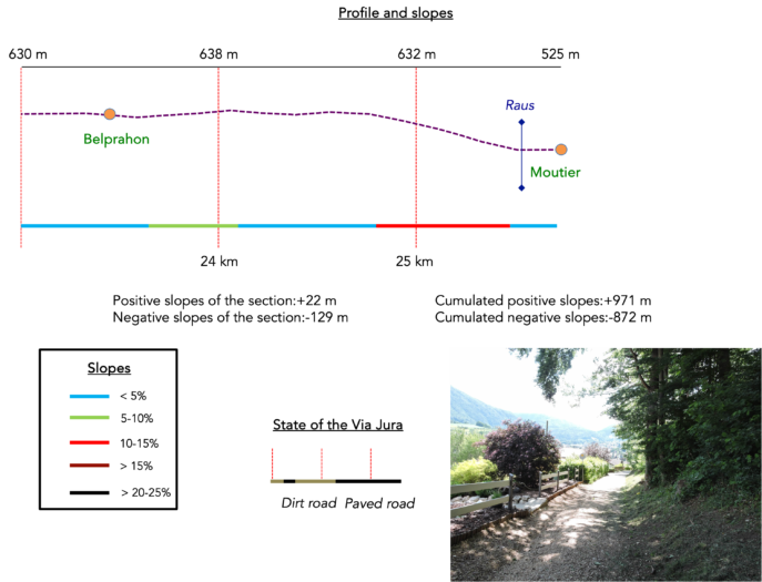
Difficulty level : In the minds of many Swiss, the Jura is not the Alps; it’s just gentle hills. So come here to check your judgment. The elevation changes are highly significant today (+971 meters / -872 meters). In reality, there’s just one bump, but what a bump! After a walk in the plains of Delémont, through the countryside or along the forest edges, from Vicques, you will have to climb to the high plateau of Raimeux de Grandval and then descend on the other side, through forests on very steep slopes. The high plateau marks the border between the Jura canton and the Bern canton.
State of the Via Jura : It’s another day primarily on trails:
- Paved roads: 9.0 km
- Dirt roads : 16.7 km
Sometimes, for reasons of logistics or housing possibilities, these stages mix routes operated on different days, having passed several times on these routes. From then on, the skies, the rain, or the seasons can vary. But, generally this is not the case, and in fact this does not change the description of the course.
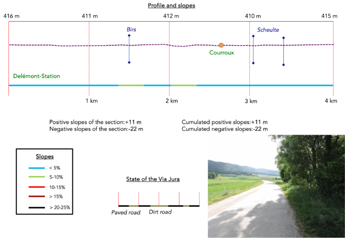
It is very difficult to specify with certainty the incline of the slopes, whatever the system you use.
For those seeking « true elevations » and enthusiasts of genuine altimetric challenges, carefully review the information on mileage at the beginning of the guide.

Section 1 : Gentle ripples in the plain

Overview of the route’s challenges : a route without difficulty.
|
In the urban maze, when seeking directions, it is often wise to start at the train station, a central point and an unchanging beacon for the lost traveler. Whether you start from the station or the city center, the route back to Soyhières is straightforward. If you finished your previous stage in Delémont, nothing will disrupt your return. Simply retrace your steps to the edge of the city, following the familiar route to the bridge over the Birs River. For those starting directly from here, let’s pick up the trail together. |
|
 |
 |
| Ascending the street from the station, the route quickly leads you to the Delémont College, an edifice that seems to watch over passersby with the solemnity of an old patriarch. | |
 |
 |
| A pleasant, peaceful asphalt path runs alongside the Sorne, winding between charming villas and austere service buildings. |
|
 |
 |
| Further along, you reach the cantonal road, where the city gives way to the outskirts. Here, a cogwheel, a relic of the industrial era, stands proudly, a reminder of Delémont’s laborious past. | |
 |
 |
| At a garden center, at the place called Auberge de Jeunesse, the route leaves the cantonal road to head towards the Birs River, bringing with it a promise of tranquility. | |
 |
 |
| The route then crosses the railway line, as if inviting you to cross the boundary of modernity to embrace the tranquility of nature by crossing over the river. | |
 |
 |
| Today, the Birs River, darkened under the canopy of leafy trees, presents a melancholic scene. It is also here that the Sorne River merges into the Birs River, in an aquatic embrace. | |
 |
 |
You join the Via Jura 80 here, the convergence point where you had tread the previous day, for those who had quietly forgotten to visit the Vorburg castles on the heights.
| Here, you are introduced to the Colliard site, a protected natural haven, a sanctuary of flourishing biodiversity where birds and amphibians thrive. As is often the case in such preserved sanctuaries, the promises are grand and the expectations high. | |
 |
 |
| No matter how keen your eye, there are only sturdy oaks and wild beeches to gaze upon. | |
 |
 |
| The road then stretches towards Courroux, with the church spire soon emerging on the horizon. A sign recalls the indelible mark of iron in this region, a history dating back to ancient times but reaching its peak in the 17th and 19th centuries, propelling prosperity through the extraction of this ore. Courroux takes its name from « Curtis rufus » (territory in red earth), in tribute to the abundance of iron ore discovered there. | |
 |
 |
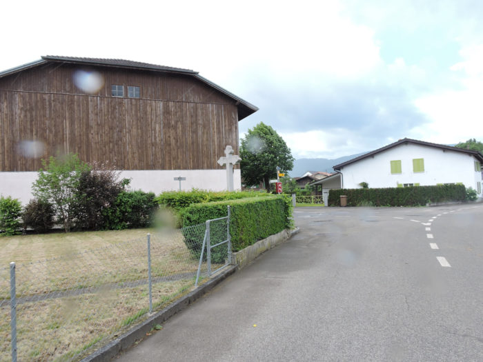
| The road then leads to the first houses of Courroux. In these villages where farmers have not yet surrendered all their land to industry, as is still the case here in Courroux, where the industrial zone gains ground each day, pride resides in the distinctions earned in cattle competitions. In the canton of Jura, the horse receives far more recognition than the cow. | |
 |
 |
| In the heart of the village, where modest homes form a fairly common tableau, without frills or old buildings, the Scheulte River flows peacefully. | |
 |
 |
| The road crosses the village. Although the Via Jura 80 is not mentioned here, you should follow the direction of Corcelon/Vicques. | |
 |
 |
| At the village exit, the road crosses the Scheulte River again, a sometimes-muddy stream that meanders through brambles and wild grasses. | |
 |
 |
| Without delay, a winding path descends through the fields, following the wooded edge and the softly murmuring river alongside. In this region where meadows predominantly outnumber crops, the land proves less generous, less fertile. The rustic simplicity of the landscapes reflects a raw authenticity, far from the idealized visions often depicted. | |
 |
 |
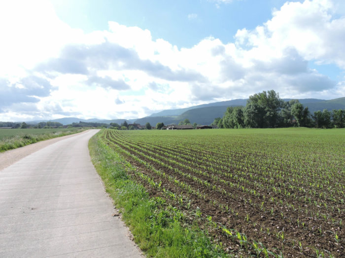
| Further on, the path meets a narrow cement road, running through the verdant fields. In Switzerland, these cement roads frequently symbolize the generous subsidies provided to farmers, an essential support for them and their tractors. These infrastructures prevent bogging down, facilitating their work and ensuring the continuity of their agricultural efforts, even under the heaviest rains. | |
 |
 |
Section 2 : Gentle ups and downs between meadows and woodland
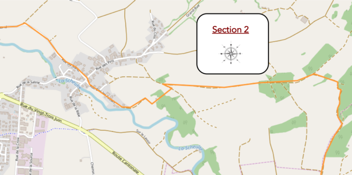
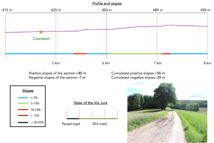
Overview of the route’s challenges : a few more vacation days before the « battle ».
|
As you proceed, the path cuts through a shooting range, an emblematic site where, by tradition, every Swiss citizen completes their annual military duty. The sounds of non-military gunfire seem to be gradually fading, a welcome change for this peaceful landscape, which offers little appeal to the hiker. |
|
 |
 |
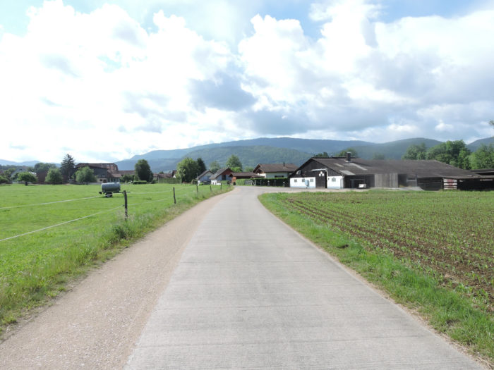
| Through the gentle dales of meadows and cultivated fields, the route eventually leads to Courcelon. Here, the land appears richer, seemingly more generous than before. | |
 |
 |
| The very name of Courcelon, in its dialect, hints at a subtle mystery, like a « small place where something is hidden ». If there is a secret here, it lies within its old farms that harmoniously coexist with more modern homes, likely inhabited by those working in Delémont. | |
 |
 |
| Discreet yet notable, a chapel from the early 19th century stands as a silent witness to the passage of time. It is here that the Via Jura continues its journey towards Recolaine. | |
 |
 |
| Leaving the village, a broad dirt path plunges into a sea of meadows, gracefully extending towards the deep woods. | |
 |
 |
|
It respectfully skirts around a solitary house, hidden behind gates, before gently moving into the grass still damp with morning dew. |
|
 |
 |
|
A little further on, the path diverges from the verdant meadows to delve deeper into the coolness of the undergrowth, among the slender beech shoots, scraggly chestnuts, and wild grasses. |
|
 |
 |
|
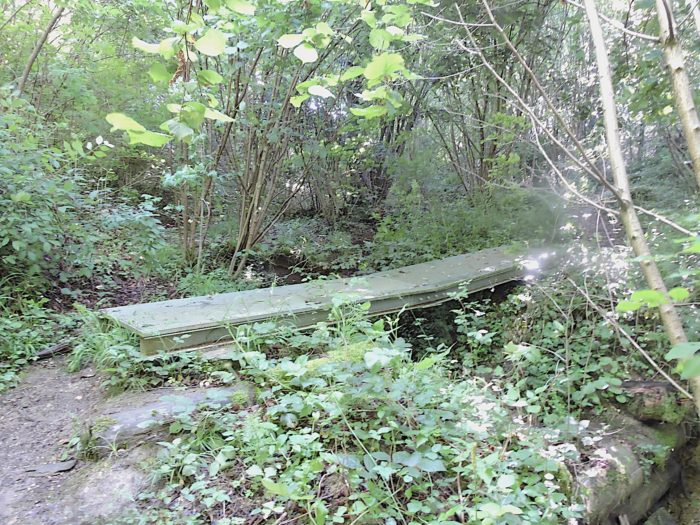
The passage through the undergrowth, where a nimble brook runs, is brief, and the path soon returns to the clarity of open air. |
|
 |
 |
|
Soon, the Via Jura meets a small cement road, typical of Jura tracks. A strip of dirt and grass in the center gives hikers the freedom to choose their path, a welcome liberty in this peaceful countryside. |
|
 |
 |
Ahead, the village of Vicques stretches out, while on the horizon, the majestic Raimeux Mountain looms like a sentinel awaiting you !
|
The road meanders long through the countryside, across the bare plain, among meadows, oat fields, and cornfields. To be honest, without offending the local inhabitants: this crossing of the Jura, from Delémont to Vicques, lacks fullness. On the Camino de Santiago, such stages often bring only the hope of a miracle that might appear at every turn of the path, though these are rare. |
|
 |
 |
 |
 |
|
It is then that the road approaches the forest edge, drawing the eye to the majestic trees lining the path. Their sincere and immutable presence comforts the walker. The vegetation here is diverse: deciduous trees predominate with their imposing beeches and oaks, while a few conifers like spruces, firs, and pines dot the landscape with their rare but precious presence. |
|
 |
 |
|
Soon after, the Via Jura returns to a beaten earth path, wavering between the undergrowth, the verdant pastures, and the cultivated fields. |
|
 |
 |
|
In this tranquil space that seems to live in self-sufficiency, there are no farms or dwellings in sight, only a nature that is self-sustaining. |
|
 |
 |
Section 3 : The start of the very long ascent of Raimeux from Grandval
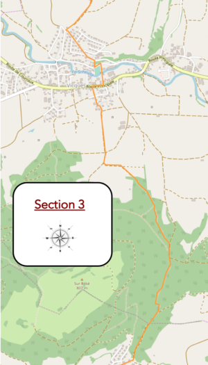
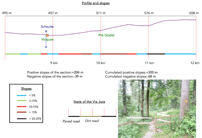
Overview of the route’s challenges : From Vicques, the slopes become challenging, ranging from 10% to 30%, with a brief flat section at Rebeuvelier to catch your breath. This is just the first part of the climb, only 200 meters of ascent.
|
The winding roads of the Jura lands reveal landscapes that are less celestial than often portrayed. Just a short distance from Vicques, the horizon expands more generously, widening the space around you. The broad dirt road that runs alongside the woodland meanders through increasingly dominant fields, their greenery marking a transition to a more tangible civilization. |
|
 |
 |
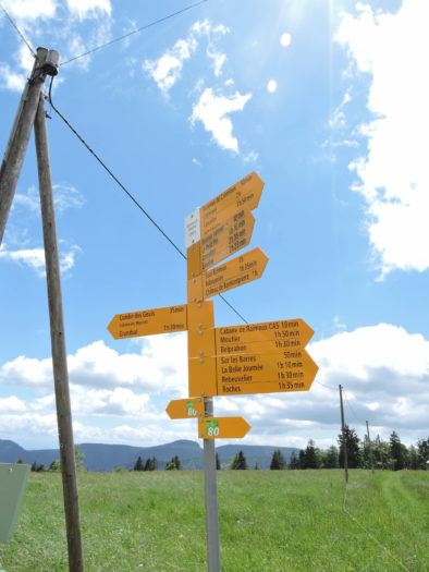
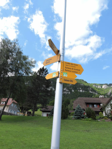
Here, a directional sign reminds you of the route to follow.
|
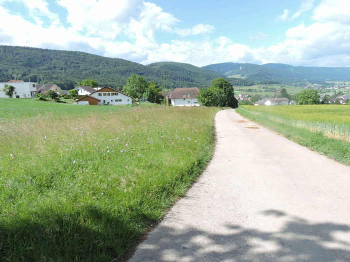
The asphalt, confidently laid, hints at the approaching entrance to the upper part of the village. The gently descending road reveals a line of recent villas, each step seemingly imbued with the silent narrative of their architecture. |
|
 |
 |
|
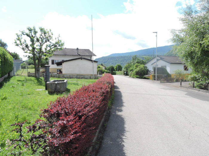
The road then runs through some of the newer residential areas above the village. |
|
 |
 |
 |
 |
|
Further on, a modest staircase descends gently towards the plain, at the heart of this peaceful village. Vicques, from the Latin vicus meaning « domain, » still retains traces of this ancient etymology, with discreet witnesses scattered throughout the urban fabric. |
|
 |
 |
|
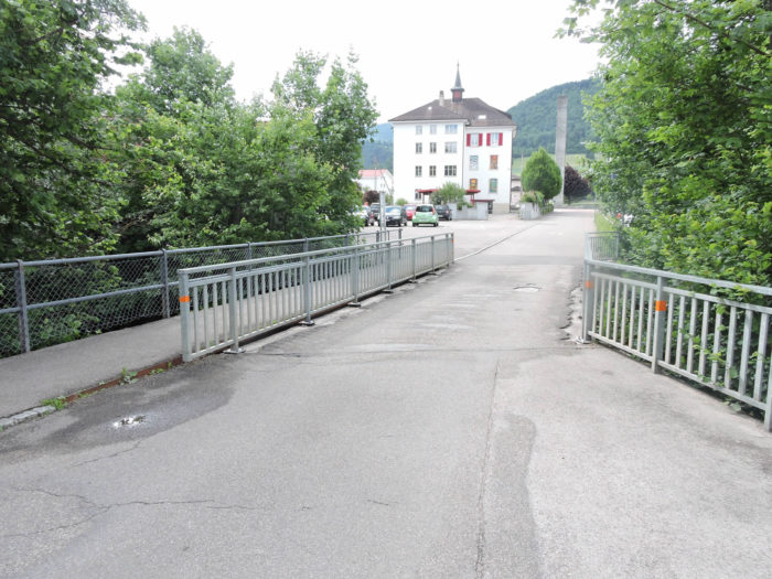
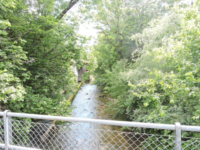
Here, church steeples do not dominate but rather the schools. In the village, the Scheulte River still flows peacefully. |
|
 |
 |
|
At the village center stands Notre-Dame du Rosaire, a contemporary church with bold concrete architecture. Around it, human activity finds its rhythm, providing nourishing stops for travelers. The route now heads towards Rebeuvelier, guided by Via Jura 80, a path weaving the wanderings of Jura hikers. |
|
 |
 |
|
Further along, Via Jura skirts a prominent administrative building, marking the village’s exit with a breath evocative of its community life, where modern houses signify the place’s contemporary character. |
|
 |
 |
|
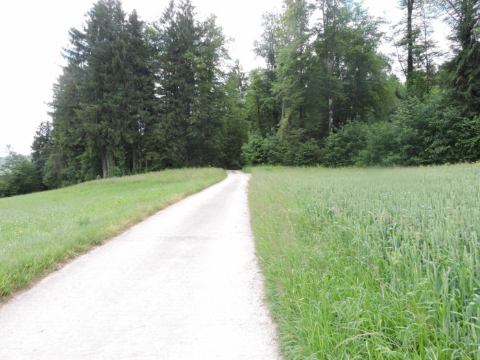
A robust road now winds between vast fields of golden cereals and verdant meadows, rising with determination towards the forest edges. This straight and open road seems inexorably directed towards the imposing mountain on the horizon, like an immutable challenge awaiting you. |
|
 |
 |
Looking back, the horizon reveals a striking view: beyond the waving grains, the silhouette of Delémont is clearly outlined. This view, after nearly ten kilometers traveled, serves as a poignant reminder of the distance already covered, a silent testament to the effort made.

|
Ahead, the first foothills of the Raimeux from Grandval rise with an almost prophetic insistence, promising upcoming challenges. It might be wise to pause for a moment, to take a seat on this solitary bench, and catch your breath before tackling the steeper ascent ahead. |
|
 |
 |
|
The road now heads towards the place known as Pré Godat, unrolling its gray ribbon over the vibrant green of the surrounding meadows, in a gentle countryside where fruit trees also bloom. |
|
 |
 |
|
The incline becomes steeper as you progress on the cemented road, sometimes exceeding 15% in the final fields and crops before fully entering the vast forest stretching before you, like a promise. |
|
 |
 |
|
Higher up, the road resolutely plunges into the canopy at Pré Godat, reaching a welcoming clearing, set up for picnics and likely favored by locals. |
|
 |
 |
|
From this point, your journey will take a different turn. A broad dirt path, sometimes grayish, sometimes reddish, initially slopes up with a reasonable incline, soon joined by a narrower forest trail. |
|
 |
 |
|
As the path gains altitude through the Rosé Forest, spruces become more numerous, and the rare, majestic white firs dominate the landscape, standing tall and slender like vigilant sentinels. While deciduous trees maintain their prominent presence, offering denser and more varied greenery, they gradually yield to their austere coniferous counterparts, reaching skyward with an almost sacred solemnity. |
|
 |
 |
|
A bit higher, you reach a wider path occasionally crossed by livestock, as evidenced by the constriction barriers scattered here and there. |
|
 |
 |
The direction towards Rebeuvelier on Via Jura 80 is clear so far, leaving no ambiguity in your route.
|
From this point, a rocky and leaf-covered trail climbs steeply, with slopes nearing 20%, softened here and there by tight turns, while following the steep side of a sunken valley. The decomposition of beech and oak leaves often tints the ground with a reddish hue, giving the environment an autumnal aura even in spring. |
|
 |
 |
|
Higher up, the path opens onto a wild landscape near a small cliff, amidst a profusion of large beeches, oaks, and spruces. |
|
 |
 |
|
The slope eases as the path crosses a small stream at the bottom of the valley, whose flow is generally calm, except during torrential rains when it joins the Schultze. |
|
 |
 |
The final ascent to Rebeuvelier is at a more moderate incline. The hamlet is perched on a small plateau at 670 meters above sea level, reminding you that your final destination lies nearly 1300 meters up, at the mountain’s summit.
Section 4 : The ascent of Raimeux de Grandval becomes more challenging
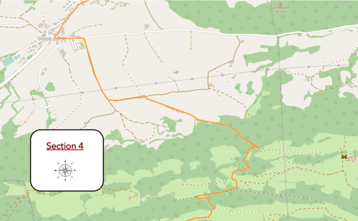
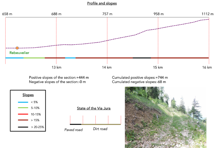
Overview of the route’s challenges : consult the section’s profile, and you’ll grasp the essence of the challenge.
|
The Via Jura crosses the hamlet, then ventures onto a cement road that begins behind the campsite and climbs through the meadows. The deep green grass stretches peacefully across nearly flat terrain, offering a soothing contrast to the surrounding mountainous landscape. |
|
 |
 |
|
Ahead, the mountain rises, sometimes hostile, sometimes welcoming, depending on the perspective, its silhouette draped in impenetrable forests. At the end of this plateau, the cement road, straight as an arrow shot by the gods, finally converges at a crossroad of paths. On this side of the mountain, several routes seem to lead towards Raimeux de Grandval, but your path firmly follows the direction of Via Jura 80, en route to Château de Raymontpierre. A bench may be placed here, inviting you to reflect on the route ahead. |
|
 |
 |
|
The road then heads toward the small place known as Champs La Derrière, but eventually decides to climb back through the woods. |
|
 |
 |
|
Higher up, the slope becomes steep, often exceeding a 15% incline. Strips of grass and earth frequently dot the cemented road, bearing witness to the ongoing efforts to maintain these access routes, vital especially when winter descends upon these harsh lands. |
|
 |
 |
|
As you near the forest’s edge, the road turns into a dirt track. On the horizon, hills appear, offering a view that seems to end in a dead end where the road does not venture. Do these enigmatic paths lead to the canton of Solothurn, the canton of Bern, or even neighboring France? Only foresters and mushroom hunters brave these remote territories. |
|
 |
 |
|
The path climbs higher through short grass with increasing determination toward the forest’s edge, clearly indicating that your destination lies somewhere, isolated in the heart of a dense and mysterious forest. Here, the deciduous trees still reign supreme. |
|
 |
 |
|
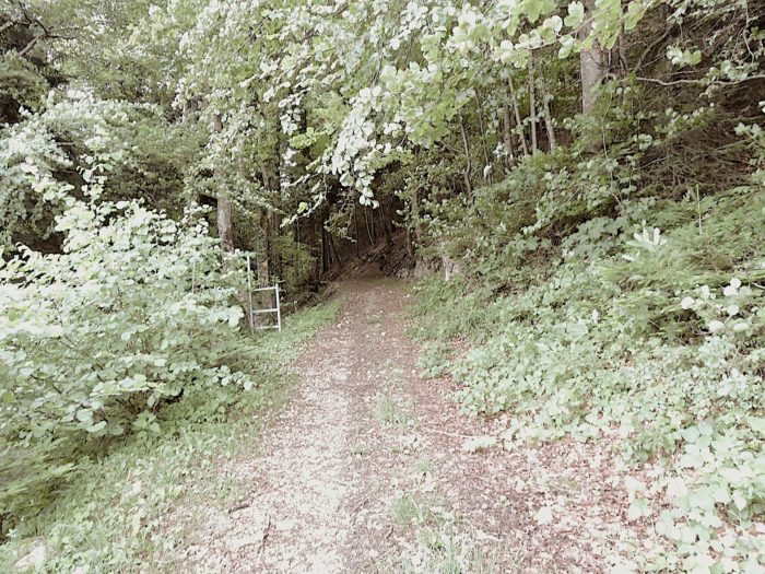
The journey continues through a forest trail, sometimes rocky, sometimes smoother, in the heart of a diverse and enchanting landscape. The untamed wilderness unfolds in all its splendor, between thick bushes and wild grasses that intertwine into a living, vibrant tapestry of colors and varied textures. |
|
 |
 |
|
At times, you might imagine yourself lost, as though venturing into the unknown. But no, here comes the cattle, frolicking at the edge of the forest. A fence suddenly appears, typical of this region where cows graze freely in enclosed pastures defined by these rustic barriers. |
|
 |
 |
At times, you might imagine yourself lost, as though venturing into the unknown. But no, here comes the cattle, frolicking at the edge of the forest. A fence suddenly appears, typical of this region where cows graze freely in enclosed pastures defined by these rustic barriers.
|
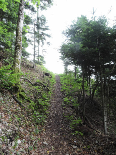
The climb becomes more arduous here, with slopes sometimes reaching dizzying inclines of over 30%. The narrow, winding path, like a ribbon snaking through the dense forest, presents a particularly demanding challenge. Occasionally, loose stones slip underfoot, reminiscent of steep high mountain trails. |
|
 |
 |
 |
 |
|
A bit higher up, although the slope becomes slightly less steep, the journey remains demanding. As the altitude increases, the spruce trees begin to spread out more, in accordance with the natural order of the Alps. |
|
 |
 |
Now, nature itself seems to sing a different tune, leaving behind the austerity of the lower woods for the serenity of the alpine pastures.
|
Higher still, another passage through the foliage… |
|
 |
 |
|
… and soon the path opens onto a modest clearing. It’s always a delightful moment to discover a small stretch of flat ground, a welcome pause in the continuous effort of the climb. |
|
 |
 |
Each stage of this ascent reveals a landscape shaped by nature’s whims, where every turn offers a new perspective, and every nook hides a fresh discovery. This is where one can finally catch their breath. From Rebeuvelier, perched at 660 meters, we have climbed to an altitude of 991 meters. The view here is magnificent. On the horizon, just below, lies the town of Delémont, only 9 kilometers as the crow flies. We have nearly doubled that distance on foot to reach this point.
|
A path branches off here, descending towards the Château de Raymontpierre, built in the 16th century by a lord of Delémont. What an odd idea to erect a castle in such a remote corner! But your route persists, continuing its ascent through the forest. |
|
 |
 |
|
The path climbs once again, scattered with small rocks and limestone debris, loosened by winter’s claws, through a forest that is now less dense. The slope remains just as steep, often exceeding 15%. |
|
 |
 |
|
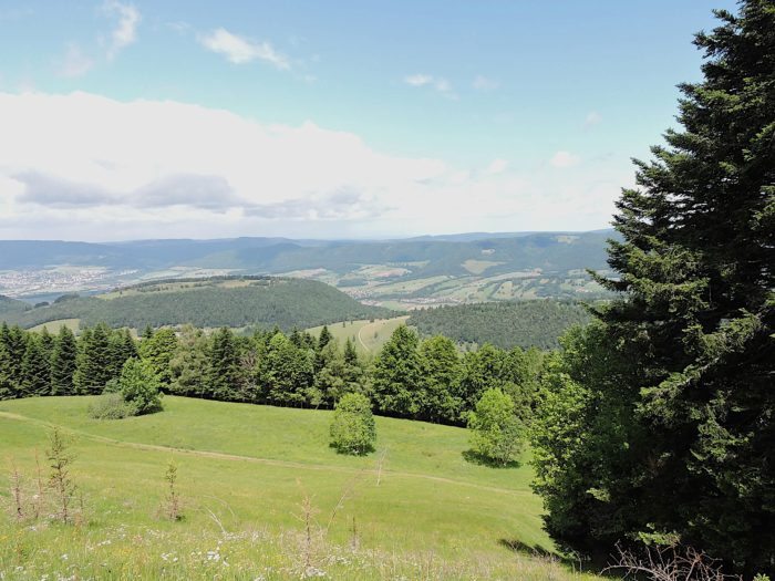
Below, you can still glimpse the plateau of Rebeuvelier, and further down, the vast plain of Delémont. |
|
 |
 |
|
Further along, the trail intersects with another route leading back to Rebeuvelier. |
|
 |
 |
|
The narrow path continues over stones, on a steep, relentless slope. |
|
 |
 |
| Despite the altitude, the forest maintains a majority of deciduous trees and wild grasses, interwoven with spruces. The path finally emerges into a clearing where a small refuge stands, a welcome stop to catch your breath. This oasis smells of alpine pastures. You have now reached an altitude of 1,112 meters. Phew! Only 200 meters left to climb. | |
 |
 |
Section 5 : A Passage over Raimeux de Grandval, followed by a descent as grueling as the ascent
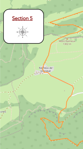
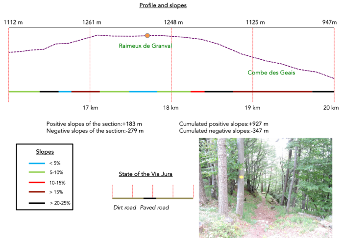
Overview of the route’s challenges : The steep slopes, ranging from 10% to 40%, are equally difficult whether ascending or descending.
|
At the horizon, the landscape unfolds majestically, reminiscent of the grand panoramas of the Alps, beneath the celestial alpine meadows. At 1300 meters altitude, the environment differs from higher altitudes, lacking the larches, Swiss stone pines, or tall white firs seen elsewhere. Instead, the path meanders through verdant pastures, bordered by woods dominated by solemn, imposing spruces. |
|
 |
 |
|
A bit higher, a broad, rocky trail, nearly an expanse of scree, plunges briefly into the dense forest. This is the last stretch before reaching the mountain’s summit. While spruces dominate the open fields, the interior of the forest reveals a mixed vegetation, featuring numerous maples and beeches. |
|
 |
 |
|
Cattle fences along the way still mark the pastoral life that thrives in these parts. |
|
 |
 |
|
Despite the steep incline, the raw beauty of the pastures draws the eye, sweet like candy, making you momentarily forget the effort required to reach them. |
|
 |
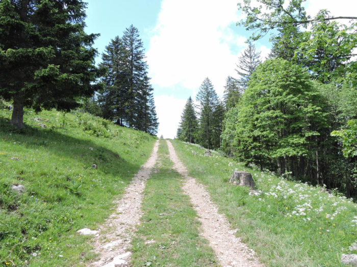 |
One last push and the summit of Raimeux de Grandval finally comes into view at 1302 meters above sea level. A panoramic tower stands, offering a breathtaking view of the surroundings. Raimeux de Grandval isn’t merely a high plateau between the cantons of Jura and Bern; for some, it embodies a “high mountain,” a sacred place inherited from Celtic times.
|
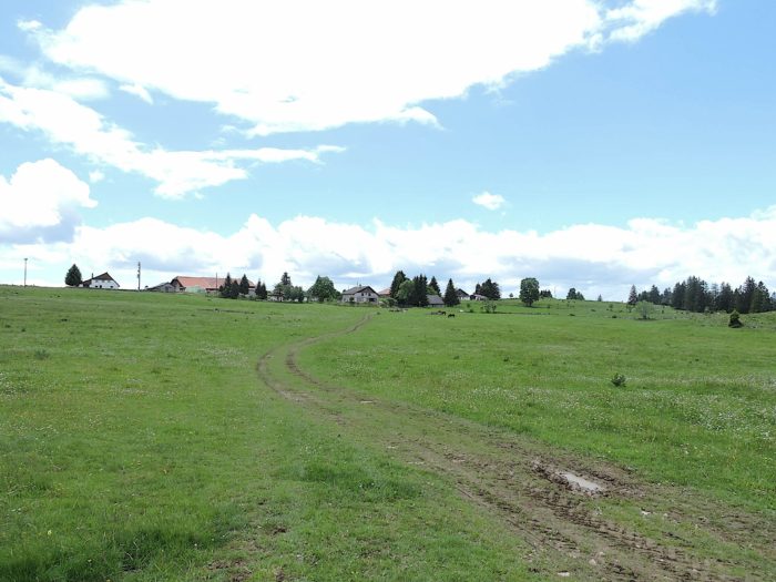
Here, livestock farming thrives, dominated by black Holsteins, hornless but renowned for their pendulous udders, a symbol of the dairy industry in French-speaking Switzerland. Far from the elegant Simmental and brown cows that populate German-speaking Switzerland, this breed represents the pastoral identity of these regions. The cows curiously watch you pass by, likely wondering why anyone would spend time walking when it’s far more pleasant to stay put and chew grass. |
|
 |
 |
|
A final effort, and you’ve reached the summit, in the pure mountain air, which smells faintly of dung. Who could deny the satisfaction of reaching the top, after starting from 416 meters in Delémont? Of course, such elevation changes pose no problem for experienced hikers, but on the Camino de Santiago, not all the many retirees on the path are marathoners. Far from it! |
|
 |
 |
|
Naturally, there’s a small country inn accessible by car from Moutier, but not from Delémont, which is always a bitter pill for walkers to swallow. Here, you’re in a world of hang-gliding and paragliding. The Jura’s landscape indeed offers numerous take-off sites, dotted with signs suggesting a certain level of regulation. |
|
 |
 |
IThere are two ways to return to Moutier from here. Your route follows the Via Jura 80, passing through the Combe des Geais.
|
A small paved road, the only access from Moutier or the canton of Bern (there’s no road from the Jura side), crosses the plateau. |
|
 |
 |
Further down, a sign planted in the meadow outlines the program for free-flying enthusiasts, numerous in these parts.
|
The Via Jura then diverts from the road, and a barely visible path winds through the pasture, identifiable thanks to the markings on the beeches at the forest’s edge below. It is advisable not to stray too far here, as cliffs lie just beyond. |
|
 |
 |
|
After crossing the pasture, the path approaches the cliffs. Well-marked, it poses no danger. A long descent follows, winding through the rocky ledges of the cliff, known as the Rochers du Droit, in the forest of the same name. This place isn’t the domain of lawyers, but rather rock climbers and paragliders. |
|
 |
 |
 |
 |
|
The path winds along the cliff, the descent just as demanding as the ascent, and described as “highly physical.” The limestone blocks of the rocks contrast with the green foliage of the forest, where pines, beeches, and spruces thrive in harmony. It’s simply a magnificent sight here. |
|
 |
 |
|
Between the vertical walls of the cliff, where the earth seems to cling desperately to the bare rock, the path boldly slides downward. The rocks, streaked with colors ranging from slate gray to deep red, resemble natural sculptures shaped by the elements, clinging to the steep slope like ancient guardians, silent witnesses to centuries past. At each step, the compacted earth reminds one of the precariousness of human existence in the face of nature’s implacable majesty. The cliffs reveal the millennia-old history of their formation, marked by the whims of time and the elements. Every corner of this steep path evokes a symphony of contrasts: the brutality of jagged rocks against the softness of velvety lichens, the implacable verticality of the walls against the fragile path. |
|
 |
 |
|
The rocky descent is steep, with slopes reaching 15% to 25%, sometimes even more. On the Camino de Santiago, many retired pilgrims prefer the ascents to the descents, as aging knees can no longer tolerate the strain of going down. |
|
 |
 |
|
The path, often veering away from the abrupt cliff plunging towards the valley, reaches the Combe des Geais at an altitude of 1038 meters, after a descent of nearly 300 meters. Switzerland, a country of mountains par excellence, is a land where verticality often imposes itself, even on the Camino de Santiago. Though these sacred paths never traverse territories reserved for seasoned hikers or mountain guides, they do occasionally offer sections that require bravery in the face of steep gradients. Here, in this oasis of happiness, everything is set for a picnic. |
|
 |
 |
Section 6 : Demanding descent to Grandval
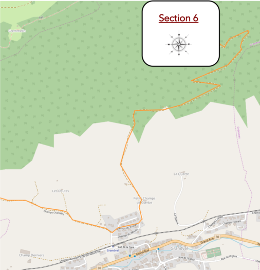
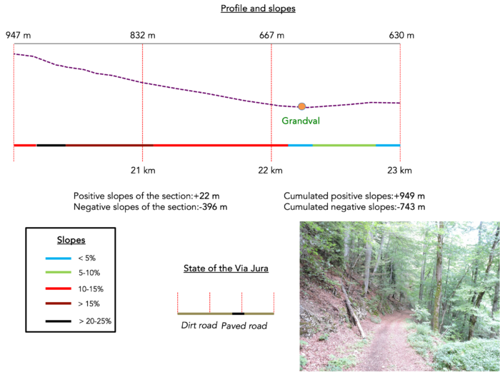
Overview of the route’s challenges : 400 more meters of descent.
|
The path stretches into a slow descent, tracing the contours of limestone cliffs and the folds of the dale. This descent, though laborious, is majestic, following a wide, stony trail that meanders in broad switchbacks. Occasionally, a fleeting view opens up onto the Moutier valley, sprawling across the plain like a painted canvas |
|
 |
 |
| Everywhere, gray and yellow limestone emerges, both on the cliff faces and on the path stones. At times, the trail brushes against the polished blue-gray of the cliffs, as if to acknowledge their natural majesty. | |
 |
 |
| From turn to turn, on a consistent slope ranging between 10% and 20%, the path continues its relentless descent through the dense forest. Just as on the other side of the mountain, the vegetation gradually transforms. The pines and spruces, rulers of the heights, give way to deciduous trees, mainly magnificent beeches, offering a palette of deep and shimmering greens as you descend, with discreet maples or chestnuts. Oaks barely make an appearance here. |
|
 |
 |
 |
 |
| Lower down, the path becomes more accommodating. The landscape evolves with a soothing softness, a serenity that gradually settles amid the majestic beeches, with their plump trunks standing like benevolent guardians of this regained tranquility. | |
 |
 |
| Further down, the Via Jura gradually leaves the dense forest behind, and the village of Grandval timidly emerges at the bottom of the valley, like a gem nestled in the lush greenery of the surrounding nature. | |
 |
 |
| The path then moves away from the dense forest to wind through undergrowth and clearings, sliding well below the daunting cliff. A discreet barrier deters daring motorists, marking the entrance to a realm where only the steps of hikers or high-flying enthusiasts echo. | |
 |
 |
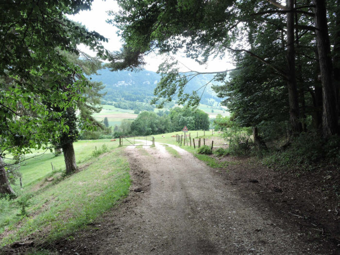
| Yet, the descent is not over. The path widens gradually, and the slope softens under the cover of scattered trees that let light filter through. Another barrier appears, signaling the arrival on the asphalt of the heights of Grandval, like a threshold between two distinctly natural worlds. | |
 |
 |
 |
 |
However, the Via Jura only briefly touches Grandval, choosing instead to continue towards Belprahon, like a line drawn by winds and the destinies of travelers.
| A small paved road then begins its gentle ascent towards the cliff, offering a new perspective on the majestic rising terrain. | |
 |
 |
| Higher up, at the first undergrowth, the asphalt gives way to a broad dirt path, climbing through carefree nature, a testament to the constant transitions of this exploration through the Santiago de Compostela routes. | |
 |
 |
Section 7 : On the way to the “Bernese” or the “Jurassians”, depending on how you look at it
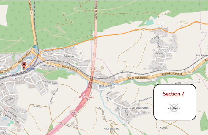
Overview of the route’s challenges : a final steep descent before Moutier, just for the thrill.
| Like a snake of dust, the dirt road winds through the meadows before reaching the village of Belprahon on asphalt, a small village nestled in the tranquil Bernese countryside. | |
 |
 |
| As noted in the introduction, here in Belprahon, you are in the canton of Bern. For how much longer? Probably until the next popular vote, which is likely to occur in the future. In 2021, Moutier became part of the Jura, but for now, Belprahon still wants to remain Bernese. This identity struggle, this hesitation between two affiliations, resonates in every stone of the village. The village seems suspended in time, awaiting the next consultation that will determine its fate, a wait almost palpable in the air. | |
 |
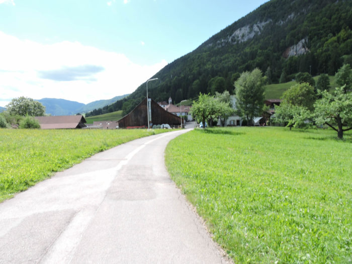 |
| As we’ve often repeated, in Switzerland, especially in Protestant cantons, bell towers are not religious symbols. In this region, bell towers often signal schools or administrative buildings. Here, you are 30 minutes from Moutier. | |
 |
 |
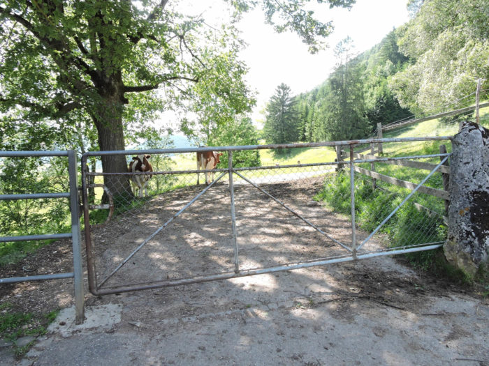
| A wide dirt path leaves Belprahon, passing between countryside and undergrowth. Cows are omnipresent along the route. The path stretches out, broad and inviting, encouraging walkers to stroll. At every turn, the landscape transforms: here, open fields where cows graze peacefully, there, undergrowth where the shadow of trees creates an atmosphere of coolness and mystery. . | |
 |
 |
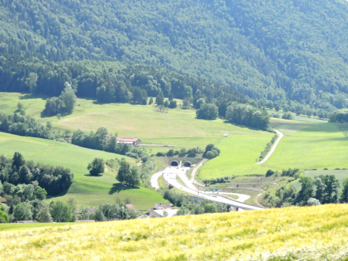
| Below, the Transjurane highway snakes from one tunnel to another, traversing this troubled land. It burrows underground from Delémont, passing well below the majestic Raimeux de Grandval, and continues its subterranean journey toward Biel. This highway, a hidden artery, cuts through the Jura earth, ignoring the rugged terrain and deep valleys, connecting cities like an invisible thread of Ariadne. | |
 |
 |
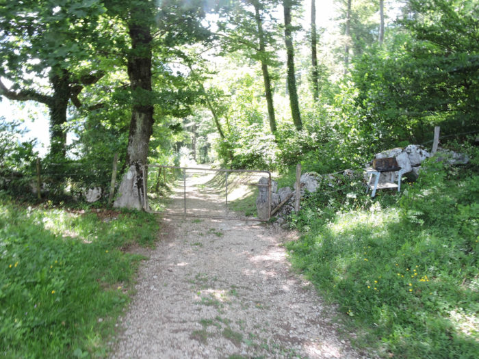
| The Via Jura, in contrast, winds along the hillside, moving from one grove of trees to another. This wilder, more intimate path offers walkers a privileged perspective of the surrounding nature. Trees stand like silent sentinels, lining the path and providing benevolent shade. | |
 |
 |
| Further along, as you approach a denser undergrowth, the path begins its descent towards Moutier. | |
 |
 |
| The descent, as if to better showcase the stage’s difficulties, proves steep and demanding. Tree roots and slippery stones add to the terrain’s complexity, forcing the walker to carefully measure each step and remain vigilant. | |
 |
 |
| At the bottom of this descent, a small road passes under the railway and crosses the Raus. | |
 |
 |
| The gentle murmur of the river accompanies your passage under the bridge, and soon, the train station appears within reach. Simply follow the underpass to find yourself at the station square, just a stone’s throw from the city center.
Moutier, known in German as Münster, now has about 8,000 inhabitants. Once, it was the most important Francophone city in the Bernese Jura. It is now part of the Jura, as evidenced by the Jura flag, fixed on the rock at the city’s entrance for years. But for how long? Who knows? The canton of Jura is far from having completed its adolescence. This city, at the heart of identity struggles, remains a living symbol of the region’s territorial evolution. Its inhabitants, like their flag, are deeply attached to their identity, ready to face whatever changes the future may bring. |
|
 |
 |
Accommodation on Via Jura
- Gîte rural, Rue du Stand 4, Courcelon; 032 422 32 85; Guestroom, breakfast
- Camping du Raimeux, Rebeuvelier; 032 435 57 17; Camping
- Chalet Raimeux, Raimeux; 032 493 47 97; Gîte
- Cabane des Gorges, CAS, Rue de Gorges 30, Moutier; 032 493 32 70; Dortoir
- B&B Prévôtoit, Derrière les Crêts 15, Moutier; 079 304 92 20; Guestroom, breakfast
- Hôtel Café boutique Oasis, Rue des Oeuches 10, Moutier; 032 495 20 20; Hotel, breakfast
- Hôtel Restaurant de la Gare, Avenue de la Gare 19, Moutier; 032 493 10 31; Hotel***, dinner, breakfast
- Hôtel du Cheval Blanc, Rue Centrale 52, Moutier; 032 493 10 44; Hotel***, dinner, breakfast
The Jura remains a popular destination mainly for local tourists. As a result, accommodations are more discreet, except for Airbnbs, for which we do not have addresses. On this stage, there are few options for dining or lodging before reaching Moutier. At the end of the stage, Moutier has all the shops. There should be no difficulty in finding a place to stay here. However, make sure to book in advance.
Feel free to add comments. This is often how you move up the Google hierarchy, and how more pilgrims will have access to the site.
 |
Next stage: Stage 5a: From Moutier to Sornetan via Moron Tower |
 |
Back to menu |
