The Brünig Pass, the only low-altitude pass on the Camino de Santiago in Switzerland
DIDIER HEUMANN, ANDREAS PAPASAVVAS

We divided the course into several sections to make it easier to see. For each section, the maps show the course, the slopes found on the course, and the state of the route (paved or dirt roads). The courses were drawn on the « Wikilocs » platform. Today, it is no longer necessary to walk around with detailed maps in your pocket or bag. If you have a mobile phone or tablet, you can easily follow routes live.
For this stage, here is the link:
https://fr.wikiloc.com/itineraires-randonnee/de-sachsen-au-col-du-brunig-par-la-via-jacobi-4-32135267
|
Not all pilgrims are necessarily comfortable using GPS or navigating routes on a mobile device, and there are still many areas without an internet connection. For this reason, you can find several books on Amazon dedicated to the major Via Jacobi 4 route, which runs through the heart of Switzerland and over the Brünig Pass. The first guide leads pilgrims through the German-speaking part of Switzerland up to Fribourg, while the second continues through French-speaking Switzerland to Geneva. We have also combined these two books into a compact, lighter, and highly practical version. While the descriptions have been slightly condensed, they remain detailed enough to guide you step by step along the way. Recognizing the importance of traveling light, this latest edition has been designed to provide only the essentials: clear and useful information, stage by stage, kilometer by kilometer. The stages have been carefully adjusted to ensure accessibility and alignment with available lodging options. These books go beyond simple practical advice. They guide you kilometer by kilometer, covering all the crucial aspects for seamless planning, ensuring that no unexpected surprises disrupt your journey. But these books are more than just practical guides. They offer a complete immersion into the enchanting atmosphere of the Camino. Prepare to experience the Camino de Santiago as a once-in-a-lifetime journey. Put on a good pair of walking shoes, and the path awaits you.
|
|
 |
If you only want to consult lodging of the stage, go directly to the bottom of the page.
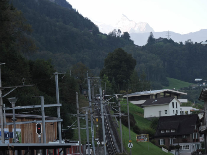
The Brünig Pass stands as an essential gateway for travelers seeking to journey from Lucerne to the Bernese Oberland, where the majestic peaks of the Bernese Alps, rising over 4,000 meters, dominate the landscape around Interlaken. Despite its modest altitude, the winding route of the pass road delights enthusiasts of two-wheeled and mountain biking alike. A narrow-gauge rack railway accompanies the constant flow of Asian and Arab tourists towards the pass, in transit between Lucerne and Interlaken. Trains snake along this track, weaving the history of travel into the folds of these mountains since 1888.
Naturally, the pilgrim takes a distinct route, separate from that of the railway, although the latter remains always in view. From Sachseln, the pilgrim follows alongside the railway, occasionally glancing at it until ascending the slopes of Kaisersthul. There, where the train continues its journey, the pilgrims find themselves on the other side of the remarkable Lake Lungern, with its striking emerald waters. However, at Lungern, the pilgrim reunites with their metallic companion. For those wishing to avoid the on-foot ascent of the pass, the train remains the preferred option. In a matter of minutes, it transports its passengers to the summit, where walking requires more time and effort, but where the pleasure of a challenging ascent awaits, punctuated by the twists of cliffs and the opportunity for contemplation along the Stations of the Cross. The climb offers a spectacular sight, unparalleled in its grandeur.
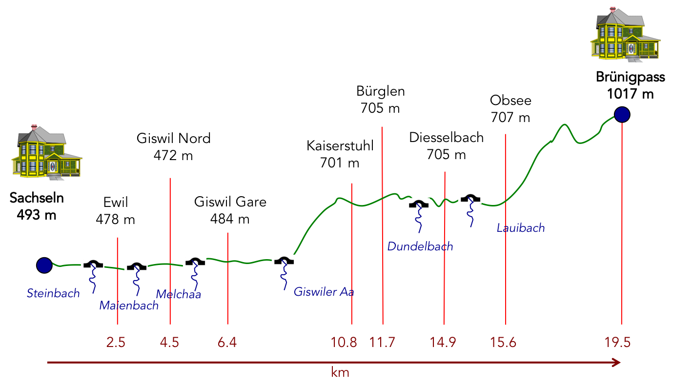
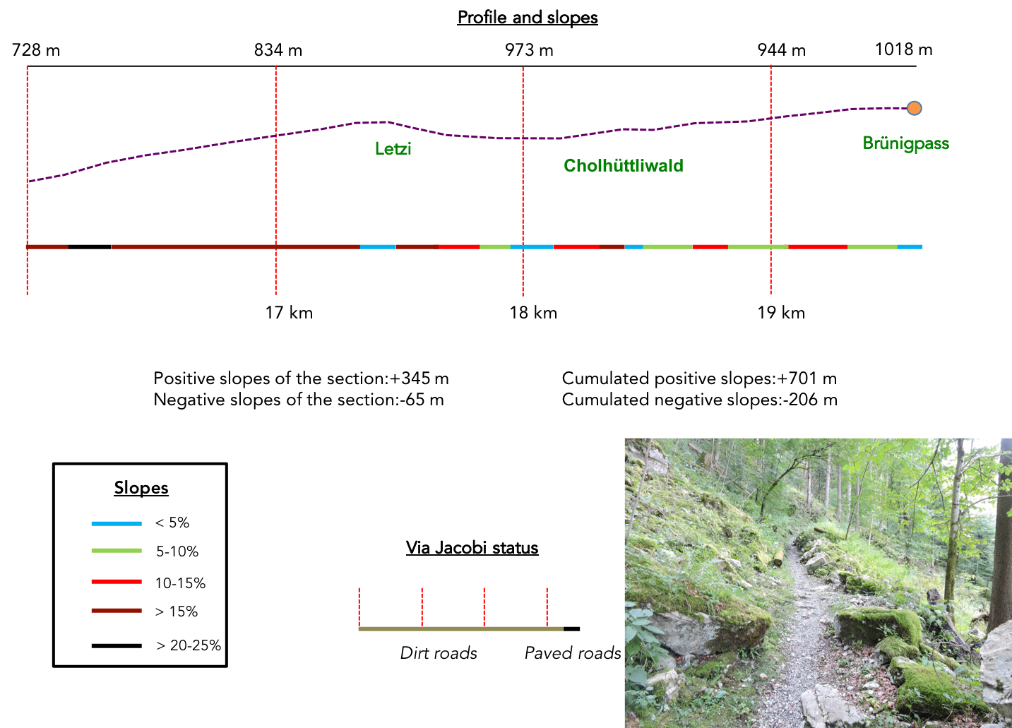
Difficulty level: Despite the brevity of the stage, the elevation changes are noticeable (+701 meters/-206 meters). This section of the journey, although short, presents its share of challenges, including crossing a pass, albeit modest compared to the highest Alpine peaks. While the beginning of the route unfolds peacefully along Lake Sarnen to Giswil, the subsequent ascent towards Lake Lungern is steep, passing through Kaiserstuhl. Here, the slope rivals that leading to the pass. The stroll along this enchanting lake poses little difficulty, but at Lungern, the ascent to the pass begins, sometimes marked (although rarely) by gradients exceeding 25%.
State of the Via Jacobi: In this stage, trails prevail significantly over roads:
- Paved roads: 6. km
- Dirt roads : 13.4 km
Sometimes, for reasons of logistics or housing possibilities, these stages mix routes operated on different days, having passed several times on these routes. From then on, the skies, the rain, or the seasons can vary. But, generally this is not the case, and in fact this does not change the description of the course.
It is very difficult to specify with certainty the incline of the slopes, whatever the system you use.
For those seeking « true elevations » and enthusiasts of genuine altimetric challenges, carefully review the information on mileage at the beginning of the guide.

Section 1: Stroll along the shore of Lake Sarnen

Overview of the route’s challenges: easy route.

|
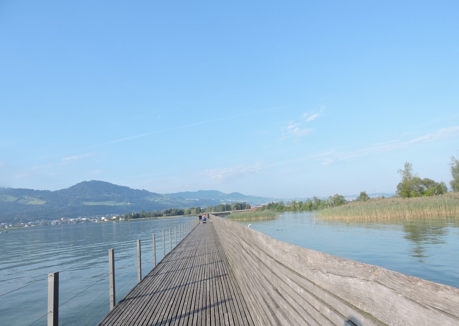
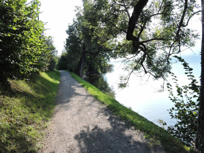
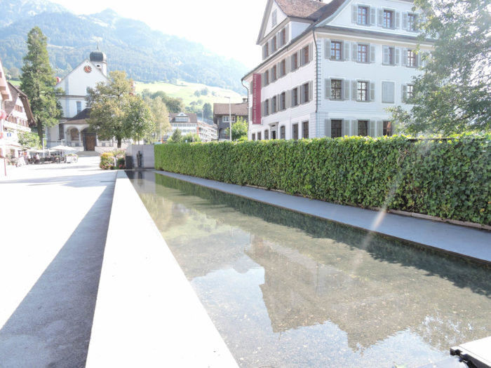
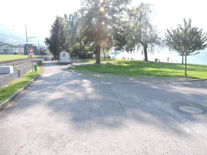
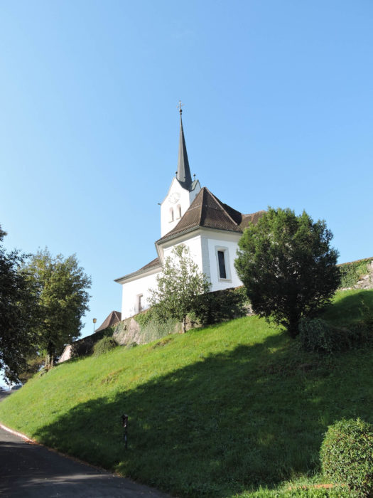
The via Jacobi, like a devoted heroine, begins its journey from the venerable square of Sachseln, humbly bowing before the imposing church before gracefully setting off towards the station, majestically contemplating the tranquil waters of Lake Sarnen.
|
 |
 |
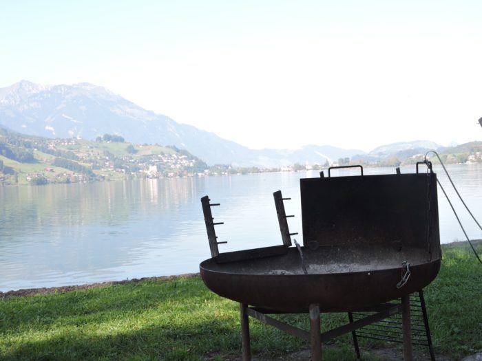
| Like a filigree of history, it weaves itself into the muffled tumult of trains, nestling tenderly by a discreet marina, like a jewel cradled in the embrace of the waters. |
 |
 |
Thus begins your journey, in the enchanting wake of this dirt path, between iron rails and the silvery reflections of the lake, a long walk, promised to joy and wonder.
|
 |
 |
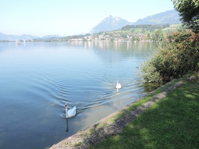
| Today, the lake slumbers in absolute tranquility, its surface mirroring a clear blue, like an offering to the serene skies, an ethereal purity that envelops the soul. |
 |
 |
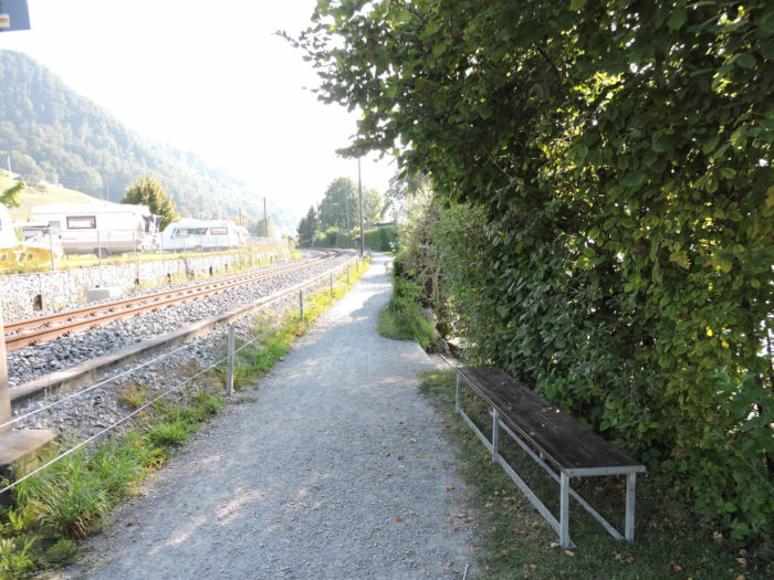
| In this German-speaking land, where order and perfection are elevated to an art form, rest areas stand in perfect harmony, offering the opportunity to surrender to the sweetness of the moment, between bites of charcuterie, reclining in a wooden hammock, in a ballet of flavors and sensations. |
 |
 |
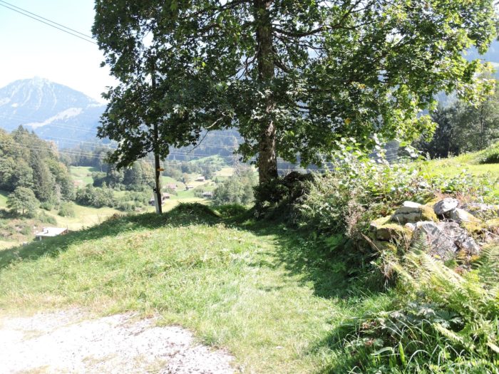
| From this blessed promontory, a dazzling panorama unfolds, embracing the majesty of the waters, the delicate contours of Sachseln and Sarnen, while in front rises the legendary Pilatus, its lofty silhouette defying the heavens, carrying on its slopes the legendary and dizzying cogwheel train. |
 |
 |
| Little by little, the Via Jacobi transforms into a generous path, offering its ground to the steps of pilgrims, to the murmurs of the streams that accompany them. |
 |
 |
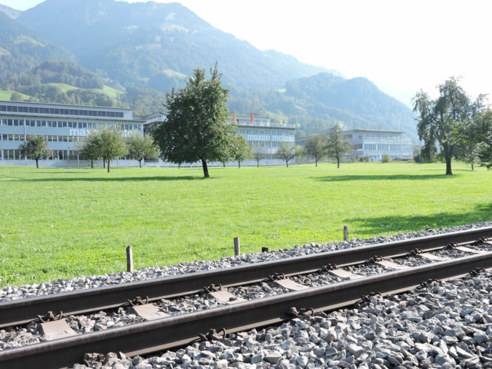
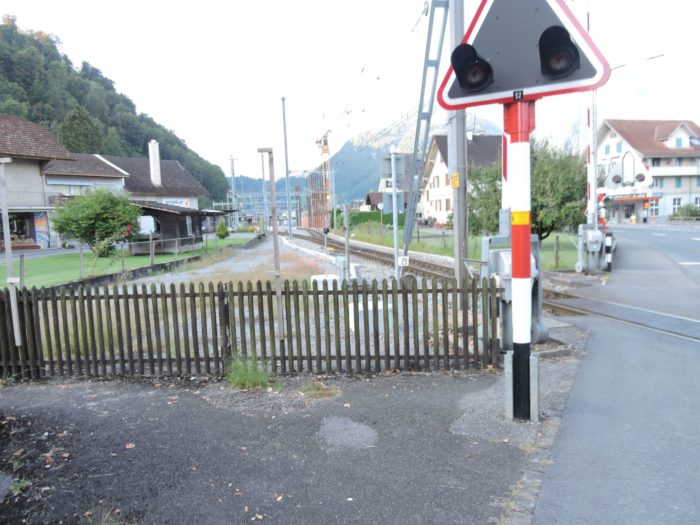
| Winding through its meanders, it modestly crosses small waterways, such as the Steinbach, then the Maienbach, before reaching Ewil station, where industrial activity comes to life, a testament to the region’s economic vitality. Here, a large company specializes in precision motors. So, when the train stops, neither Arabs nor Asians disembark, but rather the locals who work in the area. |
 |
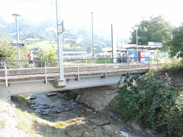 |
| Here, on this path of ecstasy, the soul surrenders to the gentle rhythm of the seasons, punctuated by the fleeting passage of trains, a symbol of the ceaseless flow of life, coveted both by travelers and by inhabitants of distant lands. This is the small single-track Interlaken-Luzern line, sometimes with a cogwheel section. This train is used by locals but, above all, by swarms of Asians and Arabs transiting from Luzern to Interlaken. |
 |
 |
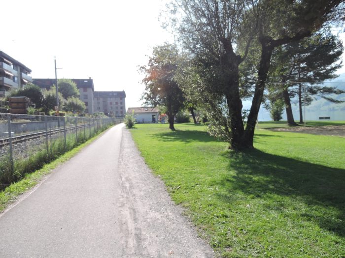
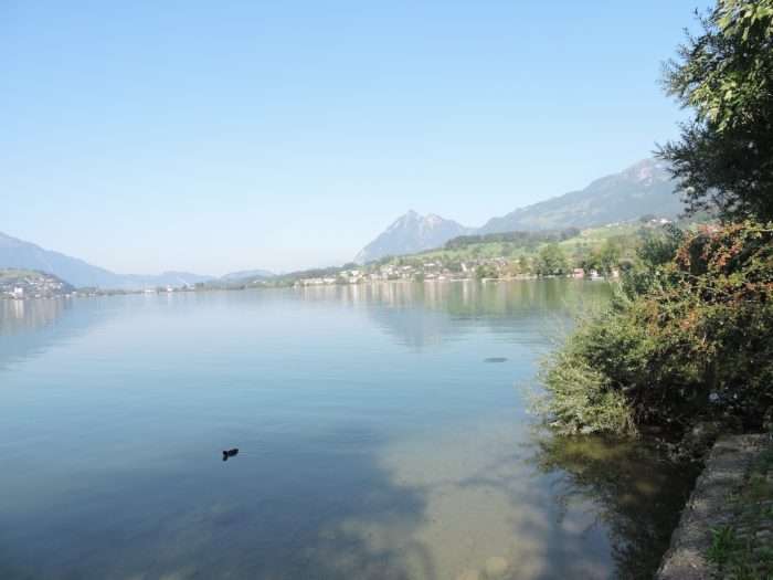
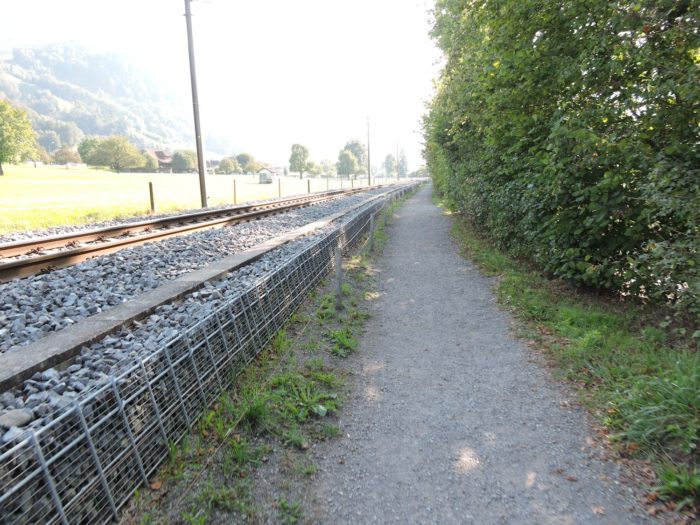
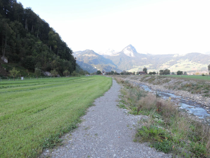
| Nothing changes for miles, with the ever-soothing peace of the lake and its shore, sometimes accompanied by the crunching of your shoes on gravel. Far from the hustle and bustle of cities, the horizon stretches in an infinite offering, bathed in the tranquility of the lake and the surrounding countryside, where prosperous agriculture thrives, while modest dwellings rise with discreet elegance, like sentinels watching over the passage of time. |
 |
 |
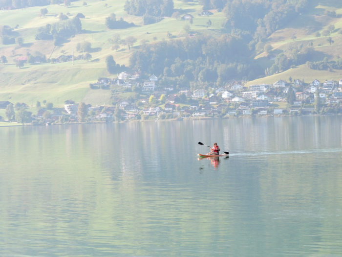
| Life flows on, long and peacefully along the water, rhythmically accompanied by the gentle lapping of the waves, where boats glide gracefully, barely skimming the smooth surface of the lake, in an enchanting choreography that celebrates beauty in its purest form. |
 |
 |
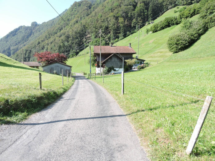
Section 2: The long journey from Giswil

Overview of the route’s challenges: a route without difficulty.

|
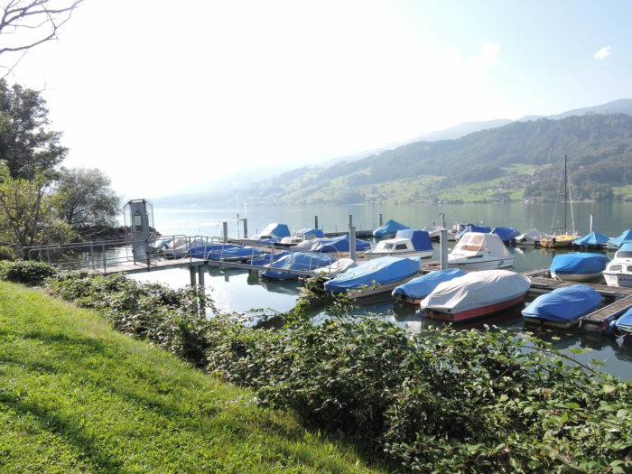
The path gracefully winds towards the end of the lake, gently advancing in front of a charming marina that seems to await the passage of travelers eager for discoveries and wonders.
|
 |
 |
|
In this elegant progression, signs towards Giswil loom on the horizon, guiding the journey along the shores dotted with peaceful marinas, each a refreshing stop for the wandering soul.
|
 |
 |
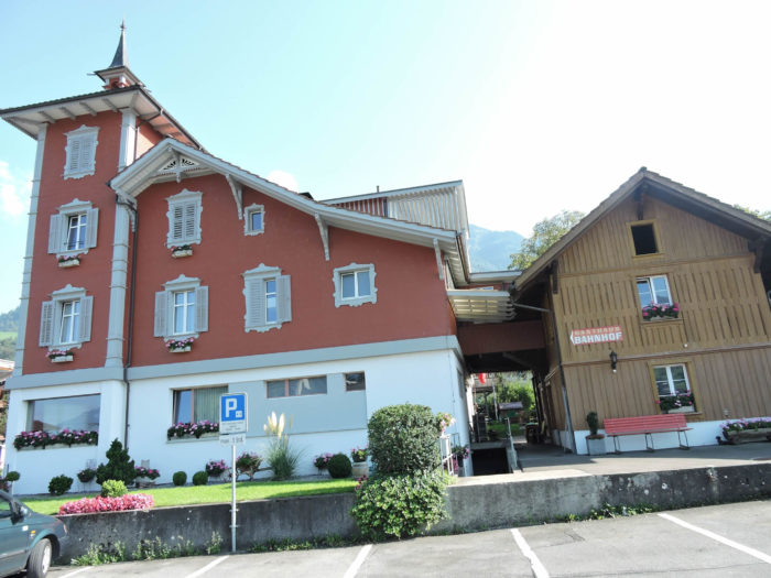
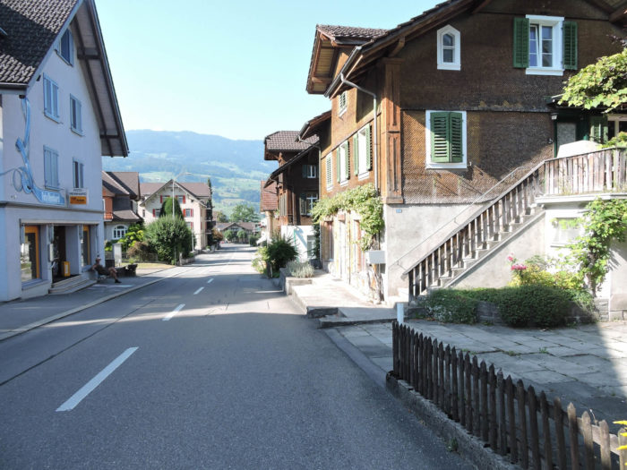
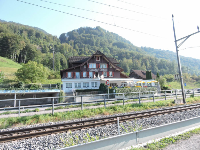
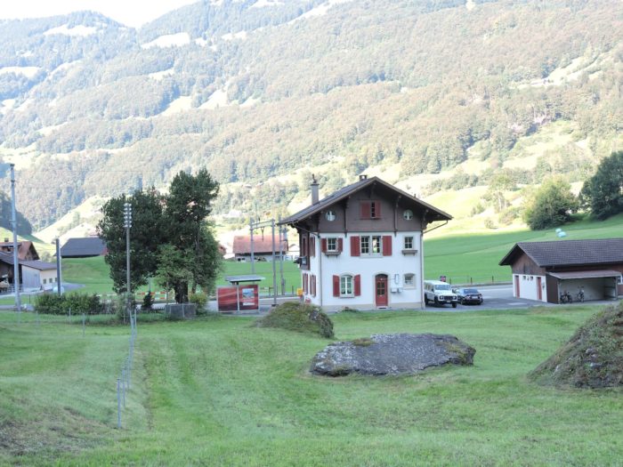
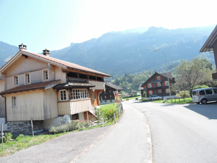
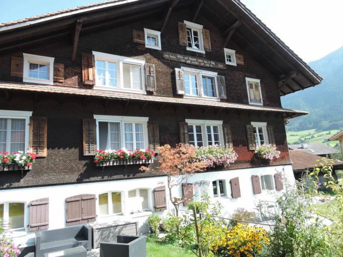
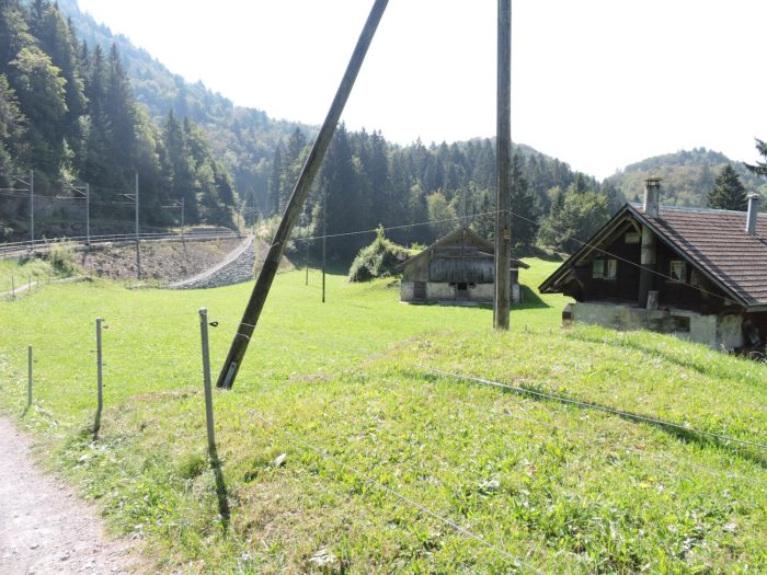
| Like a silver thread woven by the hands of time, the Via Jacobi soon reaches Zollhaus, where the soft murmur of customs officers of yore still echoes. Zollhaus means « customs house. » It was here, before 1948, that customs officials operated between the cantons of Obwald and Bern because Brünig was too far from anywhere. This name, an echo of a forgotten past, evokes the tranquility and hospitality of the place. Now, if you seek refuge for the night, it’s here, under the roof of this house, where the pike dances in the pots and where the kindness of the landlady illuminates hearts. |
 |
 |
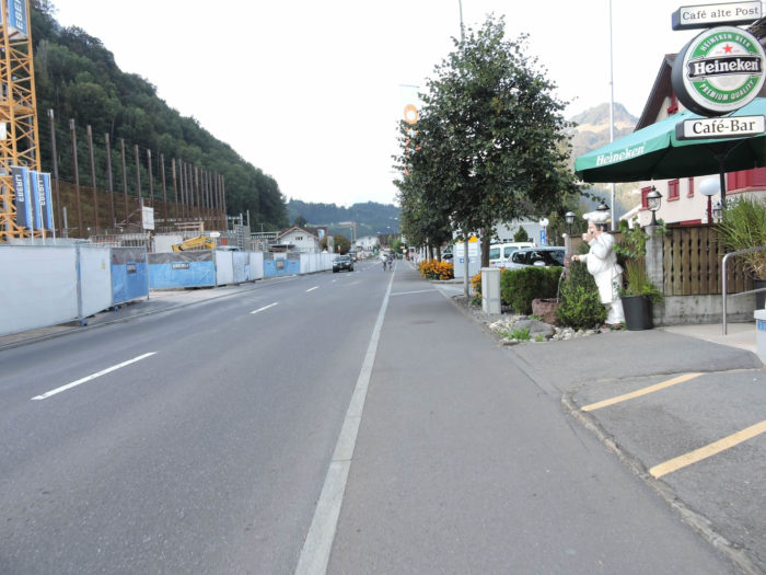
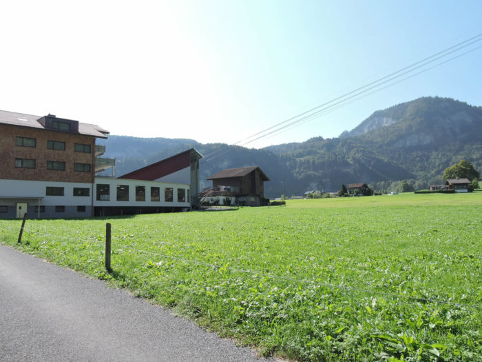
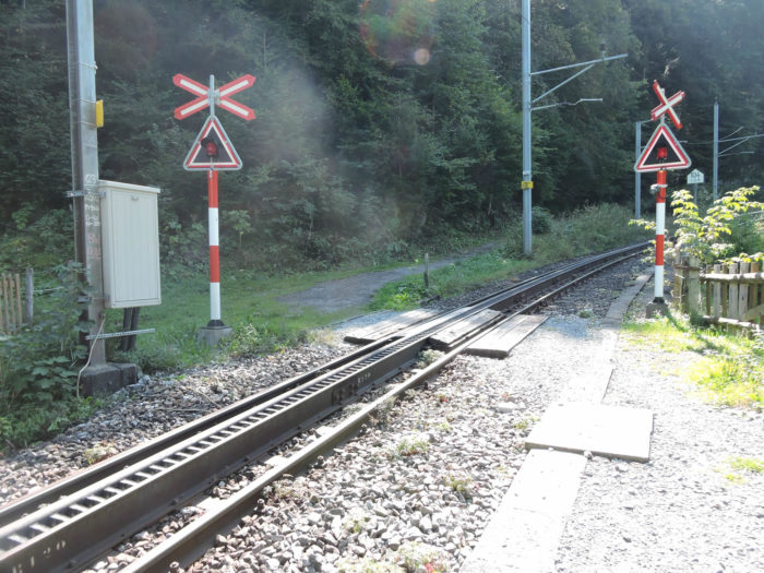
| The Via Jacobi then crosses Giswil-Nord, weaving into a complex road network where the highway winds through a maze of tunnels. The narrow and winding passage forces a delicate coexistence between the river, the road, and the railway. |
 |
 |
| Indifferent to the artifices of the modern world, the Via Jacobi escapes along a rustic trail, accompanying the Kleine Melchaa in its lively and uncertain course among the boulders. |
 |
 |
It is true that crossing these rocky lands is not without challenges. Yet, the wildness of nature harmonizes with the ruggedness of the trail, creating a striking tableau where the harshness of the landscapes meets the roughness of the way. You wouldn’t spend your vacation around here.

| Further along, the route follows the river before joining the Brünig road and arriving at Giswil, where it crosses the railway. Here, the route seems quite chaotic, to say the least. It’s quite complex to cross Giswil, between roads and rivers crisscrossing the plain. |
 |
 |
| The road runs through the center of Giswil, skirting the station where you can already sense the rumble of the cogwheel, ready to climb the first hill towards Kaiserstuhl. |
 |
 |
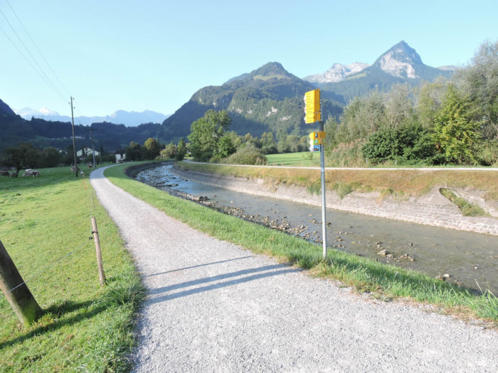
| The watercourses here are numerous, sometimes impetuous, sometimes channeled. Beyond the station, the route crosses the Giswiler Aa, an imposing river with tumultuous currents, quite different from the wild Melchaa. Then, its waters mingle with those of the Laui to reach the lake before the Via Jacobi veers away through the fields. You must diligently follow the direction signs, like a wandering soul in search of answers, to avoid getting lost. |
 |
 |
| Along the Laui, the Via Jacobi surrenders to the gentle melody of the water. |
 |
 |
| One might mistakenly believe that the route will lose itself in the meanders of nature. In fact, you are still in Giswil, just in another part of the town, Giswil-Rudenz. The route has simply made a detour to avoid the Brünig road. So, the Via Jacobi passes near the bridge over the Laui but does not cross it. |
 |
 |
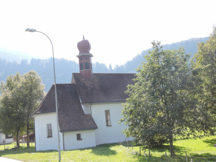
| The route then returns to Giswil, where the St. Laurentius church stands proudly, an immutable witness to the vicissitudes of time. Dating back to the 17th century, this church, with its discreet majesty, seems to defy the storms of history. |
 |
 |
| Finally, freed from the grip of the town, the route finally emerges from this endless journey, passing by a vocational school to reach the Kaiserstuhl hill. |
 |
 |
Section 3: The challenging ascent of Kaisersthul before the splendor of Lake Lungern

Overview of the route’s challenges: demanding climb; over 250 meters of elevation gain over 2 kilometers, then a leisurely stroll along the lake.

|
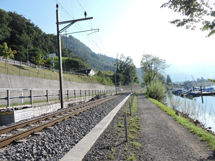
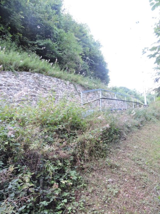
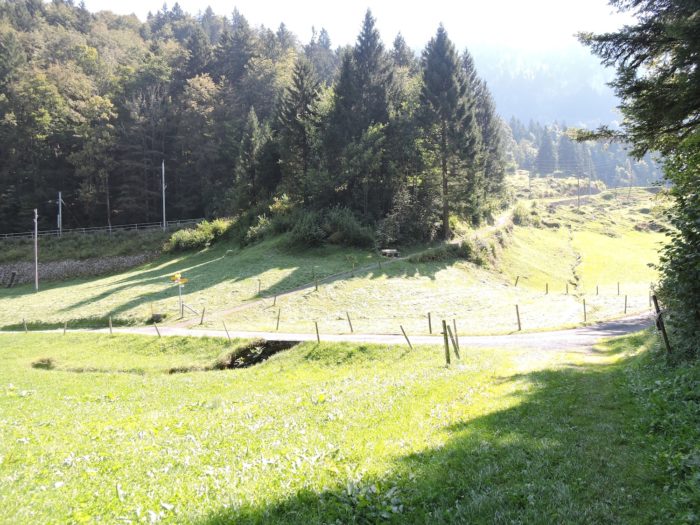
The Via Jacobi carves a path through the plain, gracelessly following the Giswilwr Aa, found here like an old travel companion, before venturing boldly towards the protective shade of the forest. Up above, the train, like a metallic breath, glides over, carefree.
|
 |
 |
| From then on, the walker is invited to climb, from Lake Sarnen to Lake Lungern, following the steps of the Brünig road and its faithful companion, the railway. The ascent, capricious and demanding, often challenges with its boldly steep slopes of more than 15%.
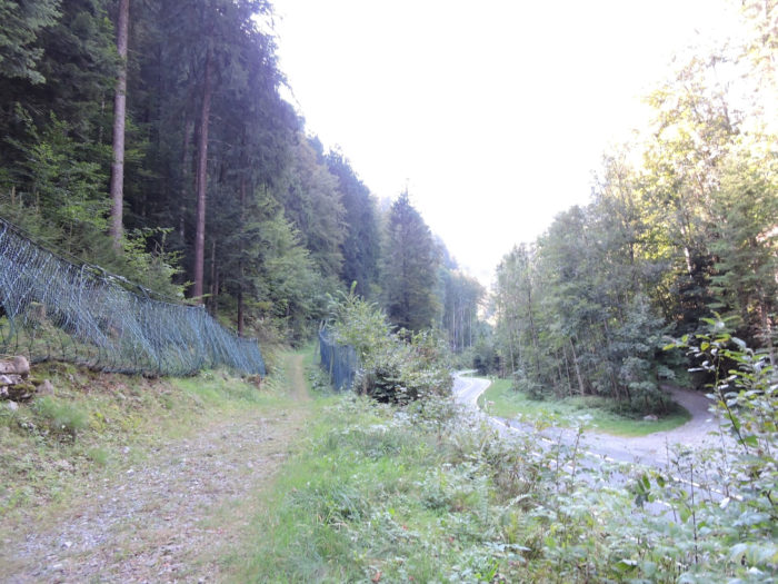
Here, the modest road abandons the fullness of the plain, giving way to a rough path that, like an ascetic, climbs steeply into the sanctuary of the undergrowth. It then winds beneath the monstrous pillars of the Brünig road, which has transformed into a semi-highway, where the hum of civilizations is clearly perceptible. |
 |
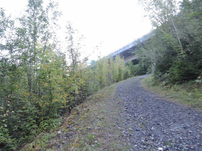 |

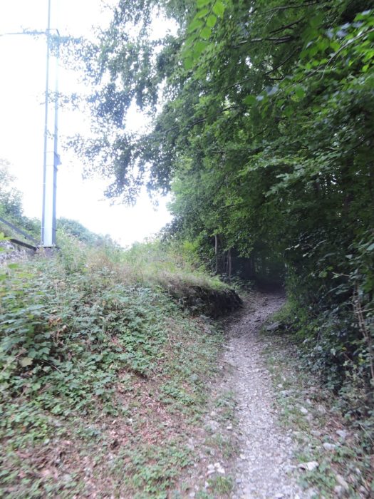
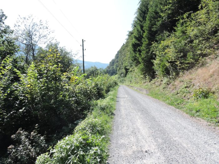
The wide path, braving the grayish and dirty gravel, climbs within the undergrowth, above the semi-highway. It feels a little like hell around here. This section, almost melancholically dull, proves to be a challenge with its relentless slope and an austere, unwelcoming forest, pushing the traveler to seek an escape. Below, truck drivers take a break—an oasis of life—at the inn.
|
 |
 |
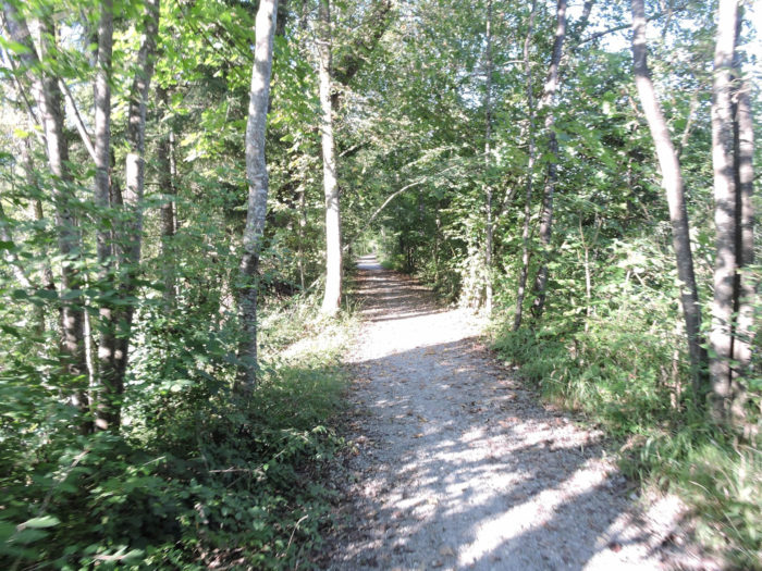
| Under a canopy of majestic beeches, interspersed with a few oaks and maples, the wide path has turned into a narrow trail that continues its ever-wild quest, yet without a soul. The ash trees at the edge offer respite for the eye, weary of stone, plunging towards the plain below, more welcoming. |
 |
 |
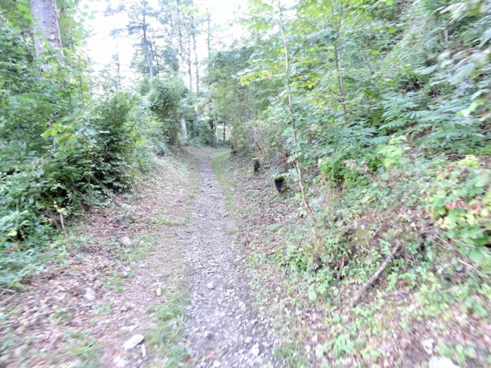
| Gradually, the trail becomes an accomplice to the railway, carving a path through bushes and wild grass. The walker is then about to leave behind the melancholy of this demanding undergrowth, where every step requires sustained effort. |
 |
 |
| When the trail meets the railway, the slope becomes less tyrannical, offering a brief respite. |
 |
 |
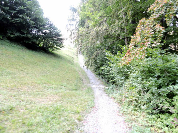
| Yet, this mercy is short-lived, and soon the trail resumes its climb through wild grass and ungrateful nature. Following the railway, it drifts away to flirt with the farms of Sommerweid. Here, the panorama broadens, and the pass road reveals itself once again, like a revelation. |
 |
 |
From this privileged observatory, the gaze can slide one last time over Giswil down to Lake Sarnen, embracing Zollhaus in its hold.

| Beyond the last sentinels of Sommerweid, a paved road humbly crosses the hilltop, as if to salute the sky. |
 |
 |
| This road leads to Kaiserstuhl, guardian of Lake Lungern, where the train and automobiles share their incessant ballet. There’s no station buffet to welcome the traveler, but a hotel stands, like a beacon. Travelers from distant horizons, Asian and Arab, do not stop here, their gaze fixed on Interlaken. |
 |
 |
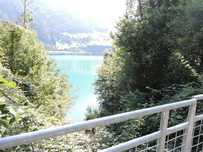
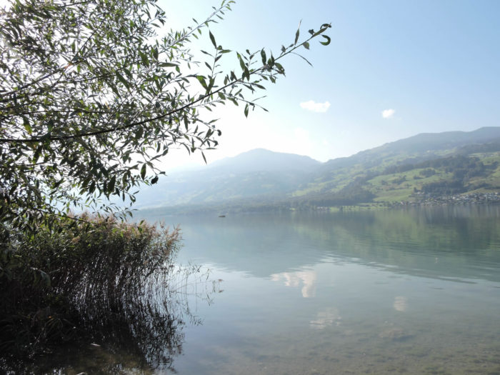
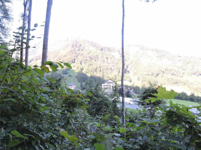
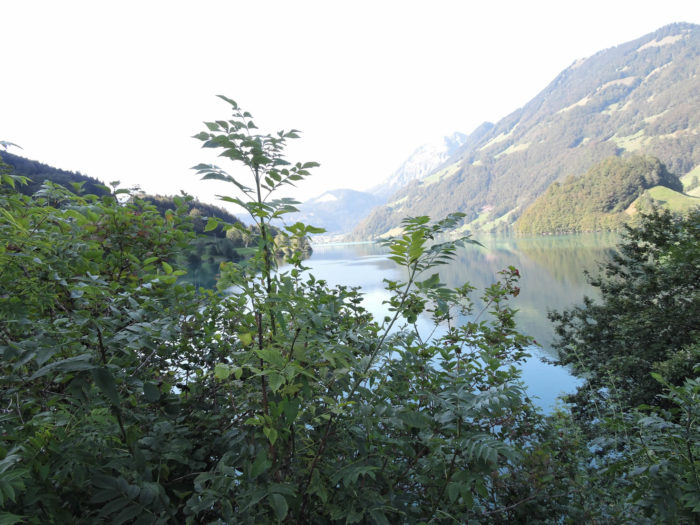
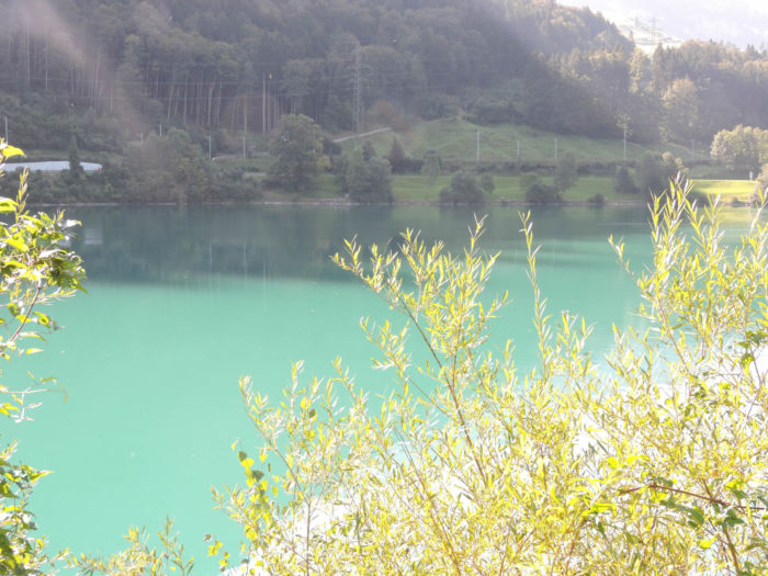
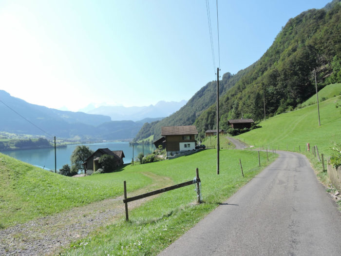
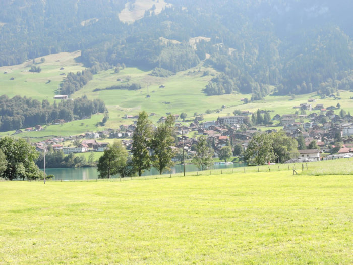
| In the distance, the Finsteraarhorn rises, majestic, guardian of the Bernese Alps, its peak reaching 4274 meters, offering a sublime spectacle. Beneath this sentinel, Lake Lungern stretches, a haven of tranquility. |
 |
 |
|
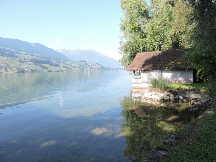
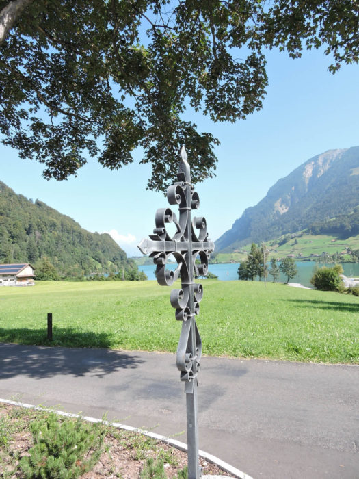
Lake Lungern, a mirror of emerald and azure, harbors perch, whitefish, trout, pike, and catfish within, dancing an aquatic symphony. Fishing, a princely activity in these parts, is celebrated by local fishing tackle shops. The clarity of the waters invites contemplation, protecting its inhabitants through welcome fishing restrictions.
|
 |
 |
| Here, two roads emerge: that of motorists, enamored with speed, to the left of the lake, and that of hikers, nature poets, to the right. Secret coves offer refuge for fishing, water games, or simply to anchor one’s boat, testimonies to moments of pure happiness, akin to the crystal-clear water of the lake. On the horizon, Lungern looms. |
 |
 |
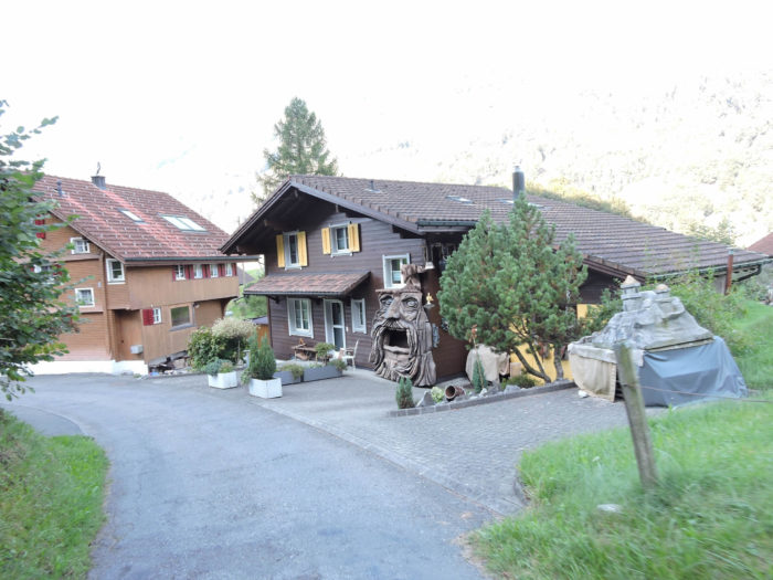
| The small road, a faithful companion to the shore, swiftly leads to Bürglen, with its modest church and scattered houses, silent witnesses to simple and full lives. |
 |
 |
| Further on, the road momentarily departs from the lake’s caress… |
 |
 |
| …only to return, drawn by its charm, near the dwellings of Margel. |
 |
 |
| Here, modest unnamed streams, full of life, descend from the mountain, as if to confide in the lake. |
 |
 |
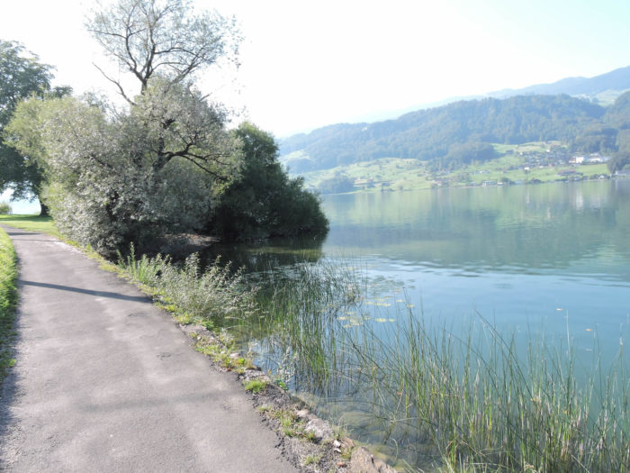
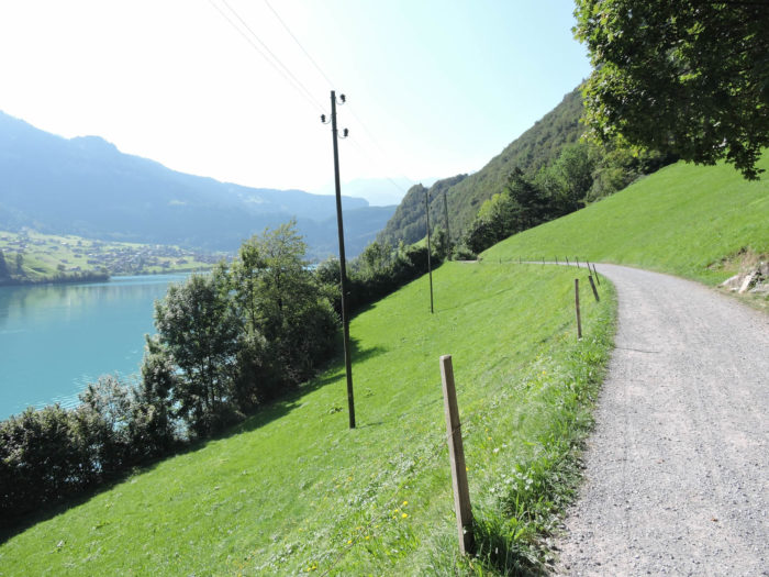
| Soon, a beaten earth track takes over from the asphalt, in a gesture of returning to origins. On the other side of the lake, the Brünig road watches, while the lake’s water retains its jade brilliance. |
 |
 |
Section 4: A little more respite before the pass

Overview of the route’s challenges: a route without difficulty.

|
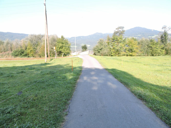
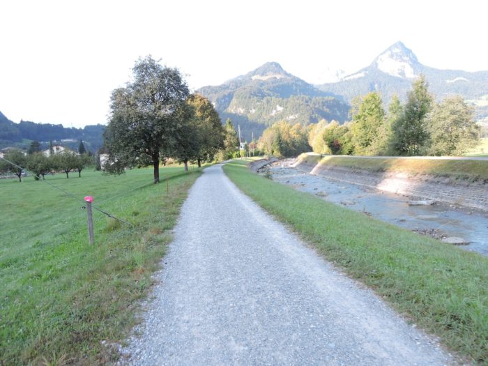
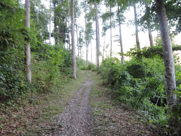
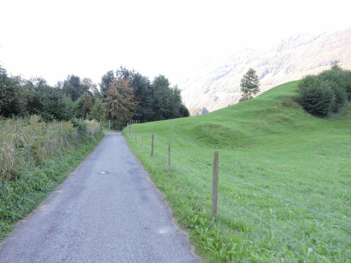
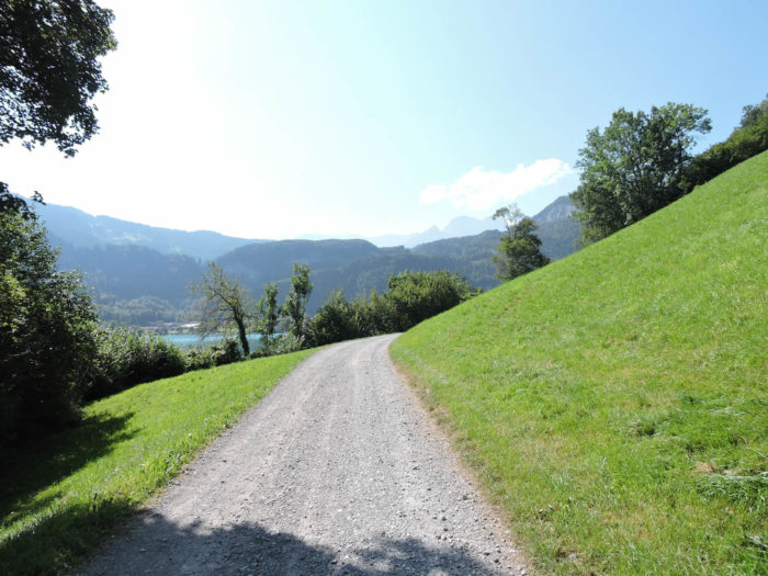
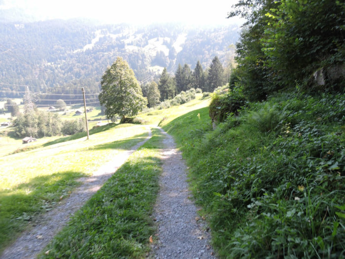
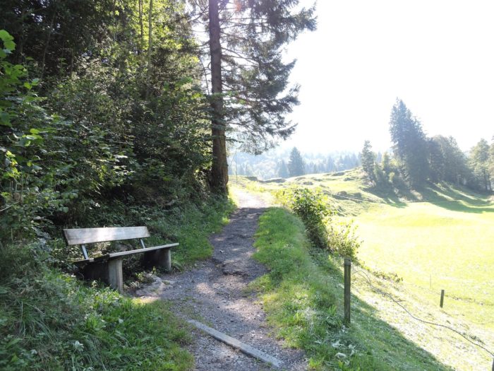
The Via Jacobi unfolds along a dirt road that majestically winds along the top of the bank, where the canopy of deciduous trees, in overwhelming dominance over the conifers, weaves a green setting. Among this vegetation, the beech, undisputed sovereign of these lands, shares its kingdom with a retinue of lush maples, some ancient oaks, as well as ash and spruce trees, punctuating the landscape with their noble presence. .
|
 |
 |
| Along the path, the beaten dirt turns into a winding ribbon, dotted here and there with sharper turns. Here and there, a solitary barn or a mysterious stream, whose origins elude you, mark your journey |
 |
 |
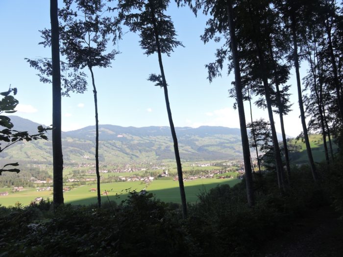
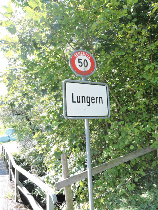
On the other side, in the distance, Lungern seems to flourish before your eyes, growing as our gaze lingers, like a living painting unfolding on the horizon.
|
 |
 |
Continuing your progress, just a few hundred meters more, and the Via Jacobi leaves the shores of the lake to embrace new horizons.
|
 |
 |
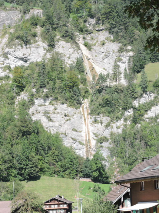
| A road then leads you to Disselbach, a suburb of Lungern, where it crosses the Dundelbach. This latter, in a wild surge, cascades over the village like a veil of foam celebrating the power and beauty of nature. |
 |
 |
| The road, continuing its way through Disselbach, heads towards Obsee, a village nestled near the lake, where the density of life echoes a preserved past and a present built with discernment. |
 |
 |
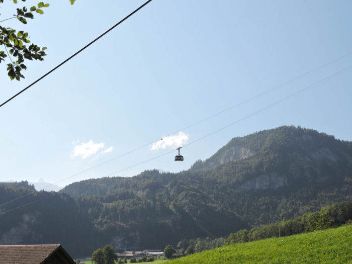
| A cable car, like an artery connecting earth to sky, rises towards the Turren/Schönbüel ski area, offering an escape to snowy peaks. |
 |
 |
| The road, continuing its journey, reaches Obsee and crosses the Lauibach, in a region where man has tamed the waterways, a testament to Switzerland’s wealth and foresight in the face of nature’s whims. |
 |
 |
| Soon, the road winds through Obsee, a village where wooden chalets, lined up and adorned with geraniums, flirt with the shores of the lake, offering an image of serenity and quality of life. |
 |
 |
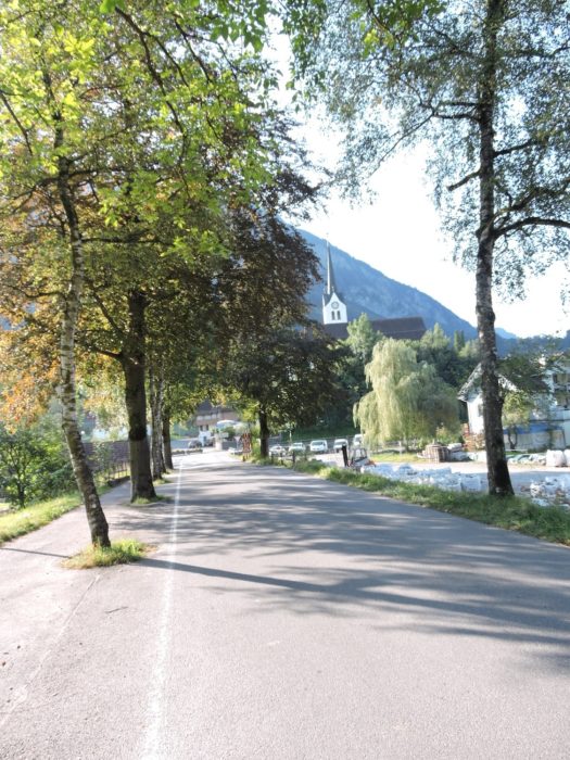
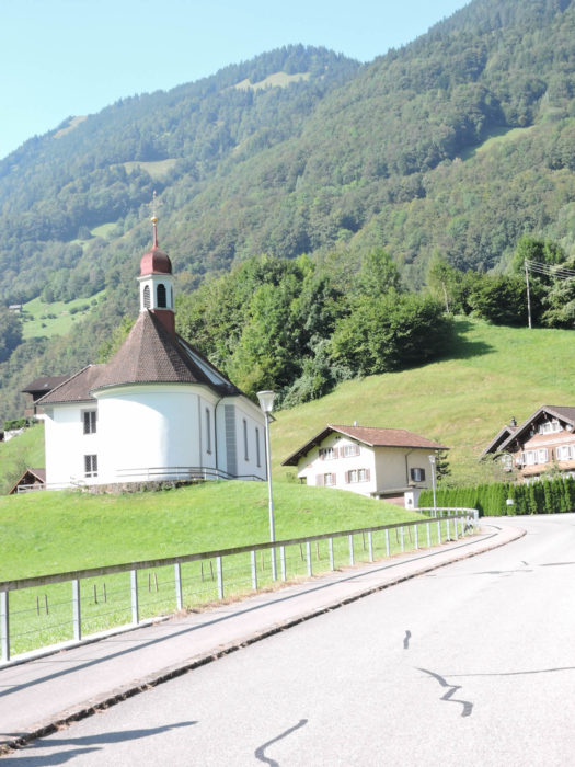
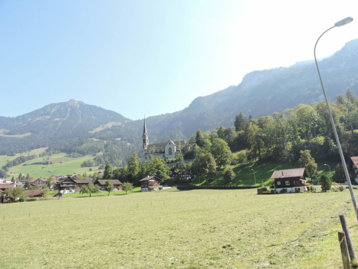
| Shortly after, the road redirects towards Lungern, crossing on its way the St. Béat Chapel, a baroque jewel from the 16th century, whose recent restoration has revived its splendor and spirituality. |
 |
 |
| The Via Jacobi, although it does not reach Lungern, serves as a guide for pilgrims wishing to reach the train ascending to Brünig. The pass, despite its intimidating evocation, represents only a minor challenge within the Swiss relief, with its modest altitude of 1000 meters. Indeed, during your passage over Schwyz, you had faced higher altitudes, exceeding 1400 meters. This pass, although it presents gradients of over 300 meters and sometimes dizzying slopes, is only a minor challenge in the grand theater of the Swiss mountains. |
 |
 |
| The path rising towards the pass begins behind an imposing wooden commerce sign, marking the entrance to the Brünig road. |
 |
 |
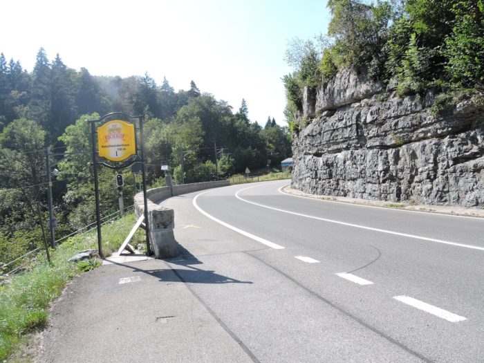
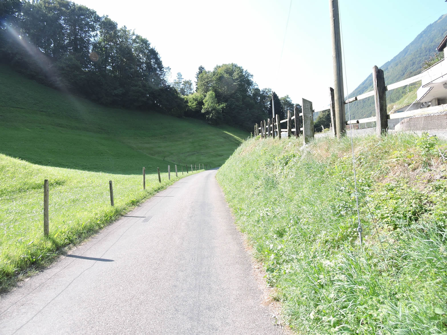
| After an ascent on a path dotted with stones, the Via Jacobi joins a discreet road, sinking under the protective shadow of the cliff, like a well-kept secret. |
 |
 |
Section 5: A long climb towards the Brünig Pass
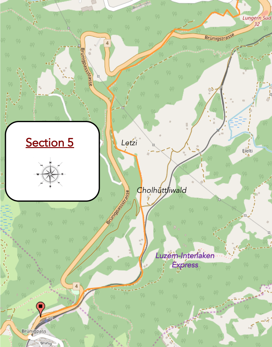
Overview of the route’s challenges: a steep climb, with an intermediate descent, just for the pleasure of climbing again afterward.
|
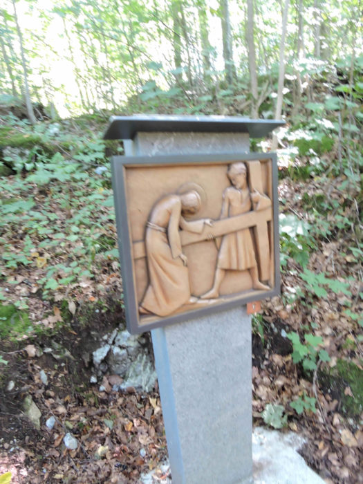
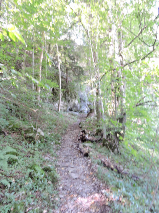
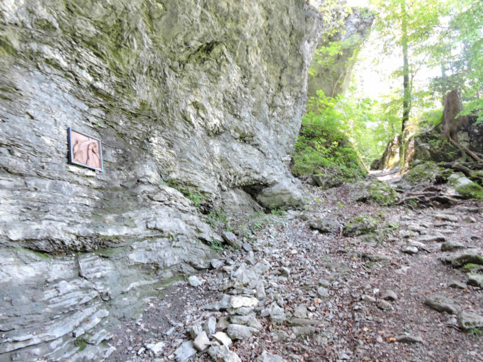
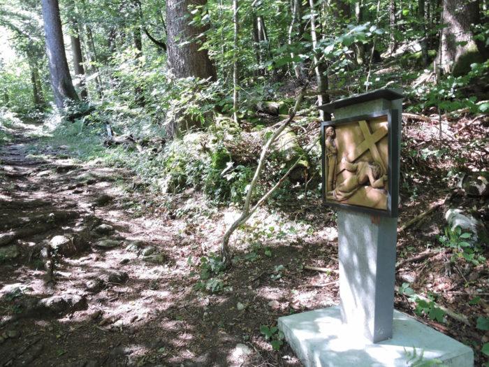
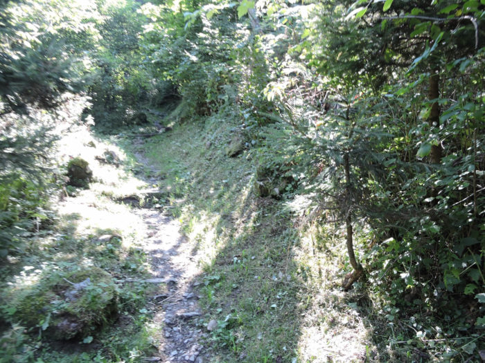
As soon as you cross the threshold of this small plateau, a rocky path boldly climbs through the shadow of a forest, backed by a cliff, accompanied by a Via Crucis that seems to watch over every stray step.
|
 |
 |
| No matter how intense your heavenly pleas for a less steep slope, they are met with the indifference of cliffs, polished by the gleam of shale, and the unyielding stones marking the trail. |
 |
 |
| In this natural theater, majestic beech trees refuse to yield the stage to maples and oaks, those scattered solitaries. |
 |
 |
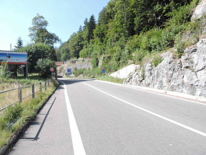
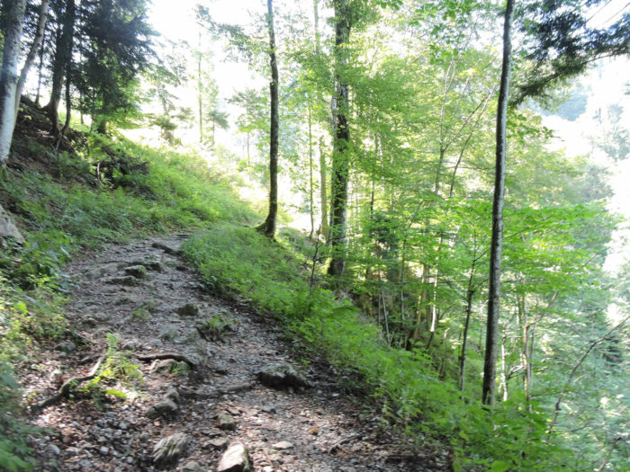
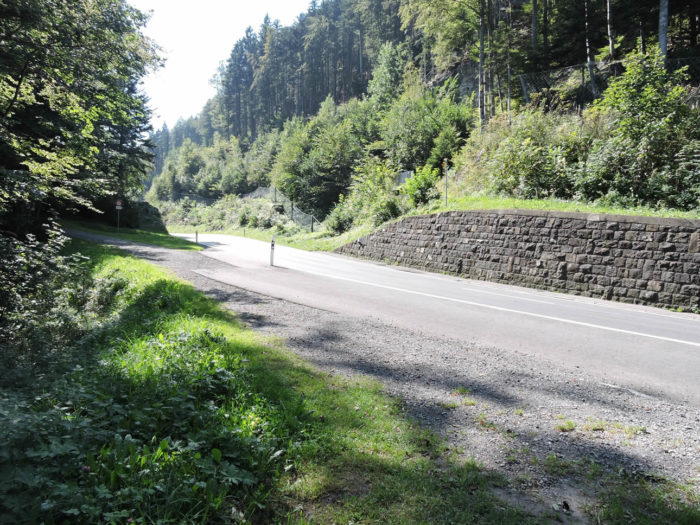
| Once the cliff is conquered, the slope finally consents to soften, although remaining at an incline approaching 15%, where the trail joins the road, animated by the incessant ballet of traffic towards the pass. |
 |
 |

| The trail persists in its ascent through the woods, overlooking the pass road. The dance of stones beneath your feet and the veil of moss covering the rocks testify to a pervasive humidity, under a sun playing hide-and-seek. |
 |
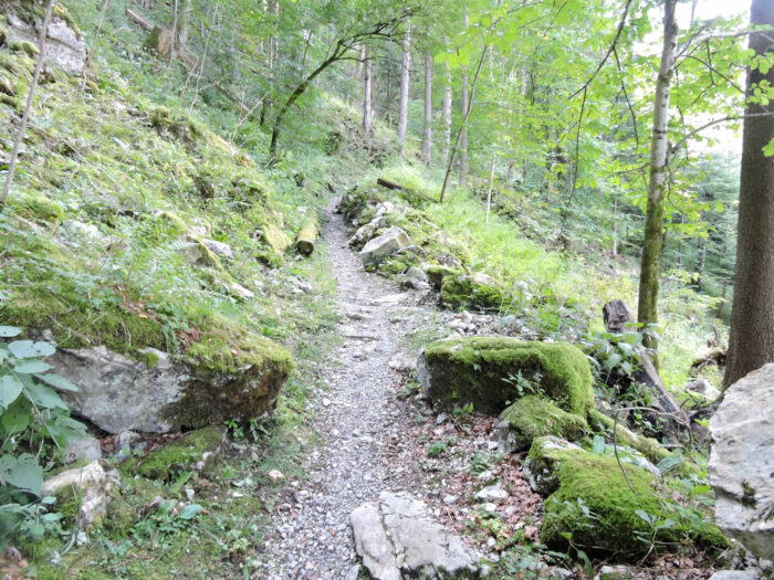 |
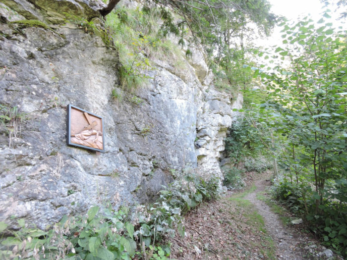
| Here, demand intertwines with the wild beauty of a sparse forest, where the trail skirts a new cliff, weaving among rocks draped in moss, amidst a procession of beeches, maples, and birches. Sometimes, the rocks are adorned with mysterious engravings, like ancestral warrior frescoes. The slope, ever imperious, weaves its way among the interlaced stones and roots. |
 |
 |
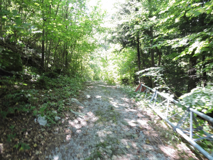
A clearing suddenly offers you a view of the pass road, stretching not far away. The roar of engines, like a constant murmur, accompanies the ascent through numerous points of this climb.

| Higher up, the trail plunges into a canyon, embraced by dense vegetation. The echo of engines reminds you of the renewed proximity to the road, frequented by a denser cohort of motorcyclists than truckers. |
 |
 |
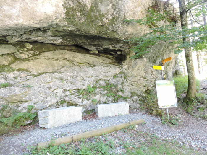
| Soon, you reach the place called Letzi, perched at 950 meters above sea level, where granite has been shaped to offer a haven of rest. |
 |
 |
| The smell of beer hangs in the air, a promise of imminent comfort, perhaps intended for travelers rather than motorists. At this altitude, the illusion of an almost completed ascent lulls you before revealing the trickery of the route: a descent of over 60 meters awaits you before climbing again. The Camino de Santiago cunningly avoids the overly frequented arteries. |
 |
 |
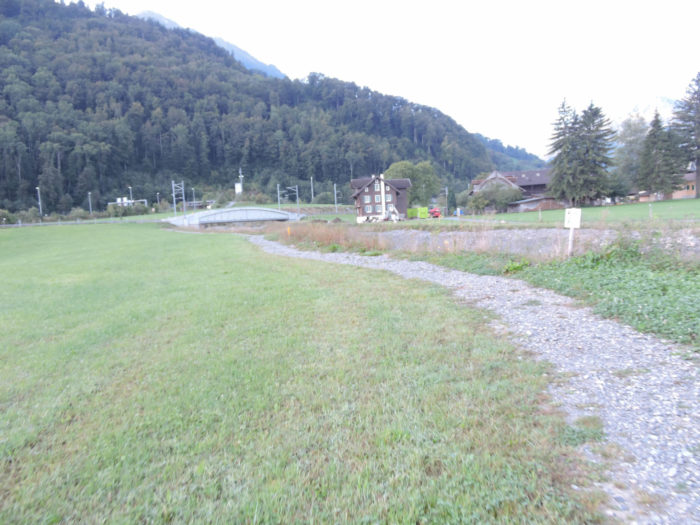
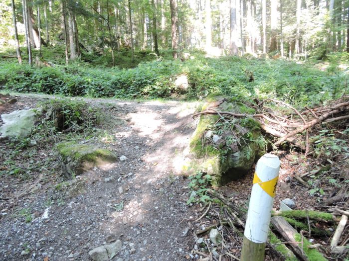
| Thus, the path suddenly withdraws from the road, first plunging into the undergrowth, then through the meadows. |
 |
 |
| Lower down, the wake of the railway crosses the landscape. |
 |
 |
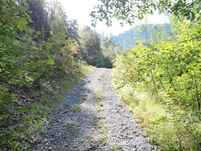
In the hollow of this descent lies Cholhüttliwald. The Brünig Pass is now just a short walk away.

|
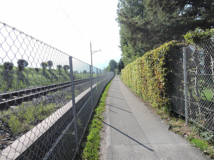
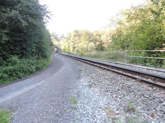
Soon, the trail straightens, promptly rejoining the railway tracks.
|
 |
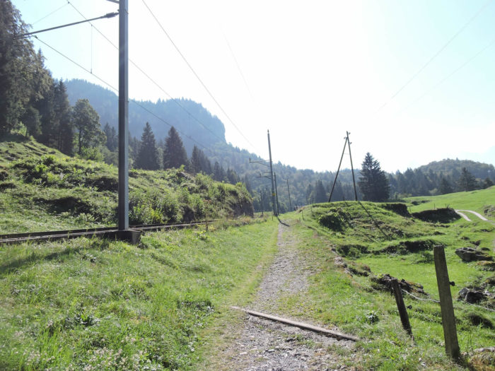 |
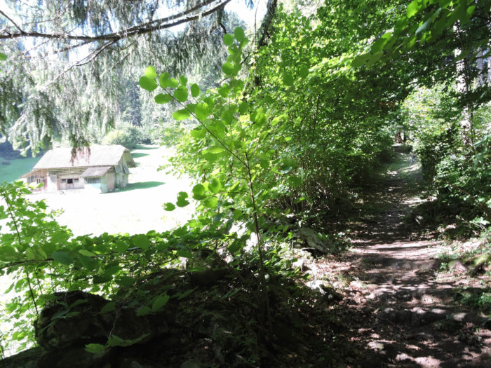
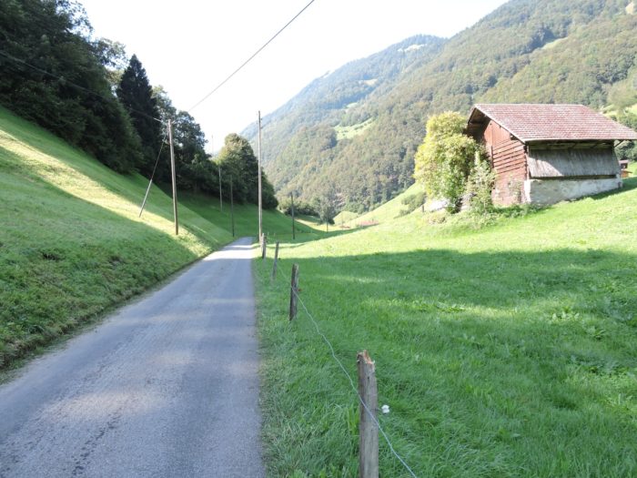
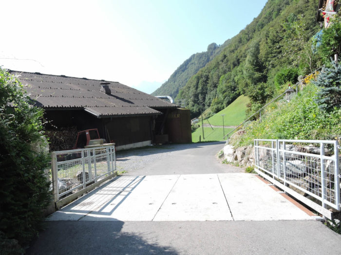
| You find yourself on a lovely trail alongside the track, bordered by a few barns and alpine chalets, silent witnesses of mountain life. . |
 |
 |
Shortly after, it leads you to cross to the other side of the tracks, but the spectacle remains unchanged, of a striking beauty.
|
 |
 |
A little higher up, advertisements for beer mingle with those of the nature conservation league, owner of a chalet nearby.

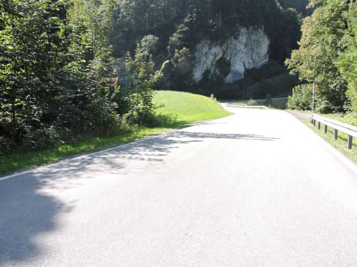
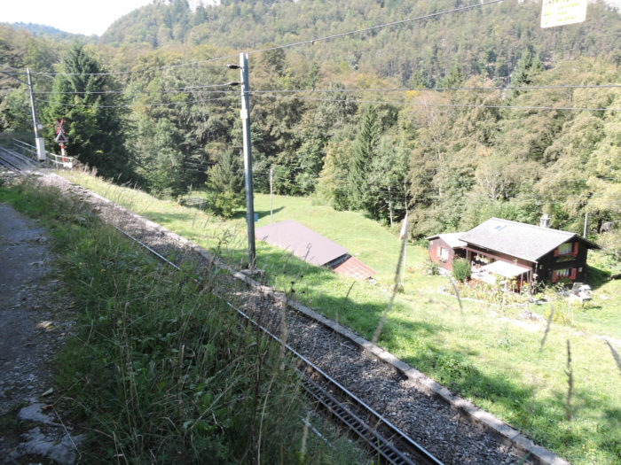
| Near the pass, the path finally leaves the railway to rejoin the pass road. |
 |
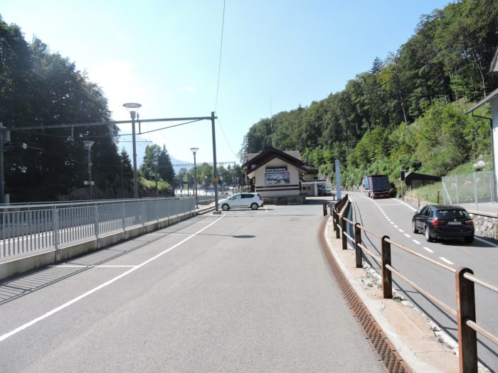
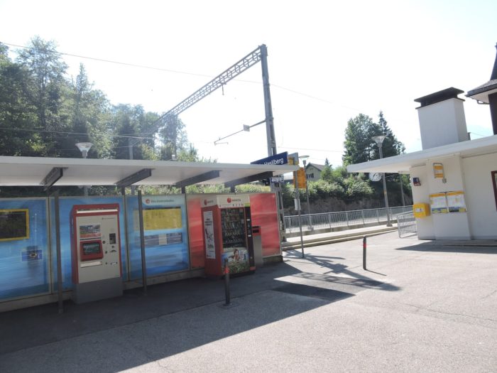
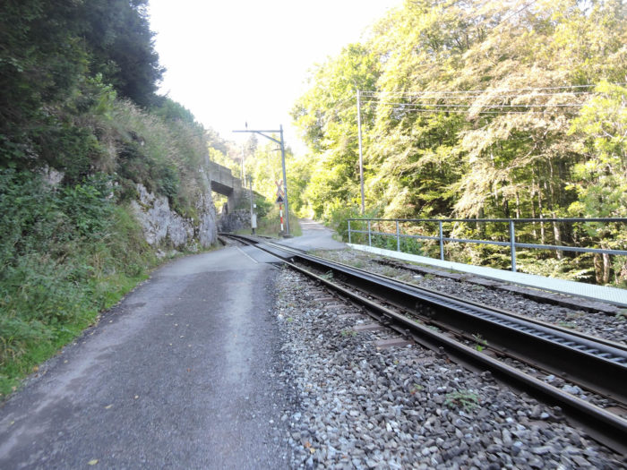 |
| The station stands at the heart of the pass. Few souls reside there, but nearby, Hasliberg, a small mountain resort, houses numerous chalets. |
 |
 |

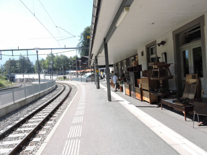
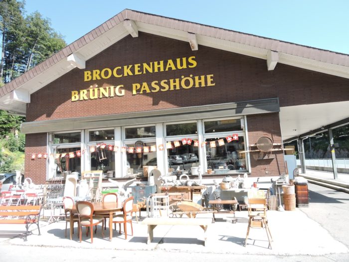
| The Brünig, lively pass by day and haven of peace by night, offers shelter and sustenance. A popular flea market displays its treasures near the station, attracting the curious in search of a breath of old Helvetia. |
 |
 |
Accommodation on Via Jacobi
- Landgasthof Hotel Zollhaus, Zollhaus; 041 675 11 72; Hotel, dinner, breakfast
- Luisia Enz-Frezza, Gerbiplätz 4, Giswil; 041 675 11 61; Guestroom, breakfast
- Johanna & Martin Rohrer, Brüngstrasse 10, Giswil; 041 675 28 67/079 152 76 06; Guestroom, breakfast
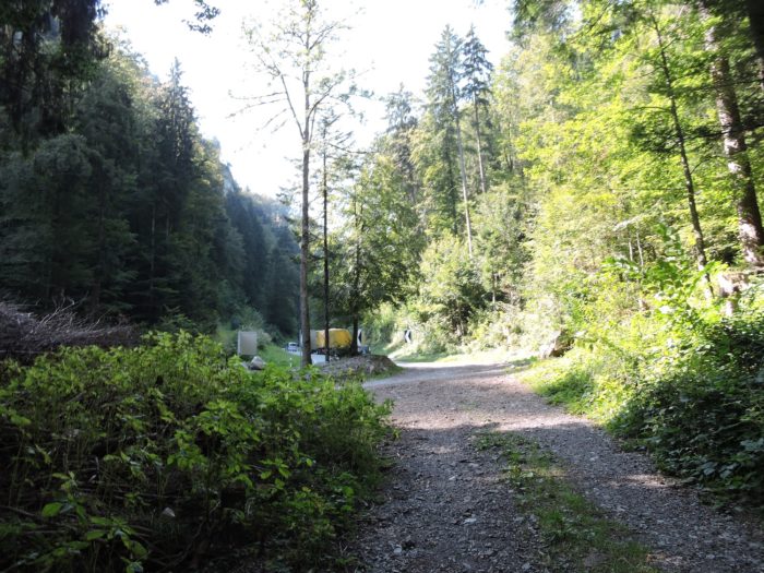
- Camp Obsee, Campingstrasse 1, Giswil; 041 675 23 55; Camping, dinner, breakfast
- Luisia Enz-Frezza, Gerbiplätz 4, Giswil; Hôtel Bahnhof, Brünigstrasse 48; Hotel, dinner, breakfast
- Biohof Ennetmatt, Bürglen; 041 678 13 02; Guesroom, dinner, breakfast
- Anne & Paul Knüsel. Hinterssestrasse 127, Bürglen; 079 272 09 58; Guestroom, dinner, breakfast
- B&B Ming, Brünigstrasse 49, Lungern; 041 678 12 86/079 259 19 86; Guestroom (straw), dinner, breakfast
- Marianne Furrer-Bucheli, Lengasse 12, Lungern; 041 678 12 38/079 928 14 11; Guestroom, dinner, breakfast
- Theres Gasser, Badmattweg 31, Lungern; 041 666 16 63/077 401 20 08; Guestroom, breakfast
- Brigitt Steiger, Röhrligasse 44, Lungern; 079 641 86 74; Guestroom, breakfast
- Szilvia Herzog, Röhrligasse 45, Lungern; 076 778 46 46/076 277 04 54; Guestroom, dinner, breakfast
- Hôtel Restaurant Waldegg, Brünigpass; 033 971 11 33; Hotel, dinner, breakfast
- Hôtel Restaurant Silvana, Brünigpass; 033 971 17 08; Hotel, dinner, breakfast
- Hôtel Restaurant Kulm, Brünigpass; 033 971 00 40; Hotel, dinner, breakfast
There are no major difficulties in finding accommodation on this stage. However, it can be crowded at the pass during the peak season. It is still advisable to book in advance for security.
Feel free to add comments. This is often how you move up the Google hierarchy, and how more pilgrims will have access to the site.
|
 |
Next stage : Stage 9: From Brünig Pass to Ringgenberg |
|
 |
Back to menu |