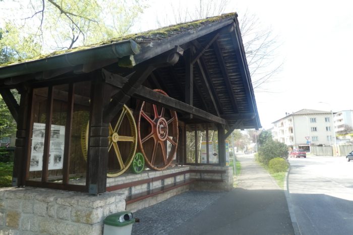
Between river and small mountain, from the Canton of Basel to the Canton of Jura
DIDIER HEUMANN, ANDREAS PAPASAVVAS
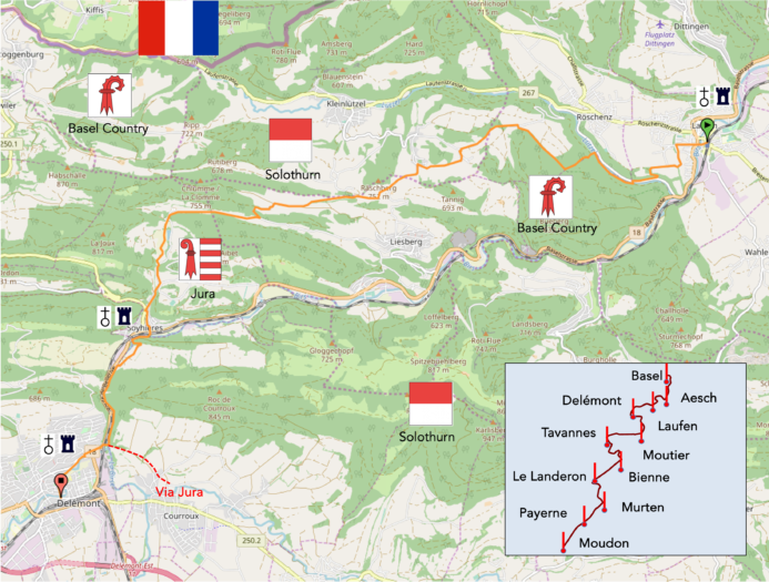
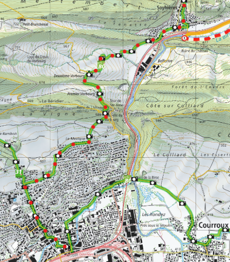
We divided the course into several sections to make it easier to see. For each section, the maps show the course, the slopes found on the course, and the state of the route (paved or dirt roads). The courses were drawn on the « Wikilocs » platform. Today, it is no longer necessary to walk around with detailed maps in your pocket or bag. If you have a mobile phone or tablet, you can easily follow routes live.
For this stage, here is the link:
https://fr.wikiloc.com/itineraires-randonnee/de-laufen-gare-a-delemont-gare-par-la-via-jura-34655959
| It’s clear that not all travelers are comfortable using GPS and navigating via smartphone, and there are still many areas without an internet connection. As a result, you find a book on Amazon that covers this journey.
If you only want to consult lodging of the stage, go directly to the bottom of the page. |
|
Between the majesty of the Alps and the gentleness of the plain stretches the Jura, a geological bastion with deep roots and subtle reliefs, shaped over millions of years of Earth’s history. Nestled between the canton of Basel and the canton of Jura, this massif is not merely a line on the map but a living testament to the evolution of our planet. The Jura is first and foremost a ballet of geological forces, a legacy of the tumultuous meeting of the African and European continents eons ago. Around 35 million years ago, driven by the formation of the Alps, this jewel of marl and limestone emerged, like a crescent of stone stretching from Zurich to the Isère. Its history begins long before, in the depths of primordial seas, during the age of reptiles and dinosaurs, when the first sediments began to settle, forming the foundations of what we know today. Through successive eras, the sea shaped this region, patiently depositing varied sedimentary layers, bearing witness to a past of warm, humid climates. Then came the Tertiary Era, marked by the gradual retreat of waters and the rise of mountains, under the embrace of the nascent Alps. Thus emerged the folds and undulations of the Jura, a landscape sculpted by millions of years of tectonic movements and subtle transformations.
Today, as you leave the shores of Basel and enter the canton of Jura, you embark on a winding journey through wooded foothills. Here, the geography becomes complex, with its administrative enclaves and unchanging panoramas, where each valley and peak tells a millennia-old story of marine deposits and telluric forces.

Difficulty level : The route is not without its challenges, with seemingly modest elevation changes of +410 meters and -365 meters, hiding their true nature beneath a reassuring appearance. The steep ascents through the Bueberg forest and the gentle slopes of Ober-Huggerwald demand a certain perseverance from hikers, rewarded by gentler descents and welcoming paths, perfect for a contemplative hike.
State of the Via Jura : This stage will delight walking enthusiasts, offering a route predominantly on natural paths:
- Paved roads: 7.3 km
- Dirt roads : 12.0 km
Sometimes, for reasons of logistics or housing possibilities, these stages mix routes operated on different days, having passed several times on these routes. From then on, the skies, the rain, or the seasons can vary. But, generally this is not the case, and in fact this does not change the description of the course.
It is very difficult to specify with certainty the incline of the slopes, whatever the system you use.
For those seeking « true elevations » and enthusiasts of genuine altimetric challenges, carefully review the information on mileage at the beginning of the guide.

Section 1 : A bit of calm, then the challenge in the Bueberg Forest

Overview of the route’s challenges : a serious effort required in the steep, zigzagging forest paths.

To explore the Via Jura 80 towards Delémont, the train station is the ideal starting point. It is where all the directions converge, providing a perfect introduction to this region rich in landscapes and history.
|
From the very first steps out of the station, the route will lead you to the Birs, a river whose gentle murmur will only be heard again at the end of your journey. |
|
 |
 |
 |
 |
| The urban landscape of Laufen gradually recedes behind you as you follow BKW-Strasse, which takes you through quiet suburbs until you finally reach the start of Schützenweg. |
|
 |
 |
 |
 |
| Schützenweg, a small paved road, begins its gentle ascent as it exits the suburb… | |
 |
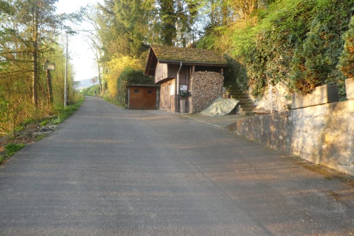 |
| …before venturing into nature through pastures where sheep are already going about their morning routines under the bright sunlight of the new day. The air is filled with the fresh scent of the fields and the song of birds. | |
 |
 |
| Soon, you leave the road for a rustic path that winds between verdant meadows and the edges of the woods. The mild weather and the golden morning light make this spot idyllic for a rest, although some might find it a bit early for a break on a bench by the forest. | |
 |
 |
 |
 |
| The path then meanders into the dense forest, narrowing into a narrow trail that follows the winding contours of the Lützel River below. Here, the ascent becomes steeper, marked by steep passages among majestic beeches and dense undergrowth. | |
 |
 |
Delémont is announced at 4:45, which is quite a distance away.
| The atmosphere is humid and cool, with moss covering the stones and tree trunks, reflecting the rich biodiversity of this preserved area, in a forest that is not the most elegant in the region. The path sometimes winds over logs on the most delicate slopes. | |
 |
 |
| Further on, the following descent is equally steep, crossing above the Lützel road, where Lützelhof, presumably a restaurant, is nestled. | |
 |
 |
| At the end of the forest, the path meets Lützelstrasse, the Lützel road. | |
 |
 |
| There, it crosses the Lützel (Lucelle in French), a seemingly rather turbulent river that initially marks the border between France and Switzerland, flowing through enclaves of the canton of Solothurn, then Basel-Land before emptying into the Birs River just a short distance away. | |
 |
 |
Parallel to the Via Jura, you will notice the Jubiläumsweg, or Jubilee Path, which will be a path of jubilation, as you will discover.
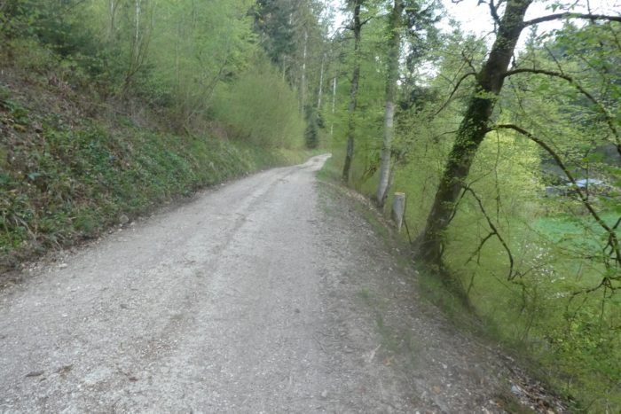
| Just across the bridge, a wide dirt road runs alongside the river, which dances and leaps somewhere between shadow and light, along the spruces and broadleaf trees. For now, it’s a bit of calm before the storm expected soon. Make the most of it. | |
 |
 |
 |
 |
| It cannot be said that this region ranks among the most beautiful forests in Switzerland. Here, the forest has a more austere, sometimes desolate appearance. The undergrowth is cluttered with dense brush and aggressive thorns. The light struggles to penetrate the canopy, creating a twilight ambiance even in broad daylight, heightening the sense of gloom in this deep dale. | |
 |
 |
And the storm looms ahead, in the form of a sign announcing the Jubiläumsweg. When a sign indicates a ban for cyclists, doesn’t it predict the worst?
| The path enters the Bueberg Forest, climbing nearly half a kilometer with vertiginous slopes well beyond 15%, sometimes reaching between 30% and 50%. From the start, the valley is so enclosed that light barely reaches the dense undergrowth, plunging the hiker into almost complete darkness. | |
 |
 |
| Small logs, worn by time, frost, and the elements, line the trail like precarious crutches, offering uncertain but welcome support for progress. | |
 |
 |
| Higher up, light finally manages to pierce the forest cover, making the forest more welcoming but still challenging to traverse. The forest is mixed, with large, sturdy beeches accompanied by a myriad of delicate, slender shoots like needles. A few oaks, maples, and spruces complete the ensemble. The path takes sweeping turns, attempting to ease the steepness of the climb. However, this attempt proves futile. From one hairpin turn to the next, the path relentlessly continues to climb, imposing its challenge without respite. Not a single bench to rest on. Only the imposing trunks of large beeches offer a brief respite, allowing you to lean, if only for a moment, to catch your breath and prepare for the next effort. This relentless and demanding ascent tests the hiker’s determination and endurance, each step a struggle against gravity and fatigue. | |
 |
 |
 |
 |
| A little higher up, the path gradually approaches a rocky outcrop on a trail covered with dead leaves, in an enchantingly wild nature. | |
 |
 |
On the rock, a handrail has even been installed. But rest assured, there is no danger here, as public hiking trails, including the Camino de Santiago, never take impassable routes. If paths are difficult or dangerous, they are always signposted in advance.
| Further up, you reach a point where a small rest is more than welcome, nestled in a richly wild green setting. The humidity clings to the slope here, as evidenced by the thick moss covering the rocks and enveloping the tree trunks, creating a fairy-tale and mysterious landscape. | |
 |
 |
| From the rocky outcrop, the slope finally eases somewhat. However, the summit is still ahead. Along the way, a granite milestone emerges from the vegetation. Does it mark an old border between Switzerland and France, or merely a boundary between the canton of Basel-Country and Solothurn? It is a bit further on where you actually leave the canton of Basel-Country to enter an enclave of the canton of Solothurn. | |
 |
 |
|
Honestly, no one will be disappointed to reach the end of this challenging section when they stop at the top of the hill in the dense vegetation to read the direction sign in detail. The Jubilee Path leads to different horizons than yours. On the Via Jura, Nieder-Huggerwald is announced as a 30-minute walk and Delémont as 4 hours away. |
|
 |
 |
Section 2 : A waltz of three Cantons: Basel-Country, Solothurn, and soon the Jura

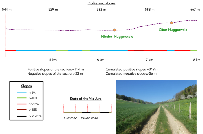
Overview of the route’s challenges : just a bit more effort around Ober-Huggerwald. After that, it will be almost like a vacation.
|
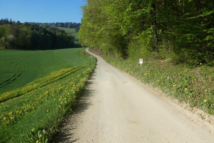
And to make amends, the Via Jura emerges from the forest, wide and bright, stretching out flat on Rütenenweg like a ribbon of nature unfurled. |
|
 |
 |
|
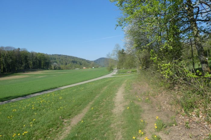
Descending along the forest edge, it follows a wide dirt path with a grassy central strip, like a road carved between shadow and light. Below, the village of Röschenz emerges, perched above the turbulent Lützel River, in Basel-Country. |
|
 |
 |
|
The dirt path gently slopes along the edge of the Bueberg Forest, offering an unobstructed view of the cereal fields below. |
|
 |
 |
 |
 |
|
You are walking on Rütenenweg, soon to be replaced by Buechbergerstrasse. The notable difference is that this route is a more carriageable dirt road. |
|
 |
 |
|
Yet, the term « Strasse » is almost excessive. Only a few Solothurn vehicles navigate this dirt road. The road winds between meadows, fields, and groves, descending towards the hamlet of Nieder-Huggerwald, nestled in the canton of Solothurn. |
|
 |
 |
|
In the distance, the village takes shape as you almost imperceptibly enter the enclave of the canton of Solothurn, with only the canton’s coat of arms planted at the roadside to mark the transition, probably highlighting the local pride of living in a canton other than Basel-Country. |
|
 |
 |
 |
 |
Swiss enclaves largely have religious origins, arising from the Reformation’s upheavals which divided communities between Catholics and Protestants. It’s an old and complex story: in Romandy, regions like Payerne-Avenches-Morat joined the canton of Fribourg, which remained loyal to their faith. Here, in this enclave, the opposite occurred. The canton of Solothurn, predominantly Catholic, welcomed those who remained attached to their original religion while Basel, predominantly Protestant, followed a different path. Historical complications persisted, but the federal state found compromises to ease inter-cantonal tensions. You are, so to speak, at the end of the world. Nearby is Kleinlützel, along the river of the same name. To the north, roads become scarce and vast forests impose their darkness, eventually leading towards France. It’s a region as wild as it is preserved, where development seems to have spared both Switzerland and its French neighbors. Geographically, the canton of Solothurn is a kind of shapeshifting monster that stretches its tentacles between Basel, Bern, the Jura, and even France.
|
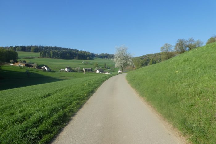
Nieder-Huggerwald rests peacefully in a hollow, embraced by the majesty of the hills rising beyond its boundaries. |
|
 |
 |
Ober-Huggerwald is announced further up, 20 minutes away.
|
Nieder-Huggerwald is a predominantly agricultural hamlet, imbued with the essence of the countryside and the land, evoking a rustic and authentic simplicity. |
|
 |
 |
|
The path boldly stretches across the landscape, winding between verdant meadows where beeches, fruit trees, and spruces provide a spectacular backdrop. But here, beauty comes with its challenges. The path persistently climbs through the rolling hills. In places, the steep incline challenges hikers, sometimes exceeding 15%. |
|
 |
 |
 |
 |
|
Halfway to Ober-Huggerwald, the slope finally eases, and the dirt path gives way to a soft grass carpet. The meadows stretch endlessly, dotted with clumps of trees and fields of golden cereals under the generous sun, in a scene of natural grace and perfect pastoral harmony. |
|
 |
 |
|
Continuing its ascent, the path transforms into a smooth asphalt ribbon, guiding travelers toward the edge of the village. |
|
 |
 |
|
At 630 meters above sea level, in the canton of Solothurn, an ancient stone cross silently bears witness to the region’s Catholic past, reminding one of a time when faith was embedded in every stone and every soul. |
|
 |
 |
|
But the summit is still to be conquered. The road persists, climbing stubbornly until it reaches a small pass lost in the meadows. |
|
 |
 |
|
Up there, near a perched reservoir, the valley stretches below, revealing a harmonious and soothing landscape. |
|
 |
 |
Following this road, a dizzying descent leads to Huggerwald, the vibrant heart of this unique region in the canton of Solothurn. Every step in these lands reminds you of the geographical curiosity of this canton, its tentacles extending and insinuating themselves everywhere, enveloping the visitor in an enchanting embrace.
Section 3 : A gentle descent into the Canton Jura

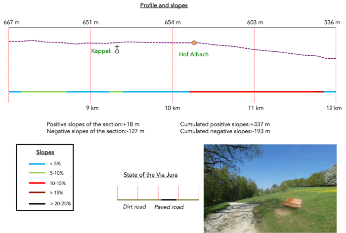
Overview of the route’s challenges : an easy path overall, though the incline can be steep at times.
|
In these expansive meadows and pastures, dominated by gently rising small mountains, cattle reign supreme. As far as the eye can see, the brown and Simmental cows, favorites of the Swiss-German region, dot the landscape with their peaceful silhouettes. |
|
 |
 |
The Via Jura briefly descends onto the road, just enough to capture the attention of travelers, who must stay alert to avoid missing a crucial turn for the continuation of their journey.
|
A gate marks the return to verdant meadows. The walk then transforms into a beautiful stroll along the mountain’s flank, where the path alternates between dirt and soft grass, sloping up gently. It’s no surprise that this spot is popular with walkers. |
|
 |
 |
 |
 |
|
Further along, as the path descends with a slightly steeper gradient, fields of rapeseed and cereals gradually replace the cattle, adding new hues to the natural palette of the landscape. |
|
 |
 |
Then, at the place called Oltme, two routes present themselves, but Via Jura 80 remains your guide towards Delémont.
|
Each region is often distinguished by its trees and their specific uses. Here, there are no sequoias, lindens, cedars, or Douglas firs—beech is the sovereign of these woods. Its trunks and branches form a continuous line along the paths, taking on such a soft green hue in spring that you might almost reach out to touch it. |
|
 |
 |
On the path that meanders with a leisurely grace through the meadows and along the forest edge, where the grass gleams with a vibrant green sometimes reminiscent of golf greens, stand majestic beeches. Their twisted and intertwined branches seem to hold the deepest secrets of nature.
|
Occasionally, a bench invites a rest, a nap, or a well-deserved picnic. |
|
 |
 |
|
Then, the dirt path gives way to soft grass, but the path remains serene, almost flat. The mind wanders, openly dreaming of the beauty of nature. On the Camino de Santiago, there are sections you wish would end as soon as they start, and others you wish could stretch on indefinitely. This one belongs to the latter category. |
|
 |
 |
 |
 |
However, the pilgrim’s rule is unyielding: you must keep moving. Soon, the path meets a small road on a sort of high plateau.
|
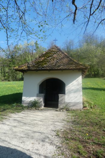
On the plain, at the charming spot of Käppeli, a small, simple, and welcoming chapel stands peacefully by the road. At this point, you have walked just over two hours from Laufen, your steps marked by the stories and legends that imbue every stone of this modest chapel. |
|
 |
 |
|
A short stretch of paved road then extends flat through vast cereal fields, their golden waves shimmering under the afternoon sun. |
|
 |
 |
|
The road then gently curves towards the hamlet of Hof Albach, still preserved in its enclave within the canton of Solothurn, where a few houses and farms nestle under the shade of the wooded hill. |
|
 |
 |
|
As you cross some diffuse cantonal boundaries, you enter a valley amid lush meadows. Here, fruit trees, heavy with promise, stretch out like silent guardians of this natural transition. |
|
 |
 |
|
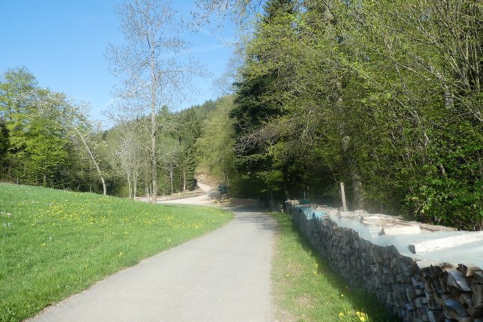
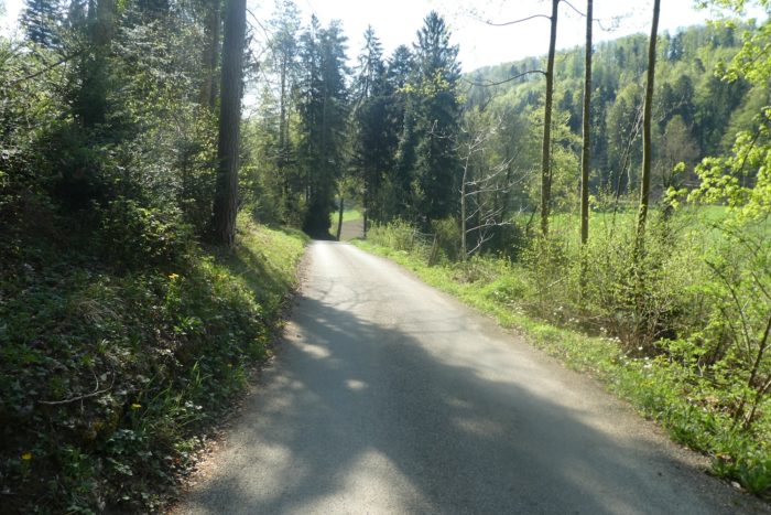
This marks the beginning of a steeper descent, with a consistent gradient of 10%. All around, forests envelop you with their broadleaf and spruce trees that have gained volume. |
|
 |
 |
|
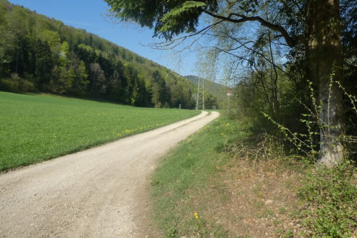
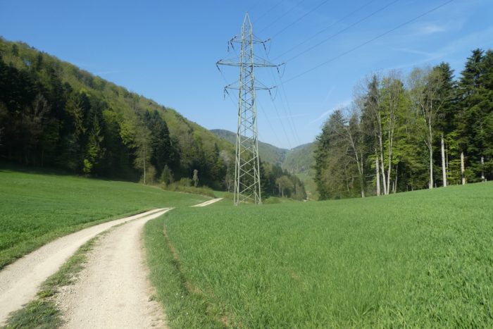
Further down, you find dirt underfoot once again. Above, a high-tension power line stretches across the sky, a testament to modern civilization coexisting harmoniously with the wild nature. |
|
 |
 |
Section 4 : In the dale of the Réselle de Soyhières stream

Overview of the route’s challenges : a sometimes-challenging descent, but not overly difficulty.
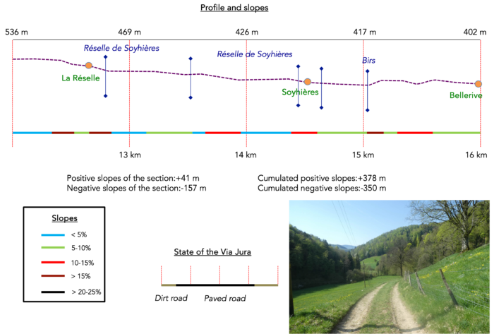
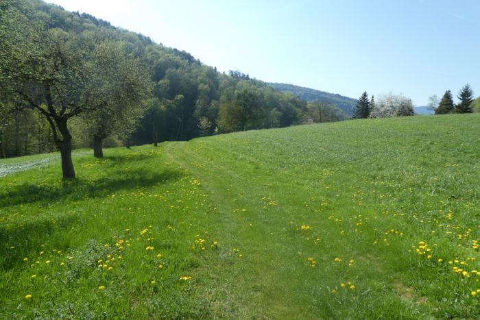
Descending through meadows, fields, and sparse orchards along the forest edge is not only pleasant but also quite lengthy. It’s a genuine journey through changing landscapes, where one seamlessly transitions from the canton of Basel-Country to the canton of Jura, marking a distinct natural and cultural boundary that is scarcely perceptible. Yet, what surveyor dared to draw clear borders in this wild nature shared among three cantons?
|
. |
|
 |
 |
 |
 |
|
The path gradually approaches the hamlet of La Réselle. |
|
 |
 |
|
The atmosphere subtly changes. You’ll need to forget the litany of Swiss-German greetings, which even native Germans have difficulty distinguishing. Here, the typical German-speaking salutations give way to a simple « Bonjour » exchanged with fellow hikers. |
|
 |
 |
The Via Jura then turns, changing direction towards Soyhières.
|
It follows the gentle murmur of the Réselle de Soyhières stream, guiding you faithfully to the bottom of the dale. |
|
 |
 |
|
A minor road descends toward Soyhières, but the Via Jura prefers a more picturesque route, winding through the verdant meadows. |
|
 |
 |
|
Continuing, the path meanders above the Réselle pond, a tranquil body of water nestled under the forest canopy, belonging to the Delémont Fishing Society. It’s here that fishing enthusiasts pursue trout, pike, roach, as well as tench and carp. In the Jura region and up to nearby Ferrette in France, carp has become a sought-after delicacy. |
|
 |
 |
 |
 |
|
Further down, the mixed dirt and grass path continues its gentle descent through the green meadows of the dale. The surrounding woods are now dominated by spruce trees, their imposing stature and dense branches creating an enchanting backdrop along the way. |
|
 |
 |
|
Further down, the grassy path reconnects with the previous road descending toward Soyhières. |
|
 |
 |
|
Here, the road joins the lively stream, whose fresh, bubbling waters provide a welcome coolness in the heart of the dale. |
|
 |
 |
|
The small road then descends, staying close to the stream, making its way through the cool shade of the dale. |
|
 |
 |
|
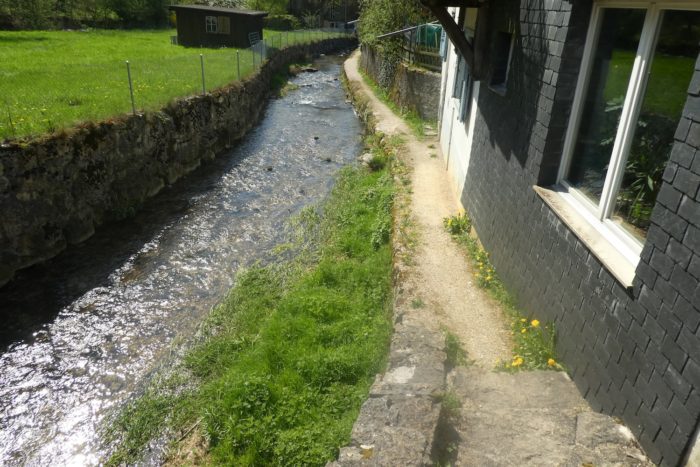
The road soon reaches the heights of Soyhières. As you approach the village, the lively stream seems to calm, gradually becoming more civilized as it channels along the road. |
|
 |
 |
|
At the village entrance, remnants of anti-tank blocks still stand, vestiges of a troubled past. Soyhières, a small village of 500 inhabitants, has long lived in the shadow of its castle perched above the village, on the forest’s edge atop a cliff overlooking the Birs River. This castle, a source of conflict between local counts, the counts of Ferrette, and the bishops of Basel, has fallen into ruin over time. Today, it is slowly being revived through the efforts of the Friends of the Castle Society. However, the Via Jura does not pass through there; it stays on the higher ground of the village. |
|
 |
 |
|
As you traverse the village, the Via Jura continues its playful descent with the Réselle stream, crossing from one side to the other, following the whims of the watercourse. |
|
 |
 |
|
The church, a more recent construction, reflects the continuity of religious life in this peaceful corner. At the village’s lower end, the Via Jura crosses the Réselle one last time. |
|
 |
 |
Here, a choice arises. The Via Jacobi maps indicate that the trail to Delémont crosses the Birs River and heads towards Vorbourg, a national historic site and pilgrimage destination, before descending back to Delémont. However, this route involves a 200-meter climb. A gentler alternative is to follow the path alongside the river, which is almost level. This route is also marked and offers a view of Vorbourg perched on its rocky outcrop from below. This is the traditional route through the Vorbourg castles.
Here is the possible alternative.
|
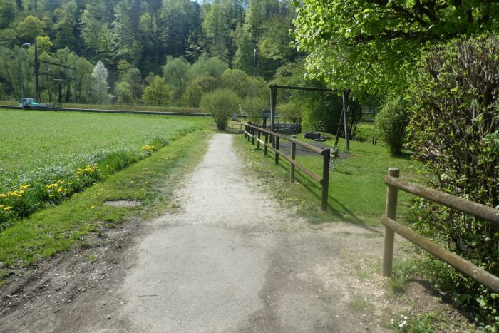
If you opt for the gentler route along the river, after a few winding detours to avoid the railway, the route continues on the opposite side of the now-abandoned station and heads towards the Birs River. Once served by the Delémont-Basel railway line, this station no longer welcomes travelers, with trains passing without stopping. |
|
 |
 |
 |
 |
A short distance away, the road crosses the Birs, the peaceful river flowing under the protection of alders and beeches, creating an atmosphere of serenity and freshness.
|
The paved road gently follows the river in a slight ascent through the undergrowth before curving away, without crossing the bridge … |
|
 |
 |
|
…soon giving way to a dirt path. |
|
 |
 |
|
The climb along the slope is brief, with the path quickly descending towards the area known as Bellerive. Ahead, the Vorbourg castle stands proudly on its rocky spur, majestically overlooking the river. |
|
 |
 |
|
The path continues its descent towards the river and the RN18, passing the farms of Bellerive, witnesses to a still-vibrant rural way of life. |
|
 |
 |
Section 5 : On the way to Delémont, capital of the Canton Jura
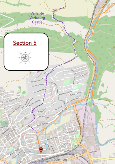
Overview of the route’s challenges : a problem-free route.

|
From this point, the path splits into two: one paved and the other a dirt trail, offering a striking contrast between modernity and raw nature. The route follows the riverbank, heading towards the Soyhières Gorge, near a small body of water, where the majestic Vorbourg castles stand. From this viewpoint, only the lower castle is visible. These castles, perched on the edge of the Soyhières Gorge, date back to the 12th century and were originally known as the lower and upper Telsperg castles, named after the family allied with Basel who lived there. Later, they were renamed Vorbourg (first and second). The lower castle has undergone many modifications over the centuries, including the addition of a chapel. Today, only the chapel and the massive square tower, the Tour Sainte-Anne, built against the rock, remain. The upper castle, abandoned and probably destroyed by the severe earthquake that ravaged Basel in the 14th century, now only leaves ruins accessible via a steep path. Restored last century, the chapel dedicated to the Virgin Mary has become a popular pilgrimage site in the Jura, mainly accessed from the north of Delémont or Soyhières via the traditional Via Jura route. |
|
 |
 |
|
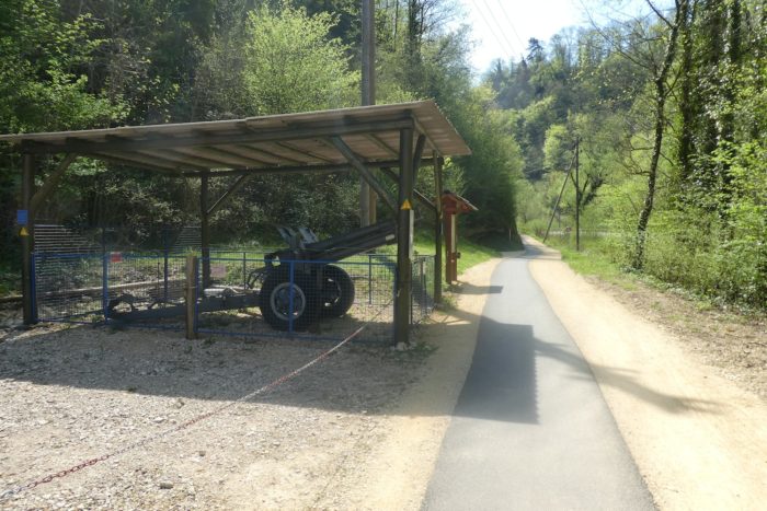
Gorges, these narrow defiles carved into the rock, have always been strategic points coveted by armies, from the Middle Ages to the present day. The Swiss, true to their reputation, have taken advantage of these sites to dig fortifications and tunnels, transforming the landscape into a true Emmental (Swiss Gruyère doesn’t have holes!). At the entrance to the memorial, the Swiss flag proudly flies. A jogger passing here might not pay much attention, absorbed by their pace, while others might take pride in the national heritage, recalling the glorious past where the Swiss prevented the Germans from crossing these lands. |
|
 |
 |
 |
 |
 |
 |
|
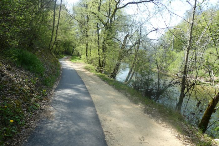
The valley narrows considerably here, flanked by imposing cliffs on one side, while on the other, the river, the cantonal road, and the railway carve their way among the hornbeams, oaks, and alders. The path even crosses genuine anti-tank blocks, far more impressive than the earlier “toy” tank ? |
|
 |
 |
 |
 |
|
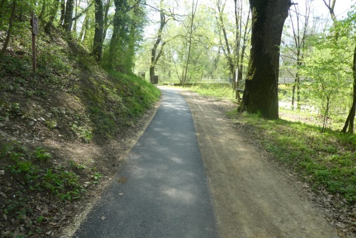
After a few hundred more meters, the path reaches the bridge over the Birs River at the entrance to Delémont. |
|
 |
 |
This strategic junction marks the point where the Via Jura 80 continues towards Courroux. For those heading to Moutier, this will be a crucial return point the next day, as well as for hikers who did not pass here and followed the Vorbourg route.
The bridge, reserved entirely for pedestrians and cyclists, is also where the Sorne, a small river flowing through Delémont, merges with the Birs. Delémont itself remains on the other side of the Birs River.
|
After crossing the bridge, the road continues by crossing the railway line. |
|
 |
 |
|
It then enters a typical suburban commercial area before following the Sorne. |
|
 |
 |
 |
 |
Further along, the road encounters a symbol of the city. Once, a sawmill and a mill, economic engines of the city in the 19th century, were located here, powered by large cogwheels, symbols of Delémont’s industrial past.
|
Further still, the route leaves the main road to follow a small paved path along the Sorne. |
|
 |
 |
| It deviates briefly from the river to cross the suburban neighborhoods before rejoining the river further on. | |
 |
 |
 |
 |
|
It then moves away from the river, passing near a college. |
|
 |
 |
|
Beyond the college, the route turns and descends the boulevard to the train station, marking the end of this stage. |
|
 |
 |
 |
 |
|
A bit of history to set the stage: The Jura canton was once part of the Kingdom of Burgundy and later the Bishopric of Basel. During the Reformation, the Bishop of Basel was ousted and established himself in Porrentruy, the other major city of the current Jura, taking control of the entire Jura region, including Bernese Jura and Laufonnais, where you passed the previous day. This situation persisted until the bishop’s expulsion in 1792 during the French Revolution. Here, the Republic was proclaimed without hesitation. However, in 1793, neighboring France annexed the new republic and made it a French department, named Mont-Terrible, with Porrentruy as its capital. The new department lasted about ten years before being attached to Haut-Rhin. Then came Napoleon, causing unprecedented chaos in Europe. After his fall, the Congress of Vienna in 1815 saw the victorious countries and other European states come together to redraw borders and establish a new world order. Neutrality was emphasized for Switzerland. This is a long-standing story for the Swiss. Here, borders and the fate of the locals were redrawn. The Jura canton was assigned to Switzerland, specifically to the canton of Bern, to compensate for Bern’s loss of the canton of Vaud. The rest you will read about as you head towards Moutier tomorrow. Delémont, with its 13,000 inhabitants, is now the capital of the canton. It houses the seat of the Parliament and Government of the Republic and Canton of Jura. The Old Town is its historical center, a well-preserved district with many medieval buildings with elegant facades. Also noteworthy are the charming Renaissance-style fountains. |
|
 |
 |
 |
 |
|
The Church of Saint-Marcel, dating from the late 18th century, oscillates between Baroque and Classicism. It was renovated towards the end of the last century. The gates of the medieval town have also been very well restored, and you can still see some sections of the town walls. |
|
 |
 |
Accommodation on Via Jura
- Maison Chappuis, Route de France 23, Sohyères; 032 422 01 24; Gîte religieux, dinner, breakfast
- Hotel Le Cavalier, Route de France 22, Sohyères; 032 422 20 07; Hotel***, dinner, breakfast
- Cantou part’âges, Rue de Morépont 5, Delémont; 032 422 89 64; Gîte religieux, dinner, breakfast
- B&B Passifleur, Sous Maichereux 121, Delémont; 032 422 37 48; Guestroom, breakfast
- Auberge de jeunesse, Route de Bâle 185, Delémont; 032 422 20 54; Gîte, dinner, breakfast
- Centre St François, Route du Vorbourg 4, Delémont; 032 421 48 60; Hotel, dinner, breakfast
- Hotel Ibis, Avenue de la Gare 37, Delémont; 032 421 10 00; Hotel, breakfast
- La Tour Rouge, Route de Porrentruy, Delémont; 032 422 12 18; Hotel**, breakfast
- Hotel Restaurant le National, Route de Bâle 25, Delémont; 032 422 96 22; Hotel***, dinner, breakfast
The Jura remains a popular destination primarily for local tourists. As a result, accommodations are more discreet, with the exception of Airbnb listings, for which we don’t have the addresses. On this stage, there’s nothing until the end of the stage at Soyhières or Delémont. At the end of the stage, it’s Delémont, with all the shops. There should be no difficulty finding a place to stay here. However, make sure to book in advance.
Feel free to add comments. This is often how you move up the Google hierarchy, and how more pilgrims will have access to the site.
 |
Next stage : Stage 4: From Delémont to Moutier |
 |
Back to menu |
