Along the Lakes of Brienz and Thun
DIDIER HEUMANN, ANDREAS PAPASAVVAS
We divided the course into several sections to make it easier to see. For each section, the maps show the course, the slopes found on the course, and the state of the route (paved or dirt roads). The courses were drawn on the « Wikilocs » platform. Today, it is no longer necessary to walk around with detailed maps in your pocket or bag. If you have a mobile phone or tablet, you can easily follow routes live.
For this stage, here is the link:
https://fr.wikiloc.com/itineraires-randonnee/de-ringgenberg-a-merlingen-spiez-par-la-via-jacobi-4-32201909
|
Not all pilgrims are necessarily comfortable using GPS or navigating routes on a mobile device, and there are still many areas without an internet connection. For this reason, you can find several books on Amazon dedicated to the major Via Jacobi 4 route, which runs through the heart of Switzerland and over the Brünig Pass. The first guide leads pilgrims through the German-speaking part of Switzerland up to Fribourg, while the second continues through French-speaking Switzerland to Geneva. We have also combined these two books into a compact, lighter, and highly practical version. While the descriptions have been slightly condensed, they remain detailed enough to guide you step by step along the way. Recognizing the importance of traveling light, this latest edition has been designed to provide only the essentials: clear and useful information, stage by stage, kilometer by kilometer. The stages have been carefully adjusted to ensure accessibility and alignment with available lodging options. These books go beyond simple practical advice. They guide you kilometer by kilometer, covering all the crucial aspects for seamless planning, ensuring that no unexpected surprises disrupt your journey. But these books are more than just practical guides. They offer a complete immersion into the enchanting atmosphere of the Camino. Prepare to experience the Camino de Santiago as a once-in-a-lifetime journey. Put on a good pair of walking shoes, and the path awaits you.
|
|
 |
If you only want to consult lodging of the stage, go directly to the bottom of the page.
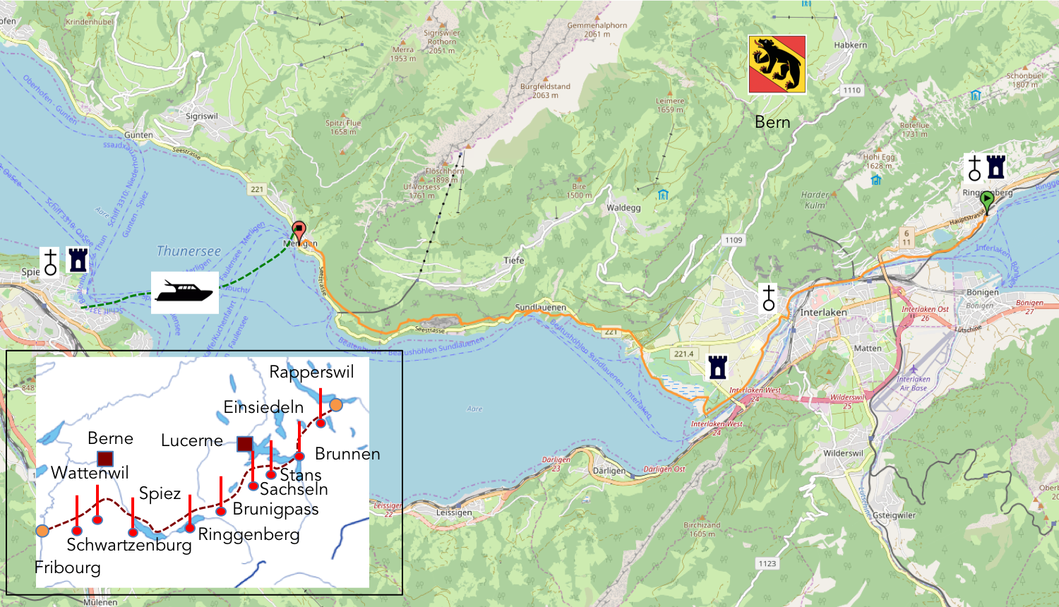
Interlaken, as its name suggests, proudly stands between the crystalline arms of two majestic lakes. This place, bathed in an irresistible charm, proves to be a true enchantment for anyone who sets eyes upon its horizon. Enveloped in a silvery mist, the Lakes of Brienz and Thun cradle the town in an aquatic embrace, while the pristine peaks of the mountains, like eternal sentinels covered in everlasting snow, watch over it. The magnetic appeal of Interlaken, particularly among visitors from the distant lands of Asia and the sands of Arabia, reveals itself almost instinctively to those who traverse its landscapes. However, akin to many natural beauty sanctuaries, Interlaken has transformed into a vast commercial theater, where tourism spins its dense web. The beating heart of this enterprise is found on Höheweg, the city’s vital artery, dotted with luxury shops, exquisite watchmakers, and star-rated hotels, akin to modern palaces. Some culinary establishments, in a burst of universality, offer menus in more than a dozen languages, including three Asian dialects, welcoming with equal ease affluent travelers from Qatar, Kuwait, Oman, Saudi Arabia, the United Arab Emirates, and even now India. The hotels, in their quest to satisfy every desire of their guests, provide prayer mats and equip rooms with compasses, so that the sacred direction of Mecca can be found with disconcerting ease. The cruises on Lake Brienz, with their halal buffet, attest to this welcoming spirit, in a setting of more than 5,000 beds ready to welcome the visitor. The Tourist Office, with over 100,000 overnight stays recorded from Arab clientele, paints a picture where, at times, strolling through Interlaken feels like walking the streets of Abu Dhabi. The trains, in a gesture of generosity, operate free of charge for accommodated tourists, creating an unbreakable link between the two stations at the city’s extremes and offering a direct connection to Lucerne, another tourist gem of the region. This constant ballet of locomotives reminds those who have experienced it of the ease with which one can be transported from one place to another.
However, for the soul in search of tranquility, a route offers itself away from the commercial hustle: the Way of St. James. This path, following the Aar, barely ventures into the city’s twists and turns and prefers to graze Unterseen, a haven of peace less altered by the tourist flow, before casting itself into the arms of Lake Thun. This journey leads the traveler towards the famous caves of Beatenberg, before descending towards Meiringen, by the lake, where the pilgrim, on their quest towards Santiago de Compostela, is invited to cross the lake towards Spiez.
.
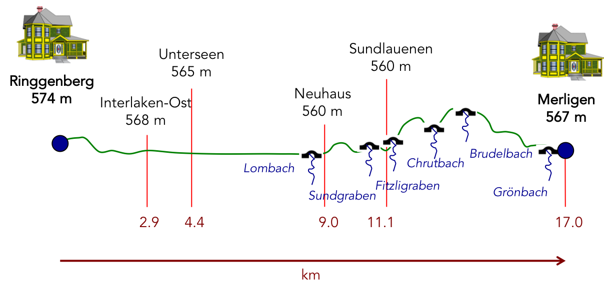
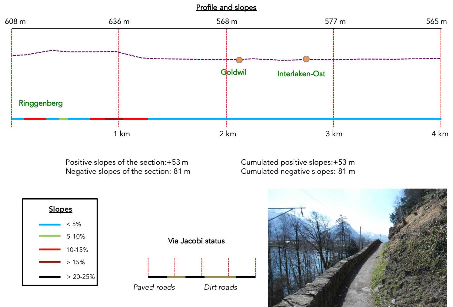
Difficulty level: The elevation changes of this stage, with an ascent of +469 meters and a descent of -463 meters, offer a course that, unpretentiously, flirts with ease, a foretaste of fullness until Neuhaus. Then, like ups and downs awakening the senses, the paths become more demanding, especially near the caves of Beatenberg, where the slopes assert themselves with vigor.
State of the Via Jacobi: In this stage, the paths are significantly more numerous than those following the road:
- Paved roads: 4.5 km
- Dirt roads : 12.6 km
Sometimes, for reasons of logistics or housing possibilities, these stages mix routes operated on different days, having passed several times on these routes. From then on, the skies, the rain, or the seasons can vary. But, generally this is not the case, and in fact this does not change the description of the course.
It is very difficult to specify with certainty the incline of the slopes, whatever the system you use.
For those seeking « true elevations » and enthusiasts of genuine altimetric challenges, carefully review the information on mileage at the beginning of the guide.

Section 1: Some undulations before reaching the river and the town

Overview of the route’s challenges: trouble-free course.
|
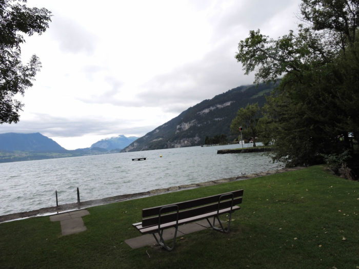
On a rainy day over Ringgenberg and Lake Brienz, we proceed as we did for the previous stage, telling the start of the stage through images taken at a different time of the year, in early spring, on a beautifully sunny day. Immerse yourself in this scene, bathed in the dazzling light of early spring, where every droplet seems to dance to the rhythm of the season’s rejuvenating breaths.
|
 |
 |
|
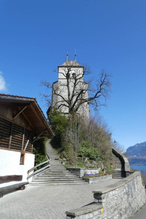
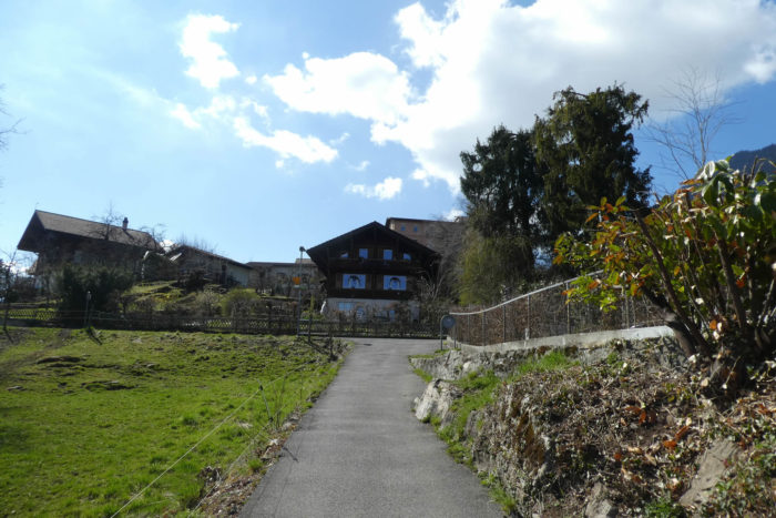
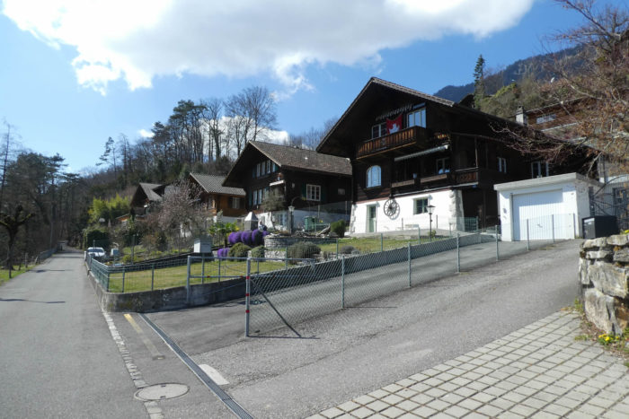
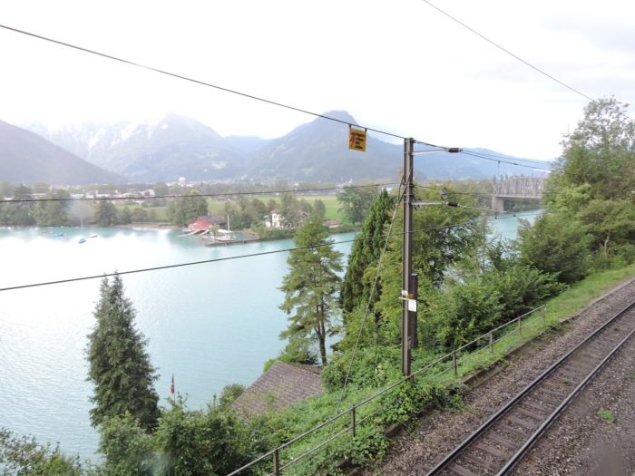
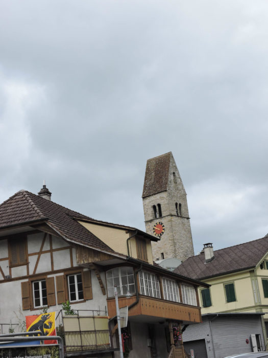
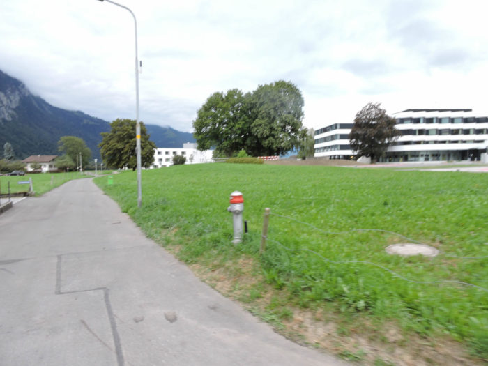
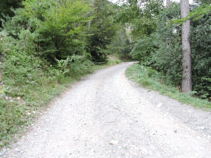
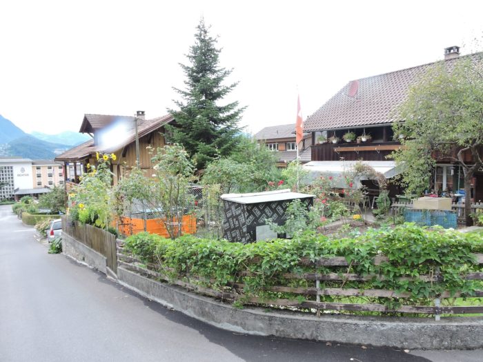
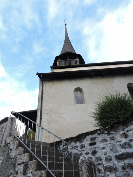
Near the church, the Via Jacobi emerges like a silent sentinel from Ringgenberg, where the Luzern-Interlaken Express plunges into the dark innards of a tunnel, thus beginning its journey through the twists of the Alpine landscape.
|
 |
 |
|
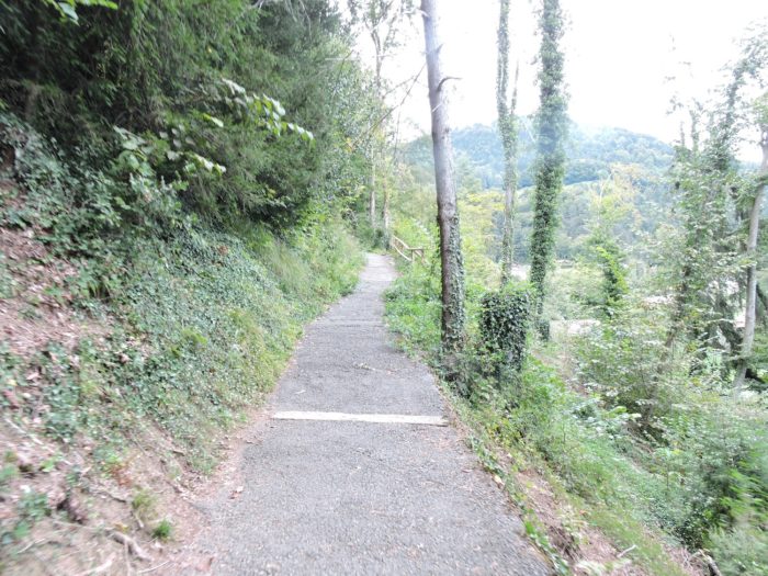
The road, initially solid beneath your feet, transforms into a tarred path that snakes with boldness and determination towards the village heights, climbing steeply through a grove where beeches seem to whisper ancient secrets to the wind.
|
 |
 |
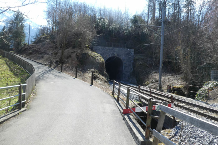
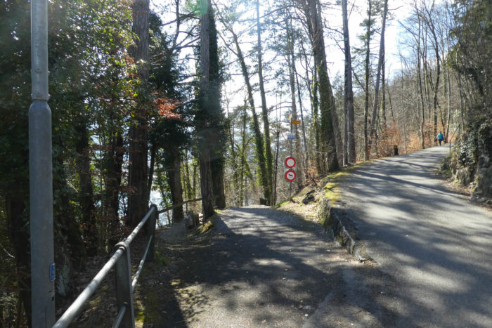
The path crosses over the railway line, which plays with tunnels a bit above the lake.
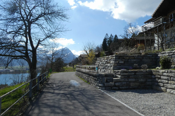
| It then reaches the top of the hill, where a road flattens out across the hillside. |
 |
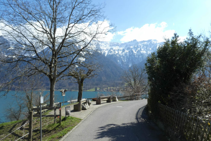 |
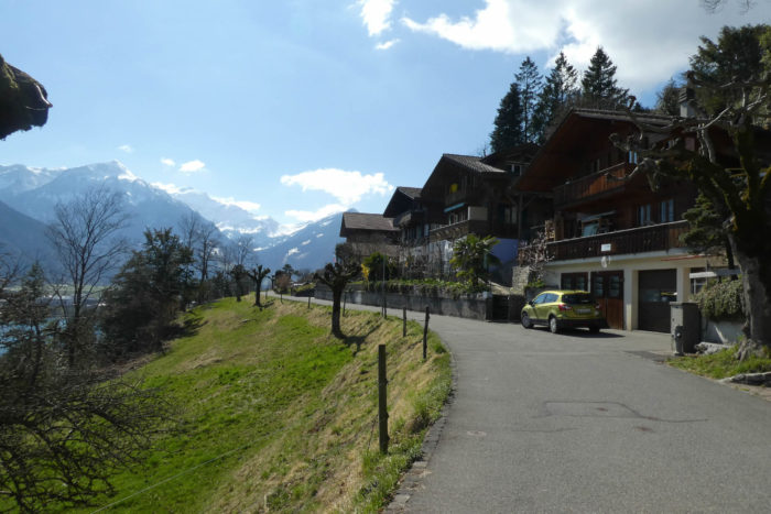
Among the grand homes, gazes are lost in the vastness of Lake Brienz and the surrounding mountains, whose snow-capped peaks stand as vigilant sentinels, guarding this natural kingdom.
|
 |
 |
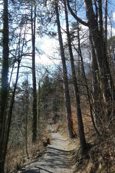
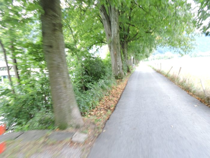
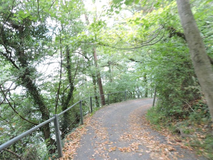
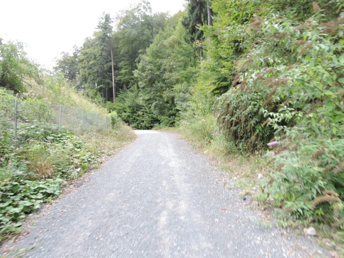
| Further on, the road bravely plunges into the forest, following a road that gracefully descends towards the lake shores, in the shadow of tall trees where beeches stand majestically, rivaling the splendor of oaks, while spruces and pine trees bow respectfully. The road weaves between gnarled trunks, offering a terrain conducive to exploration and contemplation. |
 |
 |
| Then, the slope becomes steep on a trail shaded by large trees. Here, beeches compete with oaks, and spruces hold their own against the pine trees. |
 |
 |
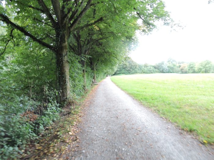
| A moment of tranquility presents itself, where the trail stretches languidly, inviting a peaceful stroll in the heart of vibrant and resplendent nature. |
 |
 |
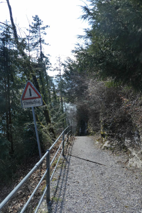
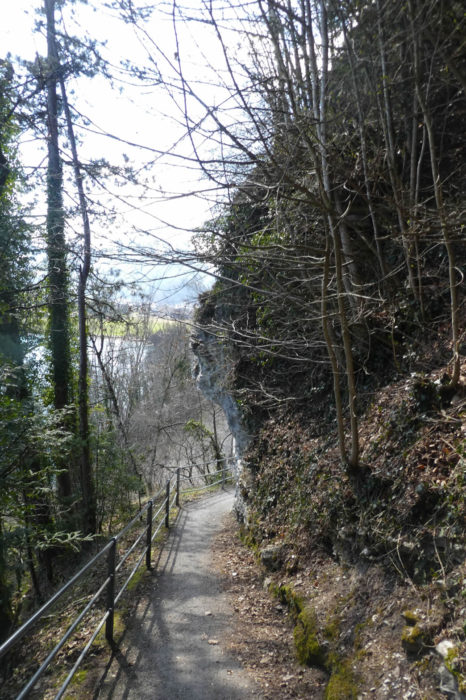
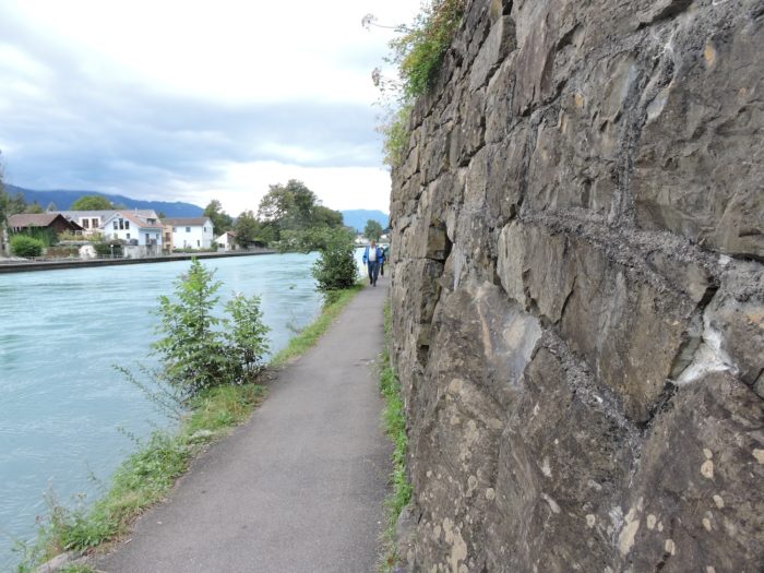
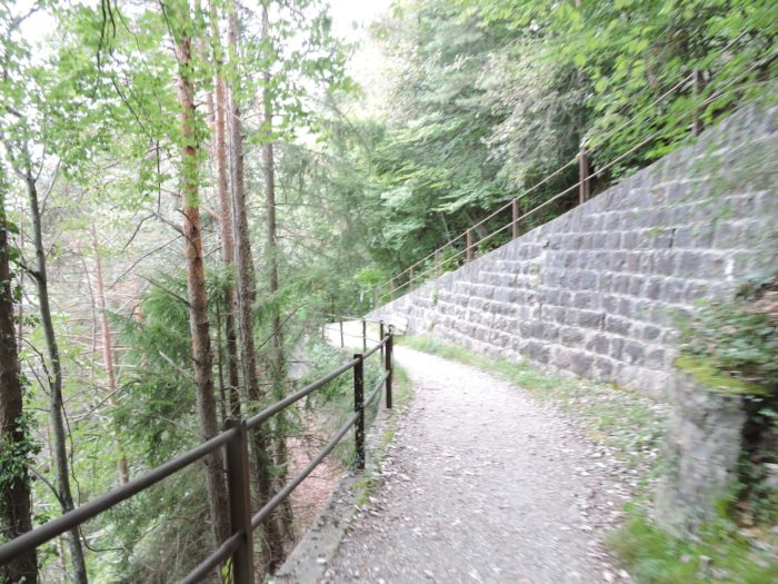
| Further down, the slope regains its commanding character, delving beneath steep cliffs, where the trail delicately threads its way. The rocky walls, witnesses to the tumult of the elements, offer a grand spectacle, reminding of nature’s power. |
 |
 |
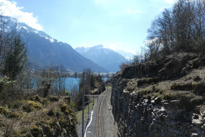
| The railway reappears, escorted by the Via Jacobi, as the gaze wanders towards the distant horizon, where the railway bridge spans the Aar, this vital water vein, connecting the waters of Lake Brienz to those of Lake Thun, before merging into the mighty course of the Rhine. |
 |
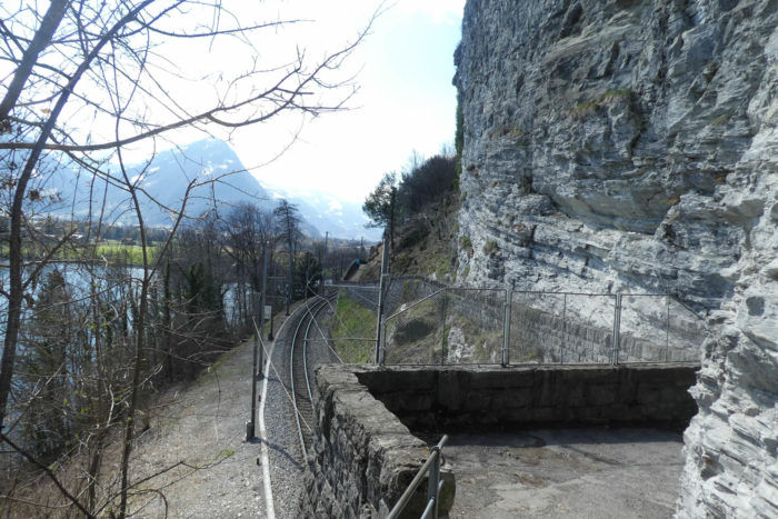 |
| On the horizon, the bridge where the train crosses the Aar, the great river emerging from Lake Brienz to reach Lake Thun and join the Rhine, far beyond, is outlined.
As the rain has stopped and we can take pictures again, let’s return to a time when there is chlorophyll on the trees! |
 |
 |
| A wider path then winds its way along the railway line, until it crosses the Aar, where the river springs from the crystal depths of Lake Brienz, like a nymph emerging from the water. |
 |
 |
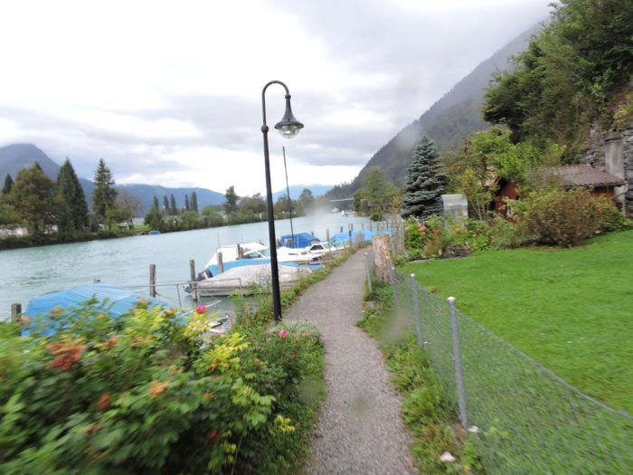
| Descending to the river’s edge, the course skirts pleasure boats, crossing modest settlements belonging to the village of Goldswil, clinging to the verdant slopes of the lake. |
 |
 |
| The route soon runs under the arches of the large bridge where the cantonal road from Ringgenberg to Interlaken-West travels. |
 |
 |
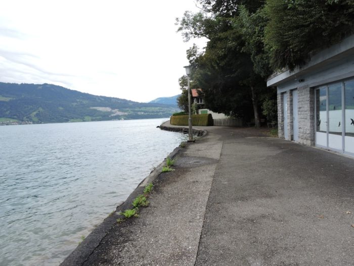
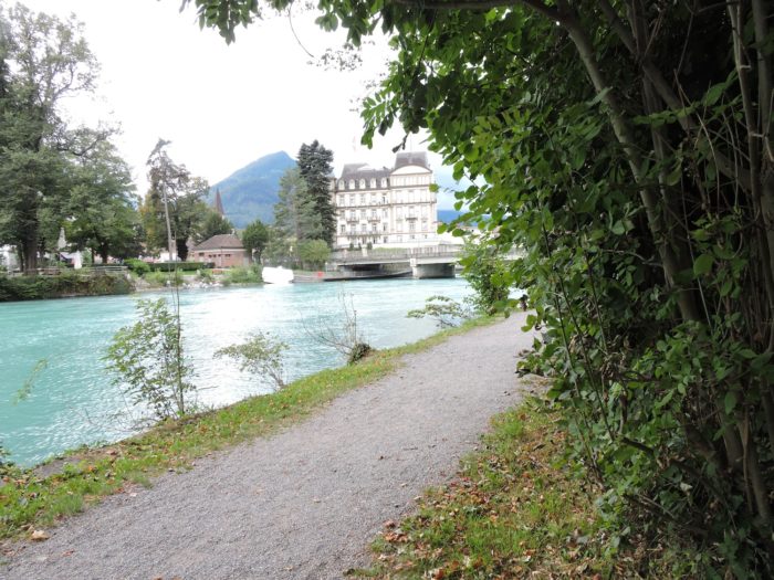
This is where the large cruise boats on Lake Brienz are moored, as downstream, the Aar is no longer navigable.
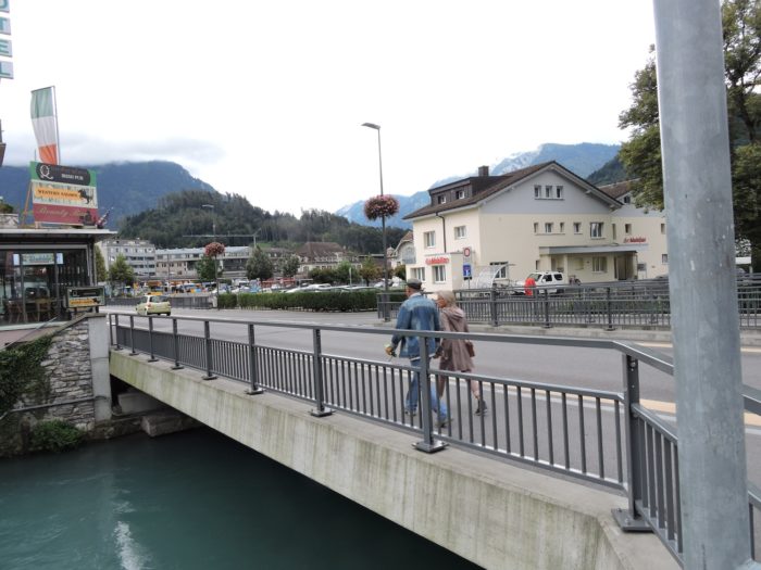
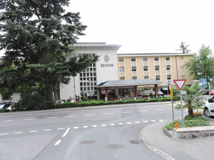
| Across the river, palaces stand proudly, silent witnesses to the opulence and refinement that reign in these places. Interlaken, a town of 5,700 souls, but how many travelers walk its streets each day? Thousands, undoubtedly many more, attracted by the irresistible charm of this tourist town, especially popular with Asian and Arab visitors. You can venture there out of simple curiosity if you feel like exploring its luxurious shops and prestigious hotels. But beyond the commercial streets, Interlaken reveals a paradise for hikers. From Interlaken Ost station, trains escape to the Jungfrau region, serving the renowned resorts of Grindelwald, Lauterbrunnen, and Wengen, stages for legendary ski competitions, such as the mythical Lauberhorn downhill race. And then, there’s the climb to the Kleine Scheidegg, facing the majestic peaks of the Eiger, Mönch, and Jungfrau, rising to 3,500 meters, where an underground train and an elevator lift you to the top of the Sphinx, a celestial observatory. The term « magical » then seems quite an understatement to describe such an experience. |
 |
 |
| The path along the right bank of the river offers a peaceful escape, shielded from the tumult of tourists, letting them hustle on the other side, between luxurious establishments and gleaming shops. The railway, for its part, once again dives under the waves, continuing its journey towards Interlaken East. |
 |
 |
| A little further, a bridge paves the way to Interlaken Ost and its tempting shops. |
 |
 |
| From this monumental bridge, a modest tarred path runs along the bank, skimming the pool, where a wooden bridge allows passage over the swift waters. |
 |
 |
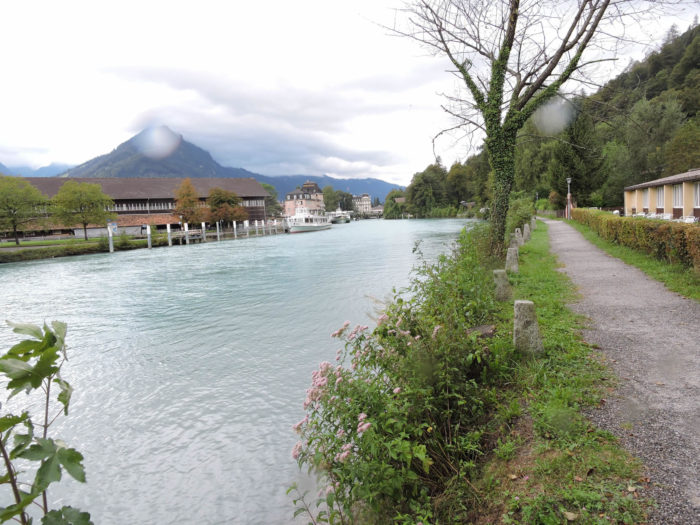
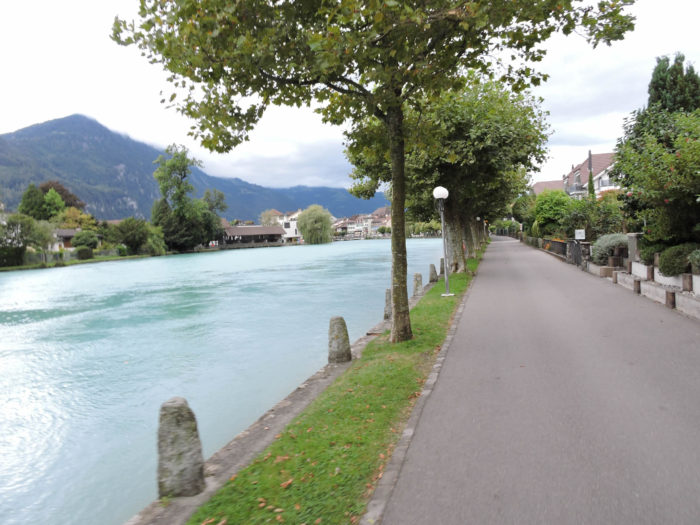
| The crossing of Interlaken stretches for nearly four kilometers, but the path persists along the bank, while the railway line finds the other side. |
 |
 |
Section 2: From Lake Brienz to Lake Thun

Overview of the route’s challenges: trouble-free course.

|
The Via Jacobi, like a curious traveler, slowly approaches Unterseen, this exquisite part that constitutes the epicenter of the city.
|
 |
 |
|
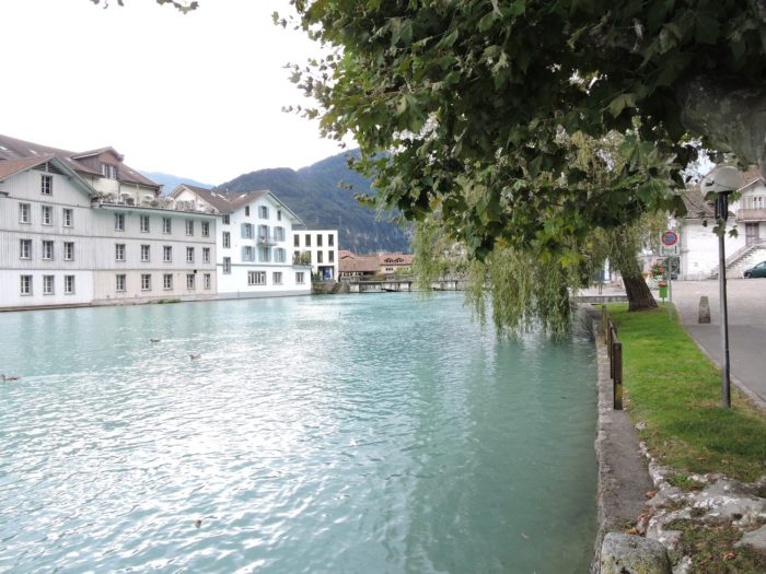
Arriving at the majestic Goldey Bridge, it marks the delicate threshold separating the municipalities of Interlaken-Ost and Unterseen, these two entities that blend harmoniously into one. Here, in the middle of a beautiful little square, stands the old town hall.
|
 |
 |
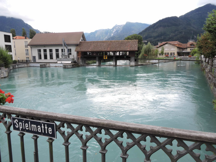
In Interlaken, the Aar, like a silver thread woven by the fingers of nature, intertwines its waters with several locks. One of these locks, discreetly nestled near the Goldey Bridge, stands there as an attentive guardian. If you cross the bridge on Spielmatte, you will arrive at the Interlaken-West station, the terminus of the Lucerne-Interlaken tourist route. Another line goes further, to Spiez, then Thun, like a promise of endless discoveries.
| However, the Via Jacobi, insatiable in its journey, chooses the opposite direction, resolutely heading towards Unterseen, like an arrow seeking its target. |
 |
 |
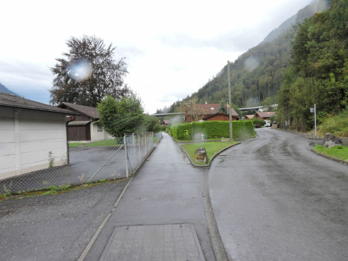
| Initially confined within the urban enclosure, it then ventures on country paths, gracefully winding through the suburbs of Unterseen, glancing at the imposing silhouette of the hospital that silently watches over. |
 |
 |
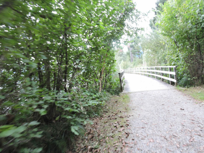
| Then, it detaches from suburban streets to engage on a shady avenue of horse chestnut trees, thus joining the soft murmur of the Aar near a modest wooden bridge, without lingering. |
 |
 |
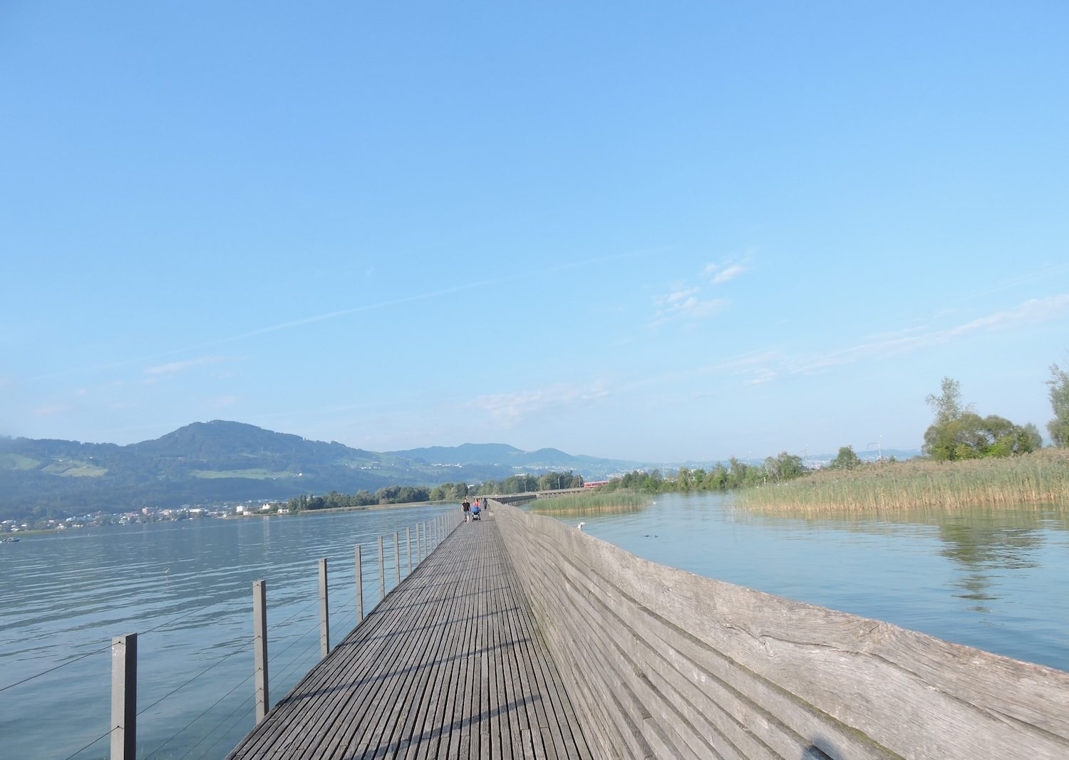
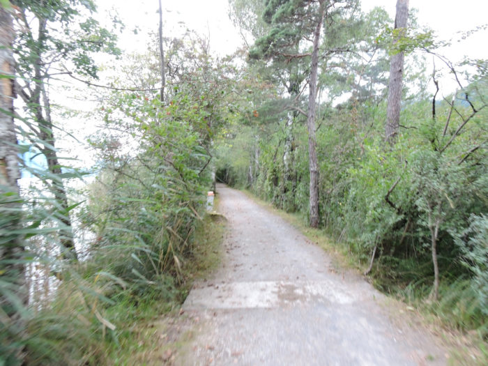
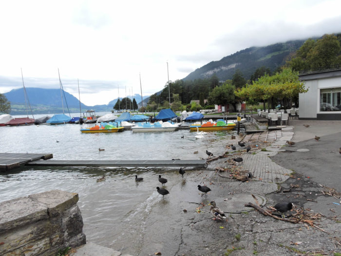
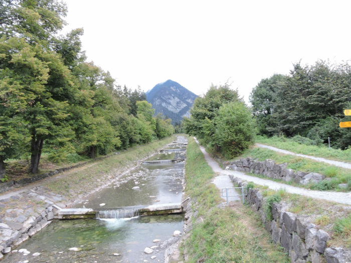
| Here, the Via Jacobi transforms into an avenue of contemplation, a solemn stroll on the wide dirt path that faithfully follows the meanders of the Aar to the shores of Lake Thun. The lakes of Brienz and Thun, like lovers separated by fate, do not touch directly, only the arms of the Aar unite them. However, this river, strewn with bridges like so many promises, remains impassable to navigation, thus offering the choice between the waves of Lake Brienz or the calm waters of Lake Thun. At Interlaken-West, boats take off towards the horizons of Lake Thun, skillfully avoiding the course of the Aar. A parallel channel, named Beatushöhlen-Interlaken West, stands as a faithful companion of the road, guiding ships in their journey. |
 |
 |
 |
 |
| Almost at the end of this long straight line, where the dust raised by horses obscures the path, the dirt road modestly snakes under a road axis where paths leading to both shores of the lake cross. The main axis stretches towards Spiez, then Thun, while the secondary axis, less frequented but equally captivating, offers an alternative route along the other shore. This will be your lot. |
 |
 |
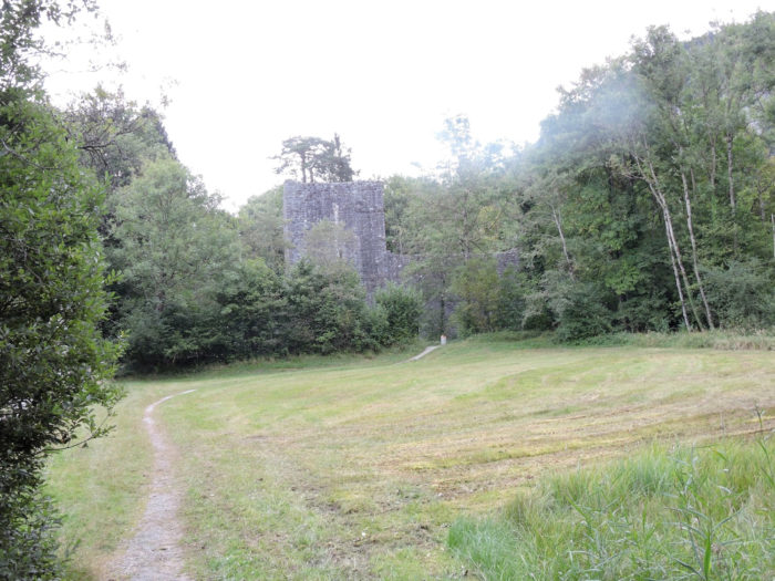
| Barely after this encounter with modern civilization, the dirt path opens onto the majestic remains of Weissenau, precious fragments of a fortress built in the 13th century, silent witnesses to the tumultuous history of the region. |
 |
 |
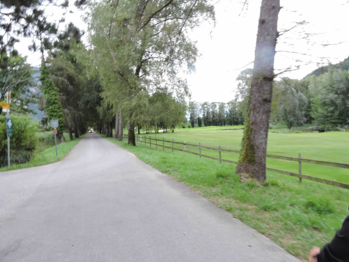
| It then continues its journey, briefly brushing past a dormant golf course, before resolutely plunging into a trail in the heart of the lake’s reeds, accompanied by the melodious song of wild ducks, in the preserved sanctuary of Weissenau. |
 |
 |
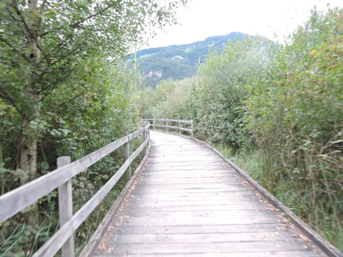
| In the haven of peace that is the Weissenau natural park, serenity reigns supreme, where small wooden bridges gracefully bend over the marshes, inviting travelers to silent meditation in the heart of nature. |
 |
 |
Section 3: Lakeside stroll before the endeavor

Overview of the route’s challenges: The journey begins with a leisurely walk, followed by the exploration of new canyons, and culminates in a steep ascent to the Beatenberg caves.
|
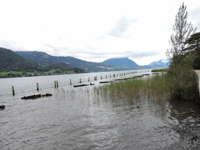
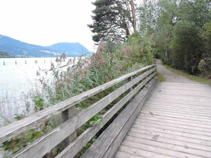
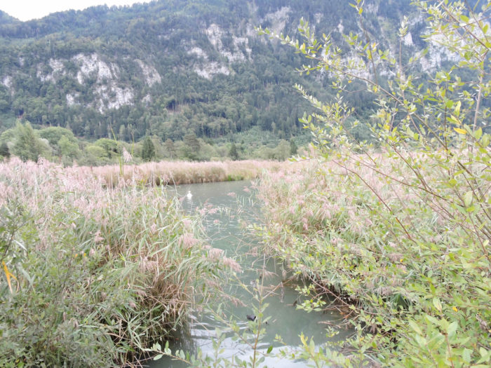
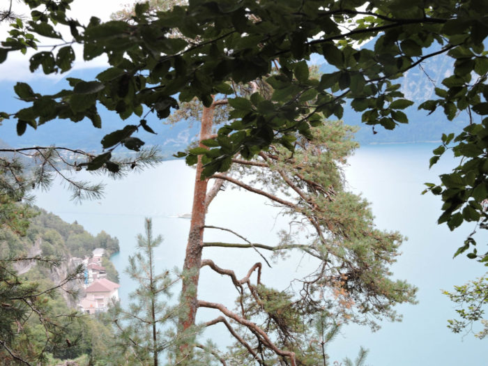
The walk unfolds in its full glory among reeds and bushes, presenting a ballet of colors and fragrances. At the lake’s edge, where the ground gives way to the marsh’s watery embrace, delicate wooden bridges weave a fragile web through the reeds. Worn planks, aged by years of use, creak under the light weight of footsteps, offering a discreet symphony to those who dare venture on their fragile structure. Each step is a discovery, each moment an invitation to contemplate the raw and wild beauty of nature. On Lake Thun’s mirror-like surface, pines emerge proudly, their unusual presence sparking the traveler’s curiosity.
|
 |
 |
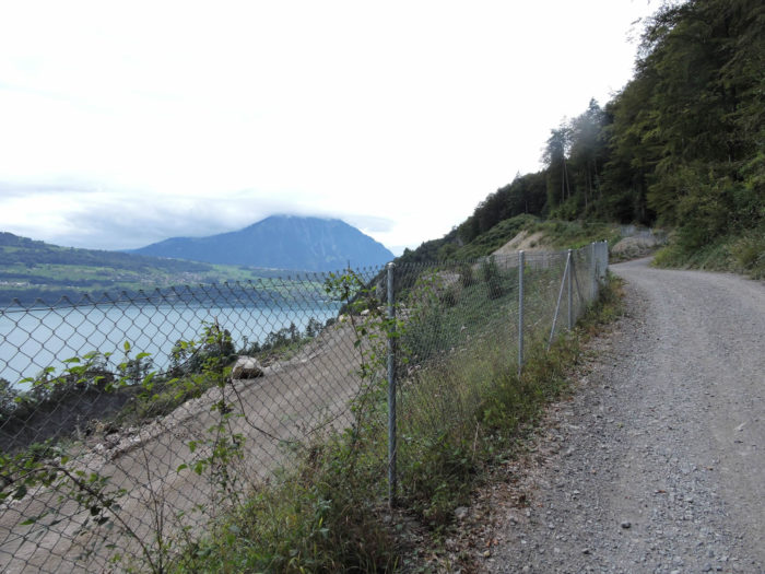
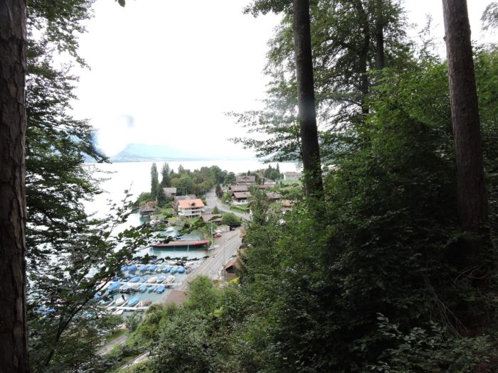
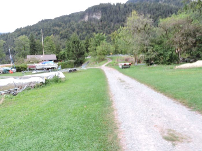
Exiting the park, the horizon of Spiez stretches before you, across the lake, while the majestic Beatenberg mountain stands to your right, guiding you on your journey.
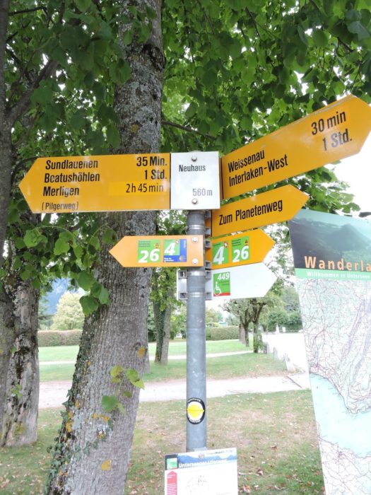
| Shortly after, the Via Jacobi leads you to Neuhaus, on the edge of a peaceful golf course, near a quaint marina. |
 |
 |
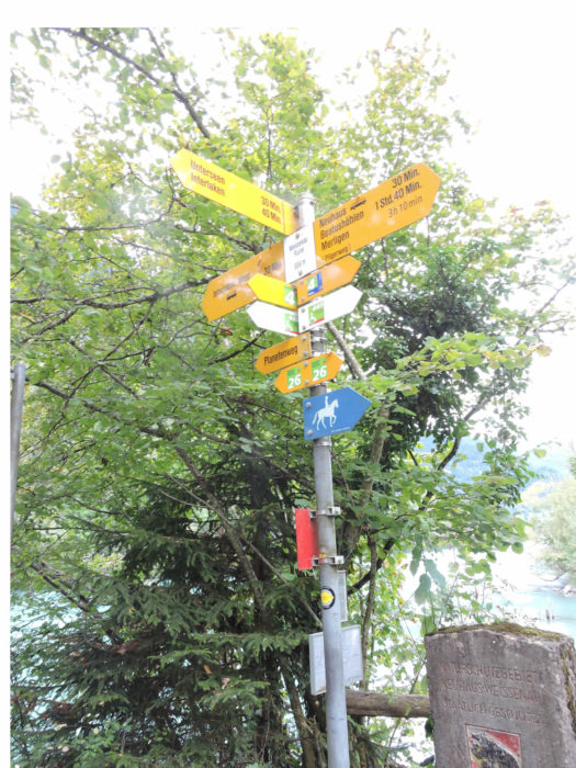
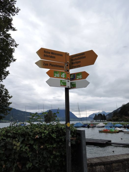
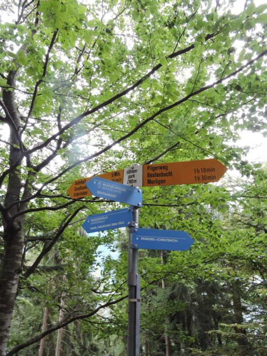
Here, the risk of getting lost is minimal, thanks to the numerous signs dotting the route. Just an hour’s walk away lie the mysterious caves of Beatenberg, while three hours further, Merligen awaits, ready to welcome you for a lake crossing back to Spiez.
|
 |
 |
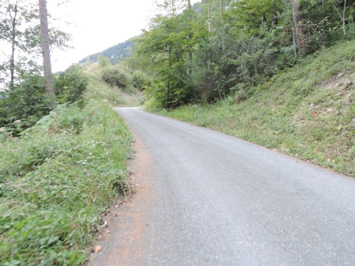
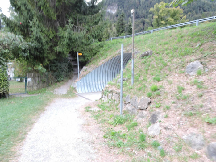
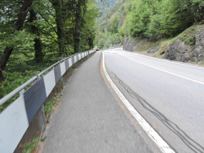
| Beyond the marina, a path slopes up, leading to a secret tunnel beneath the coastal road. This tranquil road unfolds peacefully towards Thun. |
 |
 |
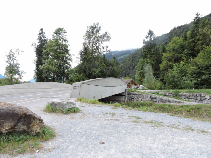
| Here, the Via Jacobi crosses the tumultuous Lombach, whose dykes bear witness to the whims of this watercourse. |
 |
 |
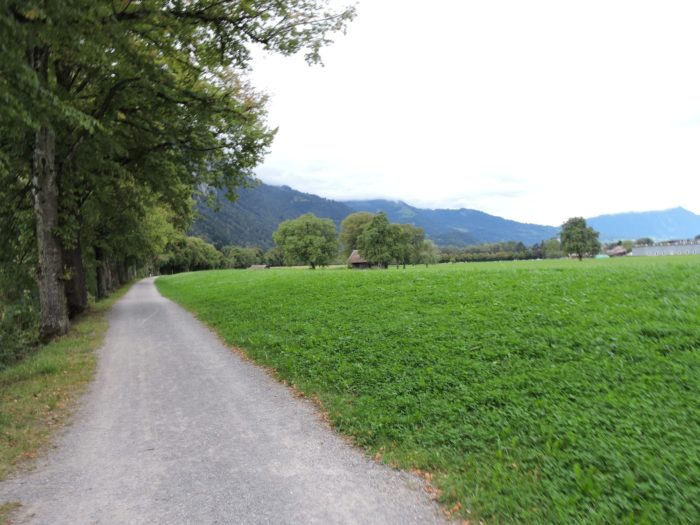
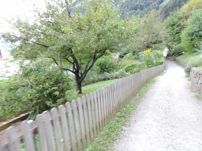
| It then follows the lake’s shore, gracefully tracing its meanders… |
 |
 |
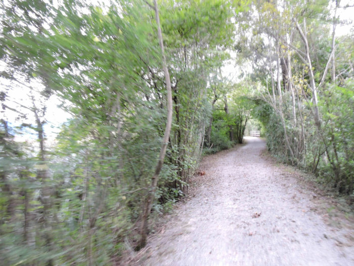
| …before delving on a path into a charming woodland, overlooking the road, where deciduous trees and pines intermingle in an enchanting plant symphony. |
 |
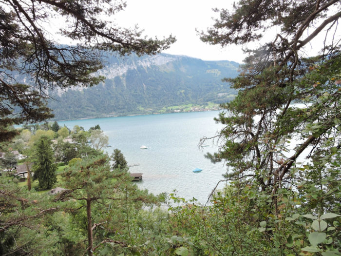 |
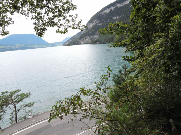
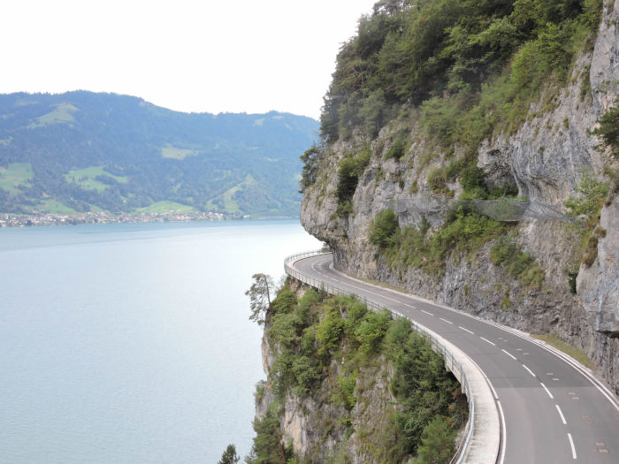
| In the distance, the winding lake reveals itself, dotted with architectural works that testify to humanity’s millennia-old struggle against the elements. |
 |
 |
| Further on, the Via Jacobi descends towards the road, accompanying it for a few hundred meters. |
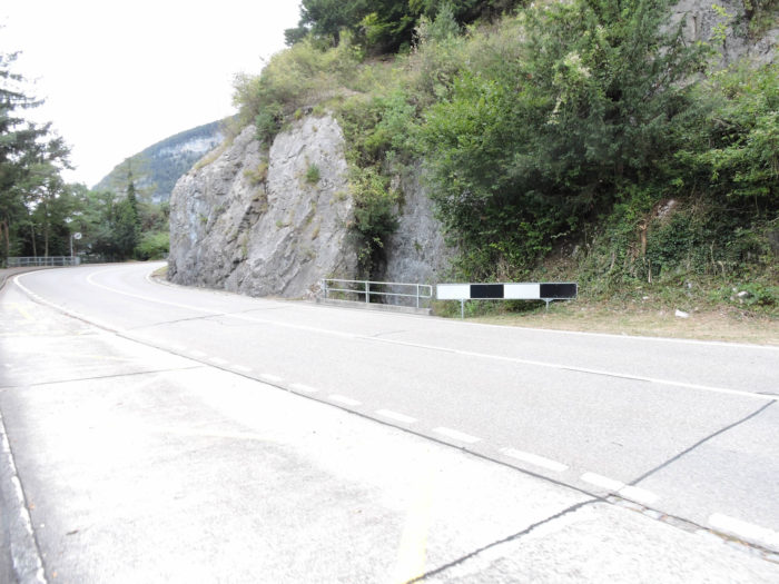 |
 |
| However, it does not linger on the pavement, soon preferring a small road, then a dirt path, rushing towards the lake. |
 |
 |
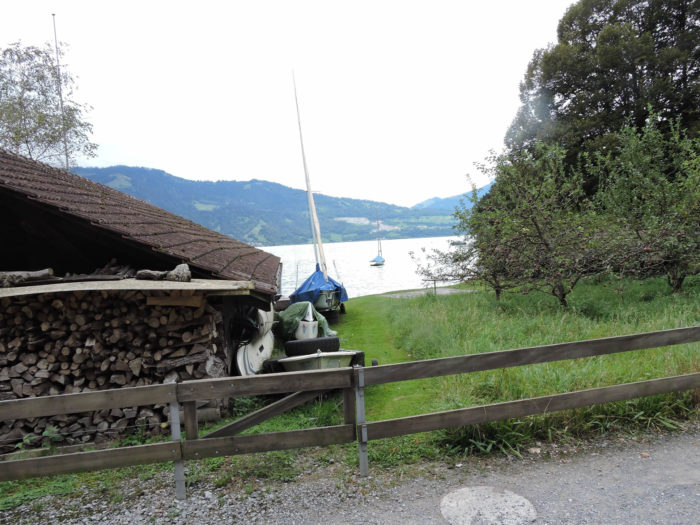
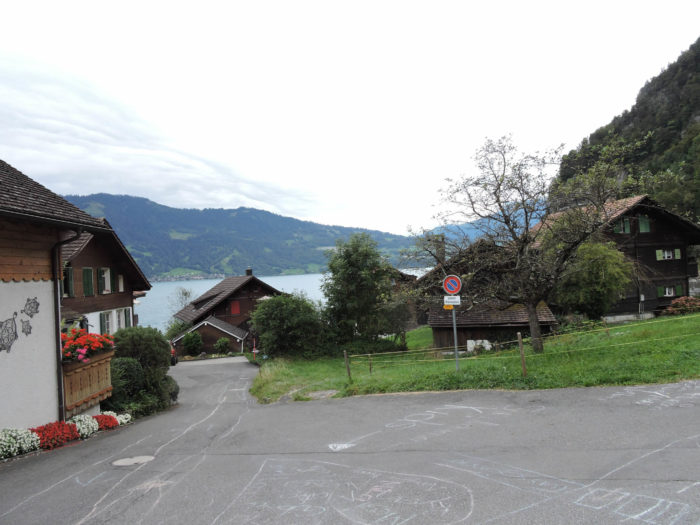
| At the edge of the calm waters lies the hamlet of Sundlauenen, where numerous second homes flourish, witnesses to a gentle tranquility. |
 |
 |
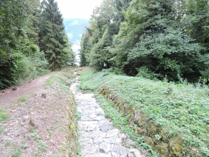
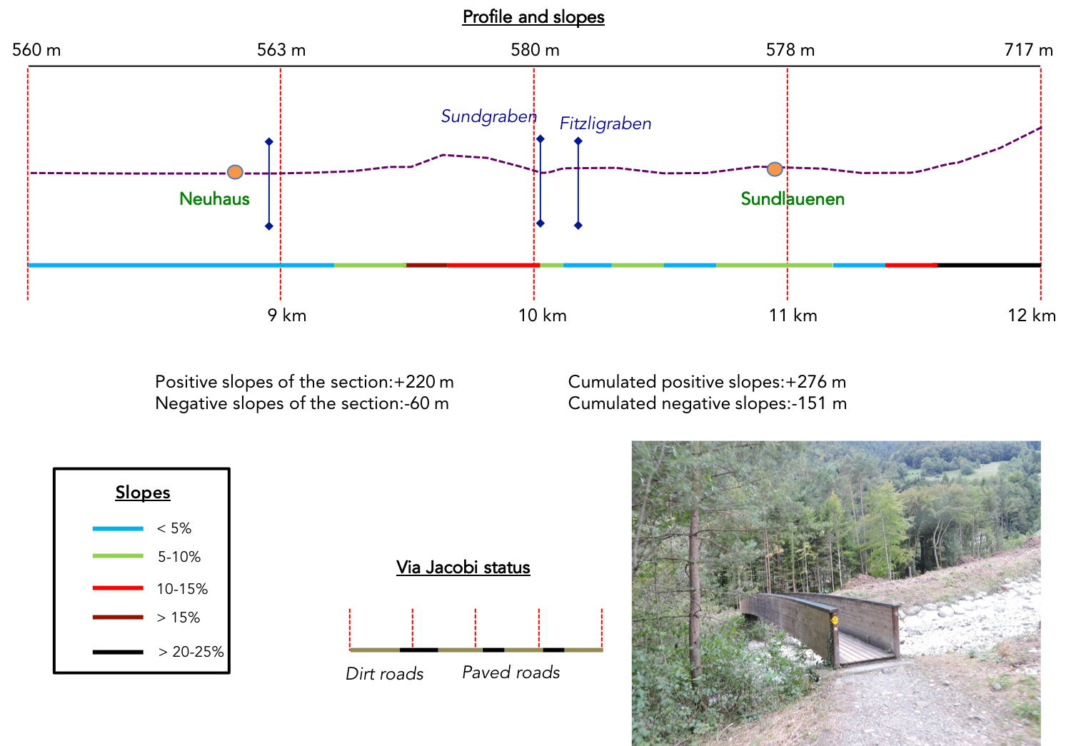
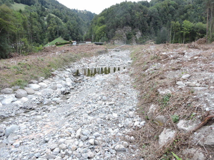
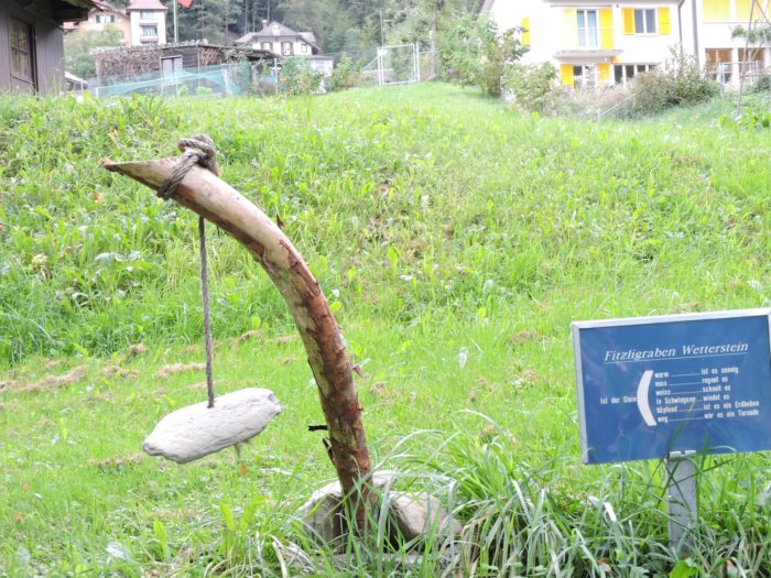
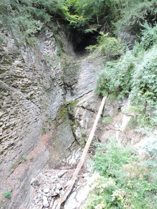
| From there, the path plunges into the forest, ascending and descending through the majestic canyons of Sundgraben and Fitzligraben. From the Brünig Pass, these natural chasms cascade down from the heights, at times as impetuous torrents, at others as silent witnesses to nature’s caprices. They are more than potential streams; they are narrow canyons with sometimes steep sides, where large floods can pile up huge amounts of stones or tree trunks, or serve as avalanche corridors in winter. |
 |
 |
Shortly thereafter, the route leads you to the other end of Sundlauenen, where you can attempt to read the signs of time as our prehistoric ancestors did.
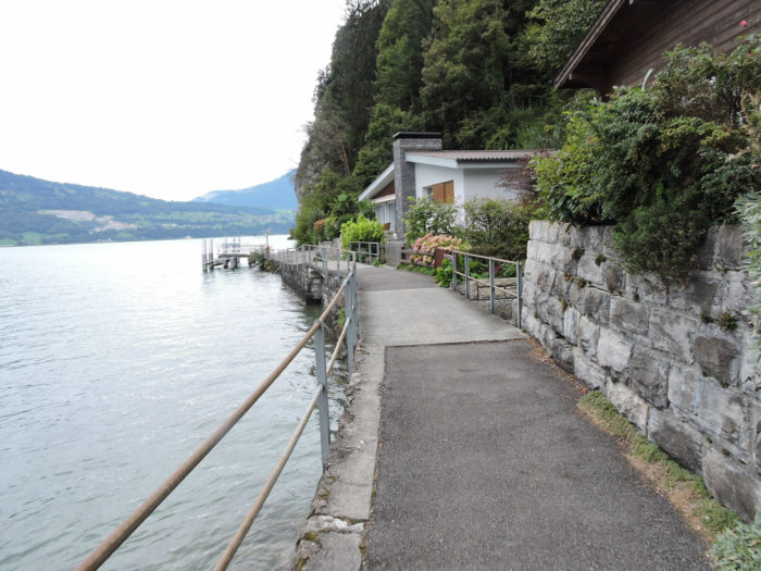
| Sundlauenen, nestled at the foot of the caves, exudes tranquility beneath the lake’s road tunnels, harboring a peaceful and serene life. |
 |
 |
The Camino de Santiago has been merciful so far, offering almost flat terrain for the pilgrim. But now come the Beatenberg caves, announced by a sign. From here, the route becomes more demanding, the slopes steeper, but only for a while…

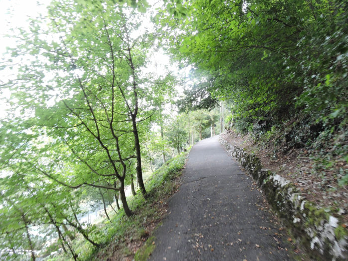
| First, a tarred trail timidly climbs through the woods, soon rejoining the coastal road, overlooking the village. |
 |
 |
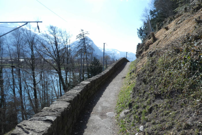
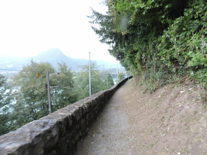
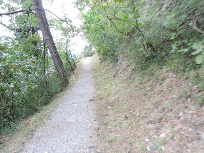
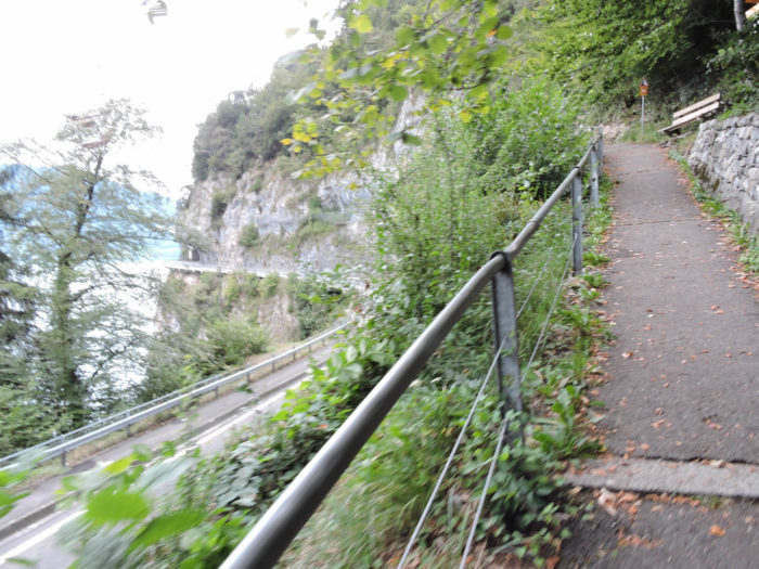
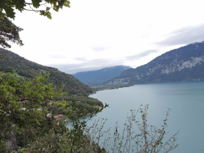
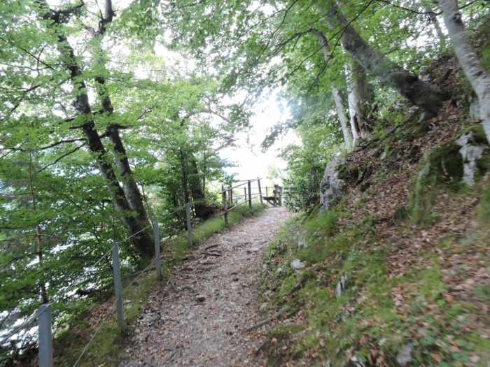
| Higher still, the trail veers above the road, carving its way along the cliff face, offering a breathtaking view over the tranquil waters of the lake. |
 |
 |
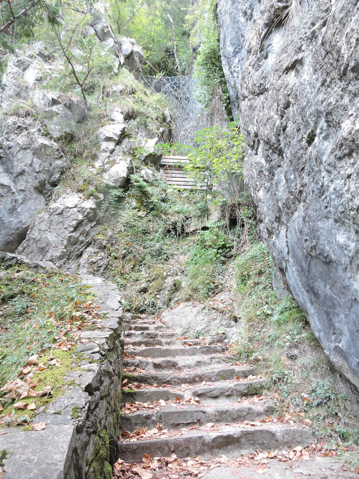
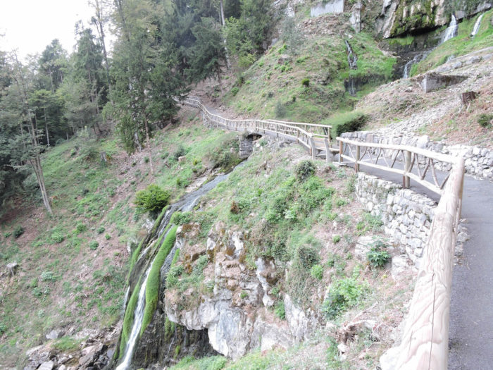
| And then, there remains only the pure pleasure, with stairs winding under the rock, providing a striking spectacle over the shimmering lake. |
 |
 |
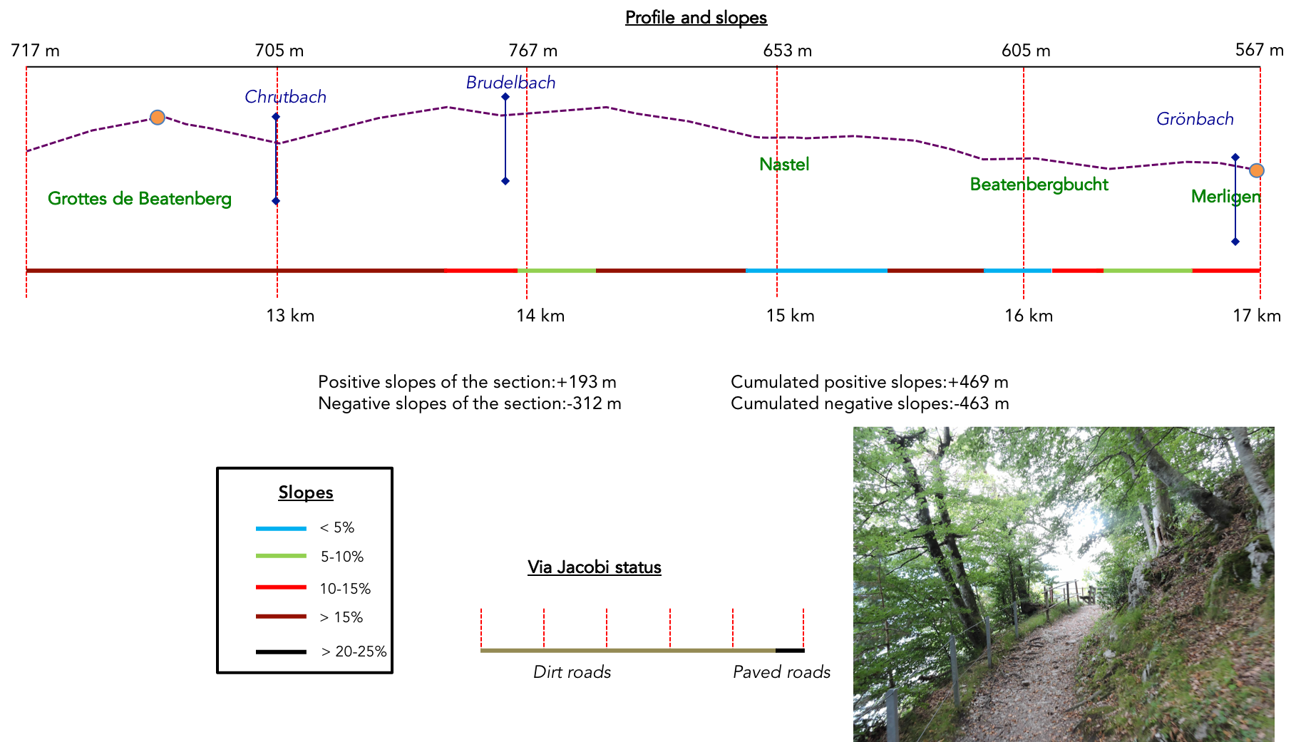
Section 4: On the flanks of Lake Thun
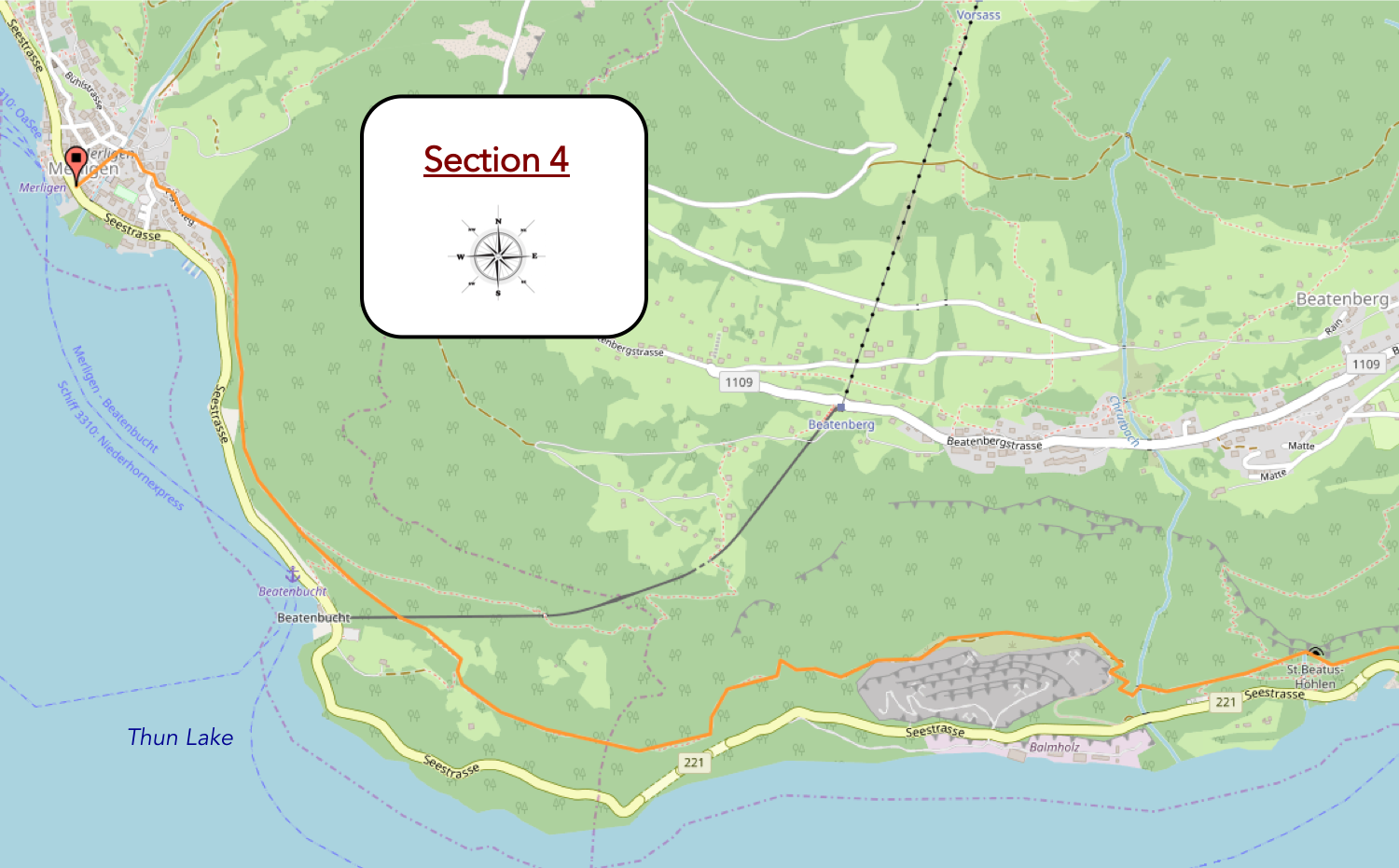
Overview of the route’s challenges:The route is a real leg-breaker, with plenty of ups and downs, often on steep slopes.
|
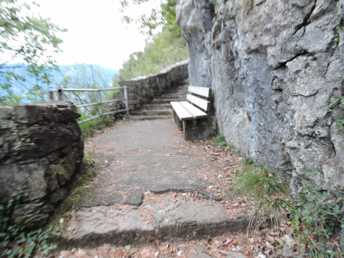
Specially designed resting areas have been set up along this route, offering a welcome respite for the weary walker, allowing them to catch their breath and contemplate the vastness of the horizons before them.
|
 |
 |
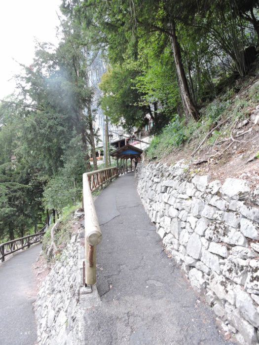
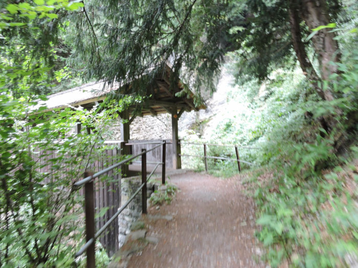
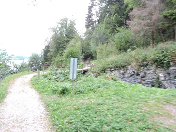
As the path continues, the slope gently eases, as if nature itself wants to make access to these mysterious caves easier. A paved trail then guides the steps of the curious visitor towards these caverns nestled in the mountainside.
| Legendary tales of the Saint Béat intertwine with the whispers of ancient winds, evoking times when men walked alongside dragons and serpents. These ancient stories, spanning from the twelfth to the sixteenth century, imbue the area with mystery and fascination. The French Saint Béat is said to have once crushed a serpent’s head in the depths of a cave, while our own Saint Béat of Lungern is said to have confronted and defeated a fearsome dragon, making this place his sanctuary. |
 |
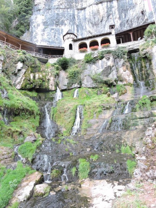 |
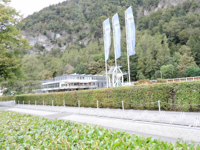
| Illuminated pathways wind inside the mountain for nearly a thousand meters, revealing to awe-struck visitors the hidden wonders of underground waterfalls, majestic stalagmites, and glittering stalactites. These caves also hold the remains of a distant prehistoric past, as well as the legendary cell where St Béat is said to have resided. The enlightened explorer can find an endless source of discoveries and wonders here. However, accessing these marvels requires some effort, as the parking lot is located below. But for the pilgrim, this ascent is just another step on the sacred path of the Via Jacobi, indifferent to modern conveniences and focused on the contemplation of heights. |
 |
 |
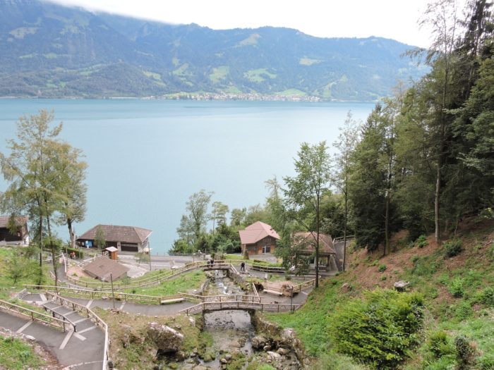
| Around the cave site, smooth and accessible paths invite leisurely strolls, offering a striking contrast to the mystical atmosphere of the caverns. Far from the inconveniences of mud, the conventional tourist finds welcome comfort here for their tired steps. |
 |
 |
| For the pilgrim in search of authenticity, a modest trail descends steeply on the other side of the caves, crossing the tranquil tumult of the Choltbach stream. |
 |
 |
| This trail descends to a vast quarry, a silent witness to past human activity, now reclaimed by nature. Then, the path climbs up the hillside. Although this interlude may seem monotonous, it is only a brief parenthesis in the enchanting narrative of this stage, punctuated by the striking beauty of the surrounding landscapes. |
 |
 |
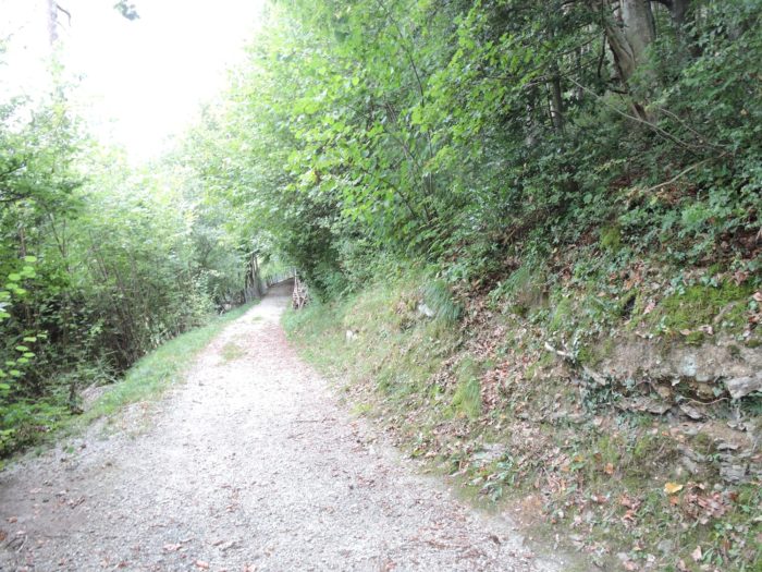
| At the top of the quarry, the gravel road begins its descent amidst the lush foliage of deciduous and coniferous trees, offering the traveler a symphony of colors and fragrances. |
 |
 |
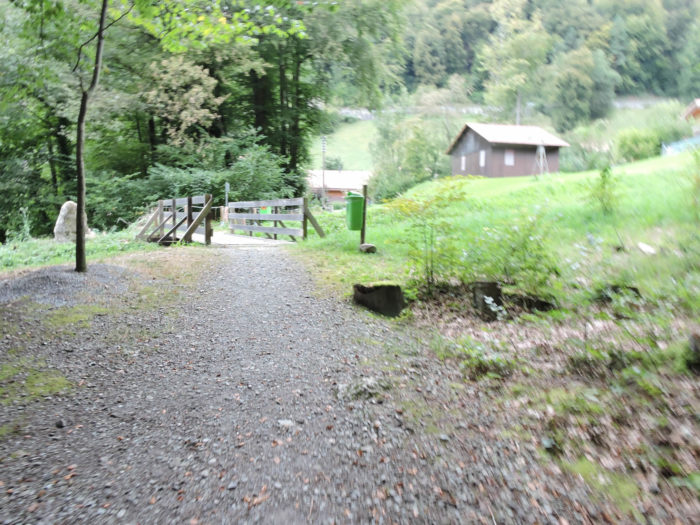
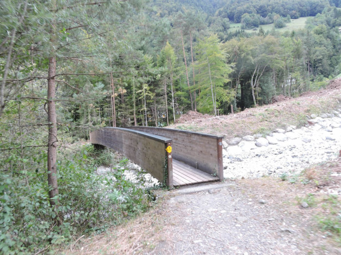
| In the hollow of the brief descent, a modest wooden bridge spans the Budelbach, whose tranquil waters barely whisper their millennia-old story. The canyon unfolding before them seems but a timid sketch of the grand spectacle awaiting them at the lakeshore. |
 |
 |
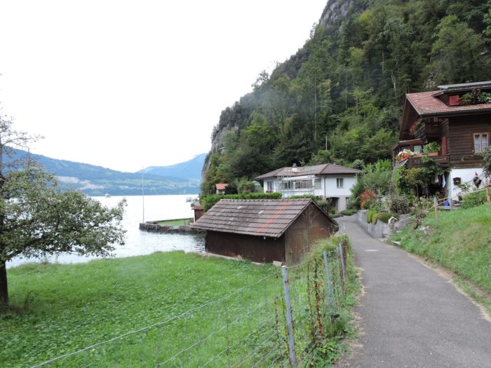
| But soon, the slope becomes steeper, and the path plunges resolutely towards the shimmering shores of the lake. From here, the walker will mostly traverse wide paths, sometimes smooth, sometimes rocky. Through the solitary silhouettes of pine trees, the idyllic scene unfolds—modest homes standing beside the tranquil waters . |
 |
 |
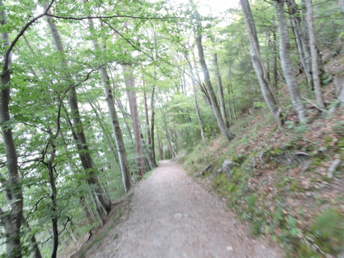
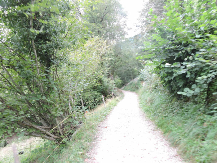
| The path then winds, sometimes sharply descending, through a dense forest where majestic beech trees reign supreme, imparting an atmosphere of mystery and timelessness. Beeches dominate, as is common in Swiss forests. |
 |
 |
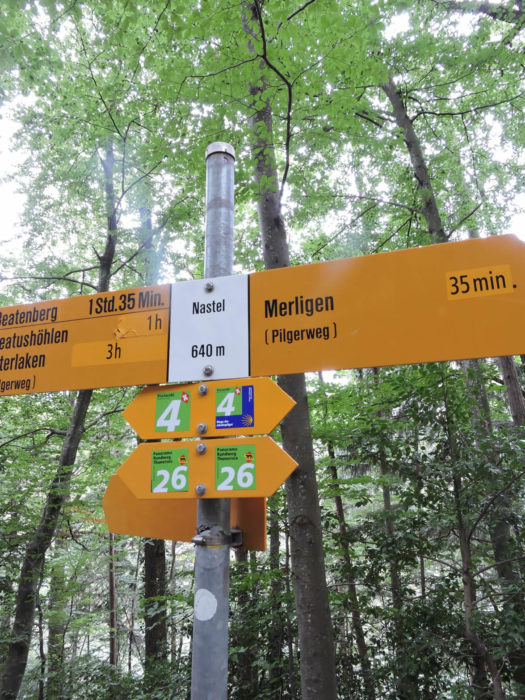
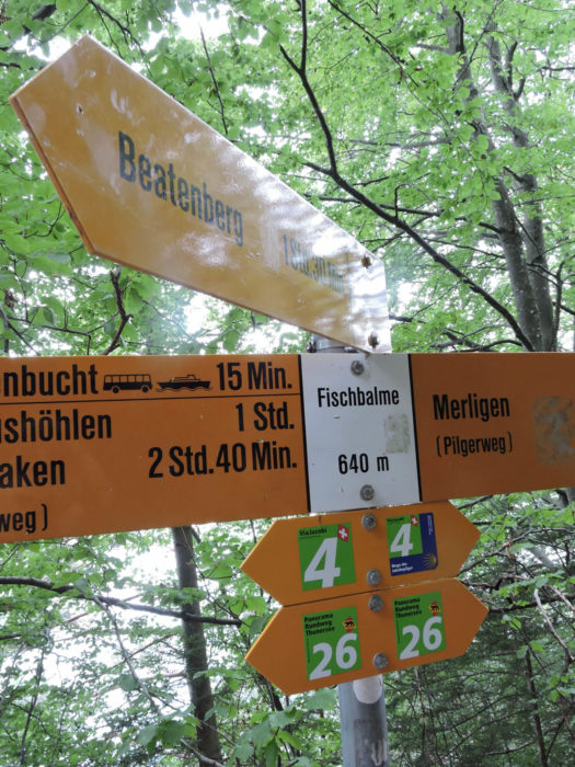
Shortly after, the path opens up to the area known as Nastel, a sign heralding the proximity of Merligen, just half an hour’s walk away. Signposts invite ascent to Beatenberg, where an altitude station overlooks the lake.
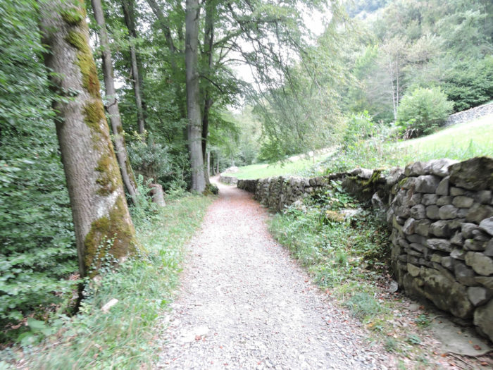
| For a brief moment, the slope eases, allowing the walker to catch their breath, while ancient stone walls seem to murmur of forgotten tales. |
 |
 |
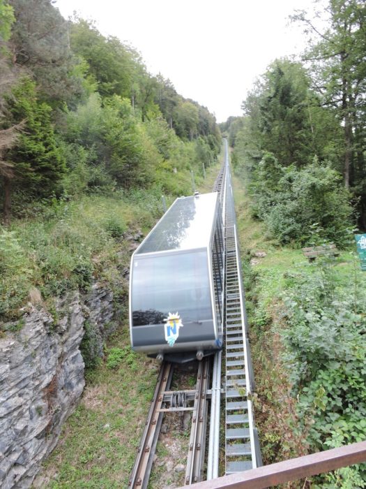
| A bit further on, the path overlooks the railway line leading from Beatenbucht, where the little train winds its way to the heights of Beatenberg. |
 |
 |
| But soon, the slope becomes rugged again, thrusting the traveler into the dense and profound nature. |
 |
 |
The path leads further to the place called Fischbalme, offering a choice between ascending towards Beatenberg or descending towards the tranquil shores of the lake at Beatenbucht.
| Here, the Via Jacobi continues its steadfast course, relinquishing the heights, offering an unobstructed view of the sleepy village of Merligen nestled below. |
 |
 |
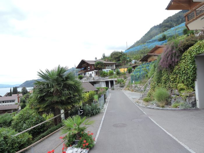
| A modest road gracefully descends towards Merligen, offering the curious eye a panoramic view of the opposite shores, where the familiar silhouette of Spiez is outlined. Winding through the dale, the road crosses the Grönbach, whose waters sing the eternal song of travel. |
 |
 |
| Merligen, with its few shops and imposing Beatus hotel, then reveals itself to the traveler. |
 |
 |
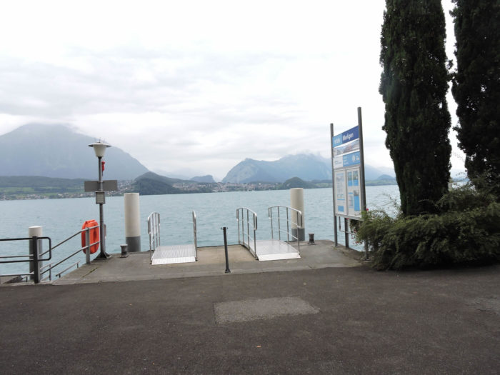
But for the pilgrim, it is primarily the small dock that captures attention, offering an open gateway to Spiez on the other side of the lake. The calm waters of the lake invite crossing, punctuated by a stop at Faulensee before reaching the other shore.
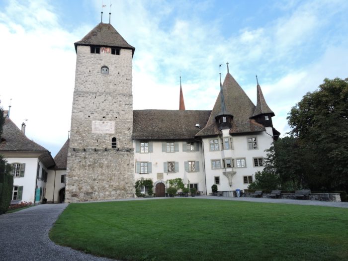
| Upon arrival at the port of Spiez, the majestic castle stands before the visitor like a guardian of centuries past. Stairs ascend to its ramparts, offering a breathtaking view of the shimmering lake waters and the surrounding mountains. |
 |
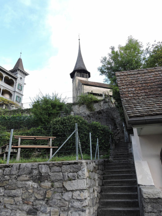 |
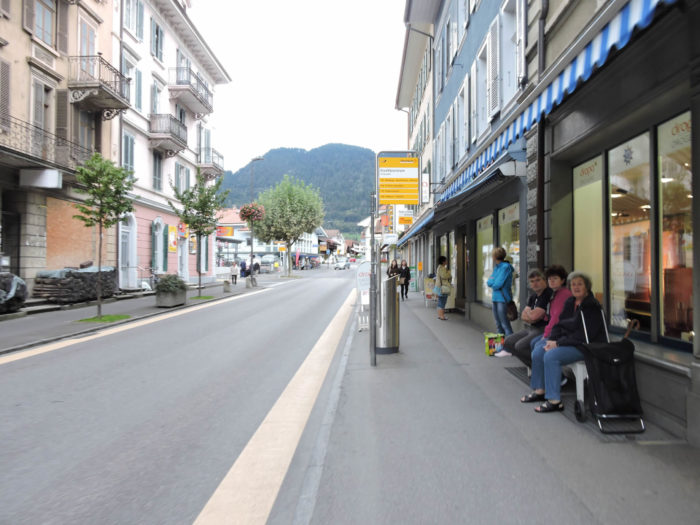
| The castle of Spiez and its adjoining church constitute a collection of invaluable artistic significance. Erected as early as the 8th century, the church was rebuilt around the year 1000 in a Romanesque style, then adorned in the 13th century with mural frescoes. It remained the parish church until the early 20th century. As for the castle, a glorious relic of the past, it elegantly intertwines Romanesque, Gothic, and Baroque styles, bearing witness to the evolving centuries that brought it into existence. The town itself, although modest, sprawls in length and height, descending from the heights of the hill down to the bustling heart represented by the train station. |
 |
 |
Accommodation on Via Jacobi
- Camping Interlaken, Brienzstrasse, Interlaken; 033 822 44 34; Camping, dinner, breakfast
- Jugendherberge, Untere Bönigstrasse 3, Interlaken; 033 826 10 90; Youth hostel, dinner, breakfast
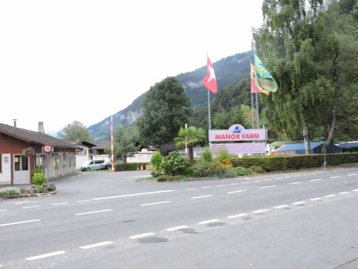
- Camping Manor Farm, Seestrasse, Neuhaus; 033 822 22 64; Bungalow, breakfast
- Neuhaus Golf und StrandHôtel, Seestrasse 121, Neuhaus; 033 822 82 82: Hotel***, dinner, breakfast
- B&B Gratwohl, Waldhaus 974, Sundlauenen; 033 251 15 34/079 555 92 10; Guestroom, breakfast
- Hôtel Beatus, Staatstrasse 985A, Sundlauenen; 033 841 16 24; Hotel**, dinner, breakfast
- Gasthaus Traube, Seestrasse 225, Merlingen; 033 251 15 34; Hotel, dinner, breakfast
- Hôtel Beatus, Seestrasse300, Merlingen; 033 748 04 34; Hotel****, dinner, breakfast
- B&B Eva Frei, Studweidstrasse 38, Spiez; 033 655 05 66; Guestroom, breakfast
- B&B Tschirren-Müller, Eigerweg 17, Spiez; 033 654 53 93; Guestroom, breakfast
- Susanne et Matthias Malbach, Lochmühleweg 3, Spiez; 033 655 00 38/079 405 01 52; Guestroom, breakfast
- B&B Kunz, Thunstrasse 98, Spiez; 033 654 14 92/078 657 89 10; Guestroom, dinner, breakfast
- Gasthaus Seeblick, Schachenstrasse 43, Spiez; 033 650 81 81; Hotel, breakfast
- Hôtel Seegaten. Schachemstrasse 3, Spiez; 033 655 67 67; Hotel**, dinner, breakfast
- Hôtel Bellevue, Seestrase 36, Spiez; 033 654 84 64; Hotel**, dinner, breakfast
There are no major difficulties in finding accommodation on this stage. You’ll find plenty of lodging options in Interlaken without any trouble, but it’s advisable to book in advance during peak times. You can inquire at the Tourist Office for assistance. At the end of the stage, you’ll be in town with all the necessary shops. However, it’s still a good idea to make reservations for security purposes.
Feel free to add comments. This is often how you move up the Google hierarchy, and how more pilgrims will have access to the site.
|
 |
Next stage : Stage 11: From Spiez to Wattenwil |
|
 |
Back to menu |