A picturesque stroll through the Bernese countryside
DIDIER HEUMANN, ANDREAS PAPASAVVAS

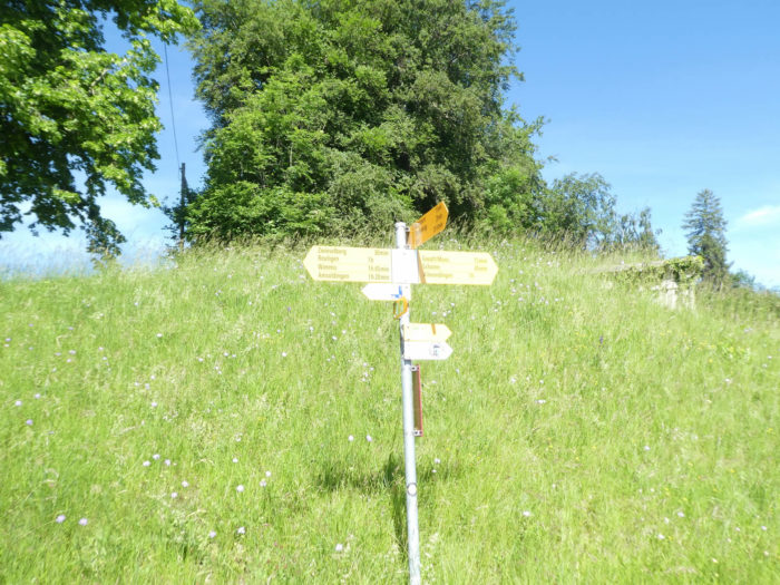
We divided the course into several sections to make it easier to see. For each section, the maps show the course, the slopes found on the course, and the state of the route (paved or dirt roads). The courses were drawn on the « Wikilocs » platform. Today, it is no longer necessary to walk around with detailed maps in your pocket or bag. If you have a mobile phone or tablet, you can easily follow routes live.
For this stage, here is the link:
https://fr.wikiloc.com/itineraires-randonnee/de-spiez-a-Wattenenwil-par-la-via-jacobi-34389161
|
Not all pilgrims are necessarily comfortable using GPS or navigating routes on a mobile device, and there are still many areas without an internet connection. For this reason, you can find several books on Amazon dedicated to the major Via Jacobi 4 route, which runs through the heart of Switzerland and over the Brünig Pass. The first guide leads pilgrims through the German-speaking part of Switzerland up to Fribourg, while the second continues through French-speaking Switzerland to Geneva. We have also combined these two books into a compact, lighter, and highly practical version. While the descriptions have been slightly condensed, they remain detailed enough to guide you step by step along the way. Recognizing the importance of traveling light, this latest edition has been designed to provide only the essentials: clear and useful information, stage by stage, kilometer by kilometer. The stages have been carefully adjusted to ensure accessibility and alignment with available lodging options. These books go beyond simple practical advice. They guide you kilometer by kilometer, covering all the crucial aspects for seamless planning, ensuring that no unexpected surprises disrupt your journey. But these books are more than just practical guides. They offer a complete immersion into the enchanting atmosphere of the Camino. Prepare to experience the Camino de Santiago as a once-in-a-lifetime journey. Put on a good pair of walking shoes, and the path awaits you.
|
|
 |
If you only want to consult lodging of the stage, go directly to the bottom of the page.
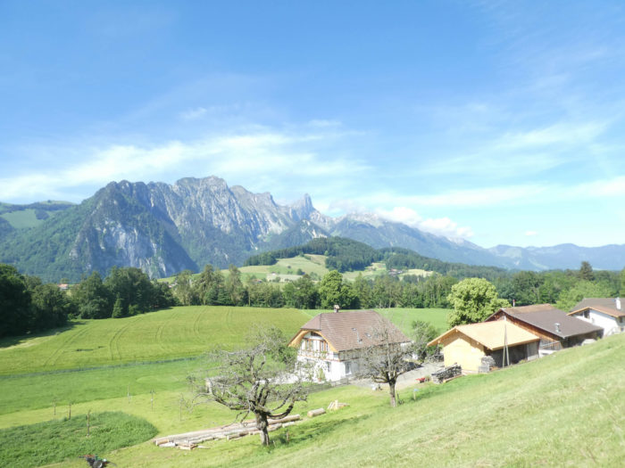
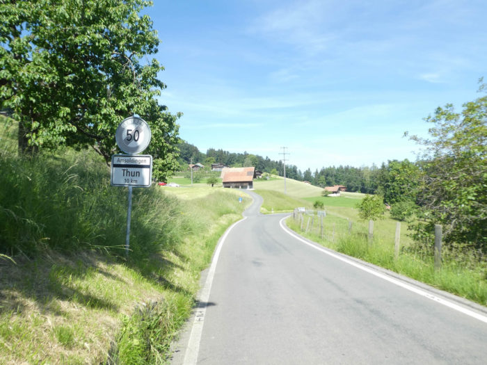
The Bernese Oberland, a majestic territory, stretches out like a monarch to the south of the Canton of Bern, a natural sovereignty with the town of Interlaken reigning at its heart, cradled by the tranquil waters of Lake Brienz and Lake Thun, two shimmering jewels of this Alpine crown. Yet, its domain extends beyond, westward to the Simmental, home of the formidable namesake cows, and northward to the Thun region, where landscapes breathe the eternal beauty of the mountains. Today, you follow the tracks carved by these valleys and hills, until reaching Wattenwil, a modest agricultural community within the Thun district, at the edge of the Canton of Fribourg, serving as a climactic note on the geographical score of this blessed region. In this landscape, where agricultural nature unfolds as far as the eye can see, cheese reigns supreme, a silent witness to the symbiosis between man and land. The homes dotting this territory carry within them history and tradition, silent witnesses of a bygone era, etched into the landscape as living remnants of the past. Still faithful to their original purpose, they withstand the passage of time, reminding onlookers of this region’s deep roots in its ancestral heritage. In this Alpine Eden that is the Bernese Oberland, each valley seems to narrate a story, each peak appears to touch the sky.
However, be warned, for in Wattenwil, finding refuge can prove to be a challenging quest. Therefore, plan your arrangements carefully and book your accommodations in advance, for Providence does not always assure a haven of peace for the wayward traveler. Fortunately, the limited number of pilgrims on the Swiss Camino de Santiago ensures a certain tranquility, thus preserving the intimacy of these places.
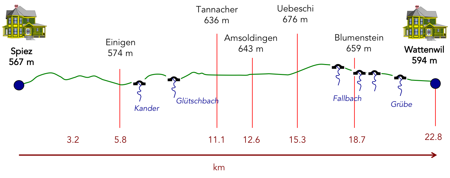
Difficulty level: The elevation gains encountered today, modest yet significant (+411 meters / -363 meters), invite a measured ascent, a harmonious dance between earth and sky, a series of light ascents and descents, punctuated here and there by more pronounced efforts, especially near the Kander or upon the initial strides up Spiezberg hill.
State of the Via Jacobi: The stretches on paved roads slightly outnumber the paths:
- Paved roads: 12.6 km
- Dirt roads : 9.2 km
Sometimes, for reasons of logistics or housing possibilities, these stages mix routes operated on different days, having passed several times on these routes. From then on, the skies, the rain, or the seasons can vary. But, generally this is not the case, and in fact this does not change the description of the course.
It is very difficult to specify with certainty the incline of the slopes, whatever the system you use.
For those seeking « true elevations » and enthusiasts of genuine altimetric challenges, carefully review the information on mileage at the beginning of the guide.

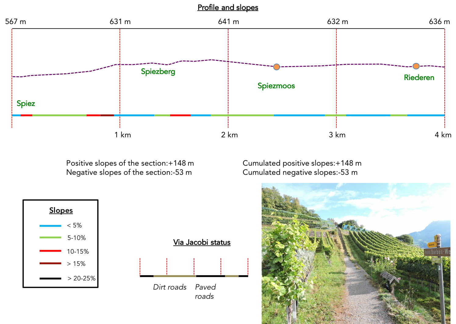
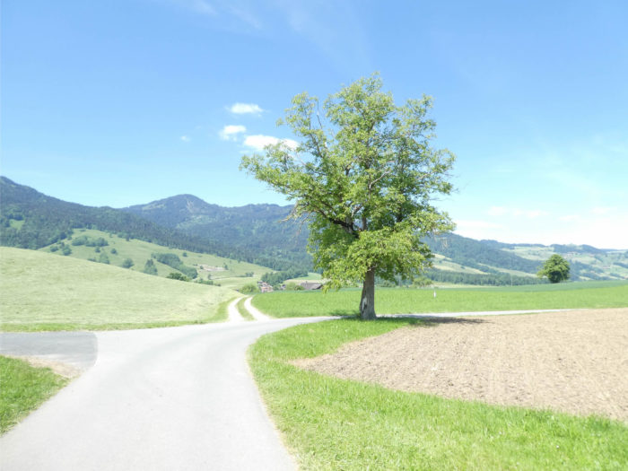
Section 1: Over Spiezberg, above the town

Overview of the route’s challenges: some serious slopes to conquer before reaching the hill, followed by a problem-free course.
|
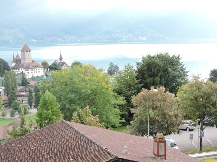
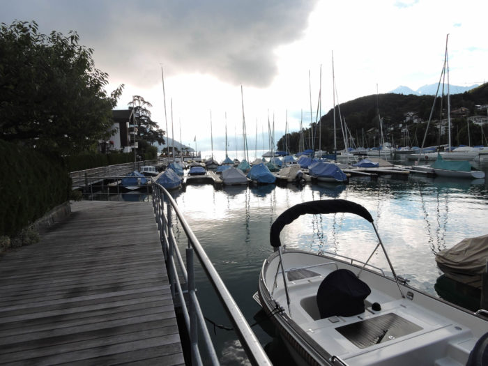
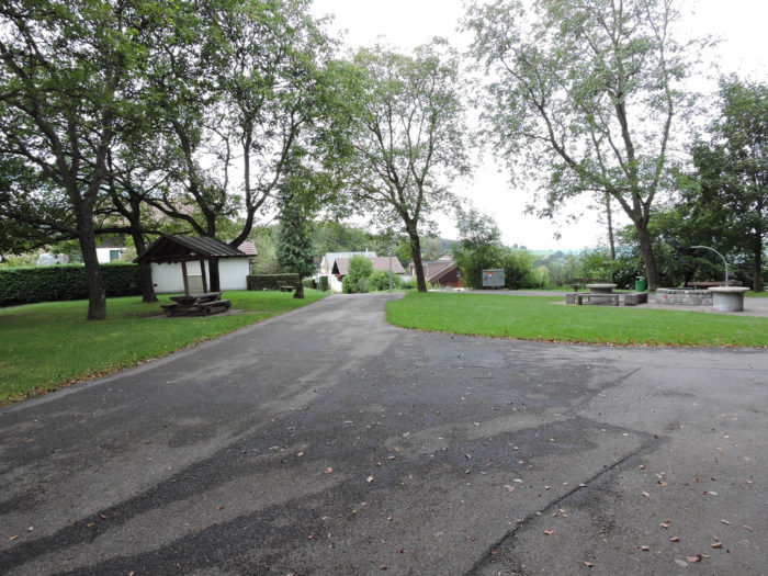
The majority of accommodations is nestled in the heart of the city, where alleyways interlace in an urban maze, while Spiez stretches languidly down a gentle slope. You likely noticed this topography the day before, as the landscape unfolded before your eyes. Thus, you should head down to the harbor to continue the journey.
|
 |
 |
| This morning, ominous weather forecasts predict overcast skies over the harbor. However, for now, raindrops are sparse and the sun, like a benevolent sentinel, lights your route.
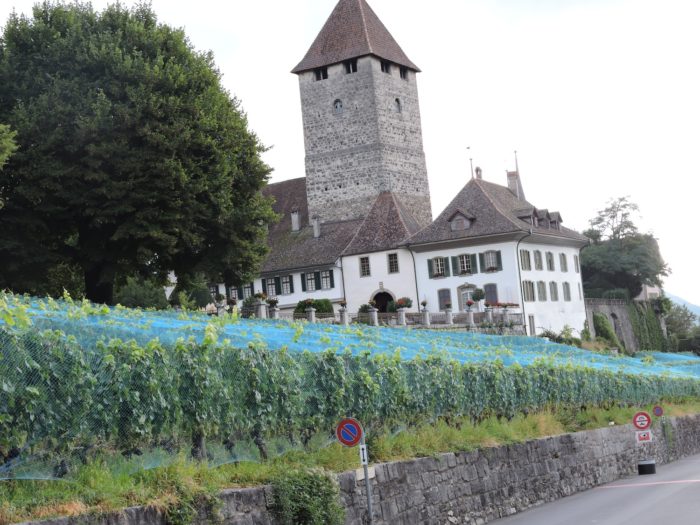
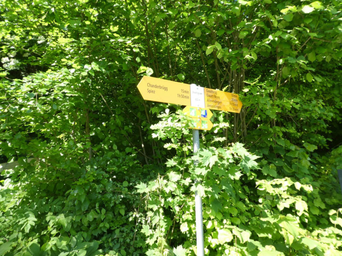
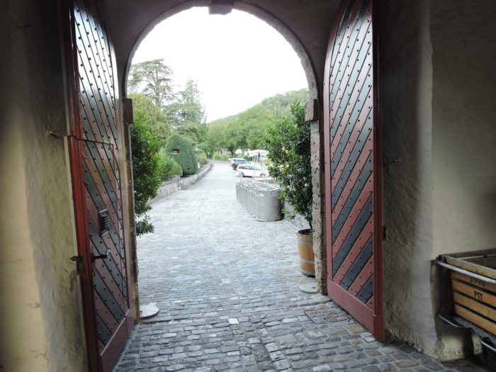
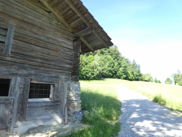
The Via Jacobi exits Spiez through the castle’s high gate, which you may have had the chance to visit the day before, provided it was accessible. |
 |
 |
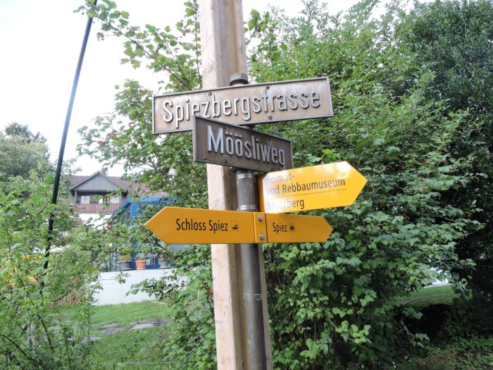
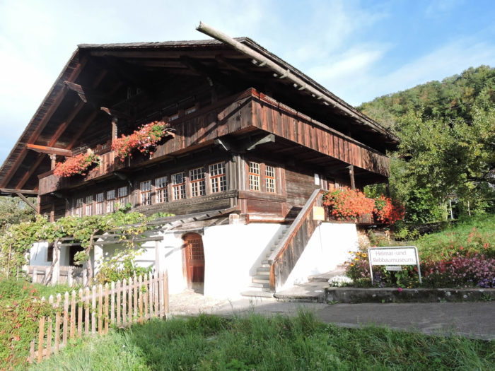
A road emerges from the castle and slopes up along Schlossstrasse. There, a signpost invites you to follow the direction to the Museum of Homeland and Vine (Heimat und Rebbaummuseum).
|
 |
 |
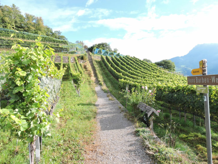
| Turning right, the route then takes the Rebbergweg, though you also have the option to climb a narrower alley up to Spiezbergstrasse, where the museum’s grand residence stands majestically. Regardless of the chosen route, it is imperative to follow the route leading to the top of Spiezberg, rather than turning back towards the station. The Rebbergweg, from its inception, proves to be a small road winding through the vineyards. |
 |
 |
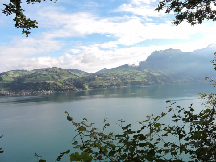
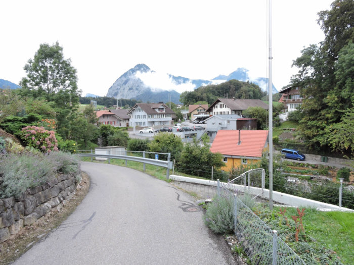
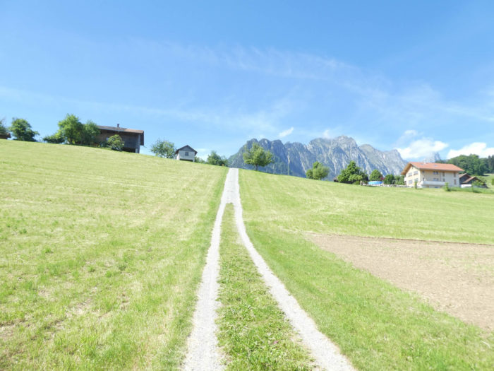
| Soon, a path replaces the road. As it climbs, the panorama opens up over the city of Spiez, dominated by its imposing castle and bordered by its tranquil bay. |
 |
 |
| Further on, the Via Jacobi climbs modest stairs to the edges of the vineyards, at the forest’s edge of Spiezberg. |
 |
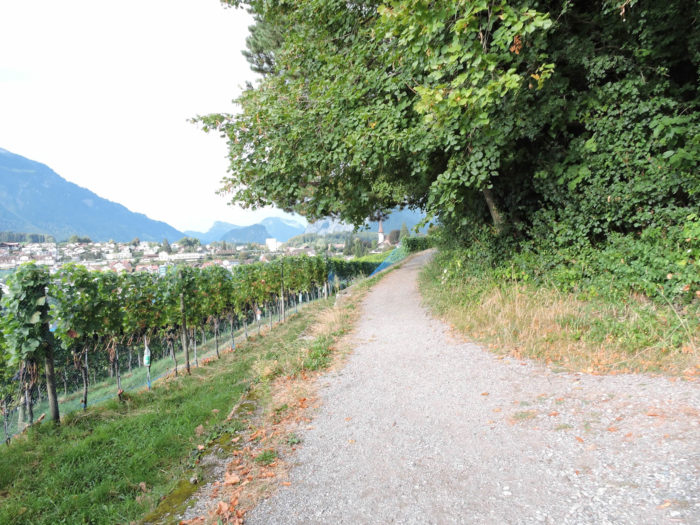 |
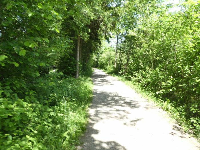
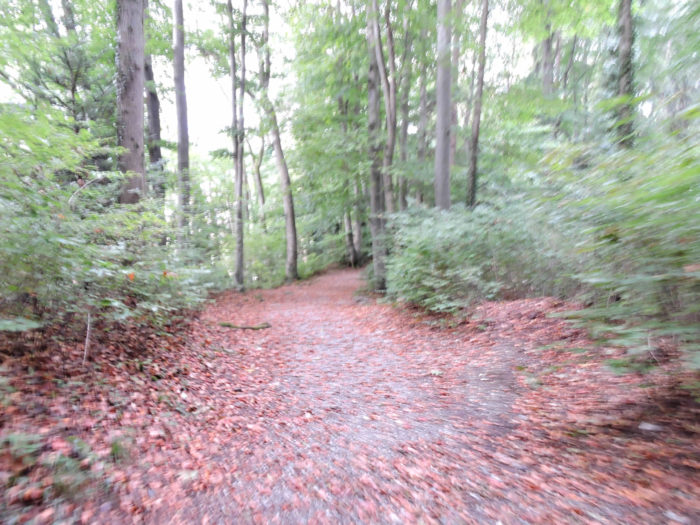
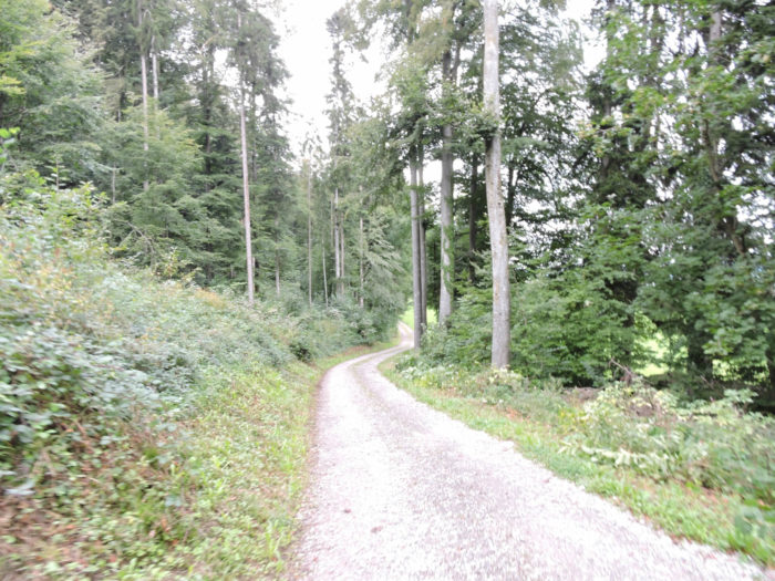
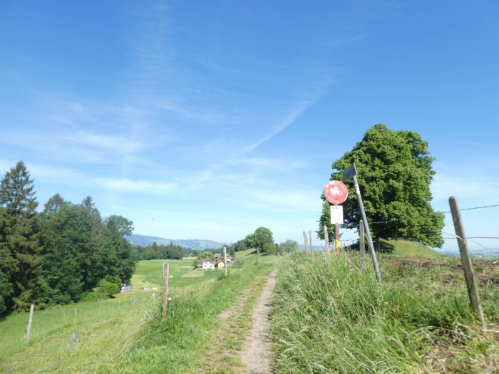
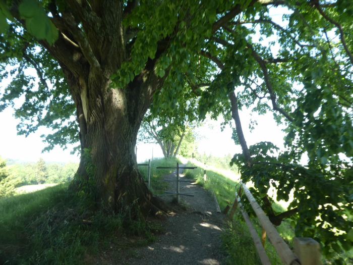
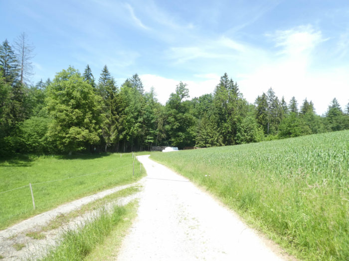
| Once atop, a dirt track first skirts the forest perimeter before plunging into the beech woods. Here and there, some scattered oaks, solitary ashes, and even valiant chestnut trees are revealed. The atmosphere is imbued with woodland freshness, while the path is adorned with reddish hues, a consequence of the abundant deposit of dead leaves, remnants of the past season. |
 |
 |
From the other side of the hill, Lake Thun unfolds, while the renowned Justistal valley is sketched above Merligen. This valley is famous for its « Chästeilet, » a tradition unchanged for nearly three centuries. At the end of each summer, cheese is equitably distributed among the farmers, perpetuating an immutable ritual observed since time immemorial. But among the attendees are also hundreds of cheese aficionados, eager to claim these precious trophies.
| The path makes its way rather steeply through the forest, almost touching the summit of this mountain, or rather, we should say, this hill. The trees stand like silent sentinels, offering reassuring shelter to walkers in this generous nature, in this tall grove. |
 |
 |
At this point, your ascent from the lake totals only about a hundred meters. However, this is not insignificant for such a short distance.
| From here, the dirt road beginning its gentle descent weaves its way through the wood. The deep green of the young beech leaves sharply contrasts with the reddish carpet of dead leaves, creating a striking spectacle of nature in transition. |
 |
 |
| Emerging from this dense vegetation, a tiny road crosses the peripheral neighborhoods on the heights of Spiez. |
 |
 |
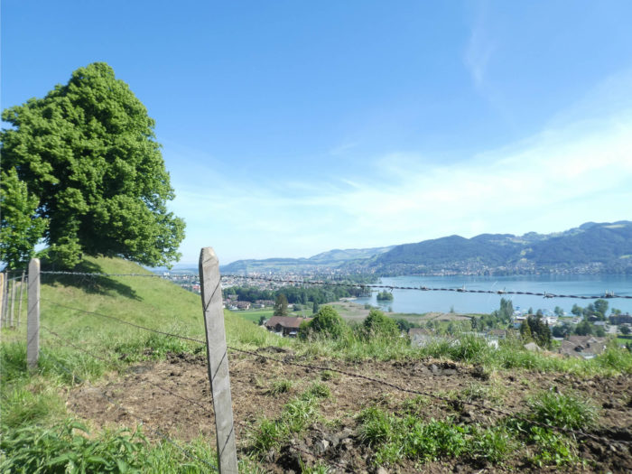
| From this vantage point, the lake stretches as far as the eye can see, and even Interlaken appears in the distance, like an enchanting mirage. |
 |
 |
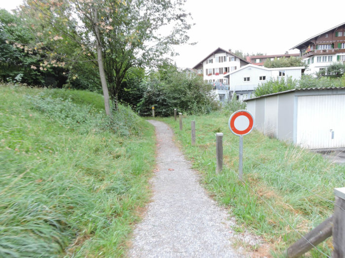
| A narrow path then guides you towards a tunnel, dug beneath the Thunstrasse. |
 |
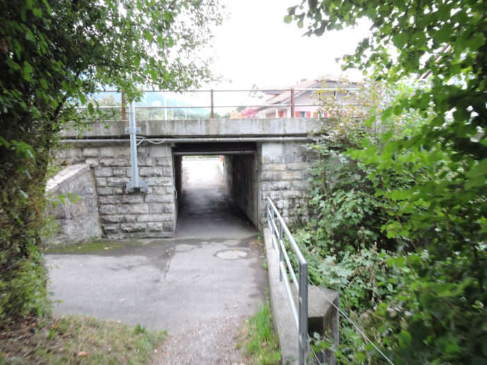 |
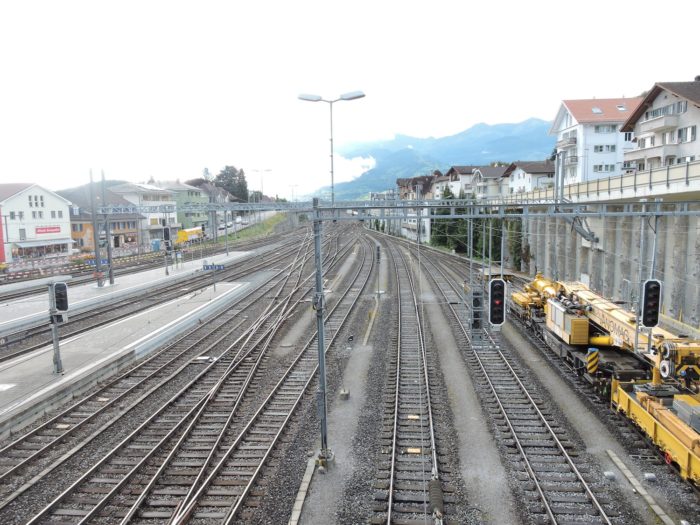
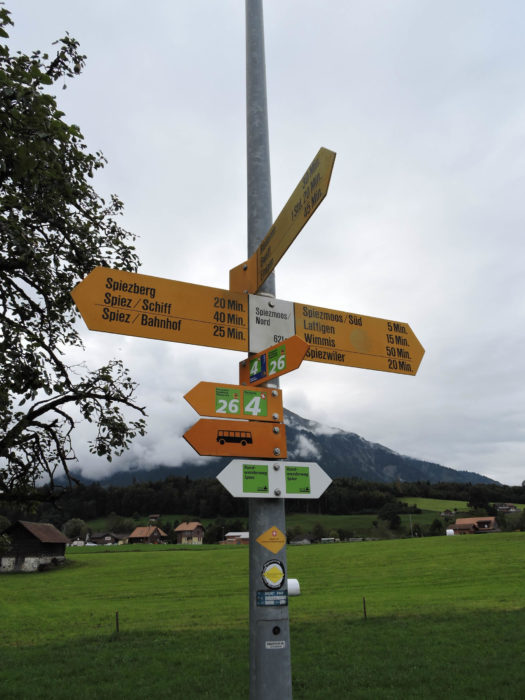
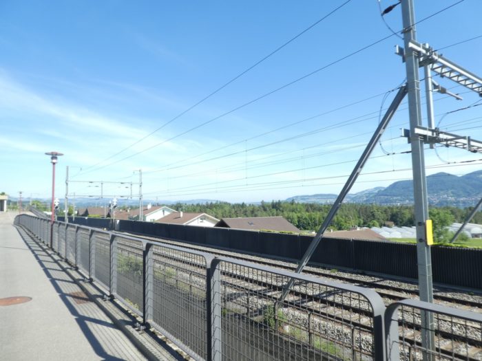
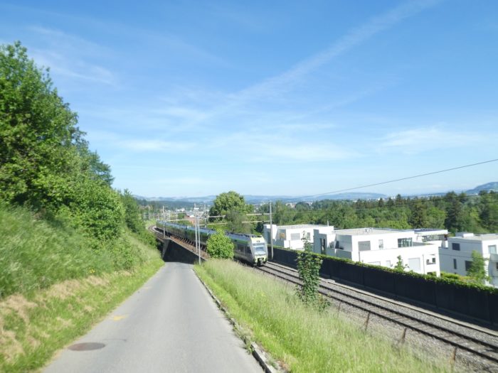
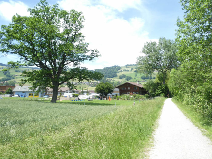
| Close by, the Via Jacobi departs from the city of Spiez, crossing the railway at the place called Spiezmoos Nord. It took nearly four kilometers to cross the city perched on the heights. |
 |
 |
| The Via Jacobi then fades onto a narrow road leading to Einingen, before quickly delving into the forest’s twists and turns. |
 |
 |
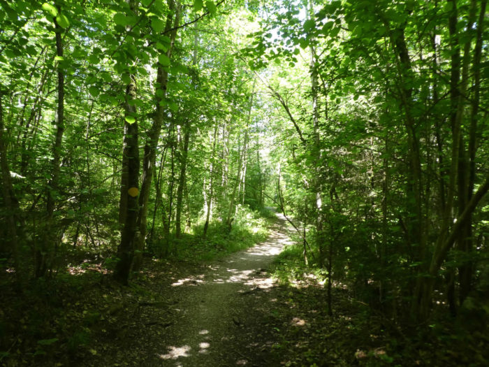
| A capricious path now snakes through the woods. Here, the beech reigns supreme, accompanied here and there by some sturdy maples and firs. Squirrels play hide-and-seek among the branches. |
 |
 |
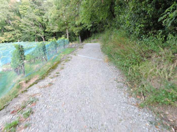
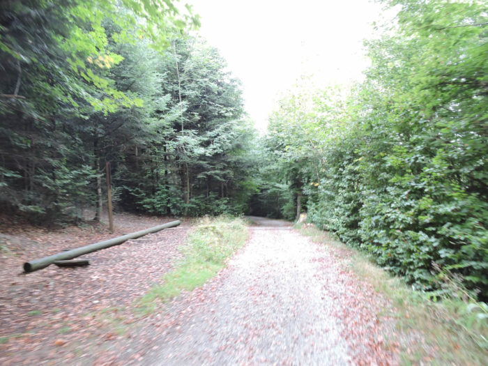
| This forest path, gradually transforming into a modest dirt road, meanders sinuously through the woods, venturing now into dense thickets, now into welcoming clearings. The woody scent envelops your senses, while the light filtered by the foliage creates a gentle spectacle. |
 |
 |
| At the edge of the forest, the silhouette of the lake is outlined once again, while the Justistal still looms on the horizon, on the other side of the lake. A stone’s throw away, the railway continues its journey, indifferent to the passage of time. |
 |
 |
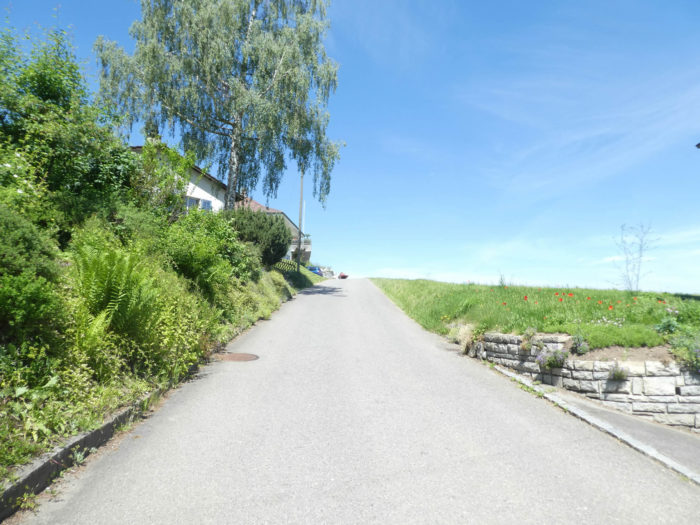
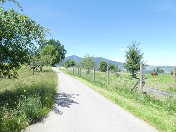
| Upon leaving this forest, which is not exactly a model of elegance, the Via Jacobi returns to the paved road at the hamlet of Riederen. |
 |
 |
Section 2: Near the Lake Thun and the Kander River

Overview of the route’s challenges: The route presents no difficulties, with the exception of a somewhat steep climb when crossing the Kander.

|
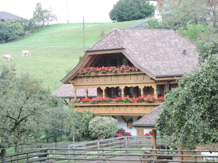
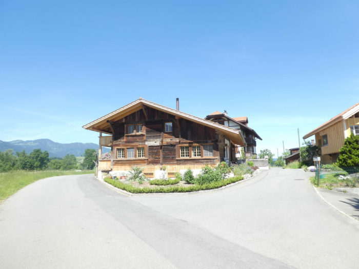
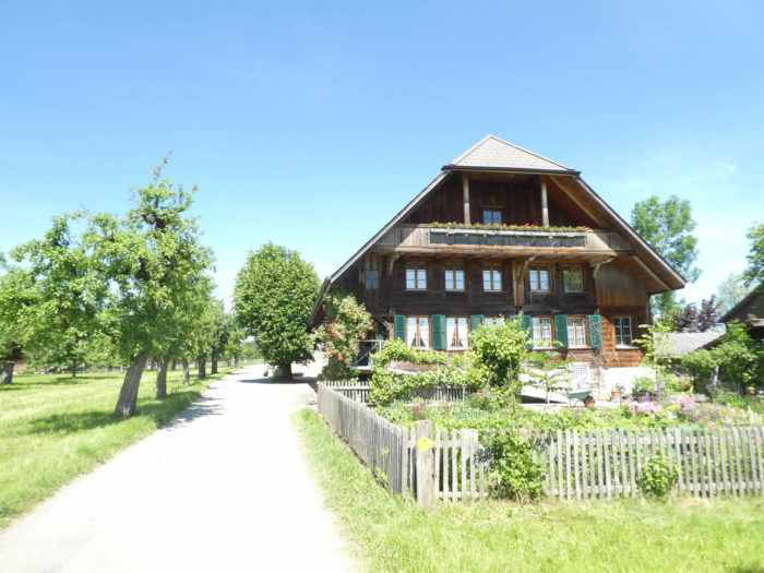
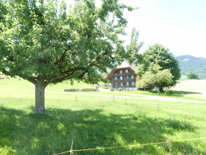
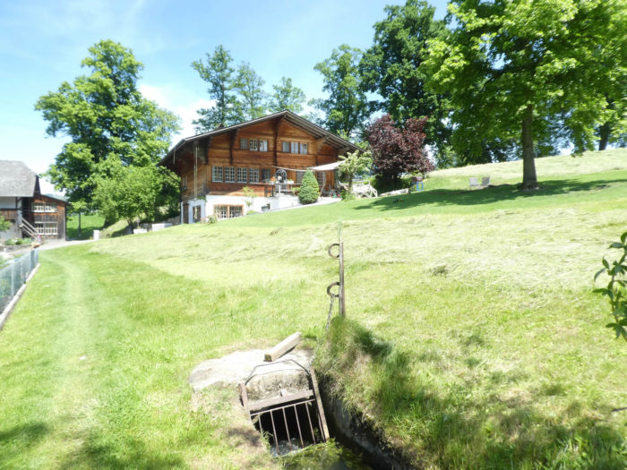
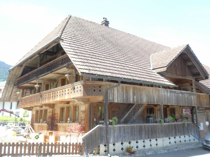
Riederen, nestled like a jewel upon the hill, unveils its splendid houses. Among these, a mansion rises majestically, in perfect harmony with stone and wood, a tribute to traditional craftsmanship. The eloquent stones and woodwork seem as though sculpted by nature’s benevolent hand, their captivating charm reflecting the soul of this quaint hamlet.
|
 |
 |
|
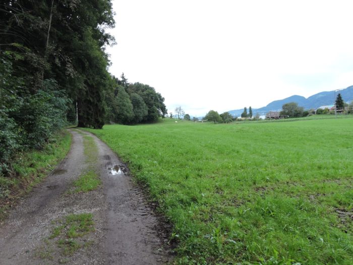
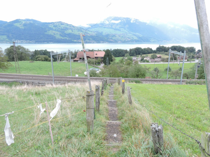
The Via Jacobi, a faithful companion to pilgrims, veers off the main road, gracefully dipping through fields towards the railway, presenting a constantly changing tableau of nature where fields blend into the endless horizon.
|
 |
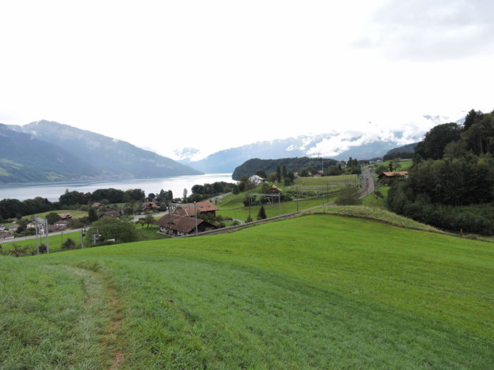 |
| It then crosses the tracks near the tranquil hamlet of Chumm, unveiling views of Lake Thun and the Justistal, stretches of great beauty. Descending towards Thunstrasse, the main artery along this side of the lake, the Via Jacobi guides travelers back to civilization. |
 |
 |
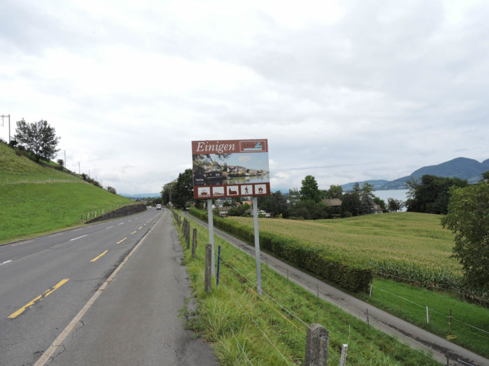
| At the bottom of the descent, it follows the flat road to the entrance of the village of Einingen, entering the lake-side part of the village. |
 |
 |
| At the village entrance stands a bar-restaurant, harmoniously paired with a refined shop where a multitude of treasures elegantly coexist, offering a variety of products that invite the senses on a unique, artisanal journey. |
 |
 |
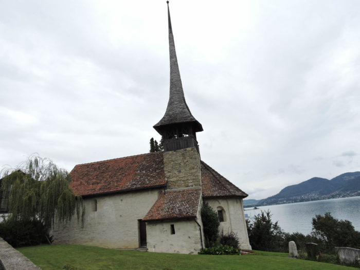
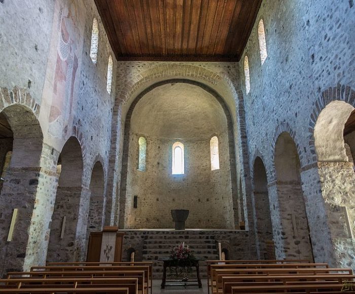
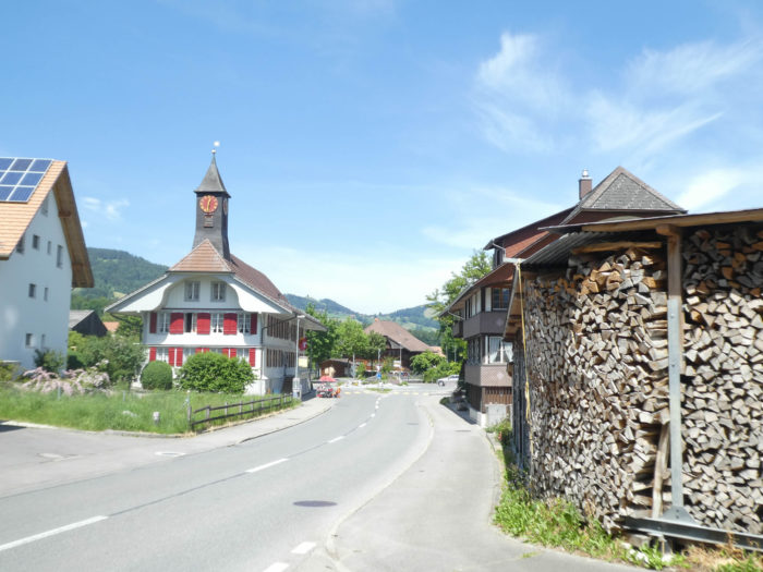
| Continuing its journey, the road passes through the village, brushing past the ancient St Michel church, whose walls narrate the story of centuries-old faith. Here, a miraculous spring once flowed, symbolizing healing and comfort for troubled souls. This church, born in the 7th century and mother to twelve other churches in the Thun region, now bears, since the Reformation, the features of a temple, austere and solemn. |
 |
 |
| Suddenly, the sky is veiled with a thousand tears, and we find ourselves forced to walk to Wattenwil under the relentless assault of rain. Let us return, then, to more clement weather to continue our journey.
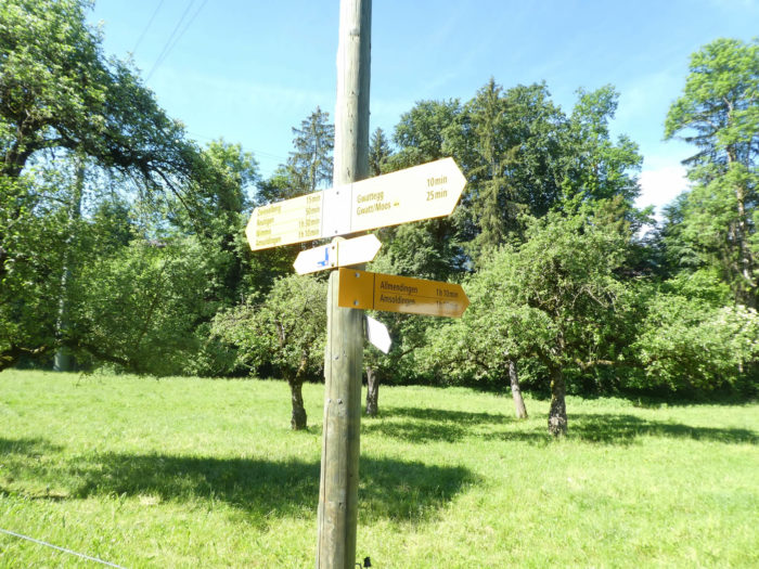
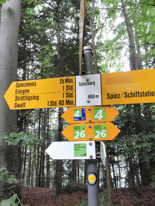
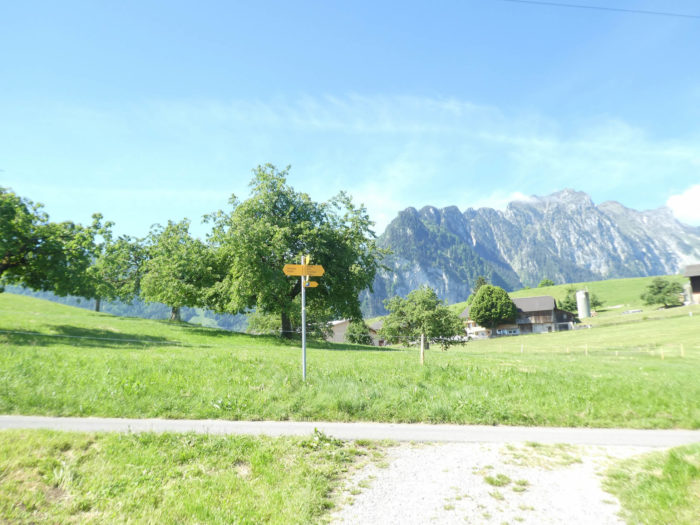
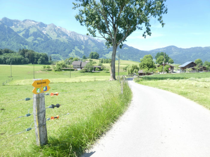
The Via Jacobi, resuming its course, climbs once again towards Thunstrasse, crossing the road to climb into the upper part of the village, where it crosses the railway tracks, ready to guide the steps of pilgrims in search of meaning. Where signs abound, it stands sentinel, confidently indicating the way to follow, towards Via Jacobi 4. |
 |
 |
| It then winds along the railway tracks, overseeing the landscape’s meanders with vigilant eyes. |
 |
 |
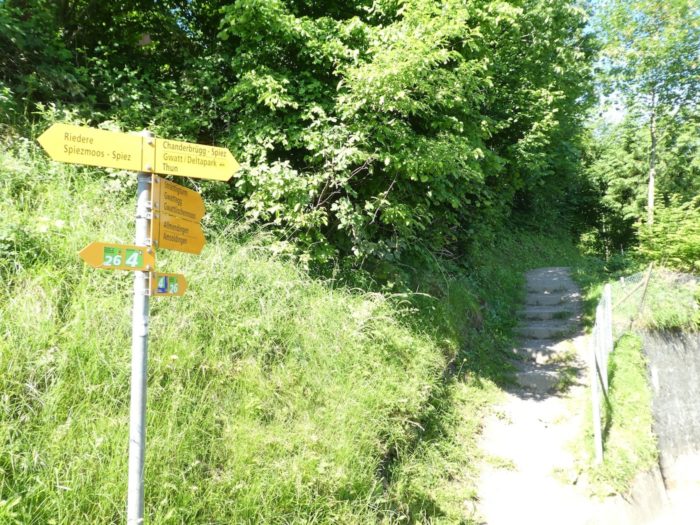
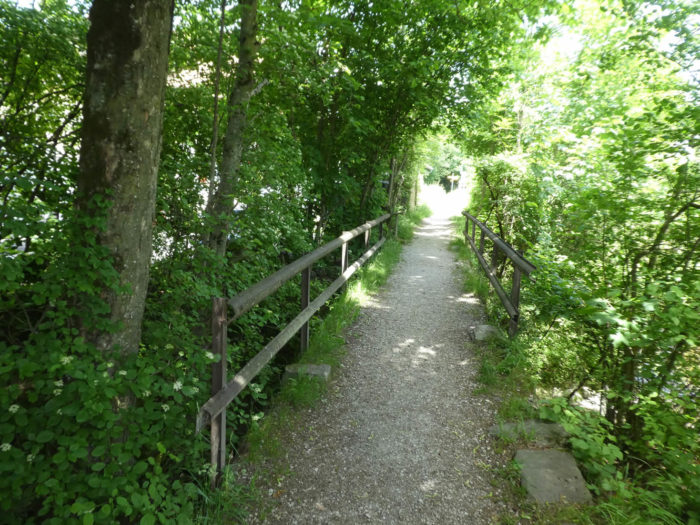
| A discreet road reveals itself, gracefully descending towards stairs in search of adventure, skillfully stealing walkers away to a mysterious wood. |
 |
 |
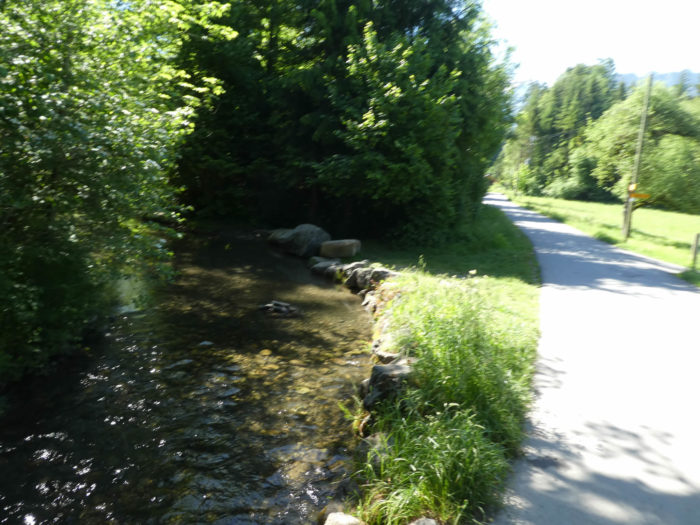
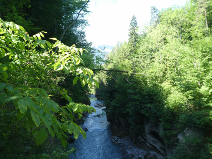
| In this enchanted forest, where beeches, oaks, and maples dance in harmony, nature unfolds its most lavish spectacles, revealing to adventurers a wild river, the Kander, in its deep gorge. Born in the peaks of the Bernese Oberland, the river winds its way to the gates of Spiez before flowing into the calm waters of Lake Thun. |
 |
 |
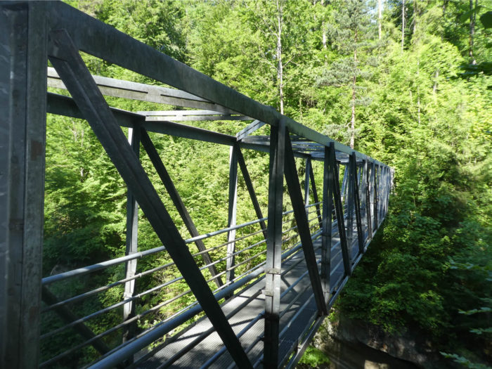
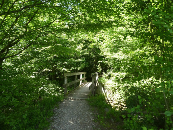
| The descent to the river is steep on a narrow trail. The suspension bridge is less intimidating, less daunting than its counterpart encountered in the Brienz canyons. . |
 |
 |
| From there, the trail climbs determinedly through the wooded darkness, while the railway, a faithful companion, crosses the tumultuous waters. |
 |
 |
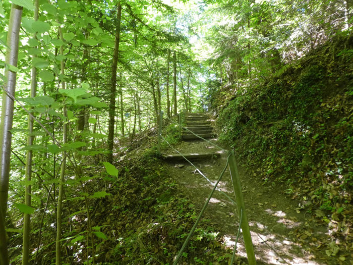
| At times, stairs rise like benevolent sentinels, offering respite to weary walkers, while the trail soon emerges from the dark woods to embrace a more peaceful route. |
 |
 |
| However, the Via Jacobi, true to its nature, forsakes the road to proudly slope up on a wide dirt path, climbing the heights to the place known as Stattligturm, under the scattered dwellings of the large commune of Gwatt. |
 |
 |
| An adorable little trail then presents itself, gracefully winding through the meadows. In the distance, the city of Thun and its castle, a majestic pearl nestled at the end of the lake, offer a vision of grace and gentleness. |
 |
 |
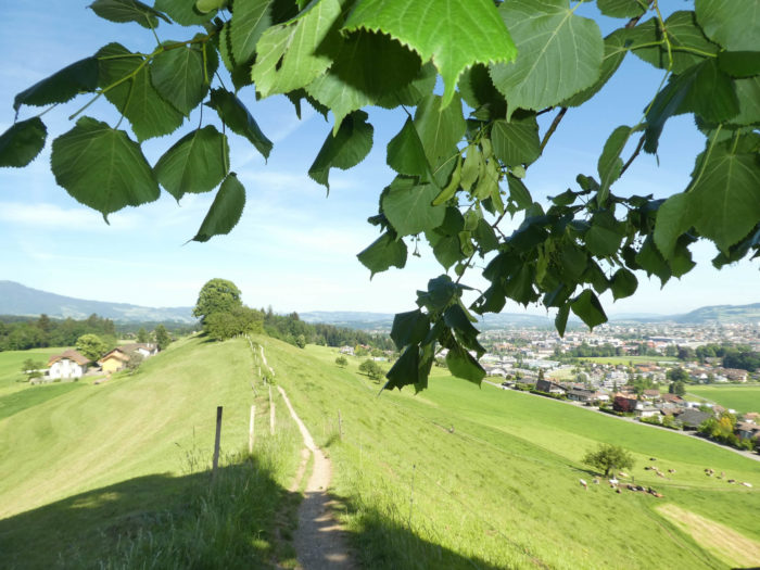
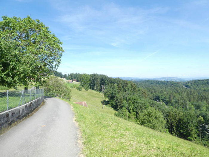
| Here grow tall hornbeams, so rare in these Swiss regions where beeches reign supreme. The trail travels along the ridge, overlooking Gwatt, one of Thun’s suburbs, like a green thread woven by nature’s own hands. |
 |
 |
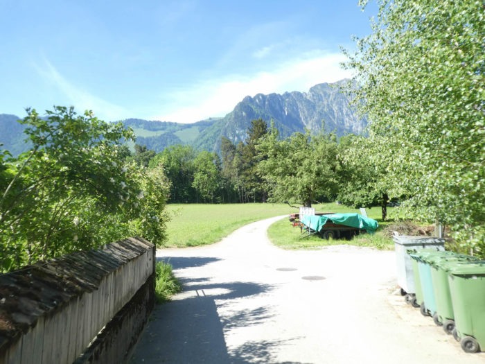
| To the left of the trail, the foothills of the Bernese Alps stand proudly, their lofty peaks reaching for the sky. Soon, the trail reaches the end of the ridge, preparing to descend the hillside. |
 |
 |
| And so, in a graceful ballet, it descends from the ridge to pass by the place known as Gwategg, just steps from Gwatt. |
 |
 |
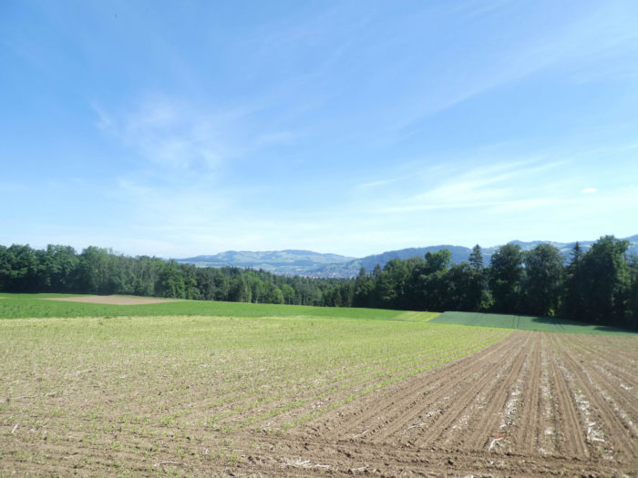
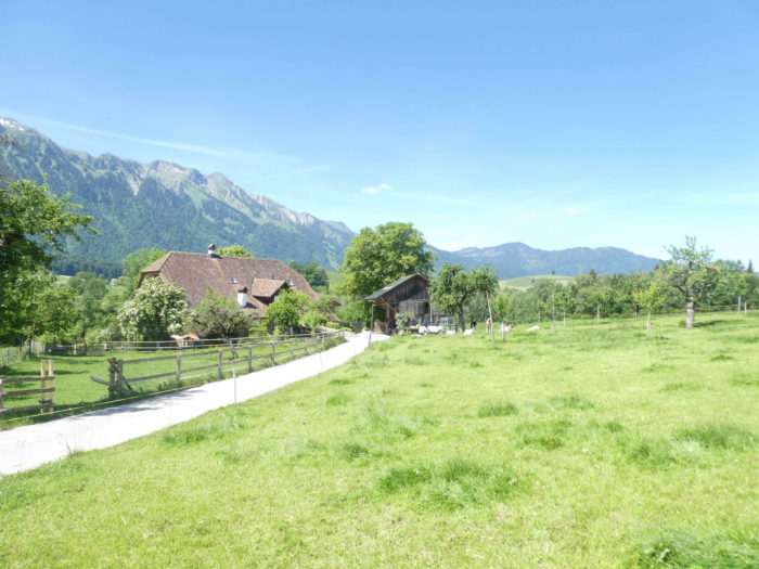
Section 3: Over hill and dale in the Bernese countryside

Overview of the route’s challenges: a few uphill passages before finding an easier route.

|
A broad dirt road then descends towards a grove, home almost exclusively to slender, tall beech trees. The atmosphere is adorned with a gentle tranquility under the beeches standing like immutable sentinels, silent witnesses to the passage of time and seasons. Each step resonates like a symphony of leaves rustling under your feet, pacing your progress.
|
 |
 |
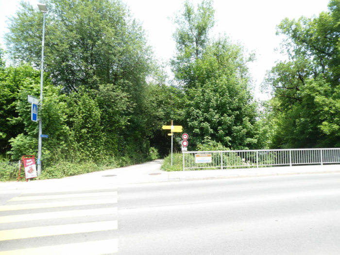
| Beyond the grove, the Via Jacobi crosses the highway connecting Interlaken and Bern. Like a silver thread stretched between two worlds, the Via Jacobi gracefully crosses the vital artery of the highway, symbolizing the marriage between modernity and tradition, between urban tumult and the tranquility of ancestral paths. Ash trees stand here and there, a rather discreet species in Switzerland. |
 |
 |
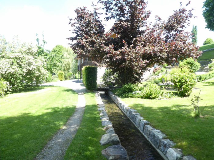
Shortly after, the Via Jacobi passes by the place known as Alti Schlyffi, where it crosses the Glütschbach stream. Here, you are a good hour’s walk from Amsoldingen, the most important village in the region, the bastion of local life. The water gently murmurs its crystalline song as the Via Jacobi humbly bows before the immutable beauty of nature.
|
 |
 |
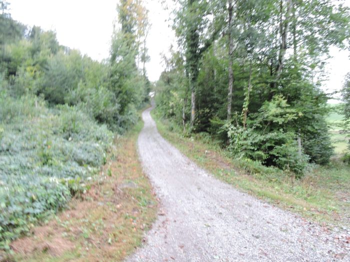
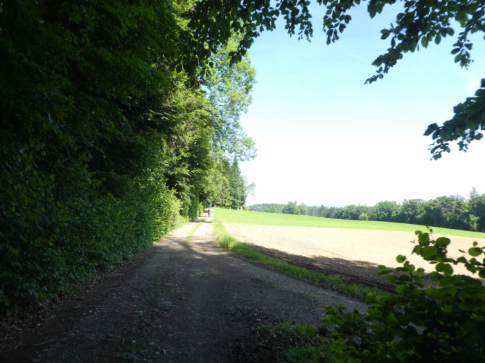
| Then, the Via Jacobi lingers very little on the road. Like a contemplative wanderer, it quickly abandons the asphalt to venture onto a winding dirt path, gracefully sloping up through the leafy foliage. |
 |
 |
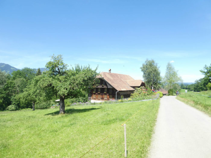
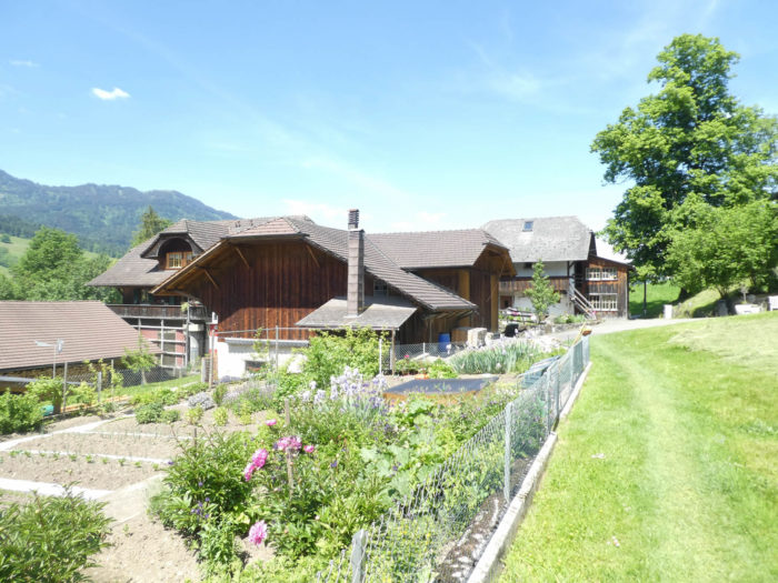
| The dirt road runs higher near the first farms of Bodmatt. The farms seem to emerge from the landscape like relics of a bygone era. The light caresses the wooden facades, revealing their authentic soul. You could easily believe that time, captivated by the magic of these places, has frozen in an eternal embrace, capturing the very essence of picturesque rurality. But this would be to misunderstand the true essence of Bernese rural architecture: it transcends museum-like stasis to breathe palpable life into every stone, into every century-old beam. These old homes, silent witnesses of the past, still beat with the rhythm of daily activity, vibrating to the rhythm of the seasons and agricultural labors that shape the soul of these lands. |
 |
 |
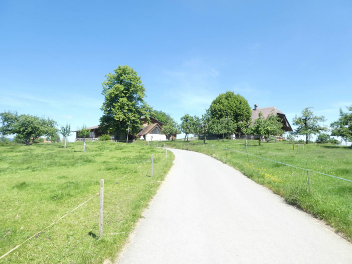
| The entire crossing of these farms is on a steep slope, amid meadows and a few fruit trees. Each step is an ascent towards the horizon, each breath an ode to the life that pulses at the heart of the wild nature. |
 |
 |
| A bit further up, the beaten earth gives way to tarmac near the beautiful houses at the exit of Bodmatt. The houses seem to silently watch over this enchanting landscape. |
 |
 |
| There, the small road joins the main artery leading towards Amsoldingen, blending harmoniously into the rural landscape where houses, witnesses of peasant labor, dot the path with their welcoming facades. |
 |
 |
| The Via Jacobi then follows the road on a gentle slope among the houses, crossing a living tableau where the houses, symbols of human activity, blend into the landscape like pieces of a rural puzzle. Traffic is gentle on the axis. |
 |
 |
| Further on, it leaves the road for a path that slopes down into the forest. Like a solitary heroine venturing into the meanders of the unknown, the Via Jacobi turns away from civilization to better blend into the mysteries of the wild nature. |
 |
 |
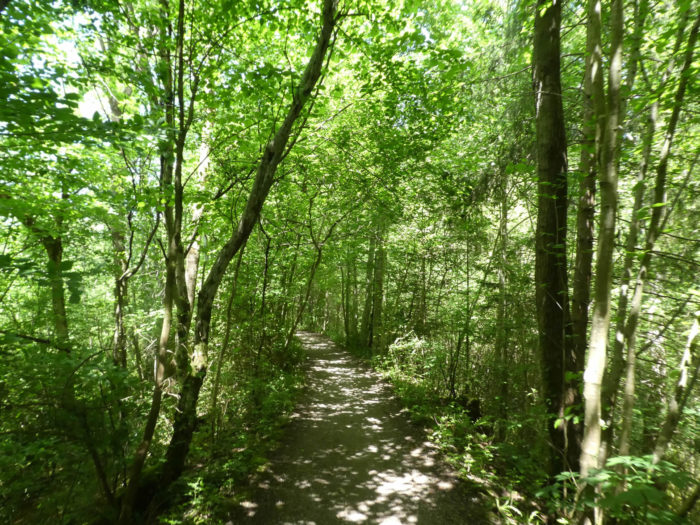
| The forest here is magnificent, restful. Maples compete in height and breadth with venerable beeches. The trees create a play of light and shadow dancing on the mossy ground. |
 |
 |
There is no doubt. You are on the right path, although the presence of the scallop shell is very rare on the Camino de Santiago paths in Switzerland. Like a divine sign, the scallop shell timidly reveals itself on the trail, offering lost travelers a glimmer of hope in the darkness of the unknown. Its ephemeral presence testifies to the long history of pilgrims who have trodden these lands.

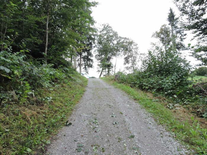
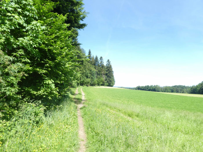
| Further on, the path exits the woods into the meadows and advances along the trees, where numerous hazelnut trees are noted among the spruces, deciduous trees, and hornbeam shoots. |
 |
 |
| You might hear gunshots in the area. No, they are not hunters; they are military personnel from the major fortress of Thun practicing shooting in the forest below. It makes noise, like war. |
 |
 |
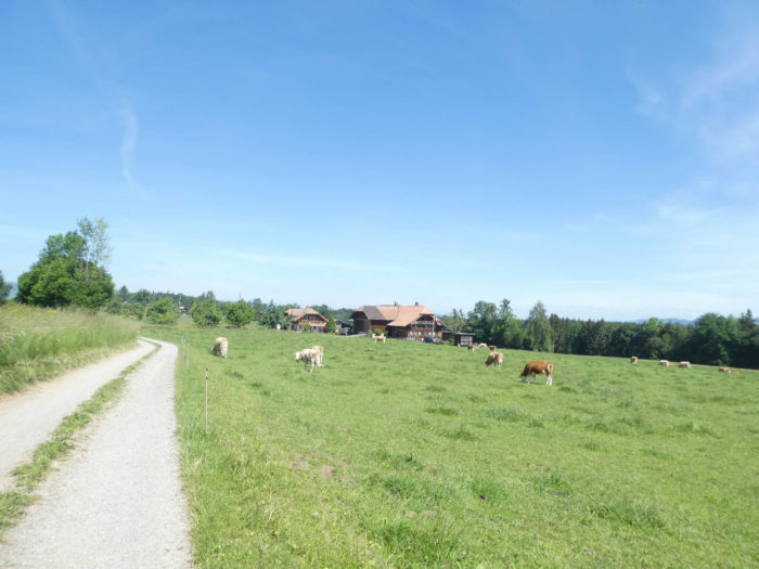
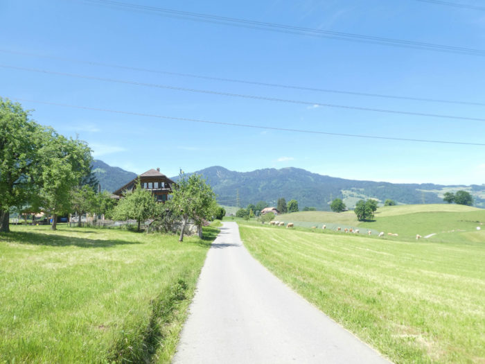
| Further on, the Via Jacobi leaves the woods and runs through the hamlet of Tannacher in the middle of the Simmental. These cows do not always have the same color, and the coat can vary from white to brown. The people here are undoubtedly true patriots, and it is very common to see a large Swiss flag planted in front of the farm. Like a living painting, the wooden houses cling to the hillside like so many precious jewels. |
 |
 |
| Here, you are just a stone’s throw from Amsoldingen, and tarmac replaces the beaten path at the hamlet of Aarbach. |
 |
 |
| This corner of the country is real countryside. Soon, the bell tower of Amsoldingen appears on the near horizon. |
 |
 |
Section 4: Meadows, cows, and lakes, such is the agenda

Overview of the route’s challenges: an easy route.

|
The road resolutely snakes through the meanders of the outlying neighborhoods of Amsoldingen, a tranquil village home to some eight hundred souls. These peripheral quarters, still infused with the freshness of their youth, bear witness to the transformation wrought by the massive influx of commuters, stealing from the community its ancestral heritage, between agricultural lands and artisanal know-how.
|
 |
 |
|
At the heart of this village, wooden houses stand proudly, silent witnesses of an age-old past. Their mysterious aura defies time, resisting any attempt at precise dating. For those who take the time to linger, the village restaurant offers a delightful interlude, where fondue, a true institution, delights the most demanding palates. As for the cheese dairy, it exhilarates the senses with its dairy treasures, vividly reminding us that the peasant soul still vibrates here.
|
|
|
| The imposing St Maurice collegiate church, a secular guardian of buried secrets, reveals to those who know how to look the remnants of a thousand-year-old church, born in the breath of the 7th century. A witness of a bygone era, it majestically stands, rooted in its history, within a harmonious ensemble where castle and agricultural buildings blend. The interior, imbued with mystery, unveils the stigmas of a long metamorphosis, the permanence of a glorious past. |
 |
 |
| Continuing its journey, the Via Jacobi blends into the landscape, glancing at the old wooden houses, like sentinels of the past, guardians of the secrets buried in their centuries-old beams. The blackened slats, worn by time, testify to the incessant labor of past generations, while the flowers on the balconies, bursting with colors, offer a striking contrast to the sobriety of the wooden planks. Through the narrow windows, barely wide enough to let daylight filter through, curious souls seem to spy, captivated by the stories whispered by the ancient walls. Each shutter, each board, bears the scars of time, as silent witnesses of the joys and sorrows that have marked the life of these homes. And yet, despite the ravages of time, they retain an indomitable beauty, a mysterious aura that irresistibly attracts the gaze of amazed passersby. It’s pure magic. Each house seems to whisper the history of these lands, silent witnesses to the relentless labor of the men who built them. Even the most recent ones, marked by discreet modernity, are already donning the vestiges of the past, in a surprising alchemy between tradition and innovation. |
 |
 |
 |
 |
| At the village exit, around a bend, Lake Amsoldingen is barely glimpsed, a discreet mirror nestled in the heart of immutable valleys, a faithful guardian of the secrets buried in its tranquil waters. Sometimes, patches of wheat brighten the monotony of the meadows, offering an ephemeral palette of colors to this timeless landscape canvas. |
 |
 |
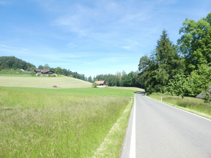
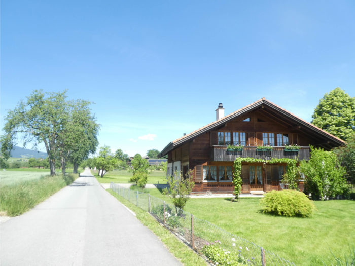
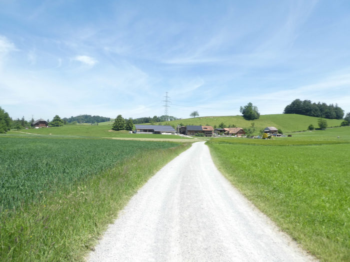
| And the road unfolds, like a serpent, between the verdant meadows and the opulent farms that dot the countryside. The wooden houses, jewels of local craftsmanship, emerge from the greenery like fairies asleep in the forest. Their richly carved facades are like pages of a book open to the past, inviting the traveler to dive into the meanders of history. Each window appears as an invitation to dream, each beam a caress for the soul in search of authentic beauty. Each farm, like a sanctuary of agriculture, seems to watch over its territory with ancient benevolence, a living symbol of an ancestral heritage that refuses to be extinguished. |
 |
 |
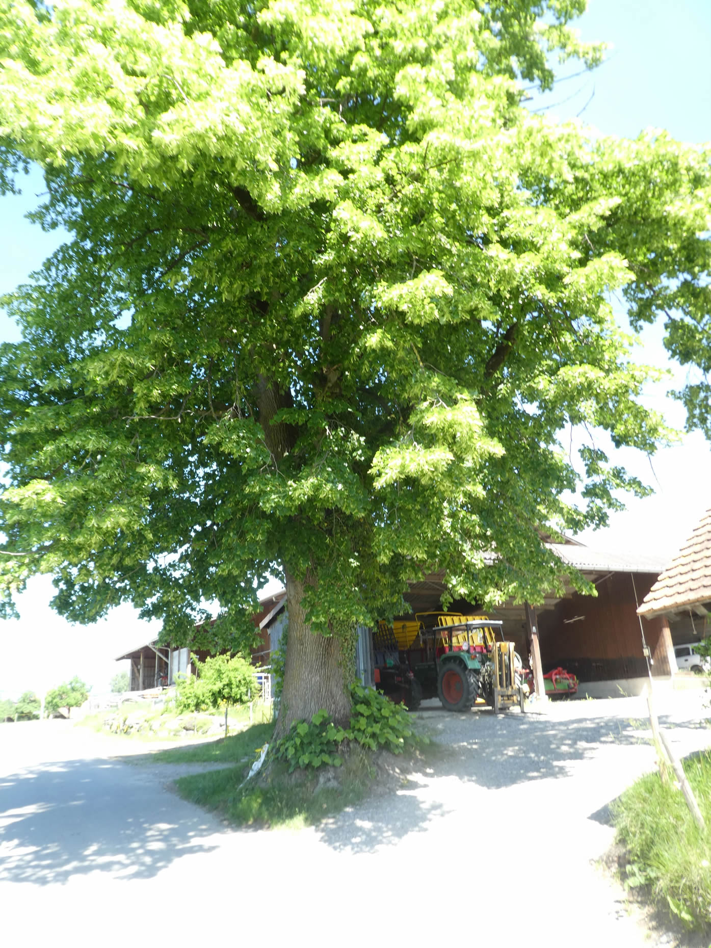
Here, under the protective shadow of an ancient lime tree, time seems suspended, as if frozen in the gentle embrace of nature. The farms, with their characteristic overhangs, evoke a glorious past, where man and earth were one, in perfect harmony. Every detail, every stone, tells a story, thus perpetuating the enchanting charm of this vernacular heritage, yet still relevant today.
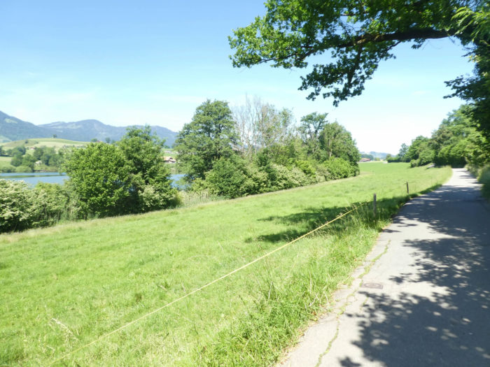
| Soon, the Via Jacobi approaches Uebeschi, and the road skirts the shores of the eponymous lake, a tranquil mirror reflecting the serenity of its surroundings. |
 |
 |
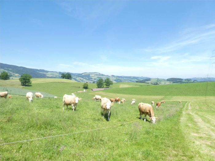
| There, on this generous land, where only meadows seem to have a right of way, the cows graze peacefully, in perfect communion with their environment. Here, cows must primarily eat grass, not corn. |
 |
 |
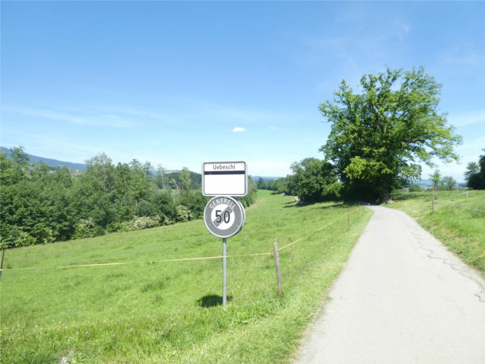
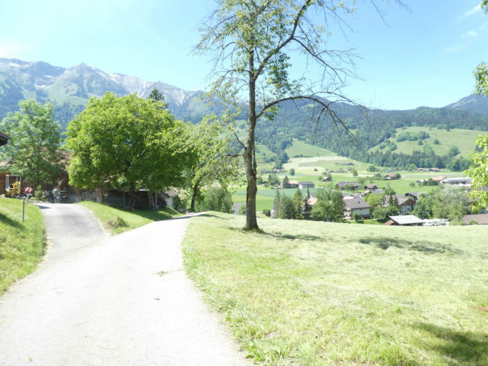
| And thus, the landscape opens up, like a grand tableau unfolding its vibrant colors, onto an endless plateau where only the meadows ripple, under the caress of the wind. Uebeschi, a modest village with the air of the end of the world, looms on the horizon, blending traditions centuries old and discreet modernity with harmony. |
 |
 |
| It’s a smaller village than Asmoldingen, more compact, with ancient farms, but also new houses. Here, too, some residents must work in Thun, or even Bern. |
 |
 |
| Now, the road slopes up, like an offering to the hill that encloses it, bravely climbing steep slopes at the edge of the village. |
 |
 |
Section 5: Meadows, cows, and streams define the new agenda
Overview of route’s challenges: a route without challenges.

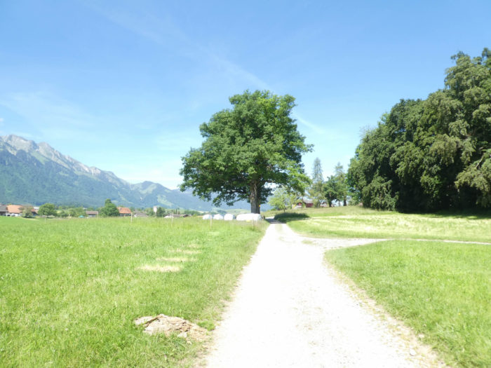
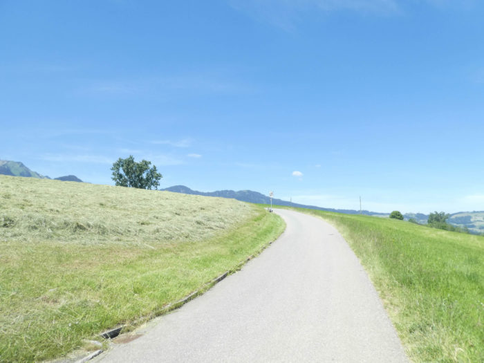
| Upon leaving Uebeschi, a slender road escapes towards the countryside. Let’s indulge in some statistics for the pleasure of being in the countryside. The Canton of Bern alone boasts nearly a quarter of the agricultural holdings (11,000 out of 55,000) and dairy cows (123,000 out of 587,000 in the country. By comparison, Geneva has less than 1,000 cows! |
 |
 |
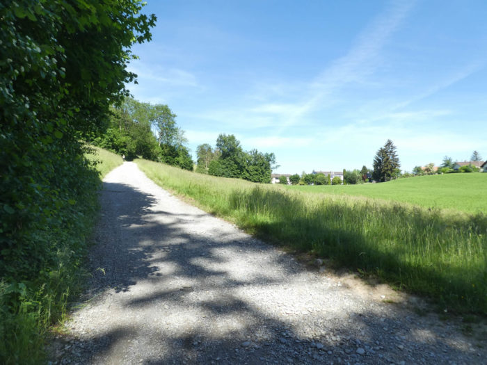
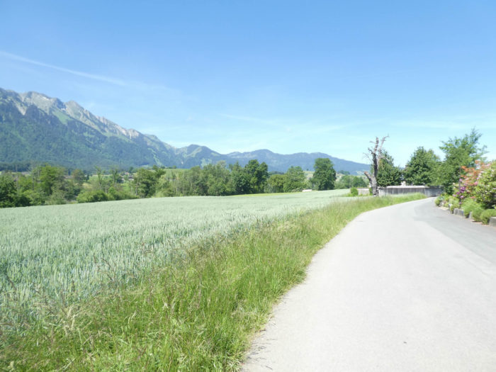
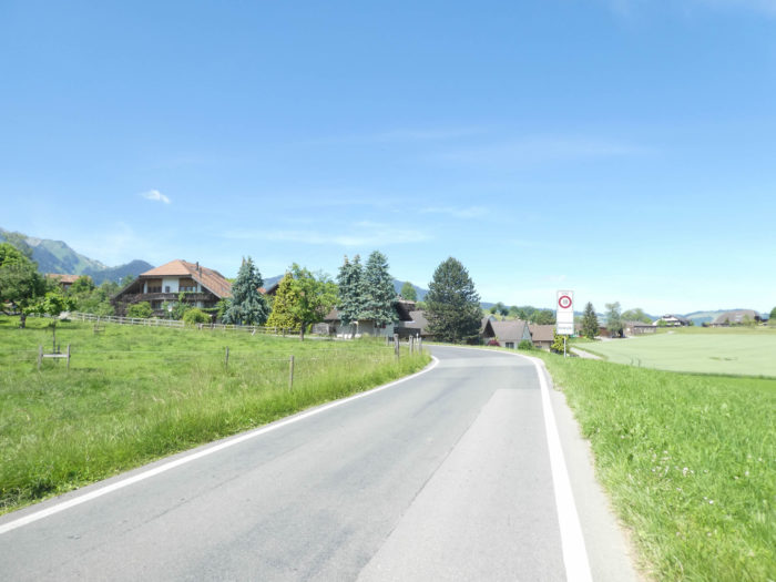
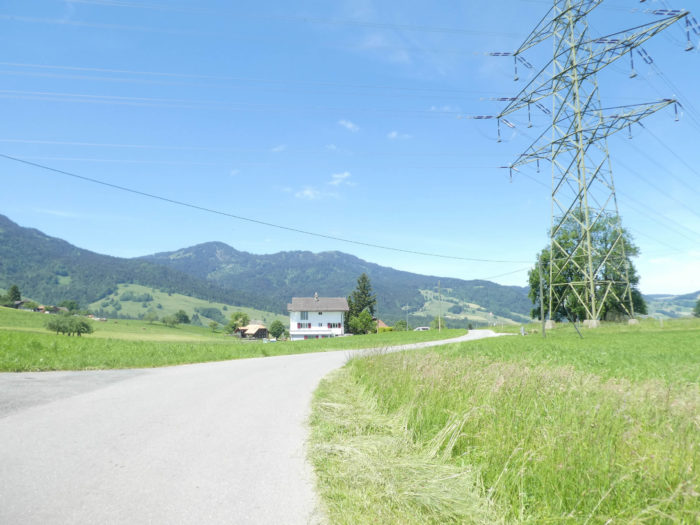
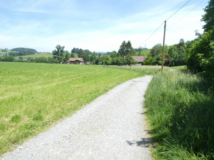
| The road, timid under scrutiny, curves gently through fertile lands where Simmental cattle graze peacefully and farms stand majestically like sentinels of tradition. The verdant hills beckon travelers. Fruit trees occasionally reach towards the sky, dotting the hills with their green presence where farms blend seamlessly into the distant horizon. |
 |
 |
| Honegg, like a jewel in the landscape, soon reveals itself, a half-hour walk from Blumenstein. |
 |
 |
| Further on, the road delves into the dale, as if to merge more fully with the generous earth that surrounds it. |
 |
 |
|
The farms of the Schubhus area stand proudly, showcasing the prosperity and solidity of Bernese agriculture. Misery is a foreign word in this canton, where even modest operations exude abundance.
|
 |
 |
| As the Via Jacobi heads towards Bühl, path and road echo each other, guiding pilgrims’ steps towards new horizons. The hills become gentler, meadows stretch as far as the eye can see, while the scattered farms in the landscape seem to watch over this rural paradise. |
 |
 |
In these picturesque hamlets, time appears to stand still, as farms gracefully neighbor bourgeois dwellings of yesteryear, silent witnesses of an era still relevant today. Traditional houses with colorful shutters line the narrow streets, their flowered gardens perfuming the air with delicate fragrances. The surrounding farms, sturdy and welcoming, bear witness to the hard labor of generations of farmers, their rustic architecture blending perfectly with the surrounding nature.
|
 |
 |
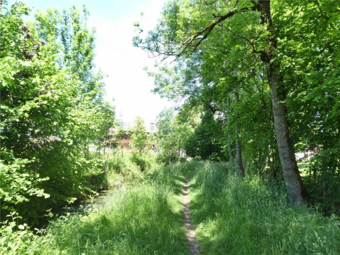
| Shortly thereafter, a trail plunges into lush vegetation, mingling with the murmurs of the Fallbach stream that faithfully accompanies it on its winding course. |
 |
 |
| The walk takes on an enchanting air along the stream, until the first houses of Mühle begin to appear on the horizon, offering their bucolic charm to walkers. |
 |
 |
| Here too, beauty is the rule, with a collection of remarkable houses, sometimes adorned with geraniums at the windows, thus brightening the landscape with their colorful brilliance. |
 |
 |
| The walk extends along the stream, alternately wild and soothing, until reaching Blumenstein, where history merges with the murmur of the waters. |
 |
 |
| At the entrance to the village, the Via Jacobi crosses the stream, offering travelers a view of its spires, discreet symbols of a faith rooted in tradition. |
 |
 |
| When you see pinnacles in the canton of Bern, they are most often administrative buildings. You are in a Protestant country and churches are rarer than temples. |
 |
 |
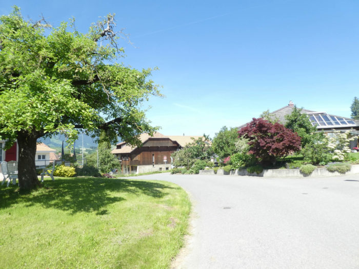
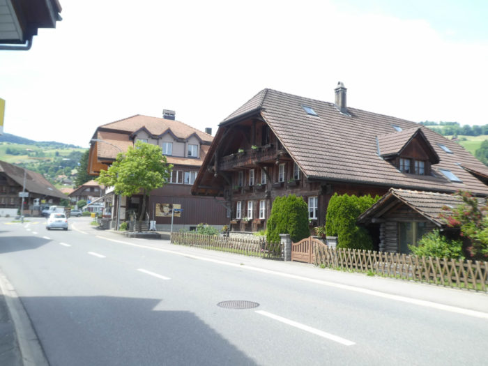
| The village crossing reveals architectural treasures, while the Via Jacobi, a faithful companion to the stream, marvels at an extraordinary house, a testament to urbanism preserved from the ravages of time. In these Bernese regions, the imprint of progress has not altered the authentic beauty of the places, thus preserving the peasant soul despite the proximity of the city of Thun. |
 |
 |

| Exiting the village, the Via Jacobi briefly follows the road towards Wattenwil, but at the location known as Blumenstein Bad, it opts for the dirt path, offering walkers a new perspective, where simplicity blends with the grandeur of the surrounding nature. |
 |
 |
| Further on, the Via Jacobi’s love for the stream reveals itself again, guiding it to cross the Fallbach once more, whose peaceful waters caress the small plain where ash trees stand as sentinels. |
 |
 |
| Here, in this land where meadows and cows reign supreme, corn is rare, a sign of a tradition preserved despite the evolutions of the modern world. The farms, sometimes touched by modernity, nevertheless retain their ancestral character, living symbols of a history rooted in the Bernese land. |
 |
 |
Section 6: Riverside walk

Overview of the route’s challenges: The route presents no difficulties.

|
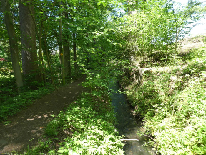
The dirt trail gradually approaches a grove, with every step seeming like an invitation into a separate world filled with mystery and promise. Trees crowd around the path as if curious spectators witnessing an ancient and timeless scene. The murmur of the Fallbach, lost in the verdant twists of the bushes, accompanies the traveler in this fairy-tale dance. Here, everything breathes serenity—the tranquil grandeur of majestic beeches, generous maples, protective oaks, and sometimes spruces standing tall like sentinels.
|
 |
 |
|
Upon entering the grove, the path crosses the Fallbach one final time before getting lost in the meanders of the Gürbe, a more imposing river that seems to have sculpted the landscape over the centuries. Its tumultuous waters echo from afar, a reminder of the power of untamed nature.
|
 |
 |
| The forest then unfolds in all its splendor, offering a breathtaking spectacle. Each leaf appears to tell a story, every branch whispers an ancient secret. Sunbeams filter through the canopy, creating a mesmerizing play of shadows and light. Each step resonates as a tribute to this generous nature, to the symphony of greens and browns composing the living tableau stretching as far as the eye can see. |
 |
 |
The muted sound of a river amplifies, and the path soon skirts the Gürbe. It’s as if the watercourse emits an enchanting song, inviting the traveler to dive into its tumultuous waters. Each glint of light on the waves seems an invitation to adventure, to discover what lies beyond the horizon.
|
 |
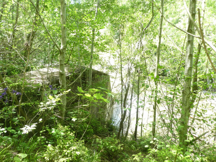 |
| Exiting the grove, the path reaches the Sägerei (sawmill), where a wooden bridge appears suspended between sky and earth. It is a structure both ancient and modern, a testament to ancestral craftsmanship combined with the latest techniques. The river’s tranquil course contrasts with the vigor of its history, reminding the traveler of the fragility and strength of passing time. |
 |
 |
Here, in this haven of tranquility, the Gürbe presents itself differently. While just a modest waterfall at this spot, it reveals its power in the heights of the Gantrisch, where it cascades dramatically from the mountain summits. Its winding course, marked by numerous dams, attests to its indomitable force, its ability to shape the landscape at its whim. Upstream, hikers gather to behold its majesty, to lose themselves in its fascinating meanders.

| Here, you are merely two steps away from Wattenwil, less than 30 minutes. Then, a pleasant and easy path runs flat along the river through the deciduous grove. Occasionally, the river cascades over stones. Each step unveils a new panorama, a new aspect of this wild and preserved nature. |
 |
 |
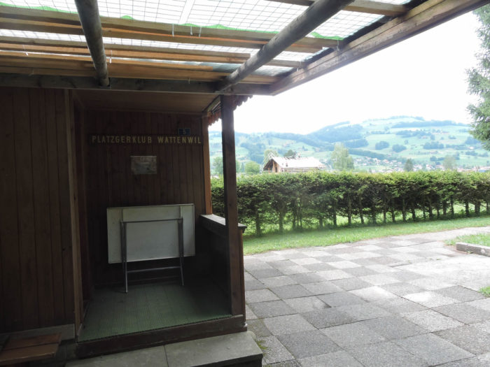
| The path passes in front of the platzgen club, where players engage in an ancient sport, symbolizing the region’s cultural richness. In the distance, the outlines of Wattenwil gradually emerge, evoking a village that is both near and far, familiar and mysterious. |
 |
 |
| The path then gradually approaches the village. Each step seems to be one more towards discovery, towards the unknown that looms on the horizon. |
 |
 |
| You leave behind the gentle murmur of the river as the dirt road joins the main road at the village entrance. It’s as if the traveler is leaving behind a dear friend, promising to return soon to hear its familiar voice again. |
 |
 |
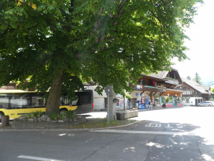
| A few beautiful patrician houses are present in the village (2,850 inhabitants). However, there is not much to see or do here. The village is less elegant than those we have passed through before. It is just more functional, with shops. The only difficulty is related to available lodging. There is no longer accommodation at the hotel, which is now only a restaurant. There are only two guesthouses in the village, and another 1 kilometer further on, after a serious climb. Therefore, make your arrangements in advance if you do not wish to sleep under the stars. Fortunately, few pilgrims cross Switzerland. But if the Way of St. James in Switzerland were to develop further, there is still much work to be done to provide walkers with accommodations. |
 |
 |
Accommodation on Via Jacobi
- Rosmarie et Walter Loosli, Höhenstrasse 75, Einigen; 033 654 34 73/079 659 44 73; Guestroom, dinner, breakfast
- B&B Andreas Habegger, Bühl 59, Zwieselberg; 033 657 25 29/ 079 257 68 02; Guestroom, breakfast
- Sonja Allenspach, Unerre Gasse 55, Zwieselberg; 079 526 37 38; Guestroom, dinner, breakfast
- B&B Dora Keller, Dorfstrasse 20, Amsoldingen; 033 341 17 64/079 227 36 64; Guestroom, breakfast
- Rosmarie Hirschi, Waldeweg 3, Amsoldingen; 033 341 12 77/079 762 50 43; Guestroom, dinner, breakfast
- Erich und Marianne Liechti, Steghalten 22, Amsoldingen; 033 841 16 24; Guestroom, dinner, breakfast
- Gasthof Kreuz, Amsoldingen; 033 341 11 60; Hotel, dinner, breakfast
- Mathilda Abegglen, Untermosi 96, Uebeschi; 033 345 63 28/079 516 57 11; Guestroom, breakfast
- B&B Berger, Lidenbühl 164, Uebeschi; 033 345 77 85/077 418 64 90; Guestroom, dinner, breakfast
- Camping Platz, Badstrasse 26, Blumenstein; 033 356 21 54; Camping, breakfast
- B&B Jozefina Trachsel, Wäsemligasse 3, Blumenstein; 033 356 05 83; Guestroom, breakfast
- B&B Casa Sotero, Riedbachstrasse 1, Blumenstein; 033 356 29 29; Guestroom, breakfast
- Evelin Winzenreid, Allmedstrasse 16, Blumenstein; 078 744 01 85; Guestroom, breakfast
- B&B Zbinden-Bähler, Wäsemligasse 7, Blumenstein; 033 356 16 09; Guestroom, breakfast
- Gasthof Bären, Bärenstutz 5, Blumenstein; 033 356 46 36; Guestroom, breakfast
- B&B Künzi, Hofmattweg 2, Wattenwil; 033 356 19 09/079 660 11 27; Guestroom, dinner, breakfast
- B&B Gerber, Gmeissstrasse 4, Wattenwil; 033 356 17 15; Guestroom, breakfast
- Brigitte Liechti, Burgisteinstrasse 5a, Wattenwil; 033 356 12 34/079 734 58 60; Guestroom, breakfast
Finding accommodation along the route before Wattenwil is not particularly difficult. However, the situation in Wattenwil is quite tricky. It is the most challenging stage for finding lodging on the Via Jacobi 4. It is mandatory to make a reservation, or alternatively, to stop before or after Wattenwil.
Feel free to add comments. This is often how you move up the Google hierarchy, and how more pilgrims will have access to the site.
|
 |
Next stage : Stage 12: From Wattenwil to Schwarzenburg |
|
 |
Back to menu |