Another medieval jewel
DIDIER HEUMANN, ANDREAS PAPASAVVAS
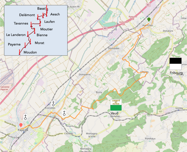
We divided the course into several sections to make it easier to see. For each section, the maps show the course, the slopes found on the course, and the state of the route (paved or dirt roads). The courses were drawn on the « Wikilocs » platform. Today, it is no longer necessary to walk around with detailed maps in your pocket or bag. If you have a mobile phone or tablet, you can easily follow routes live.
For this stage, here is the link:
https://fr.wikiloc.com/itineraires-randonnee/de-avenches-a-payerne-par-oleyyres-et-belmont-99883019
| It’s clear that not all travelers are comfortable using GPS and navigating via smartphone, and there are still many areas without an internet connection. As a result, you find a book on Amazon that covers this journey.
If you only want to consult lodging of the stage, go directly to the bottom of the page. |
|
After crossing the remnants of Roman civilization, let’s jump forward several centuries and stop in front of the imposing cathedral of Payerne, a witness to another era. Shortly before the year 1000, the religious life of the region blossomed under the influence of the royal family of Burgundy. Thanks to their support, the Payerne community became attached to the prestigious Benedictine monastery of Cluny, in France, a major spiritual and cultural center of the time. It was in the heart of the 10th century that a majestic Romanesque church rose on these lands. Its carefully cut stones stood as a monument of devotion, with each century adding its touch—a stone, a chapel, a bell tower. The church was thus embellished, transformed, and rebuilt over the centuries, reflecting changes in style and eras. But in 1536, the Reformation swept through Payerne, forcing the monastery to close its doors. This marked the beginning of a long transition period during which the Abbey Church was used for civil purposes, far removed from its original vocation. It wasn’t until the late 19th century that the perception of this monument changed, rediscovering its past grandeur. Classified as a historical monument in 1900, it was carefully restored during the 20th and 21st centuries, with the latest restoration completed just a few years ago. Today, it is considered one of the jewels of Romanesque art in Europe, bearing centuries of history and memory.
As mentioned earlier, the route from Murten (Morat), although not officially listed as part of the Via Jacobi trail, is marked, so you won’t risk getting lost. The Friends of Compostela have also developed a specific itinerary for this region, as no official Via Jacobi route passes through here. Up until Pra Graud, on the heights of Domdidier, the route poses no problem. However, beyond that, a variant is proposed, mainly following the road, though poorly marked, to say the least. Instead of venturing onto this uncertain route, we preferred to take a more scenic route, crossing an enchanting forest. Admittedly, you have to walk a bit along the road to reach it, but once in this green haven, the path transforms into a true escape. This wooded trail, with its thousand shades of green, leads you through tranquil clearings and mysterious undergrowth. Just before Belmont, you’ll find the original route of the Friends of Compostela, allowing you to continue your journey.
We will therefore continue to call it the « Three Lakes Trail » up until Moudon.
.
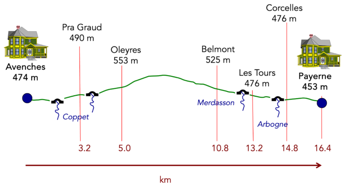
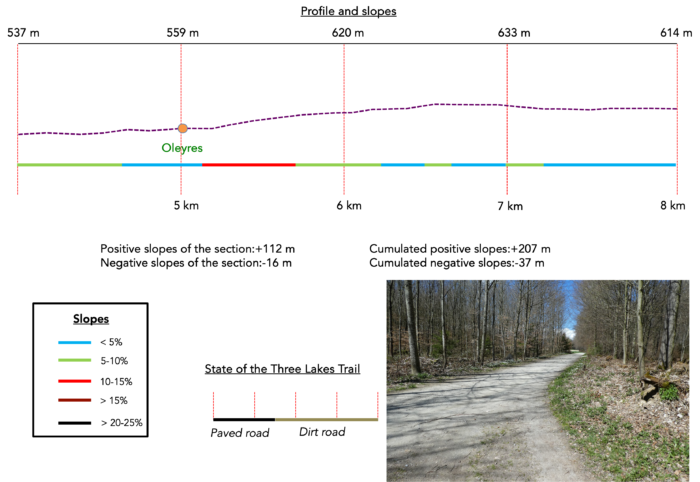
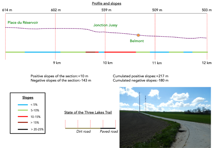
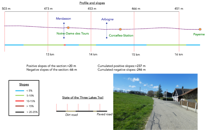
Difficulty level : Today’s elevation changes (+237 meters / -246 meters) are minimal. The notable challenge is the climb via Oleyres towards the forest.
State of the Three Lakes Trial : Once again today, asphalt dominates:
- Paved roads: 9.0 km
- Dirt roads : 6.4 km
Sometimes, for reasons of logistics or housing possibilities, these stages mix routes operated on different days, having passed several times on these routes. From then on, the skies, the rain, or the seasons can vary. But, generally this is not the case, and in fact this does not change the description of the course.
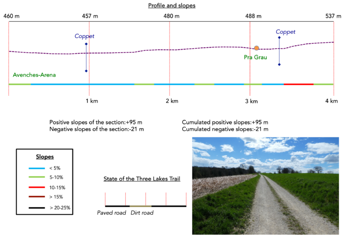
It is very difficult to specify with certainty the incline of the slopes, whatever the system you use.
For those seeking « true elevations » and enthusiasts of genuine altimetric challenges, carefully review the information on mileage at the beginning of the guide.

Section 1 : In the hills of Avenches
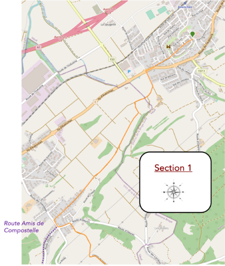
Overview of the route’s challenges : a course with no major difficulties.
|
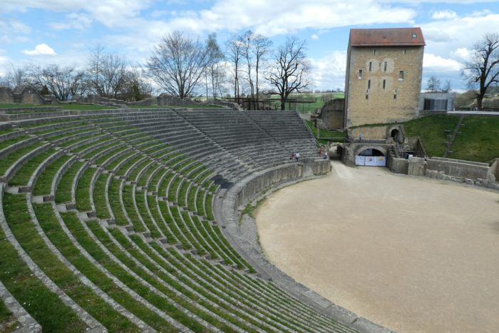
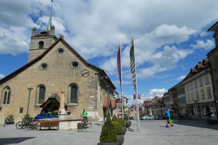
Today, you set out from the historic heart of Avenches, where the church stands proudly near the ancient amphitheater, evoking a glorious past. This place seems frozen in time, imbued with a solemnity that only centuries can bestow. |
|
 |
 |
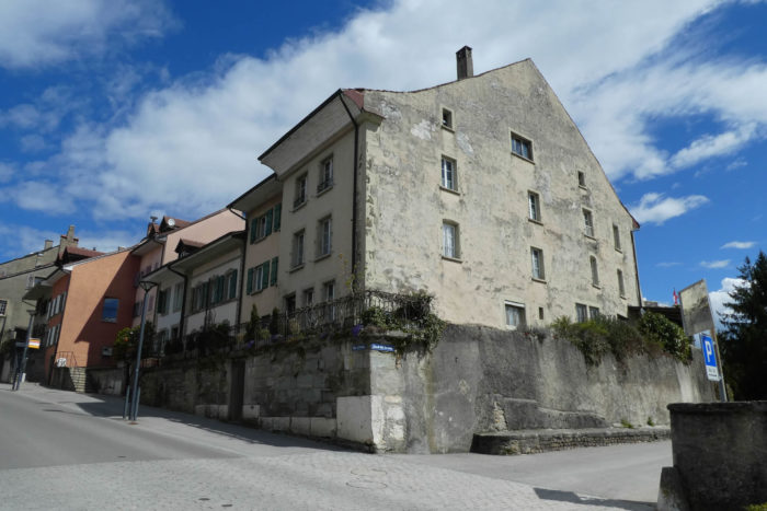
| Avenches perches on a promontory above the plain. You begin your descent down Rue de Lausanne, lined with patrician houses whose imposing facades attest to past and present prosperity. These residences, despite their apparent austerity, whisper the secrets of generations of notable figures who have shaped the city’s soul. |
|
 |
 |
 |
 |
As you descend the hill, the city gradually recedes, revealing RN1, a modern artery that contrasts with the tranquility of the surroundings. It leads you to a roundabout, a prosaic space where, contrary to expectations, no Corinthian or Doric capitals evoke Roman grandeur. Here, everything is almost disconcertingly simple.
| Suddenly, a small road veers off at a right angle, winding towards a discreet hill. It gently follows the Chandon stream, a timid watercourse that seems to slumber, rocked by the unchanging rhythm of the seasons. In this plain, the Chandon is a silent witness to the passage of time, calm and serene. | |
 |
 |
| After crossing the stream, the road climbs again, forming a straight line through lush meadows. It gradually moves away from the outskirts, inviting you to a peaceful ascent, like an escape from urban constraints. | |
 |
 |
| A broad dirt path slopes up gently, winding peacefully for nearly a kilometer, crossing the verdant meadows overlooking the hill dominating Domdidier. The ascent is tranquil, and the trail, only slightly rocky, stretches almost in a straight line across the hill, offering a pleasant progression. | |
 |
 |
 |
 |
| As you advance, the path remains soft underfoot, the earth smoothed by the steps of those who have walked it before you. It seems never to twist, maintaining its course with a straightness that soothes the mind. | |
 |
 |
You have momentarily traversed the canton of Vaud, an old Protestant stronghold, passing through Avenches. Here, the route brings you back into Fribourg territory, and with this return, crosses reappear, symbols of an unchanged faith. But it will only be a brief passage in this canton, which is an enclave within the canton of Vaud.
| Higher up, a plateau emerges on the horizon, indicating the presence of residential buildings. Along with them, asphalt makes its reappearance, reminding you that modernity is never far away. | |
 |
 |
| The road then continues along the ridge, winding between small villas that overlook the village of Domdidier, nestled in the plain below. Domdidier, a modest Fribourg enclave, subtly weaves into the canton of Vaud, serving as a discreet witness to the interlacing of territories. | |
 |
 |
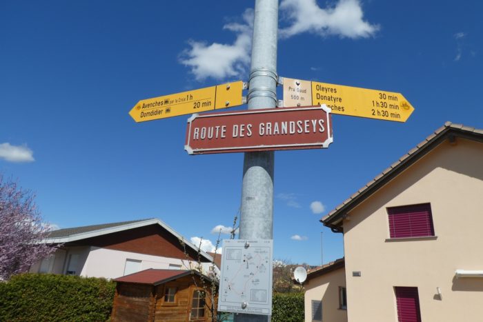
| You arrive at the location known as Pra Gaud, a strategic crossroads with multiple directions. At this precise spot, several routes are available, with a sign indicating the various options, including one leading back to Avenches. However, your route will take you towards Oleyres. After climbing a few meters, you reach the roundabout marking the intersection of roads. | |
 |
 |
| The organizers of the Camino de Santiago suggest taking the road to the right, which leads to Les Granges and Russy. Fine! But no sign marks this route, and you will never truly know where you are headed. Moreover, this road is just a stretch of unremarkable asphalt. We therefore recommend taking the left towards Oleyres. Although there is also asphalt to the village, the route then offers a beautiful crossing of magnificent paths through the forest overlooking the town. This route, though slightly longer, is much more pleasant and picturesque. The two trails eventually converge on the heights of Russy. | |
 |
 |
| Shortly after taking the road to Oleyres, you will need to turn right onto the Chemin de Saint-Georges, which climbs vigorously up the hill. | |
 |
 |
| From the start, the road crosses the Coppet stream, a discreet watercourse, before beginning a steady ascent. | |
 |
 |
| Chemin de Saint-Georges, a small paved country road, winds through the hills with a slope that is challenging yet entirely manageable. For over a kilometer, it guides you towards Oleyres, with its first houses soon appearing on the horizon, peeking above the landscape. | |
 |
 |
Section 2 : A beautiful walk through the forest
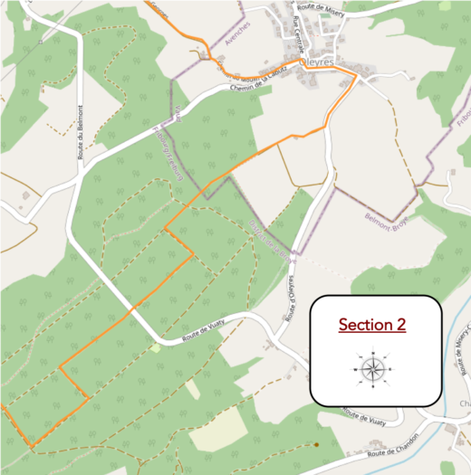
Overview of the route’s challenges : marked inclines on this section.
|
As you progress, you gradually approach the village, which seems to spread out across the verdant hills. Oleyres reveals itself in a rural tranquility, with its homes scattered across the countryside. |
|
 |
 |
|
After a few winding turns, the road eventually leads to the foot of the village. |
|
 |
 |
Here, the rustic charm of the countryside fully unfolds. Small houses and farms, untouched by time, rise modestly amidst the meadows, where cows graze peacefully on the hillside, just below the forest. The green of the meadows, vivid under the open sky, stretches as far as the eye can see.
|
Traversing the village, you discover a fairly extensive settlement, complete with its school, bell tower, and modest little church, all testaments to an ancient history. Once, in the Middle Ages, Oleyres was part of the Catholic parish of Domdidier. Mass was celebrated here until the end of the 16th century, after which the village was eventually annexed to the Protestant parish of Avenches, in the canton of Vaud territory. Here, geopolitical conflicts between cantons have always been intense, and even today, this place still bears the marks of that duality. A local restaurant, with a suggestive name, seems to promise a dream getaway, though it is rarely open, adding a touch of mystery to this small corner of the countryside. |
|
 |
 |
 |
 |
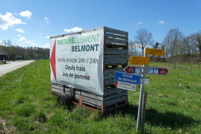
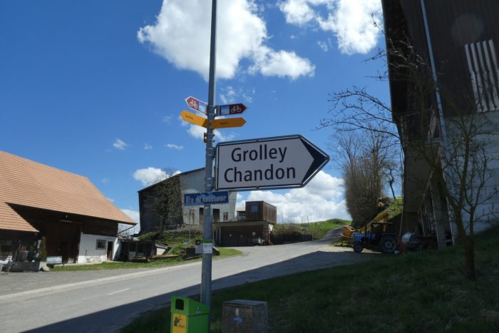
At this point in the route, you will need to head towards Payerne via Belmont. The sign indicates that Payerne is nearly three hours of walking from here.
|
You follow the road for a while as it heads towards Grolley. |
|
 |
 |
|
As you leave the village, the road gently climbs, with an incline of around 10%, winding between orchards and pastures where cows graze peacefully. In this region of the canton of Fribourg, the meadows are predominantly populated by Holstein cows, with their black-and-white or red-and-white coats. However, you are still in Vaud territory, but as the saying goes, only the cows will recognize their calves. |
|
 |
 |
|
The route does not stay long on the main road leading to Grolley. A small paved road branches off to the right, gently guiding you towards the forest. Here, directional signs stop mentioning Payerne, but fear not: there is only one path. You will not get lost in this vast forest, especially as the essential yellow markers, so characteristic of Swiss trails, ensure you stay on track. |
|
 |
 |
|
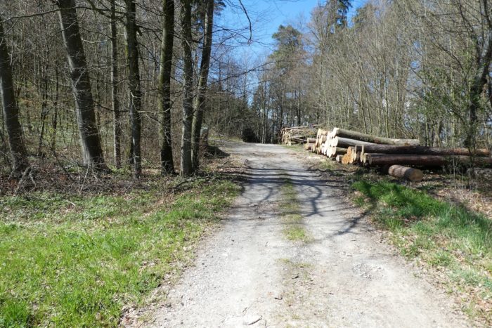
Soon, the asphalt gives way to dirt, marking the start of a new adventure. The path draws closer to the forest edge, ready to envelop you in its tranquility. You embark on a long walk of nearly three kilometers through the majestic Grand Belmont Forest. The path is remarkably well-marked, which is crucial, as numerous crossways used for timber harvesting could easily mislead you if you are not careful. |
|
 |
 |
|
From the first steps, an odd sensation takes over: that of entering a giant game of skittles. The beech trees, tall and imposing, stand before you like sentinels on a confusing track. Will you dare venture into this cathedral of trees, where each trunk seems to pray in silence, stretching its branches towards the sky? |
|
 |
 |
|
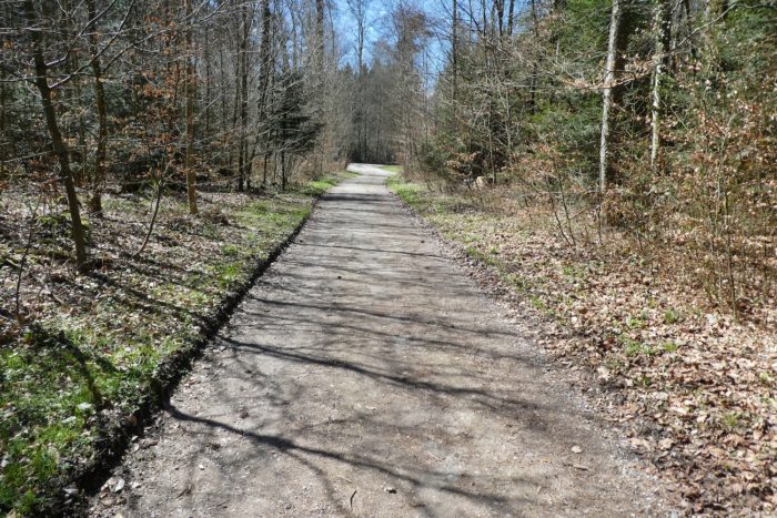
But soon, the tension eases. The path widens, offering a broader and more reassuring route. |
|
 |
 |
|
This path initially seems to stretch endlessly, though it frequently changes direction at right angles, requiring you to cross many forest roads. |
|
 |
 |
 |
 |
At times, the landscape is enriched by more robust vegetation. Majestic conifers appear: spruces, Douglas firs, and white firs, with trunks reaching vertiginous heights, sometimes retaining only a sparse tuft of branches brushing the sky.
|
Occasionally, the path becomes timider, sneaking discreetly between beeches and spruces, as if trying to escape notice. Timber harvesting is omnipresent here. Beech trunks, the kings of Swiss forests, litter the ground, accompanied by a few oaks, rarer but equally imposing. |
|
 |
 |
 |
 |
Through the forest tracks and wide logging avenues, the path meanders almost flatly under the protective shade of the trees. Here, the forest takes on an almost magical quality, its treetops conversing with the sky in a silent symphony.
|
In this enchanting setting, you quickly understand that the trees, so similar to each other, can easily disorient you. The paths themselves also seem identical, making it quite possible to get lost. Fortunately, the reliable Swiss yellow signs serve as your guide, like a reassuring companion. Never lose sight of them! |
|
 |
 |
 |
 |
Section 3 : From one forest to another as you descend towards the plain
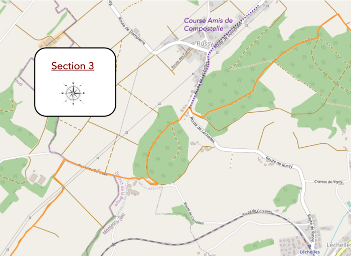
Overview of the route’s challenges : marked slopes on this section.
|
In this forest, transformed into a majestic beech grove, the tree trunks rise towards the sky, aligned with such precision that they resemble the columns of a vegetal cathedral. The path gradually widens, leading you to a clearing where the woods become sparser. |
|
 |
 |
|
Soon, the road becomes more accessible, almost car-friendly. A short stretch of asphalt appears, contrasting with the dirt track. At the end of this paved section, a small cabin timidly reveals itself at the other end, seemingly awaiting the rare visitors. |
|
 |
 |
 |
 |
|
The road eventually leads you to the end of the clearing, where you find Place du Réservoir. This spot, set up as a picnic area, marks a timid return to civilization. Here, you are no longer alone, lost in the vastness of the forest. It is accessible by car, which explains the occasional presence of walkers and families enjoying this tranquil space. |
|
 |
 |
|
The path then resumes its course with a nearly imperceptible softness, winding through the dense tangle of the forest. This forest, a harmonious blend of deciduous and coniferous trees, appears as a living painting where nature’s hues blend. The majestic beeches, tall in stature, stand alongside spruces, their dark green, scale-like needles contrasting sharply with the lighter leaves of the beeches. Oaks and maples, though present, are exceptions in this wooded landscape. Unlike French forests, where ash trees abound, ash trees are rare here, and chestnuts are few and far between. |
|
 |
 |
|
Further along, the narrow path boldly plunges into slopes often exceeding 15%, carving out a hollow trail in the heart of unparalleled wild beauty. This steep descent, shrouded in mystery and omnipresent greenery, reveals a raw landscape where nature showcases its full strength and relentless majesty. |
|
 |
 |
|
The descent, though swift, is no less picturesque. Leaving behind the forest’s comforting shade, the path merges with a small paved road, emerging on the heights of the village of Russy. |
|
 |
 |
|
It is in this residential area where the upscale villas overlook the plain that your route intersects with the variant of the Essy/Russy road, an option recommended by the Friends of the Camino de Santiago. |
|
 |
 |
|
However, your route does not take you into Russy. Instead, you descend slightly along the villas, whose views extend into the vast plain below. |
|
 |
 |
|
At the bottom of this transient hollow, a path once again escapes into the forest, sloping up gently for a while to the top of the hill in the Belmont Forest. |
|
 |
 |
|
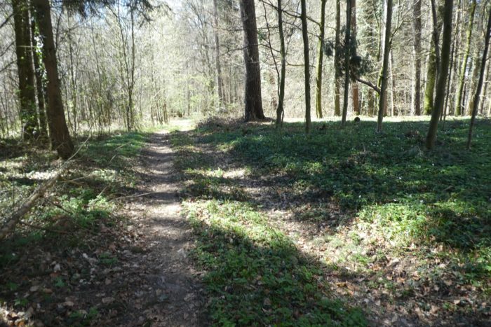
Then, without warning, the path steepens into a more pronounced slope, descending the hillside. |
|
 |
 |
In this section of the route, the forest is distinguished by its venerable oaks and majestic beeches. The large conifers are rare here, their tops lost in the clouds, and their foliage, depleted, struggles to survive.
|
The forest here reveals remarkable beauty, even though the descent is brief. |
|
 |
 |
|
At the base of the hill, near a well-maintained picnic area, the path merges with the road at the entrance to the picturesque hamlet of Belmont. |
|
 |
 |
|
Curiously, boats are visible here. But what fate awaits them? |
|
 |
 |
The road continues to the Belmont crossroads, a modest collection of houses along the roadway.
|
From this crossroads, a small agricultural road takes over, heading towards Corcelles/Payerne. It gracefully descends into the open countryside, through meadows and fruit trees, bordered by hedgerows. The small stream of Merdasson meanders along this route, adding a touch of charm to the bucolic landscape. |
|
 |
 |
 |
 |
|
Near a large agricultural complex, the road takes on a certain freedom, tracing long straight lines interrupted by right angles. |
|
 |
 |
|
It even abruptly straightens at a right angle in the fields, a challenge that may be a bit more arduous but brief for some. |
|
 |
 |
|
Then, it makes another right-angle turn before descending the slopes of the meadows to join the plain. |
|
 |
 |
Section 4 : On the way to the beautiful abbey

Overview of the route’s challenges : easy terrain.
|
The small road continues its gentle descent with a regular slope, before bending again at a right angle. |
|
 |
 |
|
On this vast hill, the cultivated fields compete with meadows to offer a spectacle of well-organized and orderly greenery. |
|
 |
 |
|
The road descends until it intersects with a hedge bordering the Merdasson stream. At this point, a path unfurls in the grass, winding along dense bushes and scraggly trees. |
|
 |
 |
|
Before you, the horizon opens up with the church of Notre-Dame des Tours and an imposing agricultural tower, marking the backdrop of this pastoral landscape. |
|
 |
 |
|
A bit further along, the path crosses the stream by fording it, hopping across large stones where the water, barely discernible amidst the dense vegetation, murmurs softly. This crossing brings you closer to the church, the silent guardian of this setting. |
|
 |
 |
|
The Church of Notre-Dame des Tours, also known as the Church of Notre-Dame de Montagny-les-Monts, is a Catholic place of worship located in the municipality of Cousset, just a short distance away in the canton of Fribourg, although we are also close to Payerne, in the canton of Vaud. Built on the remains of a medieval chapel, the current church was constructed at the end of the 18th century and enlarged in 1926. It remains a pilgrimage site frequented by the sick and parishioners. Legend has it that when the chapel was threatened with demolition, the statue of the Virgin was moved to the church in Montagny-les-Monts, a neighboring village. The next morning, it was miraculously found back in its original chapel. Subsequent attempts to move it failed, and it stayed at its current location. This legendary phenomenon echoes similar stories across Europe. |
|
 |
 |
Here, by a surprising twist of fate, a direction sign for Via Jacobi 4 appears. One might have wished to see these signs earlier in the route, especially since Via Jacobi 4 is not found in Payerne but in Moudon, a later stage. Thanks to SchweizMobil for this oddly timed information !
|
A grassy path then veers away from the peaceful site of the church, offering a smooth and serene transition. |
|
 |
 |
|
A little further on, this path meets a road near the village of Corcelles. |
|
 |
 |
|
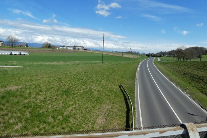
The road overlooks the RN1, the axis connecting Lausanne to Bern, before descending towards the village. |
|
 |
 |
|
It then crosses the upper part of the village, characterized by a distinctly rural atmosphere. This is where the route continues, in what was once the core of the village. |
|
 |
 |
|
A short distance away, the route crosses the Arbogne River, whose soothing murmur can be heard over the stones, adding a touch of serenity to your walk. |
|
 |
 |
|
After crossing the river, a narrow dirt path heads along the railway, discreetly following the tracks. |
|
 |
 |
Corcelles-sur-Payerne, with its 2,500 inhabitants, stands out by having two train stations: one to the north, on the line to Bern, and the other to the south, serving Fribourg. You are near Corcelles-sud station, about a half-hour’s walk from Payerne.
|
The route then crosses the tracks near the station and heads towards the outskirts of the town. |
|
 |
 |
|
The road meanders along villas, their affiliation with either Corcelles or Payerne remaining unclear, creating a blurred boundary between the two localities. |
|
 |
 |
|
Soon, the route winds through meadows before emerging on the heights of Payerne. |
|
 |
 |
|
It then connects to a paved road, crossing a new housing development, a sign of recent urban expansion. |
|
 |
 |
| The road begins its descent towards the city center, heading towards the railway station area. | |
 |
 |
|
Finally, the route passes under the railway tracks to reach the station. Before you stands the spire of the cathedral, majestic and imposing. |
|
 |
 |
Section 5 : A short visit to Payerne and its cathedral
|
Payerne, with its 10,000 inhabitants, is mainly known to tourists for the Abbey Church, a central monument of the town. The lively area is mostly between the train station and the cathedral, where a few picturesque squares add charm to the town. . |
|
 |
 |
 |
 |
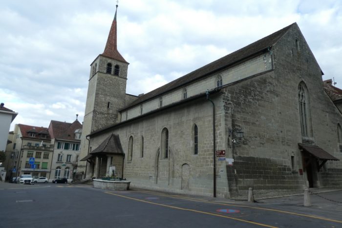
The undisputed jewel of Payerne is the Notre-Dame Cathedral. The foundation stone of this imposing structure was laid in the late 10th century on the site of a Roman villa, thanks to Saint Adelaide, daughter of Queen Bertha of Swabia, Empress of the Holy Roman Empire, in connection with the Cistercian order of Cluny. In the mid-11th century, a second church was built, forming the base of the abbey church that still stands today. Although the church was ravaged by two fires in the 12th and 15th centuries, it was always rebuilt. Payerne became a major Cluniac priory with numerous dependencies, around which the medieval town grew. The attachment to Cluny ended in 1444, and the Reformation imposed by the Bernese in 1536 marked the beginning of a troubled period. In 1565, the monastery was closed, and the monks were forced to leave and convert. The abbey church was subsequently used as a granary, bell foundry, military barracks, prison, and pump storage. The Bernese destroyed the cloister and part of the abbey buildings, leaving only the Notre-Dame Abbey Church, the chapter house, and one wing of the abbey (the dormitory).
The revival of the abbey church began at the end of the 19th century, with excavations and restoration work starting in 1920. In 2007, a costly project to preserve and safeguard the building was launched due to the imminent danger of collapse. The facades and roofs were stabilized, and part of the vaults and interior paintings were restored. The abbey church reopened to the public on July 11, 2020, offering a new discovery route. Visiting this church, considered one of the most beautiful Romanesque churches in the world, is an unforgettable experience.
|
The visit to the abbey has been modernized with an initiatory tour. The journey begins with a panoramic discovery of the site on a large screen. |
|
 |
 |
In the Romanesque nave, one can feel the majesty of the space and the height of the building. The diffused light that enters brings a surge of emotion, daydreaming, and reflection. This Romanesque part bears a strange resemblance to the church of Vézelay, particularly in the color of the stones, with the same alternating patterns of different colors. The light is the brightest at the choir, but everything is relative. The great charm of Romanesque churches lies in their preference for shadow, secrecy, and mystery, in contrast to Gothic churches, which are more ostentatious, or Baroque churches, which tend to be more flamboyant.
|
This Romanesque building is complemented by few late Gothic elements. The abbey church features frescoes from the 11th and 12th centuries and very beautiful capitals adorning the columns, depicting biblical scenes and vegetal elements, like in most famous churches. Wherever you walk, whether in the central nave, the choir, or the aisles, the faint light and reflections play with the gray and ochre of the sandstones and marls. |
|
 |
 |
|
At the top of narrow stairs in the narthex, you can access the St. Michael’s Chapel, where the monks used to celebrate services for the deceased. It’s quite kitsch here. However, the Grailly Chapel is a beautiful Gothic gem from the 15th century, contrasting with the Romanesque sobriety of the church. But overall, the changes made in the 14th and 15th centuries are minor, mainly in the Gothic lantern tower and the chapels. Therefore, the church remains an example of almost pure Romanesque art. |
|
 |
 |
|
Although the cloister has disappeared, you can still make out its location in the external buildings of the Abbey, as well as the former town hall. |
|
 |
 |
 |
 |
Accommodation on the Three Lakes trail
- Maison des Cadets, Payerne; 079 281 40 71; Dormitory
- Chambres Rue Favez 8, Payerne; 078 226 29 20; Guestroom, breakfast
- Les gîtes de Clément, Impasse des Dîmes 1, Payerne; 079 855 97 02; Guestroom, breakfast
- La Suite Hôtel-Restaurant, Rue du Temple 10, Payerne; 026 662 00 20; Hotel***, dinner, breakfast
The Three Lakes Region remains a popular destination, primarily for local tourists. As a result, accommodations are not abundant, except in cities with an international tourist focus, such as Murten (Morat), which is the priority. Elsewhere, lodgings are more discreet, with the exception of Airbnb properties, for which we do not have the addresses. There is nothing available before reaching Payerne, where all the shops are located. It is essential to book in advance.
Feel free to add comments. This is often how you move up the Google hierarchy, and how more pilgrims will have access to the site.
 |
Next stage : Stage 12: From Payerne to Moudon |
 |
Back to menu |
